Fort Senneville
| Fort Senneville | |
|---|---|
| Part of Séminaire de Saint-Sulpice | |
| In use | 1671-1763[1] |
| Materials | Stone, wood |
| Demolished | 1776 |
| Battles/wars | Iroquois incursions American Revolution |
Fort Senneville is one of the outlying forts of
Governor-General
Background
Thanks to the tireless work of French explorers, the colony of New France covered the largest area, but it was numerically inferior to the neighbouring
In the new colonies, the Spanish start by building a church, the English a tavern, and the French a fort.[4]
Quebec served as the only fortified city in the Americas, centred on the
In 1679, Jacques Le Ber, who had obtained the fief, renamed it to Senneville after Senneville-sur-Fécamp, his hometown in France.[8] A large stone windmill was built on a hill by late 1686, doubling as a watch tower over the Ottawa River, the Lake of Two Mountains, and the mouth of the Des Prairies River.[6] This windmill was like no other in New France (although a similar fortified windmill was later built in Quebec), with thick walls, square loopholes for muskets, with machicolation at the top for pouring lethally hot liquids and rocks onto attackers.[6]
In October 1687, the nearby Fort Sainte-Anne and the Senneville mill were attacked by Iroquois, and although several settlers were killed, the attackers were repulsed.[6] A second attack was more successful in 1691, and the fort was burned down. Only the mill itself was left standing.[6]
Second fort

The attack had come shortly after the 1690 Battle of Quebec, and an enraged Governor-General Frontenac ordered the construction of a second, more imposing fort.[6] The fort was rebuilt in 1692 with thick stone walls and corner tower bastions. With extensive cannons and swivel wall guns, it was the "most substantial castle-like fort" near Montreal.[2]
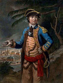
It was never attacked again. The windmill was rebuilt in 1700, and was probably still in use until the 1780s. In 1703, Jacques Le Ber de Senneville constructed a large stone house and fort in order to improve and protect his fur trading operations,[7] and the local seigneural manor house was built in 1706. However, after the fall of New France in 1763, it was not used by the British as a military post. In 1776, Fort Senneville was destroyed during the American Revolutionary War by Continental Army troops under Benedict Arnold, in military manoeuvres associated with the Battle of the Cedars.
In 1865, the property was purchased as a summer residence by
The site today
The site is on private property and therefore inaccessible. The 10-acre (4 ha) area is important part to Montreal's cultural and natural heritage for several reasons.[7]
In November 2003, Quebec recognized its historical significance by classifying it a "Site historique".[7] The Ministry of Culture and Communications has commissioned studies on the historical ownership of the fort, and funded archaeological research and repairs to consolidate the structure of the ruins, recognizing "the exceptional historic and prehistoric archaeological potential of the ruin and its surroundings".[7]
The site's value today includes its ecological and environmental significance, and its shoreline, which is in a semi-natural state, is part of the
Footnotes
- ^ a b It ever saw military use only under New France. The land itself has been in British/Canadian territory ever since.
- ^ a b Chartrand 2005, p. 38
- ^ Chartrand 2005, p. 4
- ^ Chartrand 2005, p. 2
- ^ a b Chartrand 2005, p. 37
- ^ a b c d e f g Chartrand 2005, p. 41
- ^ a b c d e f "Cultural and Natural Heritage of the site" (PDF). Archived from the original (PDF) on 2009-09-28. Retrieved 2007-03-13.
- ^ "History". villagesenneville.qc.ca. Village de Senneville. Retrieved 13 June 2022.
References
- René Chartrand, French Fortresses in North America 1535–1763: Quebec, Montreal, Louisbourg and New Orleans (Fortress 27); ISBN 978-1-84176-714-7
External links
 Media related to Fort Senneville at Wikimedia Commons
- "Fort Senneville". www.hudsonhistoricalsociety.ca. Hudson Historical Society. Retrieved 2019-04-22.</ref>
- Andrew King (2015-02-20). "HIDDEN FORTRESS: 17th CENTURY FORT ON THE OTTAWA RIVER". OTTAWA REWIND. Retrieved 2019-04-22.
- "Site patrimonial du Fort-Senneville". Répertoire du patrimoine culturel du Québec. Ministère de la Culture et des Communications. Retrieved 2019-04-22.
- "Le fort de Senneville". Mémoires des Montréalais (in French). City of Montreal. 2017-10-24. Retrieved 2019-04-22.
