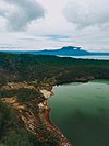
Fortune Island (Philippines)
This article needs additional citations for verification. (November 2019) |
 | |
| Geography | |
|---|---|
| Coordinates | 14°3′24″N 120°29′28″E / 14.05667°N 120.49111°E |
| Adjacent to | South China Sea |
| Area | 27 ha (67 acres) |
| Highest elevation | 98 m (322 ft) |
| Administration | |
Philippines | |
| Region | Calabarzon |
| Province | Batangas |
| Municipality | Nasugbu |
| Additional information | |
 | |
Fortune Island is a resort island of Batangas province in the Philippines. The 27-hectare (67-acre) island lies about 14 kilometers (8.7 mi) off the coast of Nasugbu in Batangas.
Ownership and development

Fortune Island was once a private island owned by Laurentina Pestano. It was turned over to the government and the island is now owned by
This island has since been parceled out into seven lots reportedly titled in the names of three companies: Fortune Resort Club, Inc., Meridian Pacific Hotel Corp., and Batangas Bay Development, Inc. Leviste holds either majority stocks or has interests in these companies.
Some government officials believe that Leviste's ownership of Fortune Island underwent “scheming procedures” to acquire both judicial and administrative titles. These officials believe that these titles should never have been granted for two reasons; firstly, the island is classified as a marine reserve under Proclamation 1801, issued in 1978 by President Ferdinand Marcos and, secondly, Section 16 of Presidential Decree 705 (the Revised Forestry Code), which provides that "areas less than 250 hectares which are far from, or are not contiguous with, any certified alienable and disposable land" are "areas needed for forest purposes and may not, therefore, be classified as alienable and disposable land." Some government officials further contend that subdividing Fortune Island into lots was a "ploy" to skirt environmental and other pertinent laws.[1][2]
Shipwrecks
It was near this island (approximately 900 meters (3,000 feet) northwest of the island) that the galleon
The island has also been the site of modern shipwrecks. On December 13, 1995, the MV Kimelody Cristy, a passenger ferry owned and operated by Moreta Shipping Lines Incorporated, caught fire and sank off Fortune Island as it was on its way to
References
- ^ a b "The Manila Times Internet Edition | SPECIAL REPORT > Govt could have reaped P395M from island". The Manila Times. Archived from the original on April 23, 2004. Retrieved December 17, 2008.
- ^ a b "The Manila Times Internet Edition | SPECIAL REPORT >The 'Fortunes' of Loren and Tony". The Manila Times. Archived from the original on April 23, 2004. Retrieved December 17, 2008.
- ^ a b [1][dead link]
- ^ List of maritime disasters in the Philippines
External links
 Geographic data related to Fortune Island (Philippines) at OpenStreetMap


