
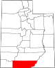
Kane County, Utah
Kane County | |
|---|---|
UTC−6 (MDT) | |
| Congressional district | 2nd |
| Website | kane |

Kane County is a
History
The county was created on January 16, 1864, by the
Geography
Kane County lies on the south line of the state of Utah. Its south border abuts the northern border of the state of Arizona. The Colorado River, reformed as Lake Powell, forms its eastern border. Grand Staircase–Escalante National Monument covers much of the county. A rugged and inhospitable country of deserts, mountains, and cliffs make up the terrain, with breathtaking scenery in every area. Parts of Bryce Canyon National Park and Zion National Park extend into the northern and western portions of the county. The eastern part of the county is part of the Glen Canyon National Recreation Area.[6] The county has a total area of 4,109 square miles (10,640 km2), of which 3,990 square miles (10,300 km2) is land and 118 square miles (310 km2) (2.9%) is water.[7]
Adjacent counties
- Washington County - west
- Iron County - northwest
- Garfield County - north
- San Juan County - east
- Mohave County, Arizona - southwest
- Coconino County, Arizona - south
Protected areas
Lakes[6]
- Lake Powell (along east border)
- Navajo Lake
Demographics
| Census | Pop. | Note | %± |
|---|---|---|---|
| 1870 | 1,513 | — | |
| 1880 | 3,085 | 103.9% | |
| 1890 | 1,685 | −45.4% | |
| 1900 | 1,811 | 7.5% | |
| 1910 | 1,652 | −8.8% | |
| 1920 | 2,054 | 24.3% | |
| 1930 | 2,235 | 8.8% | |
| 1940 | 2,561 | 14.6% | |
| 1950 | 2,299 | −10.2% | |
| 1960 | 2,667 | 16.0% | |
| 1970 | 2,421 | −9.2% | |
| 1980 | 4,024 | 66.2% | |
| 1990 | 5,169 | 28.5% | |
| 2000 | 6,046 | 17.0% | |
| 2010 | 7,125 | 17.8% | |
| 2020 | 7,667 | 7.6% | |
| US Decennial Census[8] 1790–1960[9] 1900–1990[10] 1990–2000[11] 2010[12] 2020[13] | |||
2000 census
As of the
There were 2,237 households, of which 32.20% had children under 18 living with them, 64.60% were married couples living together, 6.00% had a female householder with no husband present, and 27.20% were non-families. 23.30% of all households were made up of individuals, and 10.20% had someone living alone who was 65 years of age or older. The average household size was 2.67, and the average family size was 3.21.
The county population contained 29.40% under the age of 18, 6.80% from 18 to 24, 21.20% from 25 to 44, 25.90% from 45 to 64, and 16.70% who were 65 years of age or older. The median age was 39 years. For every 100 females, there were 98.30 males. For every 100 females aged 18 and over, there were 94.10 males.
The median income for a household in the county was $34,247, and the median income for a family was $40,030. Males had a median income of $30,655 versus $20,406 for females. The
Politics and government
Kane is one of the most reliably Republican counties in the nation. Of "straight-ticket" voters in the 2008 election, there were 992 Republicans and 326 Democrats. In the
In Presidential elections, Kane County has only been won once by a Democratic candidate when
| Position | District | Name | Affiliation | First elected | |
|---|---|---|---|---|---|
Senate
|
24 | Derrin Owens | Republican | 2020[15] | |
| House of Representatives | 73 | Phil Lyman | Republican | 2018[16] | |
| Board of Education | 14 | Mark Huntsman | Nonpartisan | 2014[17] | |
| Year | Republican | Democratic | Third party | |||
|---|---|---|---|---|---|---|
| No. | % | No. | % | No. | % | |
| 2020 | 2,998 | 71.30% | 1,083 | 25.76% | 124 | 2.95% |
| 2016 | 2,265 | 64.02% | 741 | 20.94% | 532 | 15.04% |
| 2012 | 2,522 | 74.81% | 744 | 22.07% | 105 | 3.11% |
| 2008 | 2,212 | 69.65% | 856 | 26.95% | 108 | 3.40% |
| 2004 | 2,414 | 79.12% | 576 | 18.88% | 61 | 2.00% |
| 2000 | 2,254 | 80.44% | 387 | 13.81% | 161 | 5.75% |
| 1996 | 1,682 | 72.63% | 304 | 13.13% | 330 | 14.25% |
| 1992 | 1,241 | 57.14% | 295 | 13.58% | 636 | 29.28% |
| 1988 | 1,788 | 79.29% | 398 | 17.65% | 69 | 3.06% |
| 1984 | 1,710 | 85.12% | 294 | 14.63% | 5 | 0.25% |
| 1980 | 1,492 | 81.35% | 256 | 13.96% | 86 | 4.69% |
| 1976 | 1,094 | 72.50% | 330 | 21.87% | 85 | 5.63% |
| 1972 | 1,146 | 78.82% | 218 | 14.99% | 90 | 6.19% |
| 1968 | 814 | 71.72% | 147 | 12.95% | 174 | 15.33% |
| 1964 | 784 | 69.75% | 340 | 30.25% | 0 | 0.00% |
| 1960 | 876 | 80.44% | 213 | 19.56% | 0 | 0.00% |
| 1956 | 939 | 90.20% | 102 | 9.80% | 0 | 0.00% |
| 1952 | 943 | 85.19% | 164 | 14.81% | 0 | 0.00% |
| 1948 | 769 | 77.76% | 220 | 22.24% | 0 | 0.00% |
| 1944 | 662 | 73.07% | 244 | 26.93% | 0 | 0.00% |
| 1940 | 675 | 66.57% | 339 | 33.43% | 0 | 0.00% |
| 1936 | 519 | 56.54% | 395 | 43.03% | 4 | 0.44% |
| 1932 | 618 | 71.86% | 229 | 26.63% | 13 | 1.51% |
| 1928 | 566 | 79.94% | 141 | 19.92% | 1 | 0.14% |
| 1924 | 515 | 80.22% | 117 | 18.22% | 10 | 1.56% |
| 1920 | 501 | 72.61% | 186 | 26.96% | 3 | 0.43% |
| 1916 | 304 | 46.99% | 329 | 50.85% | 14 | 2.16% |
| 1912 | 426 | 75.27% | 115 | 20.32% | 25 | 4.42% |
| 1908 | 415 | 79.81% | 102 | 19.62% | 3 | 0.58% |
| 1904 | 399 | 79.64% | 102 | 20.36% | 0 | 0.00% |
| 1900 | 392 | 70.89% | 161 | 29.11% | 0 | 0.00% |
| 1896 | 288 | 55.60% | 230 | 44.40% | 0 | 0.00% |
Communities

City
- Kanab (county seat)
Towns
Unincorporated communities
- Bullfrog
- Duck Creek Village
- Mount Carmel
- Mount Carmel Junction
Ghost towns
See also
References
- ^ Diana's Throne
- ^ "Kane County, Utah". United States Census Bureau. Retrieved June 30, 2023.
- ^ "Find a County". National Association of Counties. Archived from the original on May 31, 2011. Retrieved June 7, 2011.
- ^ Gannett, Henry (1905). The Origin of Certain Place Names in the United States. Govt. Print. Off. p. 172.
- ^ "[[Newberry Library]]. Individual County Chronologies - Kane County UT (accessed March 25, 2019)". Archived from the original on March 6, 2016. Retrieved March 25, 2019.
- ^ a b Kane County UT Google Maps (accessed 25 March 2019)
- ^ "2010 Census Gazetteer Files". US Census Bureau. August 22, 2012. Retrieved June 25, 2015.
- ^ "US Decennial Census". US Census Bureau. Archived from the original on April 26, 2015. Retrieved June 25, 2015.
- ^ "Historical Census Browser". University of Virginia Library. Retrieved June 25, 2015.
- ^ Forstall, Richard L., ed. (June 25, 1995). "Population of Counties by Decennial Census: 1900 to 1990". US Census Bureau. Retrieved March 27, 2015.
- ^ "Census 2000 PHC-T-4. Ranking Tables for Counties: 1990 and 2000" (PDF). US Census Bureau. April 2, 2001. Retrieved June 25, 2015.
- ^ "State & County QuickFacts". United States Census Bureau. Archived from the original on June 6, 2011. Retrieved December 29, 2013.
- ^ 2020 Population and Housing State Data | Utah
- ^ a b Leip, David. "Atlas of US Presidential Elections". uselectionatlas.org. Retrieved March 31, 2018.
- ^ "Senator Owens Utah Senate". senate.utah.gov. Retrieved November 16, 2021.
- ^ "Rep. Lyman, Phil". Utah House of Representatives. Retrieved November 15, 2021.
- ^ "Mark Huntsman". www.schools.utah.gov. Retrieved November 15, 2021.
Further reading
- (1994) "Kane County" article in the Utah History Encyclopedia. The article was written by Miriam B. Murphy and the Encyclopedia was published by the University of Utah Press. ISBN 9780874804256. Archived from the original on May 3, 2024 and retrieved on May 22, 2024.
External links
Places adjacent to Kane County, Utah | |
|---|---|
 | ||||
Towns |
| |||
| Unincorporated communities |
| |||
| Ghost towns | ||||
| ||||
| International | |
|---|---|
| National | |