Khorat Plateau
Khorat Plateau
ที่ราบสูงโคราช | |
|---|---|
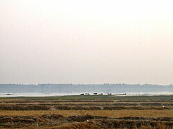
 Landscape of the Khorat Plateau | |
 A map of the Khorat Plateau region | |
| Country | Thailand |
| Elevation | 200 m (700 ft) |
The Khorat Plateau (
Geography
The average elevation is 200 metres (660 ft) and it covers an area of about 155,000 square kilometres (60,000 sq mi). The saucer-shaped plateau is divided by a range of hills called the
These mountains together with the
Geology
The plateau uplifted from an extensive
Archaeology
Many
The region was once under the suzerainty of the Dvaravati Kingdom, and later under the Khmer Empire. It is dotted with the ruins of Khmer rest houses positioned about 25 kilometres (16 mi) apart, a comfortable day's walk, along the Khmer highways. These were not just places of repose, but also were hospices and libraries, and typically included a baray (pond).[5] Archaeologist Charles Higham stated, "...we remain largely unaware of the relationships between sites and the presence or otherwise of states on the Khorat plateau" during the 7th to 11th centuries. Muang Sema and Muang Fa Daet are notable though for their religious structures, including sema stones at Muang Fa Daet.[6]: 312–316
History
There is a paucity of information from the centuries known as the
See also
References
- ^ Keyes, Charles F (March 1967). "Isan: Regionalism in Northeastern Thailand". Cornell Thailand Project; Interim Reports Series, No. 10 (PDF). Ithaca: Department of Asian Studies, Cornell University. Retrieved 16 August 2019.
- ^ Bunopas, Sangad; Vella, Paul (17–24 November 1992). "Geotectonics and Geologic Evolution of Thailand" (PDF). National Conference on "Geologic Resources of Thailand: Potential for Future Development". Bangkok. p. 224. Archived from the original (PDF) on 20 August 2011.
...latest Pleistocene early to the Recent regional uplifting must have occurred.
- ^ Lofjle, E; Kubiniok, Jochen (1996). "Landform Development and Bioturbation on the Khorat Plateau, Northeast Thailand". Natural History Bulletin of the Siam Society. 44: 199–216. Retrieved 2 April 2016.
- ^ K. Kris Hirst. "Ban Chiang, Thailand Bronze Age Village and Cemetery". About.com. Archived from the original on 6 December 2010. Retrieved 28 Dec 2010.
- ^ Werner, Ulrich. "Thailand's Ancient Civilizations, Isaan Heartland". Your Guide to Thai Culture. Archived from the original on 3 March 2016. Retrieved 2 April 2016.
- ISBN 9786167339443
- ^ ISBN 90-04-04529-5.
External links
- Khorat Plateau: A selection of articles related to Khorat Plateau from Global Oneness.
- Global Species: Northern Khorat Plateau moist deciduous forests
- WWF: Southeastern Asia: Northeastern Thailand, extending into Laos
