
Ruth Mountain
| Ruth Mountain | |
|---|---|
 Ruth Mountain seen from Hannegan Peak | |
| Highest point | |
| Elevation | 7,115 ft (2,169 m)[1] |
| Prominence | 1,315 ft (401 m)[1] |
| Parent peak | Seahpo Peak (7,441 ft)[2] |
| Isolation | 2.85 mi (4.59 km)[2] |
| Coordinates | 48°51′35″N 121°31′58″W / 48.859798°N 121.532872°W[1] |
| Naming | |
| Etymology | Ruth Cleveland |
| Geography | |
 Ruth Mountain Location in Washington  Ruth Mountain Ruth Mountain (the United States) | |
| Location |
|
| Parent range | North Cascades |
| Topo map | USGS Mount Shuksan |
| Climbing | |
| First ascent | 1916[3] |
| Easiest route | Scramble, glacier travel |
Ruth Mountain is a 7,115 ft (2,170 m)
.Climate
Ruth Mountain is located in the
snowfall onto the Cascades. As a result, the west side of the North Cascades experiences high precipitation, especially during the winter months in the form of snowfall. During winter months, weather is usually cloudy, but, due to high pressure systems over the Pacific Ocean that intensify during summer months, there is often little or no cloud cover during the summer.[3] Because of maritime influence, snow tends to be wet and heavy, resulting in high avalanche danger.[3]
The months July through September offer the most favorable weather for viewing or climbing this peak.
Geology
The North Cascades features some of the most rugged topography in the
glacial valleys. Geological events occurring many years ago created the diverse topography and drastic elevation changes over the Cascade Range leading to the various climate differences. These climate differences lead to vegetation variety defining the ecoregions
in this area.
The history of the formation of the Cascade Mountains dates back millions of years ago to the late
During the Pleistocene period dating back over two million years ago, glaciation advancing and retreating repeatedly scoured the landscape leaving deposits of rock debris.[5] The U-shaped cross section of the river valleys is a result of recent glaciation. Uplift and faulting in combination with glaciation have been the dominant processes which have created the tall peaks and deep valleys of the North Cascades area.
Ruth Mountain is a remnant of the Hannegan Caldera, a large extinct volcano.
See also
Gallery
-
 Icy Peak, Ruth Mountain, Mt. Shuksan from northeast
 -
 Ruth Mountain, west aspect
 -
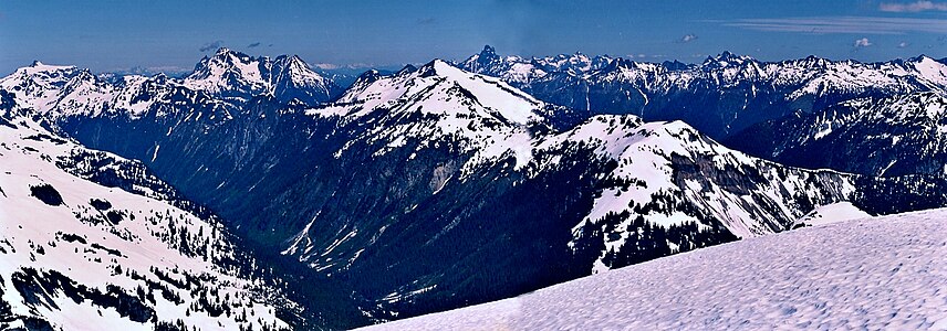 Ruth Mountain summit vista. Peaks include Tomyhoi Peak, Mount Larrabee, Mount Chardonnay, Slesse Mountain, Hannegan Peak, and Mount Rexford


References
- ^ a b c "Ruth Mountain, Washington". Peakbagger.com.
- ^ a b "Ruth Mountain - 7,115' WA". listsofjohn.com. Retrieved 2020-07-22.
- ^ ISBN 978-1-59485-136-0.
- ^ a b "Ruth Mountain". Geographic Names Information System. United States Geological Survey, United States Department of the Interior. Retrieved 2020-07-22.
- ^ a b c d Kruckeberg, Arthur (1991). The Natural History of Puget Sound Country. University of Washington Press.
External links
- Weather forecast: Ruth Mountain
- Mt. Baker Wilderness U.S. Forest Service