
Soay, St Kilda
| Scottish Gaelic name | Soaigh |
|---|---|
| Old Norse name | Sauðey[1] |
| Meaning of name | island of sheep[1] |
| Location | |
 Soay Soay shown within the Outer Hebrides | |
| OS grid reference | NA064014 |
| Coordinates | 57°50′N 8°38′W / 57.83°N 8.63°W |
| Physical geography | |
| Island group | St Kilda |
| Area | 99 ha (245 acres) |
| Area rank | 150= [2] |
| Highest elevation | Cnoc Glas 378 m (1,240 ft) |
| Administration | |
| Sovereign state | United Kingdom |
| Country | Scotland |
| Council area | Outer Hebrides |
| Demographics | |
| Population | 0 |
| References | [3][4][5] |
Soay (
Scottish Gaelic: Soaigh) is an uninhabited islet in the St Kilda archipelago, Scotland. The name is from Old Norse Sauðey, meaning "island of sheep". The island is part of the St Kilda World Heritage Site and home to a primitive breed of sheep. Excluding Rockall, it is the westernmost point of the United Kingdom
.
Geography
Soay lies some 40 miles (64 km) west-northwest of
North Atlantic It is about 2 kilometres (1.2 mi) north-west of Hirta, from which it is separated by the narrow Sound of Soay, which is only about 500 metres wide. Two sea stacks, Stac Shoaigh (Soay Stac), 61 metres (200 ft), and Stac Biorach
, 73 metres (240 ft), lie between. The island covers about 96.8 hectares (239 acres) and reaches a height of 378 metres (1,240 ft), the cliffs rising sheer from the sea.
The island is formed of a
dolerites and is a single mountain peak rising from the sea-bed, without Ice-Age erosion.[6]

Along with the rest of the archipelago, Soay is owned by the National Trust for Scotland, managed by NatureScot as a nature reserve and is included it the St Kilda World Heritage Site.[7] It is unlikely that this island ever had permanent habitation. Men from Hirta would stay for a few days while gathering wool.[8]
Wildlife
Boreray
, lives on another island in the group.
The island's cliffs hold breeding colonies of many seabirds, including
Leach's petrel and puffin
.
Gallery
-
 Soay in mist
 -
 Soay from Hirta
 -
 Soay and Hirta from Stac an Armin
 -
 Soay sheep
 -
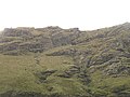 Steep pasture
 -
 Sound of Soay
 -
 Soay in the mist
 -
 Freshly fallen scree


See also
- List of islands of Scotland
- History of St Kilda
- List of outlying islands of Scotland
- Lítla Dímun, a similar island in the Faroes, formerly home to a similar breed of primitive sheep.
Footnotes
- ^ a b Gammeltoft 2006, p. 25.
- 2011 census.
- ^ 2001 UK Census per List of islands of Scotland
- ^ Haswell-Smith 2004, p. 321.
- ^ Ordnance Survey. OS Maps Online (Map). 1:25,000. Leisure.
- ^ a b Haswell-Smith 2004, p. 322.
- ^ "World Heritage Sites Protected Areas Programme - St Kilda". Archived from the original on 5 July 2007. Retrieved 22 July 2007.
- ^ "Soay Overview". Gazetteer for Scotland. Retrieved 22 July 2007.
References
- Gammeltoft, Peder (2006). "Scandinavian influence on Hebridean island names". In Gammeltoft, Peder; Jorgenson, Bent (eds.). Names through the Looking-Glass. Copenhagen: C.A. Reitzels Forlag.
- Haswell-Smith, Hamish (2004). The Scottish Islands. Edinburgh: Canongate. ISBN 978-1-84195-454-7.
Wikimedia Commons has media related to Soay.
Inhabited islands of the Hebrides | ||
|---|---|---|
| Inner Hebrides |  | |
| Outer Hebrides | ||