
Stepper Point
Stepper point | |
|---|---|
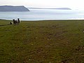
 Stepper Point viewed from the east across the River Camel estuary | |
 Location in Cornwall | |
| Coordinates: 50°34′08″N 4°57′00″W / 50.569°N 4.950°W | |
| Location | Cornwall |
Stepper Point (
Geography and Geology

The headland rises to 242 feet (74 m) at its highest point. The land is used for farming and the remains of several defunct stone quarries can be seen. The coast to the east of Stepper Point is on the estuary of the River Camel. This side of the headland boasts the sandhills of
To the south-west of the headland, the coastal scenery is more rugged with cliffs rising above a rocky foreshore. A mile south of Stepper point is another small headland called Gunver Head and a further mile on is the small sandy beach at Trevone. Offshore is a rocky outcrop known as Gulland, possibly derived from the cornish word goelann meaning gull.[3] The higher ground at the outer end of Stepper Point is made up of Polzeath Slates, with an igneous intrusion that is also the main constituent of Gulland island. Behind this the main part of the headland is Harbour Cove Slates of 260m thickness.[4] Due to its important geological features Stepper Point was designated a Site of Special Scientific Interest in 1990.[5]
Landmarks and recreation
The headland above Stepper Point is topped by a 40 ft (12 m) stone tower built in 1830 as a 'day mark' to serve as a navigation beacon for seafarers during daylight, it is visible from over 30 miles offshore and still referred to as the Daymark.[6] The South West Coast Path closely follows the coastline of the headland and the three-mile (5 km) stretch of coast path from Padstow to Stepper Point has fairly easy gradients and is well-surfaced; beyond Stepper towards Trevone the path becomes rougher and is more sharply graded.

The coast path takes walkers directly past both the Daymark and the National Coastwatch Institution lookout which is situated to the north-east of the Daymark. There is no vehicular access to the coastwatch building beyond Lellizzick Farm and the volunteers have to walk the final mile to the watchpoint.[7] The coastwatch station opened in March 2002 and has Declared Facility status meaning that it is part of the official UK Search and Rescue system. All of the staff at the watchpoint are volunteers and keep watch daily from 09.00 until between 15.00 (winter) and 18.00 (summer).[8]
Sightseeing boat tours regularly travel along the coast from the nearby port of Padstow.
Quarrying and mining
One of the most noticeable features of Stepper Point is the quarry on the river side of the headland. The initial quarrying here was carried out by the grandly named Padstow Harbour Association for the Preservation of Life and Property from Shipwreck, who intended to remove a large volume of stone to prevent sailing ships sailing upstream towards Padstow from being becalmed in the lee of the headland. Despite commencing some excavations, the actual amount of stone removed was small compared to the amount intended.[2]
At the end of
There have been two active mines on Stepper Point. On the west side of the headland at Gunver Head was a mine variously called Wheal Galway, Trevone Consols, Padstow Consols and Cuddrabridge Mine. Operating for short periods in the 19th century, the mine produced small tonnages of Copper, and also 267 oz (7.6 kg) of Silver.[11] On the east side of the point just upstream of Harbour cove was North Treleaver mine, a small lead mine which followed a lode visible in the cliffs, although the dates of operation are uncertain.[12]
Gallery of images
-
 Stepper Point (with Gunver Head to the right) viewed 'end on' from Pentire Point.
 -
 Stepper Point (with Trevose Head in the distance, right), viewed from Pentire Farm.
 -
 The Daymark.


References
- ^ Place-names in the Standard Written Form (SWF) Archived 2013-05-15 at the Wayback Machine : List of place-names agreed by the MAGA Signage Panel Archived 2013-05-15 at the Wayback Machine. Cornish Language Partnership.
- ^ a b Duxbury & Williams 1987, pp. 91–92.
- ^ "Harlyn Bay to Padstow". iWalk Cornwall. Retrieved 27 February 2021.
- ^ "Geoindex onshore". British Geological Survey. 2020. Retrieved 27 February 2021.
- ^ "Stepper Point" (PDF). Natural England. 1990. Retrieved 28 October 2011.
- ^ "Daymer Bay to Padstow". iWalk Cornwall. Retrieved 27 February 2021.
- ^ "Stepper Point - QAVS". National Coastwatch Institution. 2021. Retrieved 27 February 2021.
- ^ "Stepper Point NCI Station". NCI Stepper Point. 2020. Retrieved 27 February 2021.
- ^ a b Hateley 1977, pp. H.4.
- ^ a b Duxbury & Williams 1987, p. 101.
- ^ "Cuddrabridge Mine (Guddrabridge Mine; Padstow Consols; Trevone Consols; Wheal Galway), Gunver Head, Padstow, Cornwall, England, UK". Mindat.org. Hudson Institute of Mineralogy. 2021. Retrieved 25 February 2021.
- ^ "North Trelether Mine (North Treleather Mine), Padstow, Wadebridge District, Cornwall, England, UK". Mindat.org. Hudson Institute of Mineralogy. 2021. Retrieved 25 February 2021.
Sources
- Duxbury, Brenda; Williams, Michael (1987). The River Camel. St Teath: Bossiney Books. ISBN 0-948158-26-3.
- Hateley, Roger (1977). Industrial Locomotives of South Western England. Greenford: Industrial Railway Society. ISBN 0 901096 23 7.
| Unitary authorities | |
|---|---|
| Major settlements (cities in italics) |
|
| Rivers | |
| Topics | |