
Camden, Arkansas
Camden, Arkansas | ||
|---|---|---|
| City of Camden | ||
 Downtown Camden | ||
|
FIPS code 05-10720 | | |
| GNIS feature ID | 0076505 | |
| Website | camden | |
Camden is a city in and the
The
In 2000, Camden had a population of 13,154, but it lost 7.4 percent of its residents and recorded 12,183 in 2010.
History
European exploration
The explorers Father
In late 1762, France ceded Louisiana to Spain. In 1782, the Spanish governor sent a Frenchman named Jean Baptiste Filhiol, known to him as Don Juan Filhiol, to establish a civil and military post in the Ouachita district. Filhiol first chose to locate his headquarters at Ecore a Fabri with the expectation of creating a settlement there. After about two years, he decided to move downriver to the more central site of Prairie des Canots, present-day Monroe, Louisiana. These locations were noted in 1804 by the Hunter-Dunbar Expedition that explored the Ouachita River.[4]
Early statehood
By 1819, Jesse Bowman, of future
Camden soon became the second-largest city in Arkansas. It was a mercantile center and a bustling river port served by frequent scheduled steamboats carrying passengers and freight. Most traveled between Camden and New Orleans. Camden was also the headquarters for John T. Chidester's stagecoach line that served Arkansas, Louisiana and Texas. Chidester's company carried the United States Mail from Memphis to Fort Smith for the Butterfield stage line.[5]
American Civil War
During the Civil War, Camden was the focus of U.S. Army general Frederick Steele’s Red River Campaign of 1864. Steele moved south of Little Rock toward Shreveport, Louisiana, but got only as far as Camden, which he occupied while the Confederates pulled back to defend Washington, Arkansas. Forts Lookout and Southerland were built early in 1864, and the Camden Water Battery was built later in the same year, all to protect Camden from attack. After losing the engagement at Poison Spring and the action at Marks’ Mill, Steele had little choice but to retreat toward Little Rock. Camden and south Arkansas remained in Confederate hands until the end of the war.[4]
20th century to present
Before the steamboat era faded, Camden had become a railroad town—served by the mainline of the

In 1927, the International Paper Company built a processing mill at Camden, following development of south Arkansas' lumber industry. For several decades, Camden was the headquarters of the Clyde E. Palmer newspaper chain, which included The Camden News, the Texarkana Gazette, the Hot Springs Sentinel-Record, and the Magnolia Banner News. The daily newspaper in Camden is the original flagship publication of WEHCO Media.
During World War II, Camden was home to one of Arkansas's three contract training fields for primary pilots in the United States Army Air Forces. The base was named Harrell Field; ground was broken for it in 1942.[6] The site became surplus to the Army's needs in 1944 and was handed over to the US Navy for the Shumaker Naval Ammunition Depot. Thousands of new jobs were created. The Korean War generated new jobs and activity at the depot, which closed after war's end. The city and county redeveloped its facilities and grounds into an extensive industrial area. This was the site of some major defense establishments and multiple smaller industries. A technical campus of Southern Arkansas University is also located there.
In the 1990s, post Cold War downsizing of the defense industry brought severe job losses—and resulting population decline—to the Camden area. The International Paper Company mill closed a few years later, resulting in more job losses. In recent years, however, a partial resurgence of defense contracts and the development of a diversified mixture of small business and professional activity have stabilized the town's economy.
Camden is the home of Buckshot Smith (born 1929) who was America's oldest active duty police officer from 2020 until he retired in 2023, 2 months before his 94th birthday.[7][8][9]
Ukraine has a significant demand for all of the rockets and missiles made at the Lockheed Martin Missiles and Fire Control facility in neighboring East Camden, including those used by the Army's Patriot missile system.[10]
Geography
Camden is located on the Ouachita River, at the end of the navigable part of the river. According to the United States Census Bureau, the city has a total area of 16.5 square miles (43 km2), of which 16.5 square miles (43 km2) is land and 0.1 square miles (0.26 km2) (0.36%) is water.
Climate
The climate in this area is characterized by hot summers and cool winters. According to the
| Climate data for Camden, Arkanasa (1991–2020 normals, extremes 1890–present) | |||||||||||||
|---|---|---|---|---|---|---|---|---|---|---|---|---|---|
| Month | Jan | Feb | Mar | Apr | May | Jun | Jul | Aug | Sep | Oct | Nov | Dec | Year |
| Record high °F (°C) | 86 (30) |
89 (32) |
93 (34) |
95 (35) |
99 (37) |
107 (42) |
111 (44) |
115 (46) |
109 (43) |
102 (39) |
90 (32) |
88 (31) |
115 (46) |
| Mean maximum °F (°C) | 73.7 (23.2) |
77.1 (25.1) |
83.8 (28.8) |
87.3 (30.7) |
91.2 (32.9) |
96.4 (35.8) |
99.9 (37.7) |
100.0 (37.8) |
96.2 (35.7) |
90.2 (32.3) |
81.5 (27.5) |
74.8 (23.8) |
101.7 (38.7) |
| Mean daily maximum °F (°C) | 53.3 (11.8) |
57.9 (14.4) |
66.4 (19.1) |
74.5 (23.6) |
81.4 (27.4) |
88.8 (31.6) |
91.9 (33.3) |
92.0 (33.3) |
86.0 (30.0) |
75.7 (24.3) |
64.0 (17.8) |
55.6 (13.1) |
74.0 (23.3) |
| Daily mean °F (°C) | 42.3 (5.7) |
46.1 (7.8) |
54.1 (12.3) |
62.0 (16.7) |
70.4 (21.3) |
78.1 (25.6) |
81.5 (27.5) |
80.8 (27.1) |
74.2 (23.4) |
62.9 (17.2) |
52.0 (11.1) |
44.4 (6.9) |
62.4 (16.9) |
| Mean daily minimum °F (°C) | 31.2 (−0.4) |
34.2 (1.2) |
41.8 (5.4) |
49.6 (9.8) |
59.5 (15.3) |
67.4 (19.7) |
71.1 (21.7) |
69.7 (20.9) |
62.4 (16.9) |
50.1 (10.1) |
40.0 (4.4) |
33.3 (0.7) |
50.9 (10.5) |
| Mean minimum °F (°C) | 17.4 (−8.1) |
22.0 (−5.6) |
26.5 (−3.1) |
35.0 (1.7) |
46.1 (7.8) |
58.0 (14.4) |
64.6 (18.1) |
62.1 (16.7) |
48.3 (9.1) |
35.3 (1.8) |
25.6 (−3.6) |
21.0 (−6.1) |
15.4 (−9.2) |
| Record low °F (°C) | −10 (−23) |
−10 (−23) |
12 (−11) |
26 (−3) |
35 (2) |
44 (7) |
51 (11) |
48 (9) |
33 (1) |
20 (−7) |
12 (−11) |
1 (−17) |
−10 (−23) |
| Average precipitation inches (mm) | 4.33 (110) |
4.67 (119) |
5.43 (138) |
5.36 (136) |
4.55 (116) |
3.52 (89) |
4.11 (104) |
3.18 (81) |
3.53 (90) |
4.80 (122) |
4.17 (106) |
5.47 (139) |
53.12 (1,349) |
| Average snowfall inches (cm) | 0.9 (2.3) |
0.3 (0.76) |
0.3 (0.76) |
0.0 (0.0) |
0.0 (0.0) |
0.0 (0.0) |
0.0 (0.0) |
0.0 (0.0) |
0.0 (0.0) |
0.0 (0.0) |
0.0 (0.0) |
0.0 (0.0) |
1.5 (3.8) |
| Average precipitation days (≥ 0.01 in) | 9.4 | 8.5 | 9.1 | 7.8 | 8.7 | 7.3 | 7.2 | 6.1 | 5.7 | 7.0 | 7.7 | 8.8 | 93.3 |
| Average snowy days (≥ 0.1 in) | 0.3 | 0.2 | 0.1 | 0.0 | 0.0 | 0.0 | 0.0 | 0.0 | 0.0 | 0.0 | 0.1 | 0.0 | 0.7 |
| Source: NOAA[12][13] | |||||||||||||
Demographics
| Census | Pop. | Note | %± |
|---|---|---|---|
| 1850 | 894 | — | |
| 1860 | 2,219 | 148.2% | |
| 1870 | 1,612 | −27.4% | |
| 1880 | 1,503 | −6.8% | |
| 1890 | 2,571 | 71.1% | |
| 1900 | 2,840 | 10.5% | |
| 1910 | 3,995 | 40.7% | |
| 1920 | 3,238 | −18.9% | |
| 1930 | 7,273 | 124.6% | |
| 1940 | 8,975 | 23.4% | |
| 1950 | 11,372 | 26.7% | |
| 1960 | 15,823 | 39.1% | |
| 1970 | 15,147 | −4.3% | |
| 1980 | 15,356 | 1.4% | |
| 1990 | 14,380 | −6.4% | |
| 2000 | 13,154 | −8.5% | |
| 2010 | 12,183 | −7.4% | |
| 2020 | 10,612 | −12.9% | |
| U.S. Decennial Census[14] | |||
2020 census
| Race | Num. | Perc. |
|---|---|---|
White (non-Hispanic)
|
3,851 | 36.29% |
Black or African American (non-Hispanic)
|
5,943 | 56.0% |
Native American
|
13 | 0.12% |
Asian
|
80 | 0.75% |
Pacific Islander
|
2 | 0.02% |
Other/Mixed
|
471 | 4.44% |
Latino
|
252 | 2.37% |
As of the 2020 United States census, there were 10,612 people, 4,221 households, and 2,523 families residing in the city.
2010 census
As of the
2000 census
As of the
There were 5,421 households, out of which 30.0% had children under the age of 18 living with them, 42.6% were married couples living together, 19.4% had a female householder with no husband present, and 34.3% were non-families. 31.5% of all households were made up of individuals, and 16.0% had someone living alone who was 65 years of age or older. The average household size was 2.36 and the average family size was 2.97.
In the city, the population was spread out, with 26.2% under the age of 18, 8.1% from 18 to 24, 24.6% from 25 to 44, 21.7% from 45 to 64, and 19.4% who were 65 years of age or older. The median age was 39 years. For every 100 females, there were 82.0 males. For every 100 females age 18 and over, there were 76.4 males.
The median income for a household in the city was $27,814, and the median income for a family was $35,291. Males had a median income of $31,257 versus $19,046 for females. The
Economy
Tourism


Attractions in town include the McCollum-Chidester House, home to the Ouachita County Historical Society,.[17] Built in 1847 by local merchant Peter McCollum, the house was purchased by John T. Chidester in 1857 and was used as a way station on his stage line. It was featured in the television series North and South.[2]
Camden has numerous historic buildings. There are two National Register districts. The Clifton and Greening Streets Historic District was created in 1997, and the Washington Street Historic District in 2010. The old Camden Post Office, built 1895, was added to the register in 1977. It is now a popular restaurant. The oldest continually running restaurant in the state of Arkansas is also located in Camden. The White House Cafe was opened in 1907 by Hristos Hodjopulas.[18]
About 10 miles (16 km) to the northwest, the site of the
Education
African American students attended Lincoln High School during segregation. It was closed in 1970[19] after Brown v. Board of Education disallowed segregation.
Camden was once served by Camden School District and Fairview School District. In 1990 the two districts merged. Public education for early childhood, elementary and secondary education is available from the following school districts:
- Camden Fairview School District, including Camden Fairview High School.
- Harmony Grove High School.
Notable people
- James Hildreth (born 1956); President and CEO of Meharry Medical College; internationally known immunology researcher
- Shawn Andrews (born 1982); played for Philadelphia Eagles 2004-2009 and NY Giants 2010
- Stacy Andrews (born 1981); played for Cincinnati Bengals 2004–2008, Philadelphia Eagles 2009, Seattle Seahawks 2010, NY Giants 2011
- Jonathan Davis (born 1992), drafted by Toronto Blue Jays 2013; played in minor leagues before a brief stint on Jay's major league roster 2019
- Betty Jo Dobbs (1930–1994), science historian specializing in Newton's Alchemy
- Alexander Hawthorn (1825–1899); American lawyer, minister, C.S. Armygeneral
- George Hays (1863–1927), 24th governor of Arkansas 1913–1917
- Benjamin Laney(1896–1977), 33rd governor of Arkansas 1945–1949
- Ne-Yo (born 1979 as Shaffer Chimere Smith); R&B singer, songwriter, producer
- Andre Patterson (born 1960); defensive line coach (NFL) 1997–2006, with Minnesota Vikings since 2014
- David Pryor(born 1934); served as U.S. Representative 1967–1973, 39th governor of Arkansas 1974–1979, U.S. Senator 1979–1997.
- Tony Tillman (born 1981 as Tony Daniel Frazier), Christian hip hop artist and songwriter
- Tommy Tuberville (born 1954); head football coach for University of Mississippi, Auburn 1999–2008, Texas Tech and University of Cincinnati, U.S. senator from Alabama
- David Warner Hagen (1931-2022), United States District Court judge
- Edward A. Warren (1818–1875) politician represented Ouachita County in the Arkansas House of Representatives and United States House of Representatives
- Gertrude Weaver(1898–2015); declared oldest living documented person, but died five days later on April 6, 2015
- Corey Williams (born 1980); played for Green Bay Packers 2004–2007, Cleveland Browns 2008–2009, Detroit Lions 2010–2012
See also
- List of cities and towns in Arkansas
- National Register of Historic Places listings in Ouachita County, Arkansas
References
- ^ "2020 U.S. Gazetteer Files". United States Census Bureau. Retrieved October 29, 2021.
- ^ Arkansas Department of Parks & Tourism. Retrieved June 16, 2019.
- ^ "Population of the City of Camden, Arkansas". censusviewer.com. Archived from the original on June 15, 2013. Retrieved August 9, 2012.
- ^ Encyclopedia of Arkansas. Central Arkansas Library System. Retrieved June 16, 2019.
- ^ Dillard, Tom (December 20, 2015). "Chidester Stage Lines". Arkansas Democrat-Gazette.
- ^ "Encyclopedia of Arkansas".
- ^ Face to Face Africa
- ^ News Week
- ^ Buckshot Smith retires
- ^ "Ukraine is burning through ammunition faster than the US and NATO can produce it. Inside the Pentagon's plan to close the gap. Story by Haley Britzky, Feb 16, 2023 11:01 PM". MSN.
- ^ Climate Summary for Camden, Arkansas
- ^ "NOWData – NOAA Online Weather Data". National Oceanic and Atmospheric Administration. Retrieved November 22, 2023.
- ^ "Summary of Monthly Normals 1991–2020". National Oceanic and Atmospheric Administration. Retrieved November 22, 2023.
- ^ "Census of Population and Housing". Census.gov. Retrieved June 4, 2015.
- ^ "Explore Census Data". data.census.gov. Retrieved December 13, 2021.
- ^ "U.S. Census website". United States Census Bureau. Retrieved January 31, 2008.
- ^ "Ouachita County Historical Society". Retrieved June 16, 2019.
- ^ "The White House Cafe". AY Magazine. March 31, 2017. Retrieved January 11, 2020.
- ^ "Students from Lincoln High attend reunion | Camden News". June 30, 2017.
External links
- Government
- General information
 Geographic data related to Camden, Arkansas at OpenStreetMap
- Camden Expedition Civil War Trail at Arkansas Department of Parks & Tourism
- Camden Area Chamber of Commerce
Municipalities and communities of Ouachita County, Arkansas, United States | ||
|---|---|---|
| Cities | 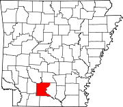 | |
| Town | ||
| CDP | ||
| Other unincorporated communities | ||
| Footnotes | ‡This populated place also has portions in an adjacent county or counties | |
| ||
| International | |
|---|---|
| National | |
| Geographic | |
| Other | |