
Ouachita County, Arkansas
Ouachita County | |
|---|---|
UTC−5 (CDT) | |
| Congressional district | 4th |
Ouachita County (
The
History
Until the late 20th century, the county was a
The politically influential Pryor family is based here; they include two U.S. senators, David Pryor (serving 1978–1997) and his son Mark Pryor (elected 2002). The elder Pryor also served as a former governor of Arkansas and US Congressman. The county is served by a daily newspaper, The Camden News.
Geography

According to the
Major highways
 Future Interstate 69
- U.S. Highway 79
- U.S. Highway 278
 Highway 4
 Highway 7
 Highway 9
 Highway 24
Adjacent counties
- Dallas County (north)
- Calhoun County (east)
- Union County (south)
- Columbia County (southwest)
- Nevada County (west)
- Clark County (northwest)
Demographics
The county had its peak of population in 1950.
| Census | Pop. | Note | %± |
|---|---|---|---|
| 1850 | 9,591 | — | |
| 1860 | 12,936 | 34.9% | |
| 1870 | 12,975 | 0.3% | |
| 1880 | 11,758 | −9.4% | |
| 1890 | 17,033 | 44.9% | |
| 1900 | 20,892 | 22.7% | |
| 1910 | 21,774 | 4.2% | |
| 1920 | 20,636 | −5.2% | |
| 1930 | 29,890 | 44.8% | |
| 1940 | 31,151 | 4.2% | |
| 1950 | 33,051 | 6.1% | |
| 1960 | 31,641 | −4.3% | |
| 1970 | 30,896 | −2.4% | |
| 1980 | 30,541 | −1.1% | |
| 1990 | 30,574 | 0.1% | |
| 2000 | 28,790 | −5.8% | |
| 2010 | 26,120 | −9.3% | |
| 2020 | 22,650 | −13.3% | |
| 2023 (est.) | 21,793 | [4] | −3.8% |
| U.S. Decennial Census[5] 1790–1960[6] 1900–1990[7] 1990–2000[8] 2010[9] | |||

2020 census
| Race | Num. | Perc. |
|---|---|---|
White (non-Hispanic)
|
12,092 | 53.39% |
Black or African American (non-Hispanic)
|
8,856 | 39.1% |
Native American
|
49 | 0.22% |
Asian
|
123 | 0.54% |
Pacific Islander
|
3 | 0.01% |
Other/Mixed
|
1,011 | 4.46% |
Latino
|
516 | 2.28% |
As of the 2020 United States census, there were 22,650 people, 9,658 households, and 6,009 families residing in the county.
2010 census
As of the
2000 census
As of the
There were 11,613 households, out of which 30.80% had children under the age of 18 living with them, 50.00% were married couples living together, 15.60% had a female householder with no husband present, and 30.50% were non-families. 28.00% of all households were made up of individuals, and 13.50% had someone living alone who was 65 years of age or older. The average household size was 2.45 and the average family size was 2.99.
In the county, the population was spread out, with 25.90% under the age of 18, 8.00% from 18 to 24, 25.60% from 25 to 44, 23.60% from 45 to 64, and 16.90% who were 65 years of age or older. The median age was 39 years. For every 100 females, there were 89.80 males. For every 100 females age 18 and over, there were 85.00 males.
The median income for a household in the county was $29,341, and the median income for a family was $35,736. Males had a median income of $30,976 versus $18,800 for females. The
Government
Over the past few election cycles Ouachita County has trended towards the GOP. The last democrat (as of 2020) to carry this county was Al Gore in 2000.
In 2020, the county saw an increase in third party votes compared to 2016, whereas the national trend was a significant drop of third party support.
| Year | Republican | Democratic | Third party | |||
|---|---|---|---|---|---|---|
| No. | % | No. | % | No. | % | |
| 2020 | 5,294 | 54.98% | 3,995 | 41.49% | 340 | 3.53% |
| 2016 | 5,351 | 53.86% | 4,321 | 43.49% | 263 | 2.65% |
| 2012 | 5,521 | 53.52% | 4,633 | 44.92% | 161 | 1.56% |
| 2008 | 5,427 | 54.49% | 4,346 | 43.63% | 187 | 1.88% |
| 2004 | 5,345 | 50.19% | 5,188 | 48.71% | 117 | 1.10% |
| 2000 | 4,739 | 45.59% | 5,464 | 52.56% | 192 | 1.85% |
| 1996 | 3,136 | 29.56% | 6,635 | 62.54% | 838 | 7.90% |
| 1992 | 3,711 | 29.89% | 7,411 | 59.69% | 1,293 | 10.41% |
| 1988 | 6,297 | 52.29% | 5,229 | 43.42% | 517 | 4.29% |
| 1984 | 6,700 | 51.19% | 5,858 | 44.76% | 531 | 4.06% |
| 1980 | 4,329 | 35.46% | 7,152 | 58.58% | 727 | 5.96% |
| 1976 | 2,753 | 23.53% | 8,946 | 76.47% | 0 | 0.00% |
| 1972 | 6,620 | 62.68% | 3,931 | 37.22% | 11 | 0.10% |
| 1968 | 2,209 | 18.65% | 4,603 | 38.87% | 5,031 | 42.48% |
| 1964 | 3,572 | 33.39% | 7,056 | 65.96% | 70 | 0.65% |
| 1960 | 2,439 | 29.77% | 5,169 | 63.10% | 584 | 7.13% |
| 1956 | 2,819 | 34.68% | 5,188 | 63.82% | 122 | 1.50% |
| 1952 | 2,171 | 26.68% | 5,936 | 72.96% | 29 | 0.36% |
| 1948 | 476 | 9.88% | 3,315 | 68.80% | 1,027 | 21.32% |
| 1944 | 473 | 13.04% | 3,154 | 86.93% | 1 | 0.03% |
| 1940 | 284 | 8.77% | 2,951 | 91.08% | 5 | 0.15% |
| 1936 | 262 | 8.53% | 2,808 | 91.47% | 0 | 0.00% |
| 1932 | 432 | 12.15% | 3,118 | 87.66% | 7 | 0.20% |
| 1928 | 1,051 | 39.92% | 1,582 | 60.08% | 0 | 0.00% |
| 1924 | 952 | 41.18% | 1,318 | 57.01% | 42 | 1.82% |
| 1920 | 1,141 | 46.12% | 1,307 | 52.83% | 26 | 1.05% |
| 1916 | 970 | 40.84% | 1,405 | 59.16% | 0 | 0.00% |
| 1912 | 793 | 42.29% | 913 | 48.69% | 169 | 9.01% |
| 1908 | 1,505 | 55.76% | 1,166 | 43.20% | 28 | 1.04% |
| 1904 | 974 | 46.89% | 1,083 | 52.14% | 20 | 0.96% |
| 1900 | 1,143 | 50.18% | 1,120 | 49.17% | 15 | 0.66% |
| 1896 | 1,029 | 42.77% | 1,366 | 56.77% | 11 | 0.46% |
Communities
Cities
- Bearden
- Camden (county seat)
- Chidester
- East Camden
- Stephens
Town
Census designated place
Unincorporated community
Townships
Townships in Arkansas are the divisions of a county. Each township includes unincorporated areas; some may have incorporated cities or towns within part of their boundaries. Arkansas townships have limited purposes in modern times. However, the United States census does list Arkansas population based on townships (sometimes referred to as "county subdivisions" or "minor civil divisions"). Townships are also of value for historical purposes in terms of genealogical research. Each town or city is within one or more townships in an Arkansas county based on census maps and publications. The townships of Ouachita County are listed below; listed in parentheses are the cities, towns, and/or census-designated places that are fully or partially inside the township. [14][15]
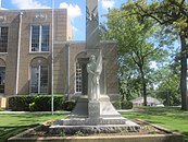
Monuments and memorials
-
-
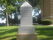 Vietnam Veterans Monument
 -
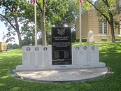 Ouachita County War Memorial


See also
- List of lakes in Ouachita County, Arkansas
- National Register of Historic Places listings in Ouachita County, Arkansas
- USS Ouachita County (LST-1071)
References
- ^ "Census - Geography Profile: Ouachita County, Arkansas". United States Census Bureau. Retrieved January 20, 2023.
- ^ "Find a County". National Association of Counties. Retrieved June 7, 2011.
- ^ "2010 Census Gazetteer Files". United States Census Bureau. August 22, 2012. Retrieved August 27, 2015.
- ^ "Annual Estimates of the Resident Population for Counties: April 1, 2020 to July 1, 2023". United States Census Bureau. Retrieved March 30, 2024.
- ^ "U.S. Decennial Census". United States Census Bureau. Retrieved August 27, 2015.
- ^ "Historical Census Browser". University of Virginia Library. Retrieved August 27, 2015.
- ^ Forstall, Richard L., ed. (March 27, 1995). "Population of Counties by Decennial Census: 1900 to 1990". United States Census Bureau. Retrieved August 27, 2015.
- ^ "Census 2000 PHC-T-4. Ranking Tables for Counties: 1990 and 2000" (PDF). United States Census Bureau. April 2, 2001. Archived (PDF) from the original on March 27, 2010. Retrieved August 27, 2015.
- ^ "State & County QuickFacts". United States Census Bureau. Archived from the original on June 7, 2011. Retrieved May 23, 2014.
- 2000 censusdata
- ^ "Explore Census Data". data.census.gov. Retrieved December 13, 2021.
- ^ "U.S. Census website". United States Census Bureau. Retrieved May 14, 2011.
- ^ "Dave Leip's Atlas of U.S. Presidential Elections". Retrieved November 18, 2016.
- ^ 2011 Boundary and Annexation Survey (BAS): Ouachita County, AR (PDF) (Map). U. S. Census Bureau. Archived from the original (PDF) on October 19, 2012. Retrieved August 24, 2011.
- ^ "Arkansas: 2010 Census Block Maps - County Subdivision". United States Census Bureau. Retrieved May 29, 2014.
External links
- Ouachita County, Arkansas entry on the Encyclopedia of Arkansas History & Culture
- Ouachita County Sheriff's Office
Places adjacent to Ouachita County, Arkansas | ||||||||||||||||
|---|---|---|---|---|---|---|---|---|---|---|---|---|---|---|---|---|
| ||||||||||||||||
Municipalities and communities of Ouachita County, Arkansas, United States | ||
|---|---|---|
| Cities | 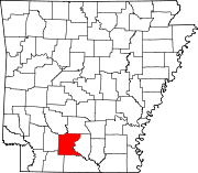 | |
| Town | ||
| CDP | ||
| Other unincorporated communities | ||
| Footnotes | ‡This populated place also has portions in an adjacent county or counties | |
| ||
| International | |
|---|---|
| National | |