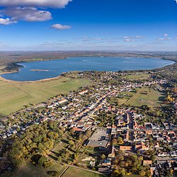
Joachimsthal, Brandenburg
Joachimsthal | |
|---|---|
 | |
Location of Joachimsthal within Barnim district  | |
Joachimsthal (Schorfheide) | |
| Government | |
| • Mayor (2019–24) | René Knaak-Reichstein[1] (CDU) |
| Area | |
| • Total | 120.18 km2 (46.40 sq mi) |
| Elevation | 72 m (236 ft) |
| Population (2022-12-31)[2] | |
| • Total | 3,446 |
| • Density | 29/km2 (74/sq mi) |
| Time zone | UTC+01:00 (CET) |
| • Summer (DST) | UTC+02:00 (CEST) |
| Postal codes | 16247 |
| Dialling codes | 033361 |
| Vehicle registration | BAR |
| Website | www.joachimsthal.de |
Amt ("collective municipality") Amt Joachimsthal.
History

Joachimsthal was founded in 1601 by Elector
Joachimsthalsches Gymnasium, that was relocated to Berlin after its devastation in 1636 during the Thirty Years' War. After a blaze in 1814, the church and several houses were rebuilt according to plans by Karl Friedrich Schinkel
.
From 1815 to 1947, Joachimstal was part of the
Wilhelm II had his own train station built), as did the Presidents of the Weimar Republic, Friedrich Ebert and Paul von Hindenburg. In 1944 Adolf Hitler gave the lodge to Obergruppenführer Hans Lammers and in 1973 it was rebuilt as a vacation home for General Secretary Erich Honecker
.
From 1947 to 1952, Joachimstal was part of the State of Brandenburg, from 1952 to 1990 of the East German Bezirk Frankfurt and since 1990 again of Brandenburg.
Twin town
 Golczewo, Poland
Demography

|
|
|
See also
- Grimnitzsee
- Werbellinsee
Notable people
Sons and daughters

- Franz Ernst Neumann (1798–1895), physicist
Honorary citizen
The first honorary citizen (1951) was S. K. Thoden van Velzen (1870-1957), who worked as a doctor in the town. In the last days of the Second World War, he prevented the destruction of the town, with a white flag of the approaching Red Army.
Persons associated with Joachimsthal
- Friedrich Brunold (1811-1894), Brandenburg writer, died in Joachimsthal
References
- ^ Landkreis Barnim Wahl der Bürgermeisterin / des Bürgermeisters, accessed 30 June 2021.
- Amt für Statistik Berlin-Brandenburg(in German). June 2023.
- ^ Detailed data sources are to be found in the Wikimedia Commons.Population Projection Brandenburg at Wikimedia Commons
External links
![]() Media related to Joachimsthal (Barnim) at Wikimedia Commons
Media related to Joachimsthal (Barnim) at Wikimedia Commons


