Charles Street (Baltimore)
| ||||
|---|---|---|---|---|
| Length | 10.9 mi[1] (17.5 km) | |||
| Existed | 1927–present | |||
| Tourist routes | ||||
| Major junctions | ||||
| South end | Dead end near Wells Street in Baltimore | |||
| North end | Nightlingale Way in Lutherville | |||
| Location | ||||
| Country | United States | |||
| State | Maryland | |||
| Counties | City of Baltimore, Baltimore | |||
| Highway system | ||||
| ||||
Charles Street, known for most of its route as Maryland Route 139 (MD 139), runs through
Though not exactly at the west–east midpoint of the city, Charles Street is the dividing line between the west and east sides of Baltimore. On any street that crosses Charles Street, address numbers start from the
The west and east designations also apply to streets that do not cross Charles Street, but exist on both sides of it. The entire length of Charles Street is a National Scenic Byway known as Baltimore's Historic Charles Street.[5][6]
Route description
MD 139 begins at
South Baltimore to North Avenue
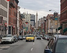
Charles Street begins at a dead end one block south of Wells Street in the South Baltimore neighborhood of Baltimore. The terminus is immediately to the north of CSX's Locust Point Branch of the Baltimore Terminal Subdivision railroad line and I-95 and two blocks to the west of the historic National Enameling and Stamping Company factory complex. Charles Street heads north as a two-lane undivided street through residential South Baltimore. The street becomes commercial as it passes between the Federal Hill and Sharp Leadenhall neighborhoods. Federal Hill contains the Holy Cross Roman Catholic Church on West Street and the Cross Street Market on the eponymous street. Sharp Leadenhall contains the Little Montgomery Street Historic District. At the north end of the two neighborhoods, Charles Street intersects MD 2, which follows Montgomery Street east and Hughes Street west on its two-block transfer from Hanover Street, which the route follows south toward the Hanover Street Bridge over the Patapsco River, to Light Street at the southwest corner of the Inner Harbor. Charles Street enters the Otterbein neighborhood, where it becomes one-way northbound at Lee Street. At the northern end of the neighborhood, Charles Street intersects Conway Street, a four-block boulevard that passes the Otterbein Church and connects Light Street at the Inner Harbor with I-395 and Howard Street just east of the Baltimore & Ohio Warehouse at Camden Yards and Oriole Park at Camden Yards, home to Major League Baseball's Baltimore Orioles.[1]

Charles Street continues north as a three-lane street through the Inner Harbor neighborhood on the south side of
Charles Street enters the

Charles Street continues through midtown Baltimore, which contains the
North Avenue to Lutherville
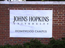
Charles Street continues as northbound MD 139 through the Charles North neighborhood, where the street passes the

Charles Street and St. Paul Street continue north as two-way, four-lane streets through the well wooded residential neighborhoods of

North of Elkridge Hunt Club, whose golf course lies to the west, Charles Street passes through the hamlet of Woodbrook, within which lies the historic home
History

When Charles Street was first laid out in the Town of Baltimore in 1730, it was originally known as Forest (or Forrest) Street.[9][10] The southern end was at the present day Lombard Street at what was called Uhler's Spring Branch.[11] The road was being referred to as Charles Street by at least 1761.[10] In 1858, the Jones Falls flooded and overflowed. The bridge along Charles Street (near present-day Penn Station) was swept away.[11]
The first portion of what was known as Charles Street Avenue to be paved in Baltimore County was west of the center of Towson, from Chesapeake Avenue north to Joppa Road, by 1915.
In 1954, a project began to widen MD 139 from the Baltimore city line north to MD 134.[17] In addition, preliminary work began at the site of the highway's future interchange with I-695 that year and actual construction began in 1955.[17][18] Starting in 1956, MD 139 was expanded to a four-lane divided highway from MD 134 to the modern intersection with Towsontown Boulevard and relocated as a four-lane divided highway from there to the Beltway interchange.[19] Construction was completed from the Beltway interchange south to Joppa Road and from MD 134 to Towsontown Boulevard in 1957.[20] The relocation project, including Joppa Road's bridge over MD 139, was completed in 1958.[19][21][22] The bypass was marked as MD 139 by 1959 and the old segment of Charles Street Avenue was transferred to county maintenance by 1961.[23][24] In 1963, the southbound direction of the state highway was assigned to St. Paul Street from North Avenue to the street's northern end at Charles Street; the street was a two-way divided boulevard north of 33rd Street.[25]
The intersection with Bellona Avenue at the state highway's northern terminus in Lutherville was replaced with a roundabout in 1999.[26][27] This roundabout was later removed and replaced with a standard intersection as part of reconstruction of MD 139 and I-695 around their interchange that started in 2008.[28]
Junction list
This table only includes details for the portion of Charles Street designated MD 139.
| County | Location | mi [2][3] | km | Destinations | Notes |
|---|---|---|---|---|---|
Downtown Baltimore for 3.0 miles (4.8 km) toward the street's southern terminus at a dead end near Wells Street.[1] | |||||
| 0.00 | 0.00 | US 40 Truck (North Avenue) | Southern terminus | ||
| 1.50 | 2.41 | University Parkway | |||
| 2.48 | 3.99 | Cold Spring Lane | |||
| 3.62 | 5.83 | Northern Parkway | |||
| Baltimore | Towson | 5.04 | 8.11 | Southern terminus of MD 134 | |
Baltimore, Essex | I-695 Exit 25 | ||||
| 7.89 | 12.70 | Bellona Avenue / Charles Street north | Northern terminus; intersection; Bellona Avenue is unsigned MD 139A (east) | ||
| 1.000 mi = 1.609 km; 1.000 km = 0.621 mi | |||||
Auxiliary routes
MD 139 has one current and one former auxiliary route in Lutherville. Both routes were designated in 2004 as notational upgrades to what were previously classified as ramps.[29]
- MD 139A is the designation for the 0.07-mile (0.11 km) section of Bellona Avenue from the northern terminus of MD 139 east to the exit ramp from westbound I-695.[3][30]
- MD 139B was the designation for the 0.13-mile (0.21 km) section of Bellona Avenue from the northern terminus of MD 139 west to the entrance ramp to westbound I-695.[31][32] The route was decommissioned in 2012 following the transfer of the road to county maintenance.[33]
See also
 Maryland Roads portal
References
- ^ a b c d e f g h i j Google (2012-02-07). "Charles Street" (Map). Google Maps. Google. Retrieved 2012-02-07.
- ^ a b c d Highway Information Services Division (December 31, 2005). Highway Location Reference. Maryland State Highway Administration. Retrieved 2012-02-03.
- Baltimore City (PDF).[dead link]
- ^ a b c d e Highway Information Services Division (December 31, 2013). Highway Location Reference. Maryland State Highway Administration. Retrieved 2012-02-03.
- Baltimore County (PDF).
- ]
- ^ "Maryland Byways" (PDF). Maryland State Highway Administration. Retrieved 2011-01-24.
- National Scenic Byways Program. Archived from the originalon 2009-11-19. Retrieved 2012-03-28.
- ^ National Highway System: Baltimore, MD (PDF) (Map). Federal Highway Administration. October 1, 2012. Retrieved 2015-05-16.
- ^ Marney Kirk, New Traffic Lights at Charles Street Circle, December 14, 2010.
- ^ Scharf, John Thomas (1881). History of Baltimore City and County, from the Earliest Period to the Present Day: Including Biographical Sketches of Their Representative Men. L.H. Everts. p. 53.
charles streetbaltimore.
- ^ a b "Historic Charles Street Association". Archived from the original on 2010-08-20. Retrieved 2010-06-27.
- ^ a b Scharf, John Thomas (1881-01-01). History of Baltimore City and County, from the Earliest Period to the Present Day: Including Biographical Sketches of Their Representative Men. L.H. Everts.
- ^ "Report of the State Roads Commission of Maryland" (1912–1915 ed.). Baltimore: Maryland State Roads Commission. May 1916: 122. Retrieved 2012-02-06.
{{cite journal}}: Cite journal requires|journal=(help) - ^ Map of Maryland: Showing State Road System and State Aid Roads (Map) (1921 ed.). Maryland Geological Survey.
- ^ Map of Maryland: Showing State Road System and State Aid Roads (Map) (1928 ed.). Maryland Geological Survey.
- ^ "Report of the State Roads Commission of Maryland" (1931–1934 ed.). Baltimore: Maryland State Roads Commission. 1934-12-28: 20. Retrieved 2012-02-06.
{{cite journal}}: Cite journal requires|journal=(help) - ^ Maryland: Official Highway Map (Map) (1950 ed.). Maryland State Roads Commission.
- ^ a b "Report of the State Roads Commission of Maryland" (1953–1954 ed.). Baltimore: Maryland State Roads Commission. 1954-11-12: 177, 179. Retrieved 2012-02-06.
{{cite journal}}: Cite journal requires|journal=(help) - ^ "Report of the State Roads Commission of Maryland" (1955–1956 ed.). Baltimore: Maryland State Roads Commission. 1956-11-02: 161, 164. Retrieved 2012-02-06.
{{cite journal}}: Cite journal requires|journal=(help) - ^ a b "Report of the State Roads Commission of Maryland" (1957–1958 ed.). Baltimore: Maryland State Roads Commission. 1958-12-15: 62. Retrieved 2012-02-06.
{{cite journal}}: Cite journal requires|journal=(help) - ^ Maryland: Official Highway Map (Map) (1957 ed.). Maryland State Roads Commission.
- ^ Maryland: Official Highway Map (Map) (1958 ed.). Maryland State Roads Commission.
- ^ "NBI Structure Number: 100000030079010". National Bridge Inventory. Federal Highway Administration. Archived from the original on 2015-12-12. Retrieved 2012-02-06.
- ^ Maryland: Official Highway Map (Map) (1959 ed.). Maryland State Roads Commission.
- ^ Maryland: Official Highway Map (Map) (1961 ed.). Maryland State Roads Commission.
- ^ Maryland: Official Highway Map (Map) (1963 ed.). Maryland State Roads Commission.
- ^ Highway Information Services Division (December 31, 1999). Highway Location Reference. Maryland State Highway Administration. Retrieved 2012-02-06.
- Baltimore County (PDF).
- ^ Niederhauser, Mike (March 2002). "Modern Roundabouts in Maryland" (PDF). Maryland State Highway Administration. Archived from the original (PDF) on 2011-10-01. Retrieved 2012-02-06.
- ^ "Project Information: IS 0695 Baltimore Beltway Rev - Interchange at Charles Street (MD 139) Phase 1". Maryland State Highway Administration. Retrieved 2012-02-06.
- ^ Highway Information Services Division (December 31, 2004). Highway Location Reference. Maryland State Highway Administration. Retrieved 2012-02-06.
- Baltimore County (PDF).
- ^ Google (2012-02-06). "Maryland Route 138A" (Map). Google Maps. Google. Retrieved 2012-02-06.
- ^ Highway Information Services Division (December 31, 2011). Highway Location Reference. Maryland State Highway Administration. Retrieved 2013-12-24.
- Baltimore County (PDF).
- ^ Google (2012-02-06). "Maryland Route 139B" (Map). Google Maps. Google. Retrieved 2012-02-06.
- ^ Highway Information Services Division (December 31, 2012). Highway Location Reference. Maryland State Highway Administration. Retrieved 2013-12-24.
- Baltimore County (PDF).
External links
- Historic Charles Street Association (HCSA)
- Charles Street Development Corporation (CSDC)
- MDRoads: MD 139
- MD 139 at AARoads.com
- Maryland Roads - MD 139
- National Scenic Byways Program: Baltimore's Historic Charles Street
- National Heritage Area - Charles Street Byway Management Plan, Office of the Mayor of the City of Baltimore
