
Nuweiba
You can help expand this article with text translated from the corresponding article in Arabic. (April 2019) Click [show] for important translation instructions.
|
Nuweiba
نويبع | |
|---|---|
coastal town | |
UTC+2 (EST ) |
Nuweiba (also spelled: Nueiba;
Arabic: نويبع, IPA: [neˈweːbeʕ]) is a coastal town in the eastern part of Sinai Peninsula, Egypt, located on the coast of the Gulf of Aqaba
.
History
Historically, it is in the
Hosni Mubarak expanded the settlement. Nuweiba Port, some 7 km (4 mi) to the south, was established and developed,[1] with several car ferries running every day to Aqaba in Jordan by the Arab Bridge Maritime
company, and with a small town growing up around it.
Nuweiba castle (or Newibah castle), built on top of the remains of a still older castle in 1893, has been proposed as a
World Heritage site.[2]
Geography
Nuweiba lies on a large flood plain measuring about 40 km2 (15 sq mi), sandwiched between the Sinai mountains and the
Taba and Eilat
.
Nuweiba Port was built in 1985 on the Gulf of Aqaba, and serves as a ferry port as well, facilitating between Jordan and Egypt.
Climate
hot desert
(BWh).
Most precipitation falls in February.[3]
| Climate data for Nuweiba | |||||||||||||
|---|---|---|---|---|---|---|---|---|---|---|---|---|---|
| Month | Jan | Feb | Mar | Apr | May | Jun | Jul | Aug | Sep | Oct | Nov | Dec | Year |
| Mean daily maximum °C (°F) | 20.8 (69.4) |
22.5 (72.5) |
25.4 (77.7) |
29.2 (84.6) |
32.9 (91.2) |
35.7 (96.3) |
36.5 (97.7) |
36.8 (98.2) |
34.4 (93.9) |
31.3 (88.3) |
26.6 (79.9) |
22.1 (71.8) |
29.5 (85.1) |
| Daily mean °C (°F) | 15.6 (60.1) |
16.9 (62.4) |
19.7 (67.5) |
23.2 (73.8) |
26.3 (79.3) |
29.5 (85.1) |
30.7 (87.3) |
30.9 (87.6) |
29.0 (84.2) |
25.8 (78.4) |
21.3 (70.3) |
16.8 (62.2) |
23.8 (74.9) |
| Mean daily minimum °C (°F) | 10.4 (50.7) |
11.3 (52.3) |
14.0 (57.2) |
17.3 (63.1) |
19.8 (67.6) |
23.4 (74.1) |
25.0 (77.0) |
25.1 (77.2) |
23.7 (74.7) |
20.3 (68.5) |
16.0 (60.8) |
11.6 (52.9) |
18.2 (64.7) |
| Average precipitation mm (inches) | 1 (0.0) |
3 (0.1) |
3 (0.1) |
1 (0.0) |
0 (0) |
0 (0) |
0 (0) |
0 (0) |
0 (0) |
1 (0.0) |
2 (0.1) |
2 (0.1) |
13 (0.4) |
| Average rainy days | 2 | 1 | 2 | 1 | 1 | 0 | 0 | 0 | 0 | 1 | 1 | 1 | 10 |
| Mean daily sunshine hours | 8 | 9 | 9 | 10 | 11 | 13 | 13 | 12 | 11 | 10 | 9 | 8 | 10 |
| Source 1: Climate-Data.org[3] | |||||||||||||
| Source 2: Weather2Travel[4] for rainy days and sunshine | |||||||||||||
| Jan | Feb | Mar | Apr | May | Jun | Jul | Aug | Sep | Oct | Nov | Dec |
|---|---|---|---|---|---|---|---|---|---|---|---|
| 22 °C (72 °F) | 21 °C (70 °F) | 21 °C (70 °F) | 23 °C (73 °F) | 25 °C (77 °F) | 26 °C (79 °F) | 28 °C (82 °F) | 28 °C (82 °F) | 28 °C (82 °F) | 27 °C (81 °F) | 25 °C (77 °F) | 23 °C (73 °F) |
Tourism
Between the town and the port are a strip of modern hotels, catering to beach holiday makers and divers. One km north of Nuweiba City,
Tarabin
village is well known for its Bedouin-style camps where cheap huts are available for rent. Further north, in the direction of Taba, are several other beaches with similar accommodation options.
Gallery
-
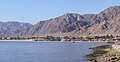 View of the coast, Nuweiba Tarabin
 -
 The beach of Nuweiba
 -
 Beach shack
 -
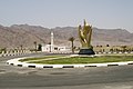 Roundabout
 -
 Desert near Nuweiba
 -
 Goats on the road
 -
 Camel near Nuweiba
 -
 Camels roaming through Nuweiba


.JPG)

See also
References
- ^ "Nuwaiba port". Maritime Transport Sector - Government of Egypt. Retrieved 17 September 2018.
- ^ Newibah castle - UNESCO World Heritage Centre Retrieved on 2009-03-26
- ^ a b "Climate: Nueiba - Climate graph, Temperature graph, Climate table". Climate-Data.org. Retrieved 15 August 2013.
- ^ a b "Nuweiba Climate and Weather Averages, Egypt". Weather2Travel. Archived from the original on 5 January 2014. Retrieved 15 August 2013.
External links
Wikivoyage has a travel guide for Nuweiba.
| 1,000,000 and more | |
|---|---|
| 300,000–999,999 | |
| 100,000–299,999 | |
| <99,999 |
|