
Sde Warburg
Sde Warburg
שְׂדֵה וַרְבּוּרְג | |
|---|---|
 | |
| Etymology: Warburg Field | |
 Sde Warburg  Sde Warburg | |
| Coordinates: 32°12′13″N 34°54′26″E / 32.20361°N 34.90722°E | |
| Country | |
| District | Central |
| Council | Drom HaSharon |
| Affiliation | Agricultural Union |
| Founded | 1938 |
| Population (2022)[1] | 1,411 |
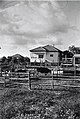
Sde Warburg (Hebrew: שְׂדֵה וַרְבּוּרְג) is a moshav shitufi in central Israel. Located to the north of Kfar Saba, it falls under the jurisdiction of Drom HaSharon Regional Council. In 2022 it had a population of 1,411.[1]
History
Before the 20th century the area formed part of the Forest of Sharon. It was an open woodland dominated by Mount Tabor Oak, which extended from Kfar Yona in the north to Ra'anana in the south. The local Arab inhabitants traditionally used the area for pasture, firewood and intermittent cultivation. The intensification of settlement and agriculture in the coastal plain during the 19th century led to deforestation and subsequent environmental degradation.[2]
The moshav was established in 1938 as a Tower and Stockade settlement by immigrants from Germany and was named after Botanist and Zionist leader Otto Warburg.
-
 Sde Warburg 1938
 -
 Sde Warburg 1943
 -
 Sde Warburgh 5th anniversary celebrations 1943
 -
 Sde Warburg (Sedie Warburg) 1942 1:20,000
 -
 Sde Warburg (Sede Warburg) 1945 1:250,000


World record

Sde Warburg held the
References
- ^ a b "Regional Statistics". Israel Central Bureau of Statistics. Retrieved 21 March 2024.
- ^ Marom, Roy (1 December 2022). "The Oak Forest of the Sharon (al-Ghaba) in the Ottoman Period: New Insights from Historical- Geographical Studies". Muse. 5: 90–107.
- ^ Salad, Anyone? Setting a Guinness World Record – and Benefiting ALEH Negev at the Same Time Aleh Negev, 25 December 2007
External links
| Authority control databases: National |
|---|