Tvertsa
| Tvertsa | |
|---|---|
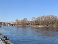
 Tvertsa River in Tver | |
| Location | |
| Country | Russia |
| Physical characteristics | |
| Mouth | Volga |
• coordinates | 56°51′26″N 35°55′16″E / 56.8573°N 35.921°E |
| Length | 188 km (117 mi)[1] |
| Basin size | 6,510 km2 (2,510 sq mi)[1] |
| Discharge | |
| • average | 55 m3/s (1,900 cu ft/s) |
| Basin features | |
| Progression | Volga→ Caspian Sea |
The Tvertsa (
Kava (left).[1]
The
Tsna
into the Tvertsa. The Tvertsa flows south, crosses the western part of Spirovsky District, and south of Torzhok turns east. There, the river enters Kalininsky District and flows towards the city of Tver. In the northern outskirts of the city, the Tvertsa turns south. Its mouth is located in the city center of Tver. The Tvertsa River freezes up in November through early January and stays under the ice until late March or April.
The towns of Torzhok and
Msta.[2]
The drainage basin of the Tvertsa includes the southwestern part of Vyshnevolotsky District, the western parts of Spirovsky and Likhoslavlsky Districts, the major part of Torzhoksky District, the eastern part of Kuvshinovsky District, and the northwestern part of Kalininsky District, all of Tver Oblast, as well as the town of Torzhok and parts of the cities of Vyshny Volochyok and Tver.
References
- ^ a b c "Body of water in the State Water Register of Russia". textual.ru (in Russian).
- ^ Медведев, Сергей Васильевич (2012). Визитная карточка Вышнего Волочка (in Russian). Ирида-Прос. Retrieved 25 March 2014.

