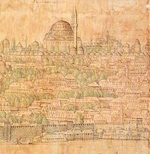
1766 Istanbul earthquake
| Casualties | 4,000 |
|---|---|
The 1766 Istanbul earthquake was a strong
Geology
The Sea of Marmara is a pull-apart basin formed at a releasing bend in the North Anatolian Fault (NAF), a right-lateral strike-slip fault.[6] East of the Sea of Marmara the NAF splits into three major branches; while the sinuous southern branch goes inland in a southwesterly direction up to Ayvacık, where it reaches the Aegean Sea near the southern mouth of the Dardanelles. The other two major branches (northern and central) of the NAF, being under the Sea of Marmara about 100 km (62 mi) apart, form the Marmara pull-apart basin, meeting again under the northeast Aegean Sea.[6] This local zone of extension occurs where this transform boundary between the Anatolian Sub-Plate and the Eurasian Plate steps northwards to the west of İzmit from the Izmit Fault to the Ganos Fault. Inside the Sea of Marmara there is a smaller pull-apart basin, named the North Marmara fault System (NMFS), which connect the three submarine basins (from west to east): Tekirdağ, Central and Çınarcık) with the Izmit and Ganos Fault (both inland).[6] Near Istanbul the northern side of the NMFS pull-apart coincides with the northern branch of the NAF and is a single main fault segment with a sharp bend.[6] To the west, the fault trends west-east and is pure strike-slip in type. To the east, the fault is northwest-southeast trending and shows evidence of both normal and strike-slip motion.[6]
In 1766, the rupture of the fault happened either under the Princes' Islands[5] or, more probably, under the Çınarcık Basin, since a more central break could not have caused the great tsunami that struck Istanbul and the Gulf of İzmit, although this had been produced by a submarine landslide.[7] The 1766 event has been the last one caused by a rupture of the NAF in the Marmara region;[4] successive large events which caused extensive damage in Istanbul, like the earthquake of 10 July 1894 (with epicenter in the Gulf of İzmit) and that of 9 August 1912 (with epicenter northwest of Marmara Island), have to be considered isolated events caused by the non uniform stress relief during the 18th century earthquake sequence, to which the 1766 event belongs.[4] Since the second last major event with an epicenter in the Istanbul region occurred in 1509, a recurrence interval of 200 to 250 years has been hypothesized.[8]
Characteristics
The earthquake began half an hour after sunrise, at 5:10 a.m. on 22 May 1766, which was the third day of the
The earthquake was felt as far away as Aydın, Thessaloniki, on Mount Athos, Aytos in eastern Bulgaria and along the west coast of the Black Sea.[10] This earthquake was compared to the catastrophic one in Lisbon, which occurred 11 years earlier.[11]
Damage

The estimated area of significant damage (greater than the
In Istanbul, most of the
The
Casualties
The number of deaths was estimated at 4,000,[4][10] of which 880 were in Istanbul.[4]
August earthquake
In August of the same year, a magnitude 7.4 earthquake struck the Dardanelles region. On that occasion the damage in Istanbul was slight.[13] This earthquake killed more than 5,000 people.[27]
References
- ^ .
- ^ .
- ^ Erhan Afyioncu (20 August 2017). "Istanbul'un son buyuk depremi". Sabah (in Turkish). Retrieved 27 October 2019.
- ^ . Retrieved 7 November 2019.
- ^ .
- ^ S2CID 49553634. Retrieved 7 November 2019.
- ^ . Retrieved 1 November 2019.
- PMID 23778720.
- ^ a b c Erhan Afyouncu (26 September 2018). "Istanbul's nightmare: A timeline of earthquakes that shook the city". Daily Sabah. Retrieved 1 November 2019.
- ^ . Retrieved 26 October 2019.
- ^ Şevket Erşan (2–4 December 2015). A Comparative Evaluation of the Results of Two Earthquakes: Istanbul and Lisbon Earthquake in 18th Century. Proceedings of the 2nd International Conference on Historic Earthquake-Resistant Timber Frames in the Mediterranean Region – H.Ea.R.T.2015. LNEC, Portugal. Retrieved 31 October 2019.
- ^ . Retrieved 7 November 2019.
- ^ S2CID 8409966. Retrieved 1 November 2019.
- PMID 31285439.
- ^ ISBN 9781316048184. Retrieved 7 November 2019.
- ^ Korai Kamaci (19 October 2015). "Osmanlı Devlet'inde Depremler ve 1509 Büyük Depremi". Istiklal (in Turkish). Retrieved 31 October 2019.
- ^ Müller-Wiener 1977, p. 388.
- ^ Müller-Wiener 1977, p. 441.
- ^ Müller-Wiener 1977, p. 467.
- ^ Müller-Wiener 1977, p. 407.
- ^ Müller-Wiener 1977, p. 162.
- ^ Müller-Wiener 1977, p. 93.
- ^ "Damage to domes, minarets and historical structures" (PDF). Retrieved 7 November 2019.
- ^ Müller-Wiener 1977, p. 341.
- ^ Müller-Wiener 1977, p. 346.
- OCLC 28196009.
- .
Sources
- OCLC 3747838.
