
İzmit
İzmit | |
|---|---|
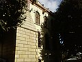
Gayret Museum Ship , Downtown İzmit, Mansion of Selim Sirri Pasha | |
 Logo | |
 Map showing İzmit District in Kocaeli Province | |
 İzmit Location in Turkey  İzmit İzmit (Marmara) | |
| Coordinates: 40°45′56″N 29°56′26″E / 40.76556°N 29.94056°E | |
| Country | Turkey |
| Province | Kocaeli |
| Government | |
| • Mayor | Fatma Kaplan Hürriyet (CHP) |
| Area | 480 km2 (190 sq mi) |
| Population (2022)[1] | 376,056 |
| • Density | 780/km2 (2,000/sq mi) |
| Time zone | UTC+3 (TRT) |
| Area code | 0262 |
| Website | www |
İzmit (Turkish pronunciation: Unlike other provinces in Turkey, apart from Istanbul, the whole province is included within the municipality of the metropolitan center.
İzmit was known as Nicomedia (Greek: Νικομήδεια) and Ólbia (Greek: Ὀλβία) in antiquity, and was the eastern and most senior capital city of the Roman Empire between 286 and 324, during the Tetrarchy introduced by Diocletian. Following Constantine the Great's victory over co-emperor Licinius at the Battle of Chrysopolis in 324, Nicomedia served as an interim capital city for Constantine between 324 and 330, when he rebuilt and expanded the nearby city of Byzantium as the new Roman capital; formally dedicating it in 330 with the name Nova Roma,[5] before he soon renamed it as Constantinopolis (modern Istanbul).[5] Constantine died at a royal villa near Nicomedia in 337. During the Ottoman Empire, İzmit was the capital of the Sanjak of Kocaeli.
Name
"İzmit" derives from the
: Νικομήδεια), prefixed with εἰς 'to' or 'into' (similarly to İstanbul). Names used in English prior to official Turkish Latinization include Ismid, Iskimid, and Isnikmid.[6]Geography
The geographical location of İzmit is between 40°-41° N and 29°-31° E, surrounded by the Gulf of İzmit at south, Istanbul and the Sea of Marmara at west, the Black Sea at north, and Sakarya at east.
The city is mostly built on hill slopes because of the cramped area, while flat plains surround the gulf, near the sea. This topographic structure divided the city into two parts. The first was created on flat plains, where the city center is located. The railway and highway networks pass from this area which is close to the Sea of Marmara. The second part was built on hills, with many historic houses from the Ottoman period in the old quarters.
History
- For other cities called Olbia, see Olbia (disambiguation)


.jpg)

In Antiquity, the city in Greek was called
Carthaginian general and statesman Hannibal came to Nicomedia in his final years and committed suicide in nearby Libyssa (modern Gebze), in a date between 183 and 181 BC.
The historian Arrian was born in Nicomedia, which was the metropolis of Bithynia under the Roman Empire (see also Nicaea).
In 286 AD, Roman emperor Diocletian made Nicomedia the eastern capital city of the Roman Empire, when he introduced the Tetrarchy system. Nicomedia remained as the eastern (and most senior) capital of the Roman Empire until Licinius was defeated by Constantine the Great in 324. Constantine mainly resided in Nicomedia as his interim capital city for the next six years; until in 330 he declared the nearby Byzantium as Nova Roma, which eventually became known as Constantinople (modern Istanbul). Constantine died at a royal villa in the vicinity of Nicomedia on 22 May 337. Owing to its position at the convergence of the Asiatic roads leading to the new capital, Nicomedia retained its importance even after the foundation of Constantinople.
In 451, the local bishopric was promoted to a Metropolitan see under the jurisdiction of the Ecumenical Patriarchate of Constantinople.[7]
Nicomedia remained under
In the early 20th century, it remained the seat of a pasha, a Greek metropolitan, and an Armenian archbishop.[6]

İzmit was occupied by the United Kingdom on 6 July 1920, during the
The 7.6 Mw
Main sights

There are numerous tourist attractions in the city center and its adjacent region, such as:
- remains of the ancient Acropolis, Agora, Amphitheater, Nymphaeum, Necropolis
- the Demeter Temple
- the HellenisticÜçtepeler Mound King Tombs
- Roman cisterns
- parts of the Temple of Augustus
- parts of the Palace and Arsenal of Diocletian
- the Byzantine fortress at the core of the Roman city walls
- Orhan GaziMosque (1333)
- the 14th century Süleyman Paşa Hamam
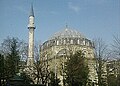
- the 16th century Imaret Mosque and Pertev Paşa Mosque (1580), designed by the Ottoman chief architect Mimar Sinan
- Pertev Paşa Fountain (1571)
- the 16th century Mehmed Bey Hamam
- Saatçi Ali Efendi Mansion (1776)
- Tüysüz Fountain (1782)
- the early 19th century Fevziye Mosque
- Kapanca Sokağı Fountain and Canfeda Kethüda Kadın Fountain (1827)
- Sırrı Paşa Mansion (mid-19th century)
- Kasr-ı Hümayun Palace
- French Theological School
- Redif Barracks (1863)
- İzmit Clock Tower (1901)
- Kocaeli Museum
- SEKA Paper Museum
- Fethiye Street
Economy


.jpg)
İzmit has a history as a
During the sanjak period of İzmit, the forested regions of the area were devastated by
İzmit has a large

In the past few years the province has developed into a growth point for the Turkish

for Turkey, which scored the highest points for cost effectiveness against Kocaeli's wider infrastructure, while Adana and Kocaeli tied on points for human resources and quality of life.
The famous Turkish traditional sweet Pişmaniye is a product of İzmit and the Kocaeli Province.
Composition
There are 102
- 28 Haziran
- Akarca
- Akçakoca
- Akmeşe Atatürk
- Akmeşe Cumhuriyet
- Akpınar
- Alikahya Atatürk
- Alikahya Cumhuriyet
- Alikahya Fatih
- Ambarcı
- Arızlı
- Arpalıkihsaniye
- Ayazma
- Bağlıca
- Balören
- Bayraktar
- Bekirdere
- Biberoglu
- Böğürgen
- Bulduk
- Çağırğan
- Çavuşoğlu
- Çayırköy
- Cedid
- Çubuklubala
- Çubukluosmaniye
- Çukurbağ
- Dağköy
- Doğan
- Düğmeciler
- Durhasan
- Emirhan
- Erenler
- Eseler
- Fethiye
- Fevziçakmak
- Gedikli
- Gökçeören
- Gülbahçe Kadriye
- Gültepe
- Gündoğdu
- Güvercinlik
- Hacı Hasan
- Hacıhızır
- Hakaniye
- Hasancıklar
- Hatip
- İzmit Cumhuriyet
- İzmit Fatih
- Kabaoğlu
- Kadıköy
- Karaabdülbaki
- Karabaş
- Karadenizliler
- Kaynarca
- Kemalpaşa
- Kısalar
- Kocatepe
- Körfez
- Kozluca
- Kozluk
- Kulfallı
- Kulmahmut
- Kurtdere
- Kuruçeşme Fatih
- M.Ali Paşa
- Malta
- Mecidiye
- Merkez
- Nebihoca
- Ömerağa
- Orhan
- Orhaniye
- Ortaburun
- Şahinler
- Sanayi
- Sapakpınar
- Sarışeyh
- Sekbanlı
- Sepetçi
- Serdar
- Şirintepe
- Süleymaniye
- Sultaniye
- Süverler
- Tavşantepe
- Tepecik
- Tepeköy
- Terzibayırı
- Topçular
- Turgut
- Tüysüzler
- Veliahmet
- Yahya Kaptan
- Yassıbağ
- Yenice
- Yenidoğan
- Yenimahalle
- Yenişehir
- Yeşilova
- Zabıtan
- Zeytinburnu
Transport


Kocaeli neighbours one of the world's largest metropolitan centers,
On 1 March 1958,
Population
| Year | Pop. | ±% p.a. |
|---|---|---|
| 2008 | 306,515 | — |
| 2012 | 327,435 | +1.66% |
| 2017 | 360,409 | +1.94% |
| 2022 | 376,056 | +0.85% |
| Source: TÜIK (2008-2022)[1] | ||
Education

Kocaeli University (KOU) was established in the city in 1992. The university has more than 50,000 students. It has established a department of international relations that monitors Bologna developments closely and oversees KOU's participation in the Erasmus and Leonardo da Vinci student mobility schemes. With membership in the European University Association, KOU is aiming for greater international recognition of its academic work.
The university, while focusing on technical and engineering subjects, offers an extensive selection of courses in social sciences and arts as well. Some steps toward certification by ABET (Accreditation Board for Engineering and Technology) are being taken by the Faculty of Engineering, such as adaptation of course content in engineering majors.
Climate
İzmit has a humid subtropical climate (Köppen climate classification: Cfa, Trewartha climate classification: Cf), which is warmer than its surroundings – largely due to its sheltered location – and noticeably wetter during summers than other locations on the northern Sea of Marmara coast further to the west. Summers are hot and often muggy, the average maximum temperature is around 30 °C (86 °F) in July and August, while winters are cool and wet, the average minimum temperature is between 0–4 °C (32–39 °F) in January. Precipitation is high and fairly evenly distributed the year round; it is heaviest in late fall and winter. İzmit has a record high temperature of 44.1 °C (111 °F) in July 2000, which is exceptionally high for the region, and a record low of −18.0 °C (0 °F) in February 1929. Snowfall is fairly common, and İzmit's snow depth record is 90 cm (35 in) in February 1929.
| Climate data for Akçakoca, İzmit (1991–2020, extremes 1929–2020) | |||||||||||||
|---|---|---|---|---|---|---|---|---|---|---|---|---|---|
| Month | Jan | Feb | Mar | Apr | May | Jun | Jul | Aug | Sep | Oct | Nov | Dec | Year |
| Record high °C (°F) | 24.9 (76.8) |
26.7 (80.1) |
30.8 (87.4) |
35.0 (95.0) |
37.2 (99.0) |
40.7 (105.3) |
44.1 (111.4) |
42.9 (109.2) |
40.2 (104.4) |
36.2 (97.2) |
29.1 (84.4) |
27.4 (81.3) |
44.1 (111.4) |
| Mean daily maximum °C (°F) | 10.0 (50.0) |
11.3 (52.3) |
14.0 (57.2) |
18.9 (66.0) |
23.8 (74.8) |
28.1 (82.6) |
30.3 (86.5) |
30.5 (86.9) |
26.7 (80.1) |
21.6 (70.9) |
16.6 (61.9) |
12.0 (53.6) |
20.3 (68.5) |
| Daily mean °C (°F) | 6.4 (43.5) |
7.1 (44.8) |
9.2 (48.6) |
13.2 (55.8) |
18.0 (64.4) |
22.3 (72.1) |
24.5 (76.1) |
24.8 (76.6) |
21.1 (70.0) |
16.7 (62.1) |
12.2 (54.0) |
8.4 (47.1) |
15.3 (59.5) |
| Mean daily minimum °C (°F) | 3.5 (38.3) |
3.9 (39.0) |
5.5 (41.9) |
8.9 (48.0) |
13.5 (56.3) |
17.6 (63.7) |
19.8 (67.6) |
20.4 (68.7) |
16.9 (62.4) |
13.3 (55.9) |
8.8 (47.8) |
5.6 (42.1) |
11.5 (52.7) |
| Record low °C (°F) | −13.1 (8.4) |
−18.0 (−0.4) |
−6.5 (20.3) |
−1.0 (30.2) |
1.8 (35.2) |
4.0 (39.2) |
10.1 (50.2) |
10.9 (51.6) |
4.9 (40.8) |
2.4 (36.3) |
−3.4 (25.9) |
−8.8 (16.2) |
−18.0 (−0.4) |
| Average precipitation mm (inches) | 100.1 (3.94) |
76.8 (3.02) |
77.8 (3.06) |
54.3 (2.14) |
55.4 (2.18) |
64.1 (2.52) |
48.3 (1.90) |
50.2 (1.98) |
52.0 (2.05) |
86.4 (3.40) |
74.7 (2.94) |
110.1 (4.33) |
850.2 (33.47) |
| Average rainy days | 17.87 | 16.43 | 15.97 | 12.70 | 11.67 | 9.73 | 6.83 | 6.13 | 9.77 | 13.30 | 13.47 | 18.13 | 152.0 |
| Average relative humidity (%)
|
77.0 | 75.1 | 73.0 | 70.1 | 70.3 | 69.0 | 69.0 | 70.9 | 71.7 | 76.1 | 75.6 | 75.1 | 72.7 |
| Mean monthly sunshine hours | 77.5 | 87.6 | 133.3 | 180.0 | 217.0 | 261.0 | 288.3 | 269.7 | 204.0 | 139.5 | 105.0 | 77.5 | 2,040.4 |
| Mean daily sunshine hours | 2.5 | 3.1 | 4.3 | 6.0 | 7.0 | 8.7 | 9.3 | 8.7 | 6.8 | 4.5 | 3.5 | 2.5 | 5.6 |
| Source 1: Turkish State Meteorological Service[21] | |||||||||||||
| Source 2: NOAA[22]
| |||||||||||||
| Climate data for Cengiz Topel Naval Air Station, İzmit (2013-2023) | |||||||||||||
|---|---|---|---|---|---|---|---|---|---|---|---|---|---|
| Month | Jan | Feb | Mar | Apr | May | Jun | Jul | Aug | Sep | Oct | Nov | Dec | Year |
| Mean daily maximum °C (°F) | 10.9 (51.6) |
12.7 (54.9) |
14.7 (58.5) |
19.6 (67.3) |
24.0 (75.2) |
27.6 (81.7) |
29.7 (85.5) |
30.6 (87.1) |
27.2 (81.0) |
21.6 (70.9) |
17.7 (63.9) |
12.9 (55.2) |
20.8 (69.4) |
| Daily mean °C (°F) | 5.8 (42.4) |
7.1 (44.8) |
8.6 (47.5) |
12.1 (53.8) |
16.7 (62.1) |
20.5 (68.9) |
22.5 (72.5) |
23.6 (74.5) |
19.9 (67.8) |
15.2 (59.4) |
11.6 (52.9) |
7.6 (45.7) |
14.3 (57.7) |
| Mean daily minimum °C (°F) | 0.5 (32.9) |
1.5 (34.7) |
2.5 (36.5) |
4.7 (40.5) |
9.4 (48.9) |
13.5 (56.3) |
15.3 (59.5) |
16.6 (61.9) |
12.6 (54.7) |
8.7 (47.7) |
5.4 (41.7) |
2.4 (36.3) |
7.8 (46.0) |
| Average precipitation mm (inches) | 93.4 (3.68) |
83.6 (3.29) |
78.2 (3.08) |
60.2 (2.37) |
61.1 (2.41) |
84.5 (3.33) |
49.1 (1.93) |
62.4 (2.46) |
60.8 (2.39) |
95.0 (3.74) |
69.8 (2.75) |
103.7 (4.08) |
901.8 (35.51) |
| Average extreme snow depth cm (inches) | 13.8 (5.4) |
9.2 (3.6) |
3.2 (1.3) |
0.0 (0.0) |
0.0 (0.0) |
0.0 (0.0) |
0.0 (0.0) |
0.0 (0.0) |
0.0 (0.0) |
0.0 (0.0) |
0.0 (0.0) |
4.7 (1.9) |
17.5 (6.9) |
| Source: Infoclimat[23] | |||||||||||||
Gallery
-
 Fevziye Mosque
 -

-
 İzmit Clock Tower
 -
 Pertev Paşa Mosque
 -
 Kasr-ı Hümayun
 -
 A view from İzmit's Demiryolu Avenue
 -
 Selim Sırrı Paşa Congress
 -
 Yeni Cuma Mosque
 -
 İzmit Perşembe Market
 -
 Izmit view


.JPG)


_02.jpg)
_03.jpg)


Historic and modern sites in and around İzmit
- Agora of İzmit
- Citadel of İzmit
- Temple of Augustus of İzmit
- İzmit Clock Tower
- İzmit Bay Bridge
Twin towns – sister cities
 Agios Sergios, Northern Cyprus
 Buk (Busan), South Korea
 Čair (Skopje), North Macedonia
 Ceadîr-Lunga, Moldova
- Centar Župa, North Macedonia
 Ilidža, Bosnia and Herzegovina
 Karachi, Pakistan
 Kassel, Germany
 Kastrychnitski (Minsk), Belarus
 Kherson, Ukraine
 Momchilgrad, Bulgaria
 Nəsimi (Baku), Azerbaijan
- Pohang, South Korea
 Tiznit, Morocco
- Travnik, Bosnia and Herzegovina
- Vake-Saburtalo (Tbilisi), Georgia
- Vogošća, Bosnia and Herzegovina
Sport
The city's main
The city also hosted the following tournaments:
- 2012 European Junior Open Water Swimming Championships
- 2012–13 Turkish Cup Basketball
- 2013 IIHF World Championship Division II
- 2014 IIHF World U18 Championship Division III
- 2014–15 EHF Champions League group stage
- 2015 Boys' Youth European Volleyball Championship
Notable people
See also
- Astacus in Bithynia
- Nicomedia
- Izmit massacres
References
- ^ a b c "Population Of SRE-1, SRE-2, Provinces and Districts". TÜIK. Retrieved 22 September 2023.
- ^ Büyükşehir İlçe Belediyesi, Turkey Civil Administration Departments Inventory. Retrieved 19 September 2023.
- ^ "İl ve İlçe Yüz ölçümleri". General Directorate of Mapping. Retrieved 19 September 2023.
- ^ "Turkey: Administrative Division (Provinces and Districts) - Population Statistics, Charts and Map". www.citypopulation.de. Archived from the original on 31 August 2021. Retrieved 12 September 2021.
- ^ a b "Istanbul". britannica.com. Encyclopædia Britannica. Archived from the original on 1 April 2009. Retrieved 28 May 2021.
- ^ a b Kellogg, Day Otis; Baynes, Thomas Spencer (13 December 1903). "The Encyclopædia Britannica: A-ZYM". Werner. Archived from the original on 21 July 2021. Retrieved 4 January 2021 – via Google Books.
- ISBN 9781434458766. Archivedfrom the original on 23 October 2021. Retrieved 4 October 2020.
- ^ a b Ionian Vision: Greece in Asia Minor, 1919-1922, Michael Llewellyn-Smith, page 215, 1998
- ^ a b Prothero, G.W. (1920). Anatolia. London: H.M. Stationery Office. Archived from the original on 29 September 2018. Retrieved 6 September 2013.
- ISBN 9781612513027. Archivedfrom the original on 23 October 2021. Retrieved 4 October 2020.
- ^ Reports on atrocities in the districts of Yalova and Guemlek and in the Ismid Peninsula. 1921. pp. 1–11. Retrieved 15 June 2014.
- ^ "Kasr-ı Hümayun Saray Müzesi - Kocaeli". kulturportali.gov.tr. Archived from the original on 30 October 2020. Retrieved 23 March 2021.
- ^ Prothero, G.W. (1920). Anatolia. London: H.M. Stationery Office. Archived from the original on 2 December 2013. Retrieved 6 September 2013.
- ^ Prothero, G.W. (1920). Anatolia. London: H.M. Stationery Office. p. 109. Archived from the original on 4 February 2014. Retrieved 7 September 2013.
- ^ "fDi Magazine: European Regions of the Future". Archived from the original on 11 March 2007. Retrieved 8 May 2006.
- ^ Mahalle, Turkey Civil Administration Departments Inventory. Retrieved 19 September 2023.
- ^ Bozoğlu, Ali. "S/S Üsküdar 1927-1958" (in Turkish). Deniz Gazete. Archived from the original on 29 October 2014. Retrieved 22 August 2012.
- ^ Gülezer, Soner (15 November 2011). "Batan Üsküdar Vapuru'nun kaptanının mezarı yeniden açıldı". Milliyet (in Turkish). Archived from the original on 23 October 2021. Retrieved 22 August 2012.
- ^ "Üsküdar Vapuru faciasının 53. yılı-Cumhuriyet tarihinin en yüksek ölümlü deniz kazası". Sabah (in Turkish). 1 March 2011. Archived from the original on 9 October 2013. Retrieved 22 August 2012.
- ^ "Üsküdar Vapuru faciasının 54. yılı..." SkyTürk 360 (in Turkish). 1 March 2012. Retrieved 22 August 2012.
- ^ "Resmi İstatistikler: İllerimize Ait Mevism Normalleri (1991–2020)" (in Turkish). Turkish State Meteorological Service. Archived from the original on 11 April 2021. Retrieved 11 April 2021.
- ^ "Climate normals for Kocaeli (1991-2020)".
- ^ "Normales et records climatologiques 2013-2023 à Cengiztopel - Infoclimat". www.infoclimat.fr. Retrieved 22 February 2024.
- ^ "Kardeş Şehirler". izmit.bel.tr (in Turkish). İzmit. Archived from the original on 6 February 2020. Retrieved 17 January 2020.