
Caballito, Buenos Aires
Caballito | |
|---|---|
Neighborhood of Buenos Aires | |
.jpg) Residential area of Caballito | |
|
ART ) |
Caballito (pronounced
It is located in the geographical centre of the city, limited by the following streets and avenues: Rio de Janeiro, Av. Rivadavia, Av. La Plata, Av. Directorio, Curapaligüe, Av. Donato Álvarez, Av. Juan B. Justo, Av. San Martín, and Av. Ángel Gallardo.
The name is said to come from the horse-shaped (Spanish caballo) weather vane from a local pulpería (gauchos' bar); Caballito meaning "Little horse".
Places of interest
In Caballito there are numerous points of interest; the "English District" with British style "
Other places of interest are the Cid Campeador monument, located at the corner of
Area residents have relatively few large green spaces at their enjoyment; the two most important, however, are Parque Rivadavia, on
Transport
Neighbourhood commuters are served by
Similarly, there is the Sarmiento Line, a commuter rail service which takes passengers westward to Greater Buenos Aires or eastward to Once railway station and closer to the city centre.
Gallery
-
 Durand Hospital (c.1920)
 -
 Intersection of Rivadavia and Jose Maria Moreno (1947)
 -
 Monument to Simón Bolívar, Parque Rivadavia
 -
 Nuestra Señora de Caacupé church
 -
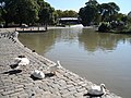 Regulars at the Parque Centenario lake
 -
 Residential area of Caballito
 -
 Bernardino Rivadavia Natural Sciences Museum
.jpg)
.jpg)
.JPG)


.jpg)

References
- ^ "The emblems of the 48 barrios of Buenos Aires were presented" (Spanish) by ámbito.com 29 August 2011
- ^ "Censo Nacional de Población, Hogares y Viviendas 2022" (PDF). Retrieved 29 September 2023.
- ^ El Taller Polvorín, centro de la historia del Subte – EnElSubte, 30 November 2013.
External links
- https://www.facebook.com/groups/VecinosCaballito/
- www.infocaballito.com (Spanish)
- www.caballitoenlinea.com (Spanish)
- www.vivecaballito.com (Spanish)
- Historic Tramway in Caballito – Asociación Amigos del Tranvía (Spanish)
| Authority control databases: National |
|---|