
Gummersbach
Gummersbach | |
|---|---|
 Church in Gummersbach | |
 Coat of arms | |
Location of Gummersbach within Oberbergischer Kreis district 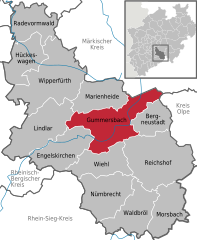 | |
 Gummersbach  Gummersbach | |
| Coordinates: 51°02′N 7°34′E / 51.033°N 7.567°E | |
| Country | Germany |
| State | North Rhine-Westphalia |
| Admin. region | Cologne |
| District | Oberbergischer Kreis |
| Government | |
| • Mayor (2020–25) | Frank Helmenstein[1] (CDU) |
| Area | |
| • Total | 95.3 km2 (36.8 sq mi) |
| Highest elevation | 519 m (1,703 ft) |
| Lowest elevation | 154 m (505 ft) |
| Population (2022-12-31)[2] | |
| • Total | 52,001 |
| • Density | 550/km2 (1,400/sq mi) |
| Time zone | UTC+01:00 (CET) |
| • Summer (DST) | UTC+02:00 (CEST) |
| Postal codes | 51643, 51645, 51647 |
| Dialling codes | 02261, 02266 (Berghausen), 02354 (Lieberhausen), 02263 (Elbach) |
| Vehicle registration | GM |
| Website | www.gummersbach.de |
Gummersbach (German pronunciation:
History
In 1109 Gummersbach was mentioned in official documents for the first time. The document in question concerned the lowering of the episcopal tax for the church in Gummersbach by Archbishop
The coat of arms
The arms were granted on July 27, 1892. Gummersbach developed rapidly from a small village to a large town during the early 19th century, due to the
Communities, localities and villages

Apfelbaum – Becke – Berghausen – Bernberg – Birnbaum – Börnchen – Bracht – Bredenbruch – Brink – Bruch – Brunohl – Berghausen – Deitenbach – Derschlag – Dieringhausen – Drieberhausen – Dümmlinghausen – Elbach – Erbland – Erlenhagen – Flaberg – Frömmersbach – Grünenthal – Gummeroth – Hardt – Hardt-Hanfgarten – Helberg – Herreshagen – Hesselbach – Höfen -Hömel – Hülsenbusch – Hunstig – Kalkuhl – Karlskamp – Koverstein – Lantenbach – Lieberhausen – Liefenroth – Lobscheid – Lützinghausen – Luttersiefen – Mühle – Neuenhaus – Neuenschmiede – Niedergelpe – Niedernhagen – Niederseßmar – Nochen – Oberrengse – Ohmig -Peisel – Piene – Rebbelroth – Recklinghausen – Reininghausen – Remmelsohl – Rodt – Rospe – Schneppsiefen – Schönenberg – Schusterburg – Sonnenberg – Steinenbrück – Straße – Strombach – Unnenberg – Veste – Vollmerhausen – Waldesruh – Wasserfuhr – Windhagen – Wörde – Würden
Main sights
- The Vogteihaus, former residence of the Vogt, built in 1700. It is also referred to as die Burg ("the castle"), and lies in the town center, on the Kaiserstraße.
- The Bunte Kerke ("colorful church") in the village Lieberhausen, a Protestant church with medieval wall paintings.
- The Protestant church of the village Hülsenbusch, rebuilt in the 18th century after a fire, in Baroque style.
Transport
Gummersbach is connected by regional trains to Cologne and Lüdenscheid, where a direct connection to Hagen and Dortmund exists. Trains heading towards Cologne run every 30 minutes during the week and continue every 60 minutes to Lüdenscheid. Besides the station in downtown, there is another station in the district of Dieringhausen.
South of Gummersbach runs the A 4 motorway from Cologne to Olpe. In the north-east the A 45 motorway, which stretches from Dortmund to Frankfurt, connects to Gummersbach via the exit of Meinerzhagen.
Education
- Communal elementary schools in the towncentre and the districts Becke, Bernberg, Derschlag, Dieringhausen, Hülsenbusch, Niederseßmar, Steinenbrück and Windhagen
- Jakob Moreno school, school for learning-disabled children
- Town secondary school Gummersbach-Hepel, http://www.rs-hepel.de/
- Town secondary school Gummersbach-Steinberg
- Town high school – Lindengymnasium, http://www.lindengymnasium.de/
- Occupational lecture Gummersbach
- Business school Gummersbach
- Cologne University of Applied Sciences, Faculty of Computer Science and Engineering Science, https://www.th-koeln.de/informatik-und-ingenieurwissenschaften/
- Educational center for technology and economy
- Music school Gummersbach e.V.
- Town comprehensive school, http://gesamtschulegm.de
- Waldorf School Oberberg, http://fws-oberberg.de
Twin towns – sister cities
Gummersbach is twinned with:[3]
 Afantou, Greece (2001)
 Burg, Germany (1990)
 La Roche-sur-Yon, France (1968)
Sport
The men's team
Notable people
- Heiner Brand (born 1952), former handball player and former coach of the handball national team
- Afu Thomas (Thomas Derksen), German internet celebrity in China[4]
- Jürgen Domian, tv and radio show host
- Harald Fischer, doctor killed in Palestine on November 15, 2000
- Wolfgang Karius, conductor, organist, and harpsichordist
- Hella von Sinnen, TV personality
- Jan Sosniok, movie actor
- Adele Bloesch-Stöcker, Swiss-German violinist and composer
- German parliament of SPD
- philosopher
- Rebekka Habermas (1959–2023), historian
References
- ^ Wahlergebnisse in NRW Kommunalwahlen 2020, Land Nordrhein-Westfalen, accessed 29 June 2021.
- Landesbetrieb Information und Technik NRW. Retrieved 20 June 2023.
- ^ "Städtepartnerschaften". gummersbach.de (in German). Gummersbach. Retrieved 2021-02-03.
- ^ "Bio". Afu Thomas Official Website. Retrieved 2020-02-08. – German version
External links
- Official website
 (in German and English)
 - Marksteine Gummersbacher Geschichte A survey about the most important historical events
- City of Gummersbach: Coat of Arms and Notes of the History of Gummersbach (in German)
- Steinmüllergelände – official website of the city development project Steinmüller terrain
Towns and municipalities in Oberbergischer Kreis | ||
|---|---|---|
 | ||
| International | |
|---|---|
| National | |
| Geographic | |