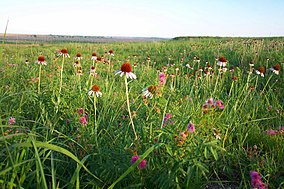
Kirwin National Wildlife Refuge
| Kirwin National Wildlife Refuge | |
|---|---|
IUCN category IV (habitat/species management area) | |
 | |
Map of the United States | |
| Location | Phillips County, Kansas, United States |
| Nearest city | Kirwin, Kansas |
| Coordinates | 39°38′30″N 99°11′00″W / 39.64167°N 99.18333°W |
| Area | 10,778 acres (43.62 km2) |
| Established | 1954 |
| Governing body | U.S. Fish and Wildlife Service |
| Website | Kirwin National Wildlife Refuge |
Kirwin National Wildlife Refuge is a
Kirwin Dam was built in the early 1950s near Kirwin, Kansas
, and the reservoir created in the process provides water to the refuge.
Ecology
The refuge is located along the North Fork of the
inhabit the refuge.Four federally listed and two state-listed
greater prairie chickens and black-tailed prairie dogs
occur on the refuge.
Recreation
Recreational activities include car tours, wildlife observation, boating, fishing, hiking, hunting, and educational programs. There is a visitor center and a museum.
External links
![]() This article incorporates public domain material from websites or documents of the United States Fish and Wildlife Service.
This article incorporates public domain material from websites or documents of the United States Fish and Wildlife Service.

