Lomilik
| Lomilik | |
|---|---|
 Bathymetry of Lomilik and Ļami Seamounts | |
| Summit depth | 1,350 metres (4,430 ft) |
| Location | |
| Coordinates | 11°42′N 161°37′E / 11.700°N 161.617°E |
| Country | Marshall Islands |
Lomilik is a
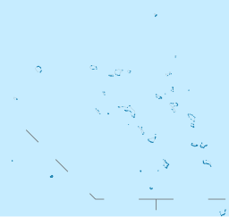
Lomilik has a 40-by-15-kilometre-wide (24.9 mi × 9.3 mi) summit terrace with the proper summit at circa 1,500 metres (4,900 ft) depth; a scarp separates the two and small hills reach depths of 1,350 metres (4,430 ft). The summit terrace is covered by rocks with ooze in between. A notch in the southern flank of Lomilik was likely created by a landslide.[2][4] It is part of the Magellan Seamounts[5] and consists of a Cretaceous volcano with a thin layer of carbonate rocks and ferromanganese.[6] Lami seamount lies northwest of Lomilik.[7]
The rocks found on Lomilik consist of basalt and limestone.[8] Fluorapatite, hyaloclastite,[9] mudstone, phosphorite and siltstone have been identified in rocks from the seamount.[10] Manganese nodules have been found on Lomilik[1] and the manganese crusts on the seamount reach thicknesses of over 10 centimetres (3.9 in);[11] the thickest crust recovered from an ocean is a 18 centimetres (7.1 in) thick ferromanganese crust from Lomilik recovered in 1989.[2] The deposits on Lomilik could potentially be mined.[12]
References
- ^ ISBN 9780080983004.
- ^ a b c Hein et al. 1998, p. 2.
- ^ Hein et al. 1990, p. 245.
- ^ Hein et al. 1999, p. 3.
- ISSN 0031-0182.
- ISSN 1944-9186.
- ^ Hein et al. 1990, p. 108.
- ^ Hein et al. 1998, p. 4.
- S2CID 128892570.
- ^ Hein, James R.; Benninger, Laura M. (2000). Diagenetic Evolution of Seamount Phosphorites (Report). p. 248.
- ^ Hein et al. 1990, p. 32.
- ^ Hein et al. 1999, p. 14.
Sources
- Hein, J.R.; Kang, Jung-Keuk; Schulz, M.S.; Park, Byong-Kwon; Kirschenbaum, Herbert; Yoon, Suk-Hoon; Olson, R.L.; Smith, V.K.; Park, Dong-Won (1990). Geological, geochemical, geophysical, and oceanographic data and interpretations of seamounts and co-rich ferromanganese crusts from the Marshall Islands, KORDI-USGS R.V. FARNELLA cruise F10-89-CP (Report).
- Hein, James R.; Moon, Jai-Woon; Lee, Kyeong-Yong; Kim, Ki-Hyun; Roberts, Leanne; Burrows, Malia; Park, S.H.; Dowling, Jennifer; Choi, Youn-ji (1998). Composition of Co-rich ferromanganese crusts and substrate rocks from the Marshall Islands, cruise KODOS 97-4 (Report).
- Hein, J.R.; Moon, Jai-Woon; Lee, Kyeong-Yong; Dowling, J.S.; Kim, Ki-Hyune; Burrows, Malia; Park, S.H.; Choi, Youn-ji; Schuetze, A.A. (1999). Co-rich Fe-Mn crusts from the Marshall Islands (Leg 1) and hydrothermal and hydrogenetic Fe-Mn deposits from Micronesia (Leg 2), KODOS 98-3 cruise, West Pacific (Report).

