
Oxford, Maine
Oxford, Maine | |
|---|---|
UTC-4 (EDT) | |
| Website | www.oxfordmaine.org |
Oxford is a town in
History
The land was part of Plantation (also called Bog Brook Plantation), granted on March 8, 1777 by the Massachusetts General Court to Alexander Shepard Jr. of Newton, Massachusetts. On March 6, 1792, the plantation was incorporated as Hebron, with Oxford its southwesterly portion. First settled in 1794, Oxford was set off and incorporated on February 27, 1829. It annexed land from Otisfield in 1830, and from Paris in 1838.[3] The town was named after Oxford, in England.[4]
Farmers grew mostly
The town was hit by an F1 tornado on Saturday, June 5, 2010, causing some serious damage.
-
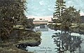 Covered bridge c. 1907
 -
 Oxford Spring House in 1907
 -
 Freeland Holmes Library in 1916


Geography
According to the United States Census Bureau, the town has a total area of 41.88 square miles (108.47 km2), of which 38.72 square miles (100.28 km2) is land and 3.16 square miles (8.18 km2) is water.[1] Oxford is drained by the Little Androscoggin River. Thompson Lake, the community's largest, is approximately 8 miles (13 km) long.
The town is served by state routes 26 and 121. It borders the towns of Paris to the north, Hebron to the northeast, Norway to the northwest, Poland to the southeast, and Otisfield to the southwest.
Demographics
| Census | Pop. | Note | %± |
|---|---|---|---|
| 1800 | 69 | — | |
| 1830 | 1,116 | — | |
| 1840 | 1,254 | 12.4% | |
| 1850 | 1,233 | −1.7% | |
| 1860 | 1,281 | 3.9% | |
| 1870 | 1,631 | 27.3% | |
| 1880 | 1,655 | 1.5% | |
| 1890 | 1,455 | −12.1% | |
| 1900 | 1,331 | −8.5% | |
| 1910 | 1,221 | −8.3% | |
| 1920 | 1,097 | −10.2% | |
| 1930 | 1,125 | 2.6% | |
| 1940 | 1,316 | 17.0% | |
| 1950 | 1,569 | 19.2% | |
| 1960 | 1,658 | 5.7% | |
| 1970 | 1,892 | 14.1% | |
| 1980 | 3,143 | 66.1% | |
| 1990 | 3,705 | 17.9% | |
| 2000 | 3,960 | 6.9% | |
| 2010 | 4,110 | 3.8% | |
| 2020 | 4,229 | 2.9% | |
| U.S. Decennial Census[6] | |||
2010 census
As of the census
There were 1,657 households, of which 31.0% had children under the age of 18 living with them, 50.6% were married couples living together, 10.2% had a female householder with no husband present, 6.0% had a male householder with no wife present, and 33.2% were non-families. 23.2% of all households were made up of individuals, and 8.5% had someone living alone who was 65 years of age or older. The average household size was 2.48 and the average family size was 2.88.
The median age in the town was 42.4 years. 21.8% of residents were under the age of 18; 6.9% were between the ages of 18 and 24; 25.4% were from 25 to 44; 32.2% were from 45 to 64; and 13.8% were 65 years of age or older. The gender makeup of the town was 50.1% male and 49.9% female.
2000 census
As of the census
There were 1,487 households, out of which 36.0% had children under the age of 18 living with them, 58.8% were married couples living together, 9.1% had a female householder with no husband present, and 26.4% were non-families. 19.0% of all households were made up of individuals, and 8.2% had someone living alone who was 65 years of age or older. The average household size was 2.66 and the average family size was 3.00.
In the town, the population was spread out, with 26.5% under the age of 18, 6.6% from 18 to 24, 30.4% from 25 to 44, 24.4% from 45 to 64, and 12.1% who were 65 years of age or older. The median age was 38 years. For every 100 females, there were 96.6 males. For every 100 females age 18 and over, there were 94.5 males.
The median income for a household in the town was $36,670, and the median income for a family was $38,438. Males had a median income of $27,957 versus $20,392 for females. The per capita income for the town was $15,480. About 2.8% of families and 7.1% of the population were below the poverty line, including 4.6% of those under age 18 and 12.0% of those age 65 or over.
Government
The town of Oxford is governed by an elected, five-person Board of Selectmen and an appointed town manager. The town's police department consists of one Chief of Police, one captain, two sergeants, four full-time patrol officers and several reserve (part-time) patrol officers.[citation needed] The town has an on-call fire rescue department made up of several dedicated members. It is run by a fire chief, two deputy chiefs, and several officers. The fire department also employs fire police for traffic control at various calls and events.
People
See also
- Grand Trunk Station (Oxford, ME)
References
- ^ a b "US Gazetteer files 2010". United States Census Bureau. Retrieved December 16, 2012.
- ^ "Census - Geography Profile: Oxford town, Oxford County, Maine". Retrieved January 13, 2022.
- ^ Coolidge, Austin J.; John B. Mansfield (1859). A History and Description of New England. Boston, Massachusetts: A.J. Coolidge. p. 244.
coolidge mansfield history description new england 1859.
- ^ Yates, Edgar A.P. (June 13, 1928). "Some Maine town names". The Lewiston Daily Sun. p. 4. Retrieved October 17, 2015.
- ^ Varney, George J. (1886), Gazetteer of the state of Maine. Oxford, Boston: Russell
- ^ "Census of Population and Housing". Census.gov. Retrieved June 4, 2015.
- ^ "U.S. Census website". United States Census Bureau. Retrieved December 16, 2012.
- ^ "U.S. Census website". United States Census Bureau. Retrieved January 31, 2008.
Further reading
External links
- Town of Oxford, Maine
- Freeland Holmes Library
- Oxford County Fair
- Oxford Plains Speedway
- Maine.gov – Oxford
- Maine Genealogy: Oxford, Oxford County, Maine
Municipalities and communities of Oxford County, Maine, United States | ||
|---|---|---|
| Towns |  | |
| Plantations | ||
| Unorganized territories | ||
| CDPs | ||
| Other villages | ||
| Footnotes | ‡This populated place also has portions in an adjacent county | |
| ||
| International | |
|---|---|
| National | |