
Alpine Loop Back Country Byway
Alpine Loop Back Country Byway | |
|---|---|
| Route information | |
| Maintained by CDOT | |
| Length | 63 mi[1][2] (101 km) |
| Existed | 1989–present |
| Major junctions | |
| West end | |
| East end | |
| Location | |
| Country | United States |
| State | Colorado |
| Counties | Hindale, Ouray, and San Juan |
| Highway system | |
| |

.jpg)
The Alpine Loop Back Country Byway is a rugged 63-mile (101 km)
The
Route
The Alpine Loop is generally considered to begin and end at Lake City. From there the route commonly followed is west over Cinnamon Pass or Engineer Pass to Animas Forks, and then returning east back to Lake City. The clockwise circuit starting with Cinnamon Pass generally puts the vehicle on the inside "lane" of the mountainous portions with the driver on the outside, providing a better view of the relative position of the vehicle and the outer edge of the road at the top of the drop-off. [3] The counter-clockwise direction is preferable for less powerful 4-wheel drive vehicles that may have a difficult time ascending steep sections on the western portion of Engineer Pass.
Major intersections
This section is missing mileposts for junctions. |
| County | Location | mi | km | Destinations | Notes |
|---|---|---|---|---|---|
| Hinsdale | Lake City | 0.00 | 0.00 | Zero milepost | |
| | FH 14 | ||||
| | Becomes FH 30 west | ||||
| | |||||
| | |||||
| | Camp Redcloud | ||||
| | Castle Lakes Campground | ||||
| | |||||
| | FH 35 | ||||
| | |||||
| | Becomes FH 5 west | ||||
| San Juan | | Becomes FH 2 north | |||
| | |||||
| | |||||
| | Becomes an unmarked road | ||||
| Hinsdale | | Becomes FH 21 north | |||
| | Becomes FH 20X east | ||||
| | Becomes FH 20 east | ||||
| | |||||
| | |||||
| | |||||
| 1.000 mi = 1.609 km; 1.000 km = 0.621 mi | |||||
Gallery
-
 Along the road to Engineer pass
 -
 Abandoned building inAnimas Forks, on the Alpine Loop
 -
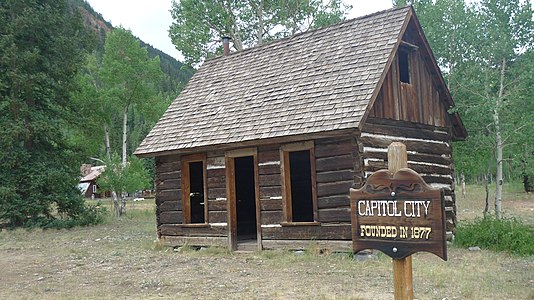 Capitol City ghost town
 -
 Animas Forks
 -
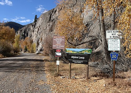 Signs at the start of the road in Lake City
 -
 Colorado blue columbinealong the Alpine Loop
 -

-

-
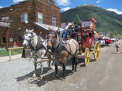 A stagecoach in Silverton


.jpg)


See also
 U.S. Roads portal
 Colorado portal
Notes
References
- ^ "Alpine Loop". Colorado Department of Transportation. 2021. Retrieved April 3, 2022.
- ^ "Alpine Loop". America's Scenic Byways. Retrieved April 3, 2022.
- ^ "The Alpine Loop" (PDF). United States Department of the Interior Bureau of Land Management. Archived from the original (PDF) on 11 June 2014. Retrieved 1 February 2015.
External links
 Media from Commons
 News from Wikinews
 Quotations from Wikiquote
 Travel information from Wikivoyage
- America's Scenic Byways: Colorado
- Bureau of Land Management Back Country Byways
- Colorado Department of Transportation
- Colorado Tourism Office
- History Colorado