
San Juan Skyway Scenic and Historic Byway
San Juan Skyway | |
|---|---|
_-_NARA_-_68886238.jpg) | |
| Route information | |
| Maintained by CDOT | |
| Length | 236 mi<[1][2] (380 km) |
| Existed | September 1988[3]–present |
| Major junctions | |
| South end | |
| North end | |
| Location | |
| Country | United States |
| State | Colorado |
| Counties | Dolores, La Plata, Montezuma, San Juan, and San Miguel counties |
| Highway system | |
| |


The San Juan Skyway Scenic and Historic Byway is a 236-mile (380 km)
It roughly parallels the routes of the narrow gauge railways:
The San Juan Skyway overlaps with the
Route description
U.S. Highway 160

Starting in
State Highway 145

The byway turns north at Cortez, following State Highway 145 (SH 145) through the town of Dolores and the Dolores River into the San Juan National Forest. The byway passes through Rico, county seat of Dolores County prior to 1941. The old Courthouse still remains. From Rico the byway crosses 10,222 ft (3116 m) Lizard Head Pass and enters the Uncompahgre National Forest. Lizard Head Pass provides views of the 14,159-foot (4,316 m) El Diente Peak, the 14,246-foot (4,342 m) Mount Wilson, the 14,017-foot (4,272 m) Wilson Peak and the pass's namesake, the 13,113-foot (3,997 m) Lizard Head Peak. The byway descends near the town of Ophir past the location of the Ophir Loop of the Rio Grande Southern Railroad. A spur road heads off to the mining town turned ski resort of Telluride. The byway follows the San Miguel River to the town of Placerville.
State Highway 62
The byway turns east at Placerville onto SH 62 and follows it over Dallas Divide. There are many excellent views of the San Juan Mountains, especially of the mountains around the 14,150-foot (4,310 m) Mount Sneffels. From the top of the divide the byway descends into the town of Ridgway. The entire route of the byway from Durango to Ridgway roughly follows the route of the Rio Grande Southern Railroad.
U.S. Highway 550


From Ridgway, the byway turns south onto
From Silverton the byway passes over the 10,910-foot (3,330 m)
History
The San Juan Skyway was designated as a National Forest Scenic Byway in September 1988. It was later named a Colorado Scenic and Historic Byway in 1989 and an All-American Road in September 1996.[4]
Gallery
-
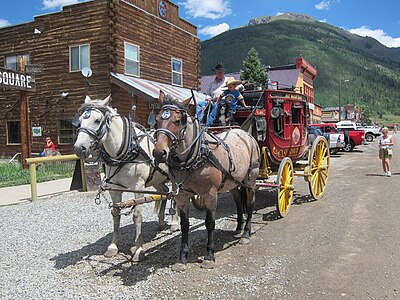 A stagecoach in Silverton
 -


See also
 U.S. Roads portal
 Colorado portal
Notes
References
- ^ "San Juan Skyway". Colorado Department of Transportation. 2021. Retrieved April 8, 2022.
- ^ "San Juan Skyway". America's Scenic Byways. Retrieved April 8, 2022.
- ^ Staff. "San Juan Skyway". National Scenic Byways. Federal Highway Administration. Retrieved September 11, 2011.
- ^ Staff. "Official Designations". San Juan Skyway. Federal Highway Administration. Retrieved September 11, 2011.
External links
- America's Byways
- America's Scenic Byways: Colorado
- Colorado Department of Transportation
- Colorado Tourism Office
- History Colorado
- National Forest Scenic Byways