
Bridger–Teton National Forest
This article needs additional citations for verification. (October 2021) |
| Bridger–Teton National Forest | |
|---|---|
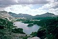
 Green Lakes region of Bridger–Teton National Forest | |
 | |
| Location | Wyoming, United States |
| Nearest city | Jackson, Wyoming |
| Coordinates | 43°25′48″N 110°43′30″W / 43.43000°N 110.72500°W |
| Area | 3,402,684 acres (13,770.17 km2)[1] |
| Established | July 1, 1908 |
| Governing body | U.S. Forest Service |
| Website | www |

Bridger–Teton National Forest is located in western
Geography
Located within the forest are the Gros Ventre, Bridger and Teton Wildernesses, totaling 1.2 million acres (4,900 square kilometers). Other points of interest contained in the forest include Gannett Peak at 13,804 feet (4,207 m), the tallest mountain in Wyoming, and the Gros Ventre landslide, which is one of the largest readily visible landslides on earth. All of the forest is in turn a part of the 20-million-acre (81,000-square-kilometer) Greater Yellowstone Ecosystem.

While Gannett Peak is the highest summit in the forest, another 40 named
U.S. Route 26 and U.S. Route 287 cross over the continental divide at Togwotee Pass and enter the forest from the north, and U.S. Highways 89 and 191 provide access to the forest in the vicinity of Jackson, Wyoming and forest lands to the south.
Ecology
The primary tree species include
Recreation

Over 2,000 mi (3,200 km) of
Administration
Bridger–Teton National Forest is an administrative combination of Bridger and Teton National Forests, amalgamated in 1973. The Bridger National Forest itself absorbed Wyoming National Forest in 1923. The Wyoming National Forest had been created as the Yellowstone Forest Reserve in 1904, then renamed in 1908.[3] The Teton Forest Reserve was created at the same time, destined to become Teton National Forest.
Ranger district offices are located in Pinedale, Kemmerer, Big Piney, Moran, Afton and Jackson. The forest headquarters is located in Jackson. In descending order of land area the forest is located in parts of Sublette, Teton, Lincoln, Park, and Fremont counties.
Hazards
Encountering bears is a concern in the Wind River Range.[4] There are other concerns as well, including bugs, wildfires, adverse snow conditions and nighttime cold temperatures.[5]
Importantly, there have been notable incidents, including
Gallery
-
 Bridger–Teton National Forest Map
 -
 Cook Lake
 -
 Middle Piney Lake
 -
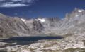 Titcomb Lakes
 -
 Slide Lake


See also
- Granite Hot Springs
- Green River
- Wilderness areas:
References
- ^ "Land Areas of the National Forest System" (PDF). U.S. Forest Service. January 2012. Retrieved June 30, 2012.
- ^ Koshmrl, Mike (June 9, 2023). "Grizzlies, environmentalists win toothless victory in court of appeals". Oil City News. Wyofile. Retrieved June 12, 2023.
- ^ "Kemmerer Ranger District". Bridger–Teton National Forest. U.S. Forest Service. August 14, 2008.
- ^ Staff (April 24, 2017). "Bear Safety in Wyoming's Wind River Country". WindRiver.org. Archived from the original on July 26, 2021. Retrieved May 31, 2022.
- ^ Ballou, Dawn (July 27, 2005). "Wind River Range condition update - Fires, trails, bears, Continental Divide". PineDaleOnline News. Archived from the original on April 21, 2021. Retrieved May 31, 2022.
- ^ Staff (1993). "Falling Rock, Loose Rock, Failure to Test Holds, Wyoming, Wind River Range, Seneca Lake". American Alpine Club. Archived from the original on July 26, 2021. Retrieved May 31, 2022.
- ^ MacDonald, Dougald (August 14, 2007). "Trundled Rock Kills NOLS Leader". Climbing. Archived from the original on July 26, 2021. Retrieved May 31, 2022.
- ^ Staff (December 9, 2015). "Officials rule Wind River Range climbing deaths accidental". Casper Star-Tribune. Archived from the original on July 26, 2021. Retrieved May 31, 2022.
- ^ Dayton, Kelsey (August 24, 2018). "Deadly underestimation". WyoFile News. Archived from the original on July 26, 2021. Retrieved May 31, 2022.
- ^ Funk, Jason (2009). "Squaretop Mountain Rock Climbing". Mountain Project. Archived from the original on July 26, 2021. Retrieved May 31, 2022.
- ^ Staff (July 22, 2005). "Injured man rescued from Square Top Mtn - Tip-Top Search & Rescue helps 2 injured on the mountain". PineDaleOnline News. Archived from the original on July 26, 2021. Retrieved May 31, 2022.
- ^ Staff (September 1, 2006). "Incident Reports - September, 2006 - Wind River Search". WildernessDoc.com. Archived from the original on January 27, 2020. Retrieved May 31, 2022.