
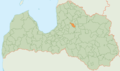
Cēsis Municipality
Cēsis Municipality
Cēsu novads | |
|---|---|
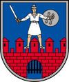
 Flag  Coat of arms | |
 | |
| Country | |
| Formed | 2009 |
| Reformed | 2021 |
| Centre | Cēsis |
| Government | |
| • Council Chairman | Jānis Rozenbergs (V) |
| Area | |
| • Total | 2,886.35 km2 (1,114.43 sq mi) |
| • Land | 2,801.23 km2 (1,081.56 sq mi) |
| • Water | 85.12 km2 (32.87 sq mi) |
| Population (2023)[1] | |
| • Total | 41,252 |
| • Density | 14/km2 (37/sq mi) |
| Website | www |
Cēsis Municipality (
Vaive parish and Cēsis town, which became the administrative centre. As of 2020, the population was 16,291.[2]
On 1 July 2021, Cēsis Municipality was enlarged when Amata Municipality, Jaunpiebalga Municipality, Līgatne Municipality, Pārgauja Municipality, Priekuļi Municipality and Vecpiebalga Municipality were merged into it.
The territory of Cēsis Municipality is defined by law as a part of the region of Vidzeme.[3]
Subdivisions
After the 2021 merger, Cēsis Municipality consists of the following subunits:[4]
- Amata Parish
- Cēsis city
- Drabeši Parish
- Dzērbene Parish
- Ineši Parish
- Jaunpiebalga Parish
- Kaive Parish
- Liepa Parish
- Līgatne Parish
- Mārsnēni Parish
- Nītaure Parish
- Priekuļi Parish
- Raiskums Parish
- Skujene Parish
- Stalbe Parish
- Straupe Parish
- Taurene Parish
- Vaive Parish
- Vecpiebalga Parish
- Veselava Parish
- Zaube Parish
- Zosēni Parish
Twin towns — sister cities
Cēsis is
twinned with:[5]
 Achim, Germany
 Baku, Azerbaijan
 Gatchinsky District, Russia
 Konstancin-Jeziorna, Poland
 Rakvere, Estonia
 Rokiškis, Lithuania
 Tyresö, Sweden
 Zhovkva, Ukraine
 Loutraki, Greece
Images
-
 Boundaries of the municipality from 2009 to 2021
 -
 Former coat of arms (2010–2021)
 -
 View of Cēsis Castle
 -
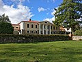
 Drabeši Manor main building
 -
 Jaunpiebalga Lutheran Church
 -
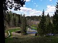 Scenery of Līgatne
 -
 Stalbe Secondary School
 -
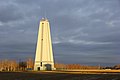 Water tower in Priekuļi
 -
 Vecpiebalga Manor


.jpg)
See also
- Administrative divisions of Latvia (2009)
References
- ^ "Iedzīvotāju skaits pēc tautības reģionos, pilsētās, novados, pagastos, apkaimēs un blīvi apdzīvotās teritorijās gada sākumā (pēc administratīvi teritoriālās reformas 2021. gadā) 2021 - 2022". Central Statistical Bureau of Latvia. Retrieved 3 October 2023.
- ^ "ISG020. Population number and its change by statistical region, city, town, 21 development centres and county". Central Statistical Bureau of Latvia. 2020-01-01. Retrieved 2021-02-12.
- ^ [1] Latviešu vēsturisko zemju likums
- ^ [2] Law on Administrative Territories and Populated Areas
- ^ "Cēsu novada starptautiskā sadarbība". cesis.lv (in Latvian). Cēsis. Retrieved 2019-08-31.
| Authority control databases: Geographic |
|---|
57°16′00″N 25°23′00″E / 57.2667°N 25.3833°E
This Vidzeme location article is a stub. You can help Wikipedia by expanding it. |