
Churchill River (Hudson Bay)
| Churchill River | |
|---|---|
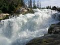
 Otter Rapids (Churchill River) | |
 Churchill River Basin in Canada | |
 Location of the mouth  Churchill River (Hudson Bay) (Canada) | |
| Etymology | Named after John Churchill, 1st Duke of Marlborough |
| Native name | |
| Location | |
| Country | Canada |
| Provinces | |
| Physical characteristics | |
| Source | Churchill Lake |
| • location | Saskatchewan |
| • coordinates | 56°6′22″N 108°14′46″W / 56.10611°N 108.24611°W |
| • elevation | 412 m (1,352 ft) |
| Mouth | Hudson Bay |
• location | Manitoba |
• coordinates | 58°47′45″N 94°12′15″W / 58.79583°N 94.20417°W[1] |
• elevation | 0 m (0 ft) |
| Length | 1,609 km (1,000 mi)[2] |
| Basin size | 281,300 km2 (108,600 sq mi)[2] |
| Discharge | |
| • average | 1,200 m3/s (42,000 cu ft/s) |
| Basin features | |
| Tributaries | |
| • left | |
| • right | |
The Churchill River (
The river is located entirely within the Canadian Shield. The drainage basin includes a number of lakes in Central-East Alberta which flow into a series of lakes in Saskatchewan and Manitoba. The main tributary, Beaver River, joins at Lac Île-à-la-Crosse.
A large amount of flow of the Churchill River after Manitoba — Saskatchewan border comes from the Reindeer River, which flows from Wollaston and Reindeer Lakes. Flow from Reindeer Lake is regulated by the Whitesand Dam. From there, the Churchill River flows east through a series of lakes (Highrock, Granville, Southern Indian and Gauer), then flows via a diversion for hydro-electric generation into the Nelson River (60% of flow), and the rest flows as the Churchill River into Hudson Bay at Churchill, Manitoba (see also Nelson River Hydroelectric Project).[6]
History
The Churchill formed a major part of the "
Fish species
The Churchill is also home of several fish species including: walleye, sauger, yellow perch, northern pike, lake trout, lake whitefish, cisco, white sucker, shorthead redhorse, longnose sucker, lake sturgeon, and burbot.
Hydroelectric developments
Island Falls
The only operating
Wintego Hydroelectric Project
In the 1970s, SaskPower was considering building another hydroelectric station on the Churchill River called Wintego. This station would have been located about 23 kilometres (14 mi) downstream of the Reindeer River forks, and 32 kilometres (20 mi) upstream of Island Falls. The project was expected to cost $338 million (equivalent to $1.3 billion in 2020),[8] including transmission and roads, and the capacity of the station would have been 300 MW.
The cost estimate assumes a 50-year lifespan, but the lifespans of SaskPower's other hydroelectric stations have been proven to be much longer (such as 90 years for Island Falls). Construction of Wintego would also enable the output of Island Falls to increase by 70 MW, and this benefit is not included in the cost estimate above.[9]
Other Saskatchewan
Two other potential hydroelectric developments between the Reindeer River Fork and Island Falls are the Iskwatam Generating Station and the Pita Generating Station, with unknown MW capacities.[10]
Manitoba
In Manitoba, the Bonald and Granville Falls generating stations could produce 110 MW and 120 MW, respectively.
Gallery
-
 Churchill Lake viewed fromBuffalo Narrows
 -
 View of upper Nistowiak Falls
 -
 Mouth of the Churchill River at Hudson Bay
 -


.jpg)

See also
- List of rivers of Manitoba
- List of rivers of Saskatchewan
- Hudson Bay drainage basin
- North American fur trade
- List of longest rivers of Canada
References
- ^ a b "Churchill River". Geographical Names Data Base. Natural Resources Canada. Retrieved August 29, 2014.
- ^ a b c "Principal rivers and their tributaries". Statistics Canada. February 2, 2005. Archived from the original on September 9, 2006. Retrieved 2010-01-13.
- ^ "Names of pan-Canadian significance". Natural Resources Canada – Mapping Services. Archived from the original on December 10, 2009. Retrieved January 13, 2010.
- ^ "Churchill River (Manitoba)". The Canadian Encyclopedia
- ^ Des Nedhe Group, "Who we are". For generations, the local Dene people have used the word Des Nedhe to describe the "great river" that flows next to them – known today as the Churchill River in northern Saskatchewan. https://desnedhe.com/about/#board
- ^ "Churchill River". Encyclopedia of Saskatchewan. Canadian Plains Research Centre. 2006. Archived from the original on October 7, 2011. Retrieved January 13, 2010.
- ^ "La Loche". The Canadian Encyclopedia. Archived from the original on September 22, 2008. Retrieved July 28, 2008.
- ^ "Inflation Calculator". www.bankofcanada.ca. Retrieved April 19, 2020.
- .
- ^ Saskatchewan, Government of (March 2003). "Amisk-Atik Integrated Forest Land Use Plan". Ministry of Environment. Retrieved April 19, 2020.
External links
- Saskatchewan's Churchill River, Canadian Parks and Wilderness Society
- Saskatchewan Documented Canoe Routes, Canoe Saskatchewan website
- Fish Species of Saskatchewan
- Encyclopedia of Saskatchewan