
Ellsworth Mountains
| Ellsworth Mountains | |
|---|---|
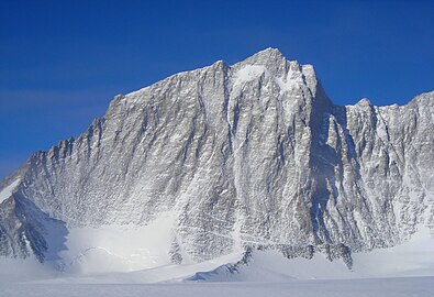
Mount Vinson; Nimitz Glacier in the foreground | |
| Highest point | |
| Peak | Mount Vinson |
| Elevation | 4,892 m (16,050 ft) |
| Coordinates | 78°31′31.74″S 85°37′01.73″W / 78.5254833°S 85.6171472°W |
| Dimensions | |
| Length | 360 km (220 mi) NNW-SSE |
| Width | 48 km (30 mi) WE |
| Geography | |
 Ellsworth Mountains Location of Ellsworth Mountains in Antarctica | |
| Continent | Antarctica |
| Land | Ellsworth Land |
| Range coordinates | 78°45′S 85°00′W / 78.750°S 85.000°W[1] |
The Ellsworth Mountains are the highest
British
ones.
Discovery
The mountains were discovered on November 23, 1935, by the American explorer Lincoln Ellsworth in the course of a trans-Antarctic flight from Dundee Island to the Ross Ice Shelf. He gave them the descriptive name Sentinel Range.[1]
The mountains were mapped in detail by the
U.S. Navy aerial photography, 1958–1966. When it became evident that the mountains comprise two distinct ranges, the US-ACAN restricted the application of Sentinel Range to the high northern one and gave the name Heritage Range to the southern one; the Committee recommended the name of the discoverer for this entire group of mountains.[1]
Geology
Geologically, the Ellsworth Mountains occupy a discrete block of
strata, which accumulated on Grenville-age continental crust. It was likely once part of the Cape Fold Belt that was detached from southern Africa during the breakup of Gondwana and later incorporated into Antarctica.[3][4]
The
uplift.[3]
Climate
The temperatures in the Ellsworth Mountains average around -30 °C (-20 °F). The best time for expeditions are November through January, mid-summer in the Southern Hemisphere. Arranging an outing here is a difficult task, requiring either official scientific sponsorship or considerable financial resources.
Maps
-
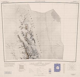 Northern Sentinel Range, USGS map
 -
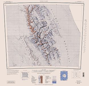 Central and southern Sentinel Range, USGS map
 -
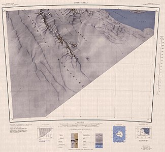
 Northern Heritage Range, USGS map
 -
 Southern Heritage Range, USGS map


- Antarctic Digital Database (ADD). Scale 1:250000 topographic map of Antarctica. Scientific Committee on Antarctic Research (SCAR). Since 1993, regularly updated.
See also
- Ellsworth Subglacial Highlands
- Antarctic Ice Marathon
- Union Glacier Camp
- Pirrit Hills
Gallery
-
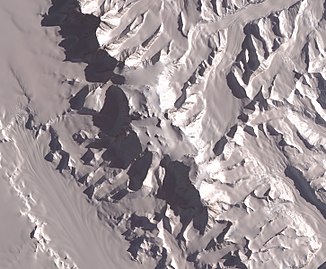 The central part of the mountains with Vinson Plateau, NASA satellite image
 -
-

-

-

-
 Mount Vinson

.jpg)

.jpg)
_from_East_by_Christian_Stangl_(flickr).jpg)
.jpg)
References
- ^ a b c d "Ellsworth Mountains". Geographic Names Information System. United States Geological Survey, United States Department of the Interior. Retrieved 6 May 2004.
- ^ Bockheim, J.G., Schaefer, C.E., 2015. Soils of Ellsworth Land, the Ellsworth Mountains. In: Bockheim, J.G. (Ed.), The Soils of Antarctica. World Soils Book Series, Springer, Switzerland, pp. 169–181.
- ^ ISBN 0813711703.
- ^ Craddock, J.P., Schmitz, M.D., Crowley, J.L., Larocque, J., Pankhurst, R.J., Juda, N., Konstantinou, A. and Storey, B., 2017. Precise U-Pb zircon ages and geochemistry of Jurassic granites, Ellsworth-Whitmore terrane, central Antarctica. Geological Society of America Bulletin, 129(1-2), pp.118-136.
External links
Wikimedia Commons has media related to Ellsworth Mountains.
- Geologic Map of the Ellsworth Mountains
- Scientific Committee on Antarctic Research (SCAR)
- Ellsworth Mountains. SCAR Composite Gazetteer of Antarctica

| International | |
|---|---|
| National | |