
Hart, Michigan
Hart, Michigan | ||
|---|---|---|
FIPS code 26-36920[2] | | |
| GNIS feature ID | 1620137[3] | |
| Website | cityofhart | |
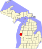
Hart is a city and county seat of
Hart is also home to the north end of the
History
Hart was named from its central position in the "heart" of Oceana County.[5]
Hart was founded in 1856 by early pioneers including Nelson Grove. Hart Township was named after Wellington Hart.[6]
Geography
According to the United States Census Bureau, the city has a total area of 2.07 square miles (5.36 km2), of which 1.91 square miles (4.95 km2) is land and 0.16 square miles (0.41 km2) is water.[7]
Transportation

 .
. Bus. US 31is a spur route into downtown Hart.
Demographics
| Census | Pop. | Note | %± |
|---|---|---|---|
| 1870 | 213 | — | |
| 1880 | 464 | 117.8% | |
| 1890 | 757 | 63.1% | |
| 1900 | 1,134 | 49.8% | |
| 1910 | 1,555 | 37.1% | |
| 1920 | 1,590 | 2.3% | |
| 1930 | 1,690 | 6.3% | |
| 1940 | 1,922 | 13.7% | |
| 1950 | 2,172 | 13.0% | |
| 1960 | 1,990 | −8.4% | |
| 1970 | 2,139 | 7.5% | |
| 1980 | 1,888 | −11.7% | |
| 1990 | 1,942 | 2.9% | |
| 2000 | 1,950 | 0.4% | |
| 2010 | 2,126 | 9.0% | |
| 2020 | 2,053 | −3.4% | |
| U.S. Decennial Census[8] | |||
2010 census
As of the
There were 757 households, of which 35.3% had children under the age of 18 living with them, 41.9% were married couples living together, 17.3% had a female householder with no husband present, 4.0% had a male householder with no wife present, and 36.9% were non-families. 32.9% of all households were made up of individuals, and 14.8% had someone living alone who was 65 years of age or older. The average household size was 2.58 and the average family size was 3.23.
The median age in the city was 37.3 years. 26.4% of residents were under the age of 18; 8.8% were between the ages of 18 and 24; 22.7% were from 25 to 44; 22.1% were from 45 to 64; and 19.9% were 65 years of age or older. The gender makeup of the city was 48.2% male and 51.8% female.
2000 census
As of the
There were 759 households, out of which 31.6% had children under the age of 18 living with them, 44.7% were married couples living together, 13.8% had a female householder with no husband present, and 36.6% were non-families. 31.6% of all households were made up of individuals, and 16.3% had someone living alone who was 65 years of age or older. The average household size was 2.45 and the average family size was 3.05.
In the city, the population was spread out, with 27.4% under the age of 18, 8.3% from 18 to 24, 28.8% from 25 to 44, 18.3% from 45 to 64, and 17.2% who were 65 years of age or older. The median age was 35 years. For every 100 females, there were 90.2 males. For every 100 females age 18 and over, there were 87.4 males.
The median income for a household in the city was $25,855, and the median income for a family was $31,875. Males had a median income of $28,839 versus $20,125 for females. The
Notable people
- Larry Paul Kelley, founder of Shelby Gem Factory
- Seymour H. Knox I, Buffalo, New York businessman
- U.S. Marine Corps soldier who was killed in action at Guadalcanal
- Walter Willett, physician and nutrition researcher
- George Winston, instrumental pop pianist and composer (b. 1949) [10]
- Houston Jones, YouTube personality of the series Bodybuilder Versus and Bro Labs, was born in New Era and went to Hart High School.[11][12]
Climate
This
| Climate data for Hart 3 WSW, Michigan (1991–2020 normals, extremes 1893–present) | |||||||||||||
|---|---|---|---|---|---|---|---|---|---|---|---|---|---|
| Month | Jan | Feb | Mar | Apr | May | Jun | Jul | Aug | Sep | Oct | Nov | Dec | Year |
| Record high °F (°C) | 59 (15) |
65 (18) |
82 (28) |
86 (30) |
95 (35) |
99 (37) |
104 (40) |
102 (39) |
97 (36) |
87 (31) |
75 (24) |
68 (20) |
104 (40) |
| Mean daily maximum °F (°C) | 29.5 (−1.4) |
31.9 (−0.1) |
42.0 (5.6) |
54.5 (12.5) |
66.7 (19.3) |
76.1 (24.5) |
79.9 (26.6) |
78.6 (25.9) |
71.6 (22.0) |
58.5 (14.7) |
45.3 (7.4) |
34.5 (1.4) |
55.8 (13.2) |
| Daily mean °F (°C) | 22.9 (−5.1) |
24.1 (−4.4) |
32.4 (0.2) |
43.8 (6.6) |
54.8 (12.7) |
64.8 (18.2) |
68.8 (20.4) |
67.6 (19.8) |
60.8 (16.0) |
49.0 (9.4) |
37.7 (3.2) |
28.4 (−2.0) |
46.3 (7.9) |
| Mean daily minimum °F (°C) | 16.2 (−8.8) |
16.3 (−8.7) |
22.8 (−5.1) |
33.1 (0.6) |
43.0 (6.1) |
53.6 (12.0) |
57.7 (14.3) |
56.6 (13.7) |
50.0 (10.0) |
39.4 (4.1) |
30.2 (−1.0) |
22.3 (−5.4) |
36.8 (2.7) |
| Record low °F (°C) | −26 (−32) |
−35 (−37) |
−16 (−27) |
1 (−17) |
19 (−7) |
26 (−3) |
35 (2) |
34 (1) |
25 (−4) |
18 (−8) |
−18 (−28) |
−19 (−28) |
−35 (−37) |
| Average precipitation inches (mm) | 2.75 (70) |
1.96 (50) |
2.37 (60) |
3.63 (92) |
4.45 (113) |
3.72 (94) |
3.53 (90) |
3.27 (83) |
3.23 (82) |
3.96 (101) |
3.43 (87) |
2.60 (66) |
38.90 (988) |
| Average snowfall inches (cm) | 26.4 (67) |
20.0 (51) |
5.9 (15) |
1.1 (2.8) |
0.0 (0.0) |
0.0 (0.0) |
0.0 (0.0) |
0.0 (0.0) |
0.0 (0.0) |
0.1 (0.25) |
5.4 (14) |
19.6 (50) |
78.5 (199) |
| Average precipitation days (≥ 0.01 in) | 15.6 | 12.7 | 9.2 | 11.7 | 11.1 | 9.9 | 9.2 | 8.3 | 9.5 | 13.2 | 13.0 | 13.6 | 137.0 |
| Average snowy days (≥ 0.1 in) | 12.8 | 9.3 | 4.3 | 1.2 | 0.0 | 0.0 | 0.0 | 0.0 | 0.0 | 0.1 | 2.9 | 9.6 | 40.2 |
| Source: | |||||||||||||
References
- ^ "2020 U.S. Gazetteer Files". United States Census Bureau. Retrieved May 21, 2022.
- ^ a b "U.S. Census website". United States Census Bureau. Retrieved 2008-01-31.
- ^ "US Board on Geographic Names". United States Geological Survey. 2007-10-25. Retrieved 2008-01-31.
- ^ "Find a County". National Association of Counties. Retrieved 2011-06-07.
- ^ Gannett, Henry (1905). The Origin of Certain Place Names in the United States. Govt. Print. Off. pp. 151.
- ^ "About Hart, History, Facts « Hart Beat". Archived from the original on 2014-07-14. Retrieved 2014-07-11.
- ^ "US Gazetteer files 2010". United States Census Bureau. Archived from the original on 2011-02-20. Retrieved 2012-11-25.
- ^ "Census of Population and Housing". Census.gov. Retrieved June 4, 2015.
- ^ "U.S. Census website". United States Census Bureau. Retrieved 2012-11-25.
- ^ Reich, Howard. "[1]." Chicago Tribune. June 14, 1987. Retrieved on December 18, 2020.
- ^ Sandip (2023-01-02). "Houston Jones Net Worth - Age, Height, Wife, Family, Income". MoneyProMax: Latest celebrities updates. Retrieved 2023-04-08.
- ^ Rajput, Sachin (2023-01-01). "Houston Jones Wiki Biography, Age, Height, Family, Girlfriend, Net Worth 2023". Celeb Biography. Retrieved 2023-04-08.
- ^ "Hart, Michigan Köppen Climate Classification (Weatherbase)". Weatherbase.
- ^ "NowData - NOAA Online Weather Data". National Oceanic and Atmospheric Administration. Retrieved September 4, 2021.
- ^ "Station: Hart 3 WSW, MI". U.S. Climate Normals 2020: U.S. Monthly Climate Normals (1991-2020). National Oceanic and Atmospheric Administration. Retrieved September 4, 2021.
External links
 | ||||
Villages | ||||
| Townships | ||||
| CDP | ||||
| Other unincorporated communities |
| |||
| Footnotes | ‡This populated place also has portions in an adjacent county or counties | |||
| ||||
43°41′54″N 86°21′50″W / 43.69833°N 86.36389°W
| International | |
|---|---|
| National | |
| Geographic | |