
St. Ignace, Michigan
St. Ignace, Michigan | ||
|---|---|---|
FIPS code 26-70840[4] | | |
| GNIS ID | 1621477[5] | |
| Website | Official website | |
St. Ignace (/ˈɪɡnəs/ IHG-nəss) is a city in the U.S. state of Michigan and the county seat of Mackinac County.[6] The city had a population of 2,306 at the 2020 census.[3] St. Ignace Township is located just to the north of the city, but the two are administered autonomously.
St. Ignace is located along Lake Huron in the Upper Peninsula on the northern side of the Straits of Mackinac. The city serves as a gateway to the state's Upper Peninsula for travelers coming from the Lower Peninsula, as the city is at the north end of the Mackinac Bridge, opposite Mackinaw City. It has one of two ports which provide ferry service to nearby Mackinac Island.
St. Ignace's history dates back to 1671 when French
History

St. Ignace is the second-oldest city founded by
.By the early 18th century, the
French explorer and priest

While separately exploring the Great Lakes region on the ship
The Ojibwe, who came to dominate most of the Native American territory of present-day Michigan in the 18th century, were allies of the French in the Seven Years' War against the British. After the British victory in the Seven Years' War, in 1763 they took over the territory of France in North America, including this part of the former New France. After the victory of rebellious colonists in the American Revolutionary War, in 1783 the village was included within the new United States, as part of what became called its Northwest Territory.
An important
Both British-Canadians and later Americans operated a larger trading center at Sault Ste. Marie, which developed on both sides of the Canadian-US border, until the decline of the fur trade in the 1830s. The fur trade also suffered before and during the hostilities of the War of 1812, as the United States first imposed a boycott on all trade with England, including traders in Canada. Many local people kept businesses going by smuggling, but postwar prohibitions on the fur trade were more difficult to avoid. prohibited British traders from operating across the border, as had been their earlier practice. The Ojibwe had allied with the British, their longtime trading partners, during the War of 1812,
In 1882, construction of the Detroit, Mackinac and Marquette Railroad, which connected the straits area to the major city of Detroit, provided an economic boost to the village. Farmers and the lumber industry could more easily get products to a major market. St. Ignace was incorporated as a village on February 23, 1882, and as a city in 1883.[7]
In the late 19th century, a new sector of its economy developed, as it began to attract tourists as a popular summer resort and for its connection to Mackinac Island.
Since the late 20th century, the city has become a rural destination for heritage tourism and is part of a regional area popular for summer tourism. A variety of water sports and activities are available.
The
Geography
According to the United States Census Bureau, the city has a total area of 2.65 square miles (6.86 km2), of which 0.01 square miles (0.03 km2) are water.[2] Point St. Ignace, which separates the Straits of Mackinac from Lake Huron, occupies the southern half of the city. The city is laid out along the west shore of Lake Huron, with the southern edge of the city facing the Straits. Straits State Park is in the southern part of the city.
Demographics
| Census | Pop. | Note | %± |
|---|---|---|---|
| 1880 | 934 | — | |
| 1890 | 2,704 | 189.5% | |
| 1900 | 2,271 | −16.0% | |
| 1910 | 2,118 | −6.7% | |
| 1920 | 1,852 | −12.6% | |
| 1930 | 2,109 | 13.9% | |
| 1940 | 2,669 | 26.6% | |
| 1950 | 2,946 | 10.4% | |
| 1960 | 3,334 | 13.2% | |
| 1970 | 2,892 | −13.3% | |
| 1980 | 2,632 | −9.0% | |
| 1990 | 2,568 | −2.4% | |
| 2000 | 2,678 | 4.3% | |
| 2010 | 2,452 | −8.4% | |
| 2020 | 2,306 | −6.0% | |
| U.S. Decennial Census[9] | |||

2010 census
As of the
There were 1,064 households, of which 27.0% had children under the age of 18 living with them, 43.3% were married couples living together, 11.1% had a female householder with no husband present, 5.1% had a male householder with no wife present, and 40.5% were non-families. 33.8% of all households were made up of individuals, and 13.6% had someone living alone who was 65 years of age or older. The average household size was 2.24 and the average family size was 2.84.
The median age in the city was 44.5 years. 21.3% of residents were under the age of 18; 7.7% were between the ages of 18 and 24; 21.6% were from 25 to 44; 31.6% were from 45 to 64; and 17.7% were 65 years of age or older. The gender makeup of the city was 48.2% male and 51.8% female.
2000 census
| Largest ancestries (2000)[11] | Percent |
|---|---|
| Ojibwe | 23% |
| German | 18% |
| Irish | 11% |
French
|
10% |
English
|
8% |
Polish
|
7% |
As of the census
There were 1,085 households, out of which 29.2% had children under the age of 18 living with them, 46.7% were married couples living together, 11.5% had a female householder with no husband present, and 37.7% were non-families. 31.6% of all households were made up of individuals, and 15.0% had someone living alone who was 65 years of age or older. The average household size was 2.35 and the average family size was 2.96.
In the city, the population was spread out, with 23.2% under the age of 18, 8.6% from 18 to 24, 27.4% from 25 to 44, 22.7% from 45 to 64, and 18.1% who were 65 years of age or older. The median age was 39 years. For every 100 females, there were 93.4 males. For every 100 females age 18 and over, there were 88.2 males.
The median income for a household in the city was $34,447, and the median income for a family was $45,893. Males had a median income of $29,813 versus $23,017 for females. The
Education
St. Ignace Area Schools is the local school district.[12]
Local sights
St. Anthony's Rock, a free-access geological limestone stack, is located in the center of the town. Castle Rock, a similar but taller stack for which admission is charged, is located three miles (4.8 km) north overlooking Lake Huron. Rabbit's Back, a prominent promontory that also overlooks Lake Huron, is four miles (6.4 km) north. Chain Lake, one mile (1.6 km) inland, features inland fishing opportunities.
Transportation

Major highways
 Lower Peninsula; northbound the freeway heads toward Sault Ste. Marie and Canada.
 BL I-75follows the route of old US 2.
 US 2 ends in St. Ignace at I-75. Westbound, US 2 traverses a scenic stretch along Lake Michigan, toward Manistique and Escanaba.
 H-63 (Mackinac Trail) is a north–south route traveling along the former route of US 2 from just north of St. Ignace to Sault Ste. Marie.
Ferry services
Two ferry companies (
Airports
The nearest airports with scheduled passenger service are in
Bus service
Indian Trails provides daily intercity bus service between St. Ignace and East Lansing, Michigan,[22] between St. Ignace and Bay City, Michigan,[23] and between St. Ignace and Ironwood, Michigan.[24]
Notable people
- Prentiss M. Brown, U.S. senator from Michigan[25]
- Tony Earl, former governor of Wisconsin
- Aubrey Fitch, vice admiral, United States Navy
- Nicholas Orontony, 18th-century Wyandot leader
- Joe Ostman, professional football player
- Les Sweetland, professional baseball pitcher
Gallery
-
 Looking south in downtown St. Ignace
 -
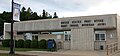 Post office
 -
 The ferry harbor with Mackinac Island in the distance


Notes
- ^ Stationed at Sault Ste. Marie, Michigan.[13]
- ^ The Mackinaw is stationed at Cheboygan, Michigan.[14]
References
- ^ City of St. Ignace (2019). "The City of St. Ignace". Retrieved April 17, 2019.
- ^ a b "2022 U.S. Gazetteer Files: Michigan". United States Census Bureau. Retrieved June 13, 2023.
- ^ a b "P1. Race – St. Ignace city, Michigan: 2020 DEC Redistricting Data (PL 94-171)". U.S. Census Bureau. Retrieved June 13, 2023.
- ^ a b "U.S. Census website". United States Census Bureau. Retrieved January 31, 2008.
- ^ U.S. Geological Survey Geographic Names Information System: St. Ignace, Michigan
- ^ "Find a County". National Association of Counties. Retrieved June 7, 2011.
- ^ a b Sawyer, Alvah Littlefield (1911). A History of the Northern Peninsula of Michigan and Its People. Lewis Publishing. p. 318.
- ISBN 978-0-8143-1838-6.
- ^ "Census of Population and Housing". United States Census Bureau. Retrieved June 4, 2015.
- ^ "U.S. Census website". United States Census Bureau. Retrieved November 25, 2012.
- ^ "Saint Ignace - Saint Ignace - Ancestry & family history - ePodunk". Archived from the original on August 22, 2017. Retrieved April 30, 2017.
- U.S. Census Bureau. Retrieved February 26, 2023.
- ^ "USCGC Katmai Bay (WTGB 101)". United States Coast Guard. January 26, 2012.
- ^ "USCGC Mackinaw (WLBB-30)". United States Coast Guard. Retrieved May 1, 2017.
- ^ King, Dominique (April 15, 2014). "From Monroe to Mackinac: Lighthouse moves to Chief Wawatam Park in St. Ignace". Michigan Midwest Guest. Retrieved April 25, 2017.
- ^ "U.S. Coast Guard Sector Sault Sainte Marie". U.S. Coast Guard Sector. Retrieved April 30, 2017.
- ^ Heffernan, Tim (February 25, 2016). "Ice Breakers: The Coast Guard Crews that Keep the Great Lakes Open for Business". Popular Mechanics. Retrieved April 30, 2017.
- Mlive. Retrieved April 30, 2017.
- ^ Final survey, Great Lakes–St.Lawrence Seaway Navigation Extension: Environmental Impact Statement. Vol. 5. Detroit: United States Army Corps of Engineers. August 1979. p. 95. Retrieved April 30, 2017.
- ^ "USCG Cutter Mackinaw Icebreaker Moored in Sault Ste. Marie, Michigan" (Video). March 20, 2014. Retrieved April 30, 2017 – via YouTube.
- ^ "Pellston Regional Airport Serving Northern Michigan Emmet County". Pellston Airport.
- ^ "East Lansing–Petoskey–St. Ignace" (PDF). Indian Trails. January 15, 2013. Archived from the original (PDF) on June 29, 2014. Retrieved February 27, 2013.
- ^ "Bay City–Alpena–Cheboygan–St. Ignace" (PDF). Indian Trails. January 15, 2013. Archived from the original (PDF) on July 24, 2013. Retrieved February 28, 2013.
- ^ "St. Ignace–Sault Ste. Marie–Ironwood" (PDF). Indian Trails. January 15, 2013. Archived from the original (PDF) on July 4, 2014. Retrieved February 28, 2013.
- ^ "Brown, Prentiss Marsh, (1889–1973)". Biographical Directory of the United States Congress. Retrieved October 14, 2012.
External links
Municipalities and communities of Mackinac County, Michigan, United States | ||
|---|---|---|
| Cities |  | |
| Civil townships | ||
| CDP | ||
| Other communities |
| |
| Indian reservations | ||
| Footnotes | ‡This populated place also has portions in an adjacent county or counties | |
| ||
| Central cities | |
|---|---|
| Counties | |
| Geography | |
| Transportation | |
| Economy | |
| International | |
|---|---|
| National | |
| Geographic | |
| Other | |