
Madison County, Mississippi
Madison County | |
|---|---|
UTC−5 (CDT) | |
| Congressional districts | 2nd, 3rd |
| Website | www |
Madison County is a
Madison County is part of the
Geography
According to the
In 1828 that part of Yazoo County, Mississippi east of the Big Black River (Mississippi) was organized as Madison County.[5]
The boundaries of the county are set in Mississippi Code section 19-1-89 as: Madison County is bounded by beginning at a point on Big Black River, where the same crosses the center line in township twelve, range three, east; thence east to the old Choctaw boundary line; thence north on said boundary line to the center line of township twelve, range five, east; thence through the center of said township twelve, range five, east, to the range line between townships five and six, east; thence south on said range line to Pearl River; thence down said river, with its meanderings, to the line between townships six and seven, north; thence west on said township line to the basis meridian of the Choctaw survey; thence north on said meridian line to the line between townships seven and eight, north; thence west on said township line to the line between ranges two and three, west; thence north on said range line to Big Black River; thence up said river, with its meanderings, to the beginning.[6]
Major highways
 Interstate 55
 Interstate 220
- U.S. Highway 49
- U.S. Highway 51
 Mississippi Highway 16
 Mississippi Highway 17
 Mississippi Highway 22
 Mississippi Highway 43
- Natchez Trace Parkway
Adjacent counties
- Attala County (north)
- Leake County (east)
- Scott County (southeast)
- Rankin County (south)
- Hinds County (southwest)
- Yazoo County (west)
National protected area
- Natchez Trace Parkway (part)
History
Madison County was the site of the Mississippi Slave Insurrection Scare of 1835.[7]
Demographics
| Census | Pop. | Note | %± |
|---|---|---|---|
| 1830 | 4,973 | — | |
| 1840 | 15,530 | 212.3% | |
| 1850 | 18,173 | 17.0% | |
| 1860 | 23,382 | 28.7% | |
| 1870 | 20,948 | −10.4% | |
| 1880 | 25,866 | 23.5% | |
| 1890 | 27,321 | 5.6% | |
| 1900 | 32,493 | 18.9% | |
| 1910 | 33,505 | 3.1% | |
| 1920 | 29,292 | −12.6% | |
| 1930 | 35,796 | 22.2% | |
| 1940 | 37,504 | 4.8% | |
| 1950 | 33,860 | −9.7% | |
| 1960 | 32,904 | −2.8% | |
| 1970 | 29,737 | −9.6% | |
| 1980 | 41,613 | 39.9% | |
| 1990 | 53,794 | 29.3% | |
| 2000 | 74,674 | 38.8% | |
| 2010 | 95,203 | 27.5% | |
| 2020 | 109,145 | 14.6% | |
| 2023 (est.) | 112,511 | [8] | 3.1% |
| U.S. Decennial Census[9] 1790-1960[10] 1900-1990[11] 1990-2000[12] 2010-2014[13] | |||
2020 census
| Race | Num. | Perc. |
|---|---|---|
White
|
60,273 | 55.22% |
Black or African American
|
38,526 | 35.3% |
Native American
|
160 | 0.15% |
Asian
|
3,167 | 2.9% |
Pacific Islander
|
13 | 0.01% |
Other/Mixed
|
2,889 | 2.65% |
Latino
|
4,117 | 3.77% |
As of the
2000 census
As of the
There were 27,219 households, out of which 37.40% had children under the age of 18 living with them, 51.90% were married couples living together, 15.60% had a female householder with no husband present, and 29.00% were non-families. 25.00% of all households were made up of individuals, and 6.70% had someone living alone who was 65 years of age or older. The average household size was 2.67 and the average family size was 3.23.
In the county, the population was spread out, with 28.60% under the age of 18, 8.90% from 18 to 24, 32.40% from 25 to 44, 20.30% from 45 to 64, and 9.70% who were 65 years of age or older. The median age was 33 years. For every 100 females, there were 90.20 males. For every 100 females age 18 and over, there were 86.20 males.
The median income for a household in the county was $46,970, and the median income for a family was $58,172. Males had a median income of $41,460 versus $29,170 for females. The
Madison County has the
Communities
Cities
- Canton (county seat)
- Gluckstadt
- Jackson (mostly in Hinds County, also in Rankin County)
- Madison
- Ridgeland
Town
Census-designated place
Other unincorporated communities
Ghost town
Government and infrastructure
The county operates the Madison County Jail. Normally pre-trial federal inmates from central Mississippi are held at this jail.[16]
| Year | Republican | Democratic | Third party | |||
|---|---|---|---|---|---|---|
| No. | % | No. | % | No. | % | |
| 2020 | 31,091 | 55.16% | 24,440 | 43.36% | 830 | 1.47% |
| 2016 | 28,265 | 56.38% | 20,343 | 40.58% | 1,523 | 3.04% |
| 2012 | 28,507 | 57.51% | 20,722 | 41.80% | 342 | 0.69% |
| 2008 | 27,203 | 57.55% | 19,831 | 41.95% | 235 | 0.50% |
| 2004 | 24,257 | 64.29% | 13,268 | 35.17% | 203 | 0.54% |
| 2000 | 19,109 | 64.00% | 10,416 | 34.88% | 334 | 1.12% |
| 1996 | 14,467 | 58.60% | 9,354 | 37.89% | 867 | 3.51% |
| 1992 | 12,810 | 54.00% | 9,386 | 39.57% | 1,525 | 6.43% |
| 1988 | 11,399 | 57.50% | 8,242 | 41.57% | 184 | 0.93% |
| 1984 | 9,298 | 53.24% | 8,002 | 45.82% | 163 | 0.93% |
| 1980 | 6,024 | 42.91% | 7,621 | 54.28% | 394 | 2.81% |
| 1976 | 4,838 | 42.75% | 6,240 | 55.14% | 238 | 2.10% |
| 1972 | 5,047 | 57.20% | 3,464 | 39.26% | 313 | 3.55% |
| 1968 | 876 | 9.26% | 4,515 | 47.72% | 4,071 | 43.02% |
| 1964 | 3,283 | 92.90% | 251 | 7.10% | 0 | 0.00% |
| 1960 | 525 | 18.35% | 753 | 26.32% | 1,583 | 55.33% |
| 1956 | 377 | 15.74% | 996 | 41.59% | 1,022 | 42.67% |
| 1952 | 1,496 | 51.22% | 1,425 | 48.78% | 0 | 0.00% |
| 1948 | 51 | 2.60% | 81 | 4.12% | 1,833 | 93.28% |
| 1944 | 104 | 5.14% | 1,921 | 94.86% | 0 | 0.00% |
| 1940 | 66 | 3.14% | 2,038 | 96.86% | 0 | 0.00% |
| 1936 | 32 | 1.71% | 1,838 | 98.24% | 1 | 0.05% |
| 1932 | 51 | 3.33% | 1,474 | 96.15% | 8 | 0.52% |
| 1928 | 124 | 7.55% | 1,519 | 92.45% | 0 | 0.00% |
| 1924 | 109 | 6.39% | 1,598 | 93.61% | 0 | 0.00% |
| 1920 | 57 | 6.36% | 831 | 92.75% | 8 | 0.89% |
| 1916 | 36 | 4.29% | 782 | 93.10% | 22 | 2.62% |
| 1912 | 11 | 1.50% | 663 | 90.45% | 59 | 8.05% |
Education
There are two school districts: Madison County School District and Canton Public School District.[18]
Private schools:
- Canton Academy
- Madison-Ridgeland Academy
- St. Andrew's Episcopal School (Secondary school campus)
- St. Joseph Catholic School (of the Roman Catholic Diocese of Jackson)
- Veritas School (CLOSED)
The local community college is Holmes Community College.[19]
Tougaloo College is in Madison County.[20]
See also
References
- ^ "Census - Geography Profile: Madison County, Mississippi". United States Census Bureau. Retrieved January 14, 2023.
- ^ "Find a County". National Association of Counties. Retrieved June 7, 2011.
- ^ Gannett, Henry (1905). The Origin of Certain Place Names in the United States. U.S. Government Printing Office. p. 196.
- ^ "2010 Census Gazetteer Files". United States Census Bureau. August 22, 2012. Archived from the original on September 28, 2013. Retrieved November 6, 2014.
- ^ Franklin L. Riley. (1905). School history of Mississippi for use in public and private schools. Richmond, Va.: B. F. Johnson Publishing Company. p. 158.
- ^ Mississippi Codes SEC. 19-1-89. Madison County. Archived June 10, 2011, at the Wayback Machine
- ISSN 0022-4529.
- ^ "Annual Estimates of the Resident Population for Counties: April 1, 2020 to July 1, 2023". United States Census Bureau. Retrieved April 5, 2024.
- ^ "U.S. Decennial Census". United States Census Bureau. Retrieved November 6, 2014.
- ^ "Historical Census Browser". University of Virginia Library. Retrieved November 6, 2014.
- ^ "Population of Counties by Decennial Census: 1900 to 1990". United States Census Bureau. Retrieved November 6, 2014.
- ^ "Census 2000 PHC-T-4. Ranking Tables for Counties: 1990 and 2000" (PDF). United States Census Bureau. Archived (PDF) from the original on March 27, 2010. Retrieved November 6, 2014.
- ^ "State & County QuickFacts". United States Census Bureau. Archived from the original on June 7, 2011. Retrieved September 4, 2013.
- ^ "Explore Census Data". data.census.gov. Retrieved December 8, 2021.
- ^ "U.S. Census website". United States Census Bureau. Retrieved January 31, 2008.
- ^ Amy, Jeff (December 27, 2016). "Judge rejects Chris Epps' request to leave jail". Associated Press at the Hattiesburg American. Retrieved May 26, 2017. "He’s not listed in records at the Madison County jail, where federal prisoners in central Mississippi are usually confined."
- ^ Leip, David. "Dave Leip's Atlas of U.S. Presidential Elections". uselectionatlas.org. Retrieved March 4, 2018.
- ^ "About Us". Holmes Community College. Retrieved June 30, 2021.
- ^ "Home". Tougaloo College. Retrieved June 30, 2021.
500 West County Line Road • Tougaloo, MS 39174
- Compare with the county map.
Campus map: "Proposed Parking Plan" (PDF). Tougaloo College. Archived (PDF) from the original on September 7, 2015. Retrieved June 30, 2021.
Compare with a map of Madison County: "General Highway Map of Madison County, Mississippi" (PDF). Mississippi State Highway Department. 1987. Archived (PDF) from the original on July 1, 2021. Retrieved June 30, 2021.
External links
 Media related to Madison County, Mississippi at Wikimedia Commons
Places adjacent to Madison County, Mississippi | ||||||||||||||||
|---|---|---|---|---|---|---|---|---|---|---|---|---|---|---|---|---|
| ||||||||||||||||
Municipalities and communities of Madison County, Mississippi, United States | ||
|---|---|---|
| Cities | 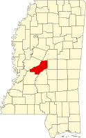 | |
Town | ||
| CDPs | ||
| Other communities | ||
| Ghost town | ||
| Footnotes | ‡This populated place also has portions in an adjacent county or counties | |
| ||
| International | |
|---|---|
| National | |
| Geographic | |
| Other | |