
Metcalfe County, Kentucky
Metcalfe County | |
|---|---|
UTC−5 (CDT) | |
| Congressional district | 1st |
| Website | www |
Metcalfe County is a
Geography
According to the
Adjacent counties
- Hart County (northwest)
- Green County (northeast)
- Adair County (east)
- Cumberland County (southeast)
- Monroe County (south)
- Barren County (west)
Demographics
| Census | Pop. | Note | %± |
|---|---|---|---|
| 1870 | 7,934 | — | |
| 1880 | 9,423 | 18.8% | |
| 1890 | 9,871 | 4.8% | |
| 1900 | 9,988 | 1.2% | |
| 1910 | 10,453 | 4.7% | |
| 1920 | 10,075 | −3.6% | |
| 1930 | 9,373 | −7.0% | |
| 1940 | 10,853 | 15.8% | |
| 1950 | 9,851 | −9.2% | |
| 1960 | 8,367 | −15.1% | |
| 1970 | 8,177 | −2.3% | |
| 1980 | 9,484 | 16.0% | |
| 1990 | 8,963 | −5.5% | |
| 2000 | 10,037 | 12.0% | |
| 2010 | 10,099 | 0.6% | |
| 2020 | 10,286 | 1.9% | |
| 2023 (est.) | 10,482 | [5] | 1.9% |
| U.S. Decennial Census[6] 1790–1960[7] 1900–1990[8] 1990–2000[9] 2010–2021[10] | |||
As of the
There were 4,016 households, out of which 32.30% had children under the age of 18 living with them, 58.10% were married couples living together, 10.00% had a female householder with no husband present, and 28.20% were non-families. 25.20% of all households were made up of individuals, and 12.30% had someone living alone who was 65 years of age or older. The average household size was 2.47 and the average family size was 2.93.
In the county, the population was spread out, with 24.60% under the age of 18, 8.20% from 18 to 24, 28.50% from 25 to 44, 23.60% from 45 to 64, and 15.00% who were 65 years of age or older. The median age was 38 years. For every 100 females, there were 95.20 males. For every 100 females age 18 and over, there were 92.60 males.
The median income for a household in the county was $23,540, and the median income for a family was $29,178. Males had a median income of $22,430 versus $18,591 for females. The
Communities
City
- Edmonton (county seat)
Census-designated place
Other unincorporated communities
Ghost Town
Landmarks
Politics
| Year | Republican | Democratic | Third party | |||
|---|---|---|---|---|---|---|
| No. | % | No. | % | No. | % | |
| 2020 | 3,959 | 78.99% | 975 | 19.45% | 78 | 1.56% |
| 2016 | 3,491 | 75.56% | 976 | 21.13% | 153 | 3.31% |
| 2012 | 2,676 | 63.96% | 1,425 | 34.06% | 83 | 1.98% |
| 2008 | 2,734 | 65.11% | 1,350 | 32.15% | 115 | 2.74% |
| 2004 | 2,645 | 63.63% | 1,472 | 35.41% | 40 | 0.96% |
| 2000 | 2,476 | 64.33% | 1,318 | 34.24% | 55 | 1.43% |
| 1996 | 1,651 | 48.89% | 1,349 | 39.95% | 377 | 11.16% |
| 1992 | 1,683 | 44.14% | 1,703 | 44.66% | 427 | 11.20% |
| 1988 | 2,179 | 55.66% | 1,705 | 43.55% | 31 | 0.79% |
| 1984 | 2,349 | 59.56% | 1,575 | 39.93% | 20 | 0.51% |
| 1980 | 2,013 | 54.30% | 1,628 | 43.92% | 66 | 1.78% |
| 1976 | 1,356 | 41.52% | 1,877 | 57.47% | 33 | 1.01% |
| 1972 | 1,896 | 58.55% | 1,308 | 40.40% | 34 | 1.05% |
| 1968 | 1,566 | 51.41% | 1,001 | 32.86% | 479 | 15.73% |
| 1964 | 1,277 | 39.27% | 1,967 | 60.49% | 8 | 0.25% |
| 1960 | 2,146 | 58.02% | 1,553 | 41.98% | 0 | 0.00% |
| 1956 | 2,412 | 54.35% | 2,014 | 45.38% | 12 | 0.27% |
| 1952 | 2,176 | 53.90% | 1,848 | 45.78% | 13 | 0.32% |
| 1948 | 1,640 | 48.68% | 1,683 | 49.96% | 46 | 1.37% |
| 1944 | 2,306 | 57.48% | 1,694 | 42.22% | 12 | 0.30% |
| 1940 | 2,206 | 54.55% | 1,826 | 45.15% | 12 | 0.30% |
| 1936 | 1,777 | 50.34% | 1,748 | 49.52% | 5 | 0.14% |
| 1932 | 1,729 | 46.35% | 1,985 | 53.22% | 16 | 0.43% |
| 1928 | 2,314 | 66.92% | 1,144 | 33.08% | 0 | 0.00% |
| 1924 | 1,450 | 53.15% | 1,262 | 46.26% | 16 | 0.59% |
| 1920 | 1,809 | 55.51% | 1,442 | 44.25% | 8 | 0.25% |
| 1916 | 1,107 | 50.97% | 1,046 | 48.16% | 19 | 0.87% |
| 1912 | 482 | 23.89% | 887 | 43.95% | 649 | 32.16% |
Metcalfe County lies at the northwestern end of the
See also
- Dry counties
- National Register of Historic Places listings in Metcalfe County, Kentucky
- The Kentucky Headhunters, a country music/southern rock act that formed in Metcalfe County
- Edmonton, KY)
References
- ^ "Find a County". National Association of Counties. Retrieved June 7, 2011.
- ^ E., Kleber, John; Kentucky, University Press of; Policy, Institute for Regional Analysis and Public; Library, Camden-Carroll; University, Morehead State (2000). "The Kentucky Encyclopedia". www.kyenc.org. Retrieved July 4, 2018.
{{cite web}}:|last3=has generic name (help)CS1 maint: multiple names: authors list (link) - ^ The Register of the Kentucky State Historical Society, Volume 1. Kentucky State Historical Society. 1903. pp. 36.
- ^ "2010 Census Gazetteer Files". United States Census Bureau. August 22, 2012. Archived from the original on August 12, 2014. Retrieved August 18, 2014.
- ^ "Annual Estimates of the Resident Population for Counties: April 1, 2020 to July 1, 2023". United States Census Bureau. Retrieved March 14, 2024.
- ^ "U.S. Decennial Census". United States Census Bureau. Retrieved August 18, 2014.
- ^ "Historical Census Browser". University of Virginia Library. Retrieved August 18, 2014.
- ^ "Population of Counties by Decennial Census: 1900 to 1990". United States Census Bureau. Retrieved August 18, 2014.
- ^ "Census 2000 PHC-T-4. Ranking Tables for Counties: 1990 and 2000" (PDF). United States Census Bureau. Archived (PDF) from the original on March 27, 2010. Retrieved August 18, 2014.
- ^ "State & County QuickFacts". United States Census Bureau. Archived from the original on June 7, 2011. Retrieved March 6, 2014.
- ^ "U.S. Census website". United States Census Bureau. Retrieved January 31, 2008.
- ^ Leip, David. "Dave Leip's Atlas of U.S. Presidential Elections". uselectionatlas.org. Retrieved July 4, 2018.
- ^ Copeland, James E.; ‘Where Were the Kentucky Unionists and Secessionists’; The Register of the Kentucky Historical Society, volume 71, no. 4 (October 1973), pp. 344–363
- New York Times, April 24, 2014
Municipalities and communities of Metcalfe County, Kentucky, United States | ||
|---|---|---|
| City | 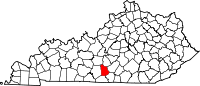 | |
| CDP | ||
| Other communities | ||
| Ghost town | ||
| ||
36°59′N 85°38′W / 36.99°N 85.63°W
| International | |
|---|---|
| National | |
| Geographic | |
| Other | |