
Logan County, Kentucky
Logan County | |
|---|---|
 Original Logan County courthouse in Russellville | |
|
UTC−5 (CDT) | |
| Congressional district | 1st |
| Website | logancountyky |
Logan County is a county in the southwest Pennyroyal Plateau area of Kentucky, United States. As of the 2020 census, the population was 27,432.[1] Its county seat is Russellville.[2]
History
The county is named for
Future
During the post-Reconstruction period, there was considerable racial violence by white mobs against black citizens in Logan County. Racist mobs
Logan was a major tobacco-growing county, with Dark Fired Tobacco produced by a special smoke processing. From 1906 some of its farmers became involved in the violent Black Patch Tobacco Wars, joining the Dark Tobacco District Planters' Protective Association of Kentucky and Tennessee to mobilize against the monopoly power of the American Tobacco Company, which had driven down prices to where farmers could barely make a living. Paramilitary Night Riders threatened other tobacco planters to "persuade" them to join the PPA. In late 1907 and early 1908, hundreds of Night Riders conducted raids against tobacco warehouses in some Kentucky towns. They struck Russellville on January 3, 1908, taking over the city and dynamiting two tobacco factories.[10]
21st century
In 2009, the Logan County/Russellville Little League Baseball team won the Little League World Series Great Lakes Regional Tournament as the 4th team from Kentucky to do so (as of 2017, Kentucky has had seven teams win the Great Lakes Tournament) to represent the Great Lakes Region in the Little League World Series.[11]
Geography
Logan County is on the south border of Kentucky; its south line abuts the north line of Tennessee. Its low hills are completely devoted to agriculture or urban development.[12] Its highest point (868 feet/265 meters ASL) is Rainbow Rock Knob WSW, located 3.6 miles (5.8 km) ESE from Russellville.[13] The Red River flows northwestward through the central and west part of the county, discharging into Todd County on the west.[12]
According to the United States Census Bureau, the county has a total area of 557 square miles (1,440 km2), of which 552 square miles (1,430 km2) is land and 4.9 square miles (13 km2) (0.9%) is water.[14]
Adjacent counties
- Muhlenberg County - northwest
- Butler County - north
- Warren County - northeast
- Simpson County - southeast
- Robertson County, Tennessee - south
- Todd County - west
Lakes
- Briggs Lake
- Boy Scout Lake
- Lake Herndon
- Spa Lake
- Lake Malone (part)[12]
Demographics
| Census | Pop. | Note | %± |
|---|---|---|---|
| 1800 | 5,807 | — | |
| 1810 | 12,123 | 108.8% | |
| 1820 | 14,423 | 19.0% | |
| 1830 | 13,012 | −9.8% | |
| 1840 | 13,615 | 4.6% | |
| 1850 | 16,581 | 21.8% | |
| 1860 | 19,021 | 14.7% | |
| 1870 | 20,429 | 7.4% | |
| 1880 | 24,358 | 19.2% | |
| 1890 | 23,812 | −2.2% | |
| 1900 | 25,994 | 9.2% | |
| 1910 | 24,977 | −3.9% | |
| 1920 | 23,633 | −5.4% | |
| 1930 | 21,875 | −7.4% | |
| 1940 | 23,345 | 6.7% | |
| 1950 | 22,335 | −4.3% | |
| 1960 | 20,896 | −6.4% | |
| 1970 | 21,793 | 4.3% | |
| 1980 | 24,138 | 10.8% | |
| 1990 | 24,416 | 1.2% | |
| 2000 | 26,573 | 8.8% | |
| 2010 | 26,835 | 1.0% | |
| 2020 | 27,432 | 2.2% | |
| 2023 (est.) | 28,283 | [15] | 3.1% |
| U.S. Decennial Census[16] 1790–1960[17] 1900–1990[18] 1990–2000[19] 2010–2020[1] | |||
2000 Census
As of the
There were 10,506 households, out of which 33.30% had children under the age of 18 living with them, 57.20% were married couples living together, 11.20% had a female householder with no husband present, and 27.90% were non-families. 25.00% of all households were made up of individuals, and 11.40% had someone living alone who was 65 years of age or older. The average household size was 2.50 and the average family size was 2.96.
The county population contained 25.70% under the age of 18, 8.40% from 18 to 24, 28.50% from 25 to 44, 23.60% from 45 to 64, and 13.80% who were 65 years of age or older. The median age was 37 years. For every 100 females there were 93.10 males. For every 100 females age 18 and over, there were 90.40 males.
The median income for a household in the county was $32,474, and the median income for a family was $39,307. Males had a median income of $29,750 versus $20,265 for females. The
Communities
Cities
- Adairville
- Auburn
- Lewisburg
- Russellville (county seat)
Census-designated place
- Dunmor (mostly in Muhlenberg County)
Unincorporated places
Attractions
Notable people
- Peter Cartwright — 2nd Great Awakening preacher
- Alice Allison Dunnigan — African American journalist and activist
- Philip Alston — counterfeiter and early settler near Russellville[22]
- Jim Bowie
- Green Pinckney Russell (1861–1939) — American school administrator and teacher[23]
- Mark Thompson (baseball) — MLB pitcher
Politics
| Year | Republican | Democratic | Third party | |||
|---|---|---|---|---|---|---|
| No. | % | No. | % | No. | % | |
| 2020 | 9,067 | 73.42% | 3,094 | 25.05% | 189 | 1.53% |
| 2016 | 7,778 | 71.36% | 2,755 | 25.28% | 366 | 3.36% |
| 2012 | 6,899 | 65.64% | 3,469 | 33.01% | 142 | 1.35% |
| 2008 | 6,925 | 63.59% | 3,811 | 35.00% | 154 | 1.41% |
| 2004 | 6,815 | 64.03% | 3,768 | 35.40% | 61 | 0.57% |
| 2000 | 5,344 | 57.27% | 3,885 | 41.63% | 103 | 1.10% |
| 1996 | 3,888 | 44.15% | 4,181 | 47.47% | 738 | 8.38% |
| 1992 | 3,710 | 41.93% | 4,064 | 45.93% | 1,075 | 12.15% |
| 1988 | 4,295 | 55.74% | 3,379 | 43.85% | 31 | 0.40% |
| 1984 | 4,889 | 58.83% | 3,347 | 40.28% | 74 | 0.89% |
| 1980 | 3,366 | 43.26% | 4,264 | 54.80% | 151 | 1.94% |
| 1976 | 2,430 | 32.89% | 4,850 | 65.64% | 109 | 1.48% |
| 1972 | 3,573 | 57.86% | 2,459 | 39.82% | 143 | 2.32% |
| 1968 | 3,402 | 39.16% | 3,339 | 38.44% | 1,946 | 22.40% |
| 1964 | 2,232 | 26.28% | 6,234 | 73.39% | 28 | 0.33% |
| 1960 | 4,117 | 46.59% | 4,719 | 53.41% | 0 | 0.00% |
| 1956 | 2,855 | 34.93% | 5,299 | 64.83% | 20 | 0.24% |
| 1952 | 2,758 | 35.86% | 4,917 | 63.94% | 15 | 0.20% |
| 1948 | 1,352 | 22.45% | 4,355 | 72.31% | 316 | 5.25% |
| 1944 | 2,211 | 30.13% | 5,110 | 69.63% | 18 | 0.25% |
| 1940 | 2,268 | 25.46% | 6,631 | 74.44% | 9 | 0.10% |
| 1936 | 1,812 | 26.86% | 4,912 | 72.82% | 21 | 0.31% |
| 1932 | 2,778 | 28.01% | 7,072 | 71.31% | 67 | 0.68% |
| 1928 | 4,858 | 55.79% | 3,843 | 44.13% | 7 | 0.08% |
| 1924 | 3,705 | 42.80% | 4,772 | 55.13% | 179 | 2.07% |
| 1920 | 3,948 | 38.99% | 6,111 | 60.36% | 66 | 0.65% |
| 1916 | 2,501 | 42.05% | 3,373 | 56.71% | 74 | 1.24% |
| 1912 | 1,632 | 32.80% | 2,697 | 54.21% | 646 | 12.98% |
See also
- National Register of Historic Places listings in Logan County, Kentucky
- News Democrat & Leader, local newspaper
References
- ^ a b "State & County QuickFacts". United States Census Bureau. Retrieved August 14, 2022.
- ^ "Find a County". National Association of Counties. Retrieved June 7, 2011.
- ^ The Register of the Kentucky State Historical Society, Vol. 1. Kentucky State Historical Society. 1903. p. 36.
- ISBN 9780722249208.
- ^ Collins, Lewis (1882). Collins' Historical Sketches of Kentucky: History of Kentucky, Vol. 2. Collins & Company. p. 26.
- ^ a b Richardson, Evelyn B. Kentucky Encyclopedia, p. 568. "Logan County". University Press of Kentucky (Lexington), 1992. Accessed July 27, 2013.
- ^ Lynching in America/ Supplement: Lynchings by County[permanent dead link], 3rd Ed. (2015) p. 5
- ^ "Lynching in Russellville, Logan County, Kentucky", Photographic postcard, Oshkosh Public Museum
- ^ George C. Wright, Racial Violence in Kentucky, 1865--1940: Lynchings, Mob Rule, and "Legal Lynchings", LSU Press (1996) pp. 124-125
- ^ Griffin, Mark. Stand There and Tremble: When the Night Riders Came to Russellville . Pumpkin Bomb Press (2008)
- ^ "Little League Baseball". www.littleleague.org. Archived from the original on June 11, 2010. Retrieved August 9, 2017.
- ^ a b c Logan County KY (Google Maps, accessed August 29, 2020)
- ^ Logan (Highest Point) (PeakBagger.com, accessed August 29, 2020)
- ^ "2010 Census Gazetteer Files". US Census Bureau. August 22, 2012. Archived from the original on August 12, 2014. Retrieved August 17, 2014.
- ^ "Annual Estimates of the Resident Population for Counties: April 1, 2020 to July 1, 2023". United States Census Bureau. Retrieved March 14, 2024.
- ^ "U.S. Decennial Census". United States Census Bureau. Retrieved August 17, 2014.
- ^ "Historical Census Browser". University of Virginia Library. Retrieved August 17, 2014.
- ^ "Population of Counties by Decennial Census: 1900 to 1990". United States Census Bureau. Retrieved August 17, 2014.
- ^ "Census 2000 PHC-T-4. Ranking Tables for Counties: 1990 and 2000" (PDF). United States Census Bureau. Archived (PDF) from the original on March 27, 2010. Retrieved August 17, 2014.
- ^ Richelieu KY (Google Maps, accessed August 29, 2020)
- ^ Richelieu (Auburn KY). Accessed August 29, 2020)
- ^ Alex C. Finley. 1876, Reprint c. 2000. The History of Russellville and Logan County, Ky. Reprint: Russellville, Ky.: A. B. Willhite. 21–23, 25, 42 (numbering from reprint).
- S2CID 143448048.
- ^ Leip, David. "Atlas of US Presidential Elections". uselectionatlas.org. Retrieved July 4, 2018.
Municipalities and communities of Logan County, Kentucky, United States | ||
|---|---|---|
| Cities | 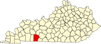 | |
| CDP | ||
| Other unincorporated communities | ||
| Footnotes | ‡This populated place also has portions in an adjacent county or counties | |
| ||
36°52′N 86°53′W / 36.86°N 86.88°W
| International | |
|---|---|
| National | |
| Other | |