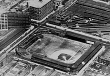
North Broad station
North Broad 54 | ||||||||||||||||||||||||||||||||||||||||||||
|---|---|---|---|---|---|---|---|---|---|---|---|---|---|---|---|---|---|---|---|---|---|---|---|---|---|---|---|---|---|---|---|---|---|---|---|---|---|---|---|---|---|---|---|---|
| Construction | ||||||||||||||||||||||||||||||||||||||||||||
| Structure type | At-grade | |||||||||||||||||||||||||||||||||||||||||||
| Parking | Street-side | |||||||||||||||||||||||||||||||||||||||||||
| Accessible | Yes | |||||||||||||||||||||||||||||||||||||||||||
| History | ||||||||||||||||||||||||||||||||||||||||||||
| Opened | 1929 | |||||||||||||||||||||||||||||||||||||||||||
| Electrified | 1931 | |||||||||||||||||||||||||||||||||||||||||||
| Services | ||||||||||||||||||||||||||||||||||||||||||||
| ||||||||||||||||||||||||||||||||||||||||||||
| ||||||||||||||||||||||||||||||||||||||||||||
North Broad Street Station, Reading Company | ||||||||||||||||||||||||||||||||||||||||||||
| Architect | Horace Trumbauer; Irwin & Leighton | |||||||||||||||||||||||||||||||||||||||||||
| Architectural style | Classical Revival | |||||||||||||||||||||||||||||||||||||||||||
| NRHP reference No. | 96000325 | |||||||||||||||||||||||||||||||||||||||||||
| Added to NRHP | March 28, 1996[1] | |||||||||||||||||||||||||||||||||||||||||||
| Location | ||||||||||||||||||||||||||||||||||||||||||||
North Broad station, known as North Broad Street until 1992, is a
North Broad station is within a few blocks of the
History
Huntingdon Street station

The
In 1888, the Reading announced plans to add local stations on the line, including one next to the
North Broad Street station

In 1928, facing competition from the impending completion of the
However, the Great Depression took away passengers and prevented the planned development, and the collapse of local industry after World War II further damaged the neighborhood. Ridership at the station dwindled as passengers opted for private cars or the more frequent subway. The station building was closed and sold for use as a motel in the 1960s; passengers continued to access the platforms through the pedestrian tunnel.[10] In 1981, the station was heavily damaged by fire.[10]
Railworks

On April 5, 1992, SEPTA began their 18-month-long
Before RailWorks, North Broad Street served 1,200 riders per day, many of whom were transferring to the Broad Street Line or changing for one of the few trains that stopped at Temple.[16] With the addition of Regional Rail platforms at Fern Rock Transportation Center for RailWorks, substantially more service to Temple through the Center City tunnel after the conclusion of the project, and sharply reduced service due to only having two platform tracks rather than the previous four, the importance of North Broad declined significantly after RailWorks.[15] By 2001, under 300 riders used the station daily.[17]
Station building reuse
In March 1996, the station building was added to the National Register of Historic Places.[1][10] That September, Volunteers of America began a $8.3 million renovation to convert the structure into 108 housing units for people transitioning out of homeless shelters. The organization previously had used part of the first floor for adult rehabilitation and counseling programs, but the structure was so deteriorated that only 18% of the floor space was usable. The first residents moved into Station House Apartments in August 1997.[10]
References
- ^ a b "National Register Information System". National Register of Historic Places. National Park Service. January 23, 2007.
- ^ "Johnson's Philadelphia". Johnson's New Illustrated Family Atlas of the World. Alvin J. Johnson & Co. 1872 – via Ward Maps.
- ^ "Outline Maps of the County and City of Philadelphia and Vicinity". O. W. Gray and Son. 1882 – via Ward Maps.
- ^ "Railway Projects". Railway World. 14 (16): 376. 21 April 1888.
- ^ "Map of Philadelphia". Rand, McNally & Co's Indexed Atlas of the World. Rand, McNally & Co. 1891 – via Ward Maps.
- ^ "Plan 28". Baist's Property Atlas of the City and County of Philadelphia, Penna. G. William Baist. 1895 – via Ward Maps.
- ^ "Rand, McNally & Co's Philadelphia". Rand, McNally & Co's Business Atlas and Shipper's Guide. Rand, McNally & Co. 1903 – via Ward Maps.
- ^ "The Rand-McNally Commercial Atlas Map of Philadelphia". Rand McNally & Co's Commercial Atlas of America. Rand McNally & Co. 1916 – via Ward Maps.
- ^ "Break Ground for Reading Company's New Station". Reading Eagle. 1 August 1928 – via Google Newspapers.
- ^ a b c d e f Leobet, Deise (16 August 1997). "Ornate Station To House Homeless: Long Neglected, The Historic Building On N. Broad Is Being Remodeled. Next Month, It Will Become Apartments For 108 Men And Women". The Philadelphia Inquirer. Retrieved 13 June 2016.
- ^ Darlington, Peggy; Jones, John; Metz, George; Wright, Bob. "SEPTA Broad Street Subway". NYCSubway.org.
- ^ Fish, Larry (5 September 1993). "Septa Is Wooing Riders Anew: Railworks Worked. Trains Are Back". The Philadelphia Inquirer. Retrieved 13 June 2016.
- ^ "RailWorks Roundup". The Delaware Valley Rail Passenger. 10 (5). Delaware Valley Association of Rail Passengers. 5 May 1992.
- ^ "Railworks Roundup". The Delaware Valley Rail Passenger. 10 (7). Delaware Valley Association of Rail Passengers: 3. 8 July 1992.
- ^ a b "Five Septa Stations To Be 'Flag Stops'". The Morning Call. 3 September 1993. Retrieved 13 June 2016.
- ^ Mitchell, Matthew (8 September 1992). "Rethink North Philadelphia Rail Stops". The Delaware Valley Rail Passenger. 10 (9). Delaware Valley Association of Rail Passengers: 13.
- ^ "SEPTA Rider Census Full of Lessons, Trivia" (PDF). The Delaware Valley Rail Passenger. 20 (9). Delaware Valley Association of Rail Passengers: 5. September 2002.


