Portal:Oceania/Selected article/2009
| This Wikipedia page has been superseded by historical reference. |
| Note: Article entries are now being transcluded directly on the main portal page. However, this page should be retained for historical reference. |
- January 2009
The primary goal of the voyage was to further support the anthropological theory of the Asiatic origin of native Oceanic people, of Polynesians and Hawaiians in particular, as the result of purposeful trips through the Pacific, as opposed to passive drifting on currents, or sailing from the Americas. A secondary goal of the project was to have the canoe and voyage "serve as vehicles for the cultural revitalization of Hawaiians and other Polynesians."
Since the 1976 voyage to Tahiti and back, Hōkūle‘a has completed nine more voyages to destinations in Micronesia, Polynesia, Japan, Canada, and the United States, all using ancient wayfinding techniques of celestial navigation.
- February 2009
The Fiji Indians have fought for equal rights, although with only limited success. Many have left Fiji in search of better living conditions and social justice and this exodus has gained pace with the series of coups starting in the late 1980s.
Indo Fijians are concentrated in the so-called Sugar Belt and in cities and towns on the northern and western coasts of
- March 2009
The Battle of Wau, 29–31 January 1943, was a battle in the New Guinea campaign of World War II. Forces of the Empire of Japan sailed from Rabaul and crossed the Solomon Sea and, despite Allied air attacks, successfully reached Lae, where they disembarked. Japanese troops then advanced overland on Wau, an Australian base that potentially threatened the Japanese positions at Salamaua and Lae.
A race developed between the Japanese moving overland, hampered by the terrain, and the Australians, moving by air, hampered by the weather. By the time the Japanese reached the Wau area after a trek over the mountains, the Australian defenders had been greatly reinforced by air. In the battle that followed, despite achieving tactical surprise by approaching from an unexpected direction, the Japanese attackers were unable to capture Wau.
The Japanese prepared to make another attempt to capture Wau in June. This time, the plan was to approach from the north, using a road to be built from Markham Point to the Snake River Valley. Road construction was carried out at great hardship to the troops involved, but the road was still incomplete when the Allied landings at Nadzab and Lae caused work to be suspended.
- April 2009
Isla Salas y Gómez, also known as Isla Sala y Gómez, is a small uninhabited Chilean island in the Pacific Ocean. It is the easternmost point in the Polynesian Triangle. Administratively, it is part of the Easter Island commune and province of the Valparaíso Region.
The island is showered with
Although there is no evidence that the island has ever been permanently inhabited, Easter Islanders were certainly aware of its existence, as indicated by the pre-European name of the island. Because of these historical connections to Easter Island, Salas y Gómez can be considered part of Polynesia; if so its location makes it the easternmost landmass of Polynesia. The title is usually awarded to Easter Island, 415 km further west.
- May 2009
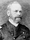
Tilley was named Acting Governor in April 1901. His first acts were to impose a
In November 1901, Tilley was court-martialled for alleged immorality and
- June 2009
Aitutaki is famous for its turquoise central lagoon, uninhabited islands and palm-fringed beaches. Another advantage is that until now it has been spared by mass tourism. Noteworthy also are an old church (the oldest in the Cook Islands) and some gigantic Banyan trees (Ficus prolixa).
Tapuaetai (One Foot Island), a small islet in the south-east of the lagoon, is often said to be the most important attraction. It is regarded as providing the visitor with the best views of the Aitutaki lagoon and depending on the tide one is able to walk on a sandbank a decent distance away from Tapuaetai (One Foot Island). The trip to this island is the most frequented trip available on Aitutaki and is bookable in most hotels. One Foot Island was awarded "Australasia's Leading Beach" at the World Travel Awards held in Sydney in June 2008.
- July 2009
Typhoon Pongsona produced strong wind gusts peaking at 278 km/h (173 mph 1-min), which left the entire island of
- August 2009
The volcano has probably been erupting for at least 700,000 years and may have emerged above sea level about 400,000 years ago, although the oldest-known dated rocks do not extend beyond 200,000 years. Its
Mauna Loa's most recent eruption occurred from March 24, 1984, to April 15, 1984. No recent eruptions of the volcano have caused fatalities, but eruptions in 1926 and 1950 destroyed villages, and the city of
- September 2009
The Kokoda Track or Trail is a single-file foot thoroughfare that runs 96 kilometres (60 mi) overland — 60 kilometres (37 mi) in a straight line — through the Owen Stanley Range in Papua New Guinea. The track is the most famous in Papua New Guinea and is renowned as the location of the World War II battle between Japanese and Australian forces in 1942. The trail was first used by European miners in the 1890s who were travelling to the Yodda Kokoda goldfields.
The track starts, or ends, at Owers Corner in Central Province, 50 kilometres (31 mi) east of Port Moresby, and then crosses rugged and isolated, terrain, which is only passable on foot, to the village of Kokoda in Oro Province. It reaches a height of 2,190 metres (7,185 ft) as it passes around the peak of Mount Bellamy.
Hot, humid days with intensely cold nights, torrential rainfall and the risk of endemic
- October 2009
Palau competed at the 2008 Summer Olympics in Beijing, China. Palau's Olympic delegation was led by Frank Kyota, the President of the Palau National Olympic Committee, and consisted of five athletes, three team officials and four coaches. This was an increase from the nation's two previous appearances at the Summer Olympic Games; four athletes had been sent to both the Sydney and Athens Games. Palau's Olympic team was one of the 117 that won no medals at the Games.
Palau was the 119th national team to enter the
The 2008 Summer Olympics marked the first time that Palauans were able to watch complete Olympic television coverage of all events in their own country. Palau's in-depth television coverage was due to a special agreement between
- November 2009
The
The group is uninhabited except for a few families on
- December 2009
During the seventeen years between his second and third terms as Prime Minister, Somare was appointed to political posts by other Prime Ministers. Somare served as
In


