Potomac Heights (Washington, D.C.)
Potomac Heights | |
|---|---|
Neighborhood of Washington, D.C. | |
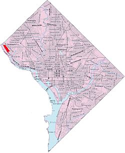
 Map of Washington, D.C., with Potomac Heights highlighted in red | |
| Coordinates: 38°55′39″N 77°06′28″W / 38.9276°N 77.1078°W | |
| Country | United States |
| District | Washington, D.C. |
| Ward | Ward 3 |
| Government | |
| • Councilmember | Matthew Frumin |

Potomac Heights is a neighborhood in
In June 1909, the Potomac Heights Land Co. (based in N.C.) acquired 75 acres (300,000 m2) previously known as the Athletic Park tract at the reported cost of $1000 an acre. The tract extends parallel with and between Conduit Road and the Potomac.[1] It is divided by the Washington Railway and Electric Company and ran from Georgetown to Glen Echo for a 5 cent fare. There were 800 lots at $450–$500 per lot and no home was to be erected at less than $,2500.
Sights in the area include Chesapeake & Ohio Canal National Historic Park, Andrew S. Edwards Island, and Chain Bridge.
References
- ^ ISBN 9780801893537. Retrieved 24 December 2021.
- ^ "Potomac Heights - Summary Report". GNIS. USGS. Retrieved 26 December 2021.
