
Anacostia
Anacostia | |
|---|---|
Neighborhood of Washington, D.C. | |
 Anacostia within the District of Columbia | |
| Country | United States |
| District | Washington, D.C. |
| Ward | Ward 8 |
| Government | |
| • Councilmember | Trayon White |
Anacostia /ænəˈkɒstiə/ is a historic neighborhood in Southeast Washington, D.C. Its downtown is located at the intersection of Marion Barry Avenue (formerly Good Hope Road) and Martin Luther King Jr. Avenue. It is located east of the Anacostia River, after which the neighborhood is named.
Bounded by the Southeast Freeway to the north and northwest, the Suitland Parkway to the south and southwest as well as Fort Stanton and Ricketts Park to the east, Anacostia includes all of the Anacostia Historic District, which was listed on the National Register of Historic Places in 1978.[1] Often the name "Anacostia" is used to refer to the entire portion of the city that is southeast of the Anacostia River. The Anacostia Business Improvement District is responsible for the development of the area.
History
The name "Anacostia" comes from the anglicized name of a
Captain
Around the year 1668, native peoples previously living south of Anacostia were forced northward by war. Anacostine Island, which first appeared on a 1670 map drawn by Augustine Herman, was settled by the Anacostans around this time.[6]

The core of what is now the Anacostia historic district was incorporated in 1854 as Uniontown and was one of the early suburbs in the District of Columbia. It was designed to be affordable for Washington's working class, many of whom were employed across the river at the
During the Civil War, Anacostia was protected by a series of forts upon the hills southwest of the city. Following the conclusion of the war, the forts were dismantled and the land returned to its original owners.[6]
Anacostia, always part of the District of Columbia, became a part of the city of Washington when the city and District became coterminous in 1878.[6] On January 27, 1886, the
The opening of the Pennsylvania Avenue Bridge in 1890 began to link Anacostia to the rest of the District of Columbia.[12]
Great Depression
In 1932, during the
Post-war years
Anacostia's population remained predominantly European-American up until the late 1950s and early 1960s, with whites comprising 87% of the population. During the 1960s, the
Shopping, dining, and entertainment facilities throughout greater Anacostia are limited, as development slowed with a decrease in income in the area. Residents often must travel to either the suburbs or downtown Washington for these services. Anacostia, however, does have a year-round ice skating rink at Fort Dupont Park; the city police boys' club; and a tennis and learning center, combining sports with academic tutoring in Congress Heights.
St. Elizabeth's Hospital, D.C. Village and the Blue Plains sewage treatment plant[15] were long-established Anacostia developments noted in a late-1990s report. The report also cited attention to the area at that time from Hillary Clinton and Newt Gingrich.[16]
In 2005, Building Bridges Across the River opened the 110,000-square-foot (10,000 m2)
Geography
Anacostia downtown is located at the intersection of Marion Barry Avenue (formerly Good Hope Road) and
Demographics
As of the
Landmarks
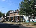
The Anacostia Historic District is listed on the National Register of Historic Places as a historic district, and it retains much of its mid-to-late 19th-century low-scale, working-class character, as is evident in its architecture.
In 1957, an Anacostia landmark, the "world's largest chair", was installed at the corner of Martin Luther King Jr. Avenue and V Street SE. The chair was installed by the Curtis Brothers Furniture Company and built by Bassett Furniture. In the summer of 2005, the "Big Chair" was removed for repairs, then returned in April 2006.[17]
Industry
Notable facilities in the area include Joint Base Anacostia–Bolling (formerly Bolling Air Force Base and Naval Support Facility Anacostia).
Tourism
Founded in 2000, the Anacostia Waterfront Initiative is revitalizing a 45-acre (180,000 m2) piece of the Anacostia River waterfront to promote the community. Plans include numerous parks restored of their natural wetlands and forests, canoe tie-ups, a playground, a four-acre 9/11 memorial grove, and an environmental education center. The center provides visitors with education about the history and use of the Anacostia River through a 9,000-square-foot (840 m2), two-story complex topped by a green roof/nursery center with classrooms, labs, and a multipurpose area beneath.[18] Studios Architecture was chosen to be the architect of the project,[19] while the administrating agency will be the Anacostia Waterfront Corporation.
Hospitals
- St. Elizabeths Hospital (more than 100 years old)
- United Medical Center (formally Greater Southeast Community Hospital)
Education
District of Columbia Public Schools operates public schools. Anacostia High School serves Anacostia.[20] Ballou High School is in southern Anacostia. The area has a number of middle and elementary schools, and is also the location of Thurgood Marshall Academy.
Culture
- The Anacostia Museum, a branch of the Smithsonian Institution, was established in 1967 by S. Dillon Ripley, then-Secretary of the Smithsonian Institution.
- The Anacostia Arts Center and Honfleur Gallery, located near the corner of Martin Luther Jr. King Ave and Good Hope Road is a gallery showcasing nationally known works alongside that of local artists. It hosts a bi-monthly poetry series called Intersections, sponsored by the American Poetry Museum.
- District of Columbia Public Library operates the Anacostia Neighborhood Library.[21]
- Cedar Hill, the home of abolitionist Frederick Douglass, known as the "Lion of Anacostia", sits atop a hill overlooking the Anacostia neighborhood on W Street SE.
- The Anacostia Playhouse brings in many different events to their blackbox theater which includes productions by Theater Alliance located at 2020 Shannon Place SE.
Cultural reference
In the 2007 film inspired by the life of Ralph Waldo 'Petey' Greene (played by Don Cheadle), Greene's straightlaced counterpart Dewey Hughes played by Chiwetel Ejiofor surprises all with his skill at '9 ball' pool. "Grew up in the Anacostia projects ... [and] made [my] way through school hustling", he explains about himself after their game in Talk to Me. The film is set in the late 1960s.[22]
Transportation
The neighborhood, served by the
Gallery
-
 An old Anacostia cottage
 -
 The historic neon "Anacostia" sign at 1115 Good Hope Road SE. The sign is the traditional gateway to Historic Old Anacostia.
 -
 Houses on W Street, SE in Anacostia.
 -
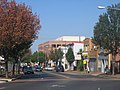 Martin Luther King Jr. Avenue, SE in Anacostia.
 -
 The intersection of High St. & Maple View Place SE
_(3).jpg)


See also
- Congress Heights
- Fort Greble
- Fort Stanton
- Washington Bellevue
- Washington Hillcrest
- Washington Highlands
References
- ^ "National Register Information System". National Register of Historic Places. National Park Service. April 15, 2008.
- ^ Humphrey, Robert L.; Mary Elizabeth Chambers (1977). Ancient Washington: American Indian Cultures of the Potomac Valley. George Washington University.
- ^ "Native Americans Were Original Residents of Nation's Capital". Voice of America News. Archived from the original on August 28, 2023.
- ^ McAtee, Waldo Lee (April 6, 2018). "A Sketch of the Natural History of the District of Columbia Together with an Indexed Edition of the U.S. Geological Survey's 1917 Map of Washington and Vicinity". Press of H.L. & J.B. McQueen, Incorporated. Retrieved April 6, 2018 – via Google Books.
- ^ McAtee, Waldo Lee (1918). A Sketch of the Natural History of the District of Columbia. H.L. & J.B. McQueen.
- ^ JSTOR 40067143.
- ^ "Anacostia Historic District". National Park Service. Retrieved 9 December 2014.
- ^ "Minor District Matters". The Washington Post. January 27, 1886. p. 2.
- ^ "Local Bills in Congress: Measures Which Have Been Introduced This Session". The Washington Post. July 5, 1886. p. 1.
- ^ Havenner, George C. "The Old and The New Anacostia". The Washington Post. January 24, 1926. p. SM3.
- ^ "It Is a Growing Suburb: Anacostia Is at Present Making Rapid Strides for Itself". The Washington Post. August 27, 1889. p. 7.
- ^ (introduction), xroads.virginia.edu, no date. Retrieved 2019-02-09.
- ^ "American Experience". PBS. Retrieved 9 December 2014.
- ^ "The Changing Face of Anacostia: Public Housing and Urban Renewal", xroads.virginia.edu, no date. Retrieved 2019-02-09.
- ^ Halsey, Ashley III, "D.C. Water adopts Norway’s Cambi system for turning sewage into electricity and fertilizer", Washington Post, April 5, 2014. Retrieved 2019-02-09.
- ^ "'No Negroes, Mulattoes, Pigs, or Soap Boiling': Race in Anacostia", xroads.virginia.edu, footnoted material dated 1996/1997. Retrieved 2019-02-09.
- ^ Schwartzman, Paul (April 16, 2006). "The Big Chair, Rebuilt to Last". The Washington Post. Retrieved 25 January 2011.
- ^ "Kingman Island and Heritage Island Parks". Office of the Deputy Mayor for Planning and Economic Development. Archived from the original on July 21, 2011. Retrieved 25 January 2011.
- ^ "Studios Architecture". Archived from the original on 2011-02-08. Retrieved 25 January 2011.
- ^ "Attendance Zones for Neighborhood High Schools" (PDF). Office of the Chief Technology Officer. 8 September 2009. Archived from the original (PDF) on 19 October 2010. Retrieved 25 January 2011.
- ^ "Anacostia Library". District of Columbia Public Library. Retrieved on November 16, 2014.
- ^ Talk to Me DVD. 2007 Universal Studios. Subtitles SDH. Circa minute 28:29. Retrieved May 29, 2015.
Further reading
- The Anacostia Waterfront: Imagine, Act, Transform. Washington, D.C.: District of Columbia, Office of Planning. c. 2003. OCLC 56807937.
- Williams, Brett (June 2001). "A River Runs through Us". American Anthropologist. 103 (2): 409–431. .
- Burr, Charles (1920). "A Brief History of Anacostia, its Name, Origin and Progress". Records of the Columbia Historical Society. 23: 167–179.
- Dale, Dianne (2011). The Village That Shaped Us. Lanham, MD: Dale Publishing. ISBN 978-1888018417.
External links
- Anacostia Historic District
- Honfleur Gallery
- Anacostia Watershed Society
- Live Anacostia
- Three Things About Poplar Point and Anacostia Flats
- History of Anacostia Documentary produced by WETA-TV
- Anacostia Waterfront Initiative
- Why Is It Named Anacostia - Ghosts of DC blog
Places adjacent to Anacostia | ||||||||||||||||
|---|---|---|---|---|---|---|---|---|---|---|---|---|---|---|---|---|
| ||||||||||||||||
| Topics | |
|---|---|
| Lists by state |
|
| Lists by insular areas | |
| Lists by associated state | |
| Other areas | |
| Related | |
| International | |
|---|---|
| National | |
| Other | |