
Road signs in Denmark
This article needs additional citations for verification. (May 2018) |
.jpg)
This is a list of
Denmark signed the Vienna Convention on Road Signs and Signals on November 8, 1968 and ratified it on November 3, 1986.[1]
Road signs in Denmark are regulated by the Road Traffic Act (Færdselsloven). [2] The design and definitions of road signs is delegated to the executive, according to §95 ¶1 of the Road Traffic Act. [2] The executive, in this case the danish minister of transport (transportministeren), issues executive orders on the subject. The latest executive orders were issued on April 13, 2023[3] [4]
A: Warning signs
Sources[fn 1]
Outside built-up[fn 2] areas, warning signs, except A18, A35, A74, A75 and A92[fn 3]
, are usually placed from 150m to 250m before the danger.
If the warning signs are placed at a different distance, the distance is shown on a subpanel.
Inside built-up[fn 2] areas, warning signs can be placed at a shorter distance from the danger, without the distance being shown on a subpanel.
- Warning signs
-
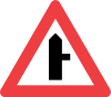
 A11: Dangerous crossroad with a non-priority road
 -
 A12.1: Dangerous side road with a non-priority road
 -
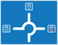
 A16: Roundabout
 -
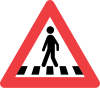 A17: Pedestrian crossing
 -
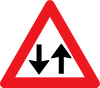 A18: Two-way traffic
 -
 A19: Traffic signals
 -
 A20: Traffic queue
 -
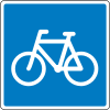
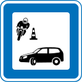
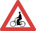
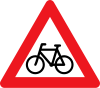 A21: Cyclists
 -
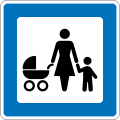
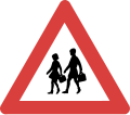
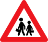 A22: Children
 -
 UA22: School
 -
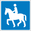
 A23:Equestrians
 -
 A26: Wild animals crossing
 -
 A27: Cattle
 -
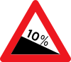
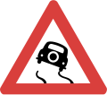
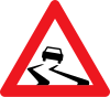 A31: Slippery road
 -
 UA31: Icy
 -
 A33: Loose chippings
 -
 A34: Rockfall
 -
 A35: Dangerous shoulder
 -
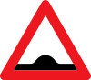 A36: Speed bump
 -
![A36.1: Actibump [fn 4]](//upload.wikimedia.org/wikipedia/commons/thumb/0/05/A36._1_actibump.svg/71px-A36._1_actibump.svg.png)
-
 A37: Uneven road
 -
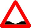 A38: Dip
 -
 A39: Roadworks
 -
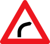 A41.1: Curve to the right
 -
 A41.2: Curve to the left
 -
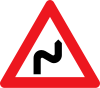 A42.1: Multiple curves, first to the right
 -
 A42.2: Multiple curves, first to the left
 -
 UA41: Recommended speed in curves
 -
 A43.1: Road narrows
 -
![UA43.1: Narrow road[fn 5]](//upload.wikimedia.org/wikipedia/commons/thumb/3/3b/Denmark_road_sign_UA43_1.svg/100px-Denmark_road_sign_UA43_1.svg.png) UA43.1: Narrow road[fn 5]
UA43.1: Narrow road[fn 5] -
 A43.2: Road narrows to the left
 -
 A43.3: Road narrows to the right
 -
 UA43: Width limit
 -
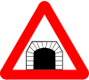 A44: Tunnel (formerly used
 )
) -
 A46.1 Downward gradient
 -
 A46.2: Upward gradient
 -
 A72: Level crossing without gates
 -
 UA72: Look for trains
 -
 A73: Level crossing with gates
 -
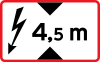 UA73: Overhead electricity lines at level crossing
 -
 A74.1: Single track level crossing
 -
 A74.2: Multi track level crossing
 -
 A75: Distance to level crossing
 -
 A91: Opening bridge
 -
 A92: Quayside
 -
 A95: Side winds
 -
 A96: Lowairplanes
 -
 A97: Lowhelicopters
 -
 A99: Other danger
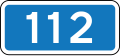
 -
 UA99: Accident-prone intersection


![A36.1: Actibump [fn 4]](/File:A36._1_actibump.svg)


B: Priority signs
Sources[fn 6]
- Priority signs
-
 B11: Yield
 -
 UB11.1: Stop ahead
 -
 UB11.2: Two-way cycle track or lane crossing
 -
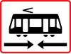 UB11.3: Light rail crossing
 -
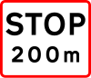
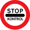
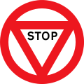
 B13: Stop
 -
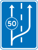
 B15: Lane merge
 -
 B16: Main road
 -
 B17: End of main road
 -
 B18: Priority for oncoming vehicles
 -
 B19: Priority over oncoming vehicles


C: Prohibitory signs
Sources[fn 7]
- Prohibitory signs
-
 C11.1: No right turn
 -
![C11.2: No left turn[fn 8]](//upload.wikimedia.org/wikipedia/commons/thumb/1/12/Denmark_road_sign_C11.2.svg/100px-Denmark_road_sign_C11.2.svg.png) C11.2: No left turn[fn 8]
C11.2: No left turn[fn 8] -
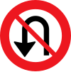 C12: No U-turns
 -
 C19:No entry
 -
 C21: Driving in both directions prohibited
 -
 C22.1: No motor vehicles
 -
 C22.2: No motorcycles or large mopeds
 -
 C23.1: No lorries
 -
 C23.2: No buses
 -
 C23.3: No vehicles carrying dangerous goods
 -
 C24.1: No tractors or motor equipment
 -
 C24.2: No horse-drawn vehicles or similar
 -
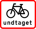
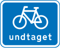
![C25.1: No bicycles or small mopeds [fn 9]](//upload.wikimedia.org/wikipedia/commons/thumb/0/09/Denmark_road_sign_C25.1.svg/100px-Denmark_road_sign_C25.1.svg.png) C25.1: No bicycles or small mopeds [fn 9]
C25.1: No bicycles or small mopeds [fn 9] -
 C25.2: No small mopeds
 -
 C26.1: Noridingor leading a horse
 -
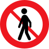 C26.2: No pedestrians
 -
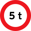 C31: Max weight
 -
 C32: Max weight of roadtrain
 -
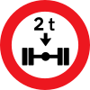 C35: Max axle load
 -
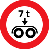 C36: Max bogie load
 -
 C41: Max width
 -
 C42: Max height
 -
 C43: Max length
 -
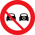
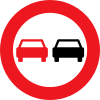 C51: No overtaking
 -
 C52: No overtaking by truck
 -
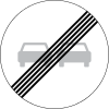 C53: End of no overtaking
 -
 C54: End of no overtaking by truck
 -
 C55: Local speed limit
 -
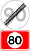
 C56: End of local speed limit
 -
 UC56: Built up area subpanel
 -
 UC57: End of local speed limit subpanel
 -
 C59: End of prohibition
 -
 C61: No stopping
 -
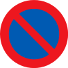 C62: No parking

![C11.2: No left turn[fn 8]](/File:Denmark_road_sign_C11.2.svg)


![C25.1: No bicycles or small mopeds [fn 9]](/File:Denmark_road_sign_C25.1.svg)


- Subpanels to C61 and C62
-
 UC62: Limited parking
 -
 UC61: No stopping subpanel
 -
 UC62: No parking subpanel
 -
 UC60.1: Restriction applies before and after sign
 -
 UC60.2: Restriction begins at sign
 -
 UC60.3: Restriction ends at sign
 -
 UC60.5: No stopping on shoulder
 -
 UC60.6: No parking on shoulder
 -
 UC60.7: Parking on shoulder allowed
 -
 UC60.7: Parking partly on sidewalk allowed


- Prohibitory signs
-
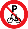 C63: No parking for bicycles
 -
 C92: Continuing without stop prohibited


D: Mandatory signs
Sources[fn 10]
- Mandatory signs
-
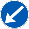
 D11.1: Mandatory direction
 -
 D11.2: Mandatory direction
 -
 D11.3: Mandatory direction
 -
 D11.4: Mandatory direction
 -
 D11.5: Mandatory direction
 -
 D11.6: Mandatory direction
 -
 D11.7: Mandatory direction
 -
 D11.8: Mandatory direction
 -
 D12: Mandatory direction in the roundabout
 -
 D15.2: Mandatory passage
 -
 D15.3: Mandatory passage
 -
 D16: Passage
 -
 D21:Cycleway
 -
 UD1: Subpanel which points to lane or path
 -
 UD21.1: Two-way cycle traffic
 -
 UD21.2: End of Two-way cycle traffic
 -
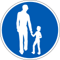
 D22:Footway
 -
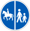
 D23:Bridleway
 -
 D26: Segregated path
 -
 D26.1: Segregated path
 -
 D26.2: Segregated path
 -
 D26.3: Segregated path
 -
 D26.4: Segregated path
 -
 D26.5: Segregated path
 -
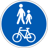 D27: Combined path
 -
 D27.1: Combined path
 -
 D55: Minimum speed
 -
 D56: End of minimum speed


E: Information signs
Sources[fn 11]

- Arrow signs suspended above lanes at intersection
-
 E11.1: Continue straight
 -
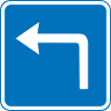 E11.4: Turn left
 -
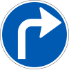
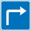 E11.5: Turn right
 -
 E11.6: Continue straight or turn left
 -
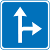 E11.7: Continue straight or turn right
 -
 E11.8: Turn left or right
 -
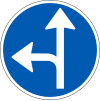
 E11.9: Continue straight, turn left or right


-
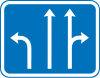 E15: Lanes at intersection
 -
 E16.1: Reduction of number of lanes with lane-merge
 -
 E16.2: Reduction of number of lanes with lane-change
 -
![E17: Pedestrian crossing. (Variant:[fn 12])](//upload.wikimedia.org/wikipedia/commons/thumb/5/50/Denmark_road_sign_E17.svg/100px-Denmark_road_sign_E17.svg.png) E17: Pedestrian crossing. (Variant:[fn 12])
E17: Pedestrian crossing. (Variant:[fn 12]) -
![E18: Dead end. (Variants: [fn 13])](//upload.wikimedia.org/wikipedia/commons/thumb/d/d6/Denmark_road_sign_E18.svg/100px-Denmark_road_sign_E18.svg.png) E18: Dead end. (Variants: [fn 13])
E18: Dead end. (Variants: [fn 13]) -
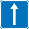
 E19: One way
 -
 E21.1: Recommended route for cyclists
 -
 E21.2: Recommended route for pedestrians
 -
 E21.3: Recommended route for equestrians
 -
 E21.4: Recommended route for mopeds
 -
 E22.1: Recommended route for lorries
 -
 E22.2: Recommended route for hazardous goods vehicles
 -
 E22.3: Recommended route for tractors and motor equipment
 -
 E22.4: Recommended route for busses
 -
 E23: Instructions for disabled
 -
 E24: Instructions for visually impaired
 -
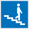
 E26.1: Pedestrian overpass
 -
 E26.2: Pedestrian underpass
 -
 E30: Light rail stop
 -
 E31: Bus stop
 -
 E31: Taxi stand
 -
 E33.1: Parking
 -
 E33.2: Indoor parking
 -
 UE33.1: Before and after sign
 -
 UE33.2: After sign
 -
 UE33.3: Before sign
 -
 UE33.4: Charging
 -
 E34: Breakdown bay (formerly used
 )
) -
 UE34: Fire extinguisher and emergency phone
 -
 E35: Tunnel
 -
 E37: Crawler lane begins
 -
 E39: Advisory maxspeed
 -
 E40: End of advisory maxspeed
 -
 E41: Recommended max speed on exit slip road
 -
 E42:Motorway
 -
 E43: Trunk road
 -
 E44: End ofMotorway
 -
 E45: End of Trunk road
 -
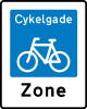 E47: Bicycle boulevard
 -
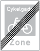 E48: End of Bicycle boulevard
 -
 E49: Pedestrian zone
 -
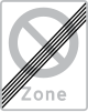
 E50: End of Pedestrian zone
 -
 E51: Living street
 -
 E52: End of living street
 -
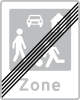
 E53: Zone with traffic calming
 -
 E53: End of zone with traffic calming
 -
 E55: Urban area
 -
 E56: End of urban area
 -
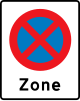 E68.2: Zone with no stopping
 -
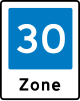
 E68.4: Zone with local speed limit
 -
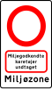 E68.9: Low-emission zone
 -
 E69: End of zone with no parking
 -
 E69.3: End of zone with parking
 -
 E69.4: End of zone with local speed limit
 -
 E69.5: End of zone with no lorries
 -
 E69.9: End of low-emission zone
 -
![E80:[fn 14] General speed limits](//upload.wikimedia.org/wikipedia/commons/thumb/9/97/Denmark_road_sign_E80.svg/59px-Denmark_road_sign_E80.svg.png) E80:speed limits
E80:speed limits -

-
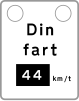 E91: Speed feedback sign
 -

-
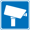 E93: Video surveillance


![E17: Pedestrian crossing. (Variant:[fn 12])](/File:Denmark_road_sign_E17.svg)
![E18: Dead end. (Variants: [fn 13])](/File:Denmark_road_sign_E18.svg)


![E80:[fn 14] General speed limits](/File:Denmark_road_sign_E80.svg)


F: Direction Signs
Sources[fn 15]
- On roads
-
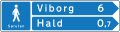
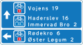
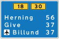
 F11: Arrow direction sign
 -
 F11: Arrow direction sign
 -
 F11: Arrow direction sign
 -
 F11: Arrow direction sign
 -
 F12: Arrow direction sign
 -
 F12: Arrow direction sign
 -
 F13: Arrow direction sign
 -
 F13: Arrow direction sign
 -
 F13: Arrow direction sign
 -
 F14: Temporary arrow direction sign
 -
 F14: Temporary arrow direction sign
 -
 F16:
F16: -
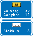
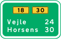
 F18: Tabular direction signs
 -
![F34.1: Bypass route[fn 16]](//upload.wikimedia.org/wikipedia/commons/thumb/b/ba/Denmark_road_sign_F34_1.svg/86px-Denmark_road_sign_F34_1.svg.png) F34.1: Bypass route[fn 16]
F34.1: Bypass route[fn 16] -
![F34.2: Arrow sign for bypass route[fn 16]](//upload.wikimedia.org/wikipedia/commons/thumb/c/ce/Denmark_road_sign_F34_2.svg/100px-Denmark_road_sign_F34_2.svg.png) F34.2: Arrow sign for bypass route[fn 16]
F34.2: Arrow sign for bypass route[fn 16] -
![F34.3: Diagram orientation sign for bypass route[fn 16]](//upload.wikimedia.org/wikipedia/commons/thumb/3/35/Denmark_road_sign_F34_3.svg/86px-Denmark_road_sign_F34_3.svg.png) F34.3: Diagram orientation sign for bypass route[fn 16]
F34.3: Diagram orientation sign for bypass route[fn 16]

![F34.1: Bypass route[fn 16]](/File:Denmark_road_sign_F34_1.svg)
![F34.3: Diagram orientation sign for bypass route[fn 16]](/File:Denmark_road_sign_F34_3.svg)
- On paths
-
 F21.1:
 -
 F21.2:
 -
 F21.2.2:
 -
 F21.2.3:
 -
 F21.3
F21.3 -
 F21.4:


- For parking
-
 F33.1: Arrow direction sign
 -
 F33.1: Tabular direction sign

G: Orientation Signs
Sources[fn 17]
- Orientation signs
-
 G11: Portal oriantation sign
 -
 G14: Diagram orientation sign
 -
 G15: Lane orientation sign
 -
 G18: Tabular orientation sign


H: Distance- and Locality Signs
Sources[fn 18]
-
 H41: Distance sign
 -
 H42: Split distance sign
 -
 H45: Locality
 -
 H46: Regional border
 -
 H47: Municipal border
 -
 H49: National park
 -
 H49.1: Nature park
 -
 H50: Leaving national park
 -
 H50.1: Leaving nature park
 -
 H51: National Border


I: Direction- Locality Signs on Motorways
Sources[fn 19]
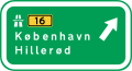
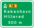
On motorways, direction signs have blue background when they lead to the ordinary road network, via an exit from the motorway, Directions have green background when they lead to the destination via the motorway(s).[fn 20]
-
 I11: Exit from motorway
 -
 I12: Exit from motorway in 500 m
 -
![I13: Exit from motorway in 1500m[fn 21]](//upload.wikimedia.org/wikipedia/commons/thumb/3/38/Denmark_road_sign_I13.svg/120px-Denmark_road_sign_I13.svg.png) I13: Exit from motorway in 1500m[fn 21]
I13: Exit from motorway in 1500m[fn 21] -
![I13: Exit from motorway in 1500m [fn 21]](//upload.wikimedia.org/wikipedia/commons/thumb/7/70/Denmark_road_sign_I13_variant.svg/120px-Denmark_road_sign_I13_variant.svg.png) I13: Exit from motorway in 1500m [fn 21]
I13: Exit from motorway in 1500m [fn 21] -
 I16: Exit to another motorway
 -
 I17: Exit to another motorway in 500m
 -
 I18: Exit to another motorway in 1500m
 -
 I20: Motorway junction


![I13: Exit from motorway in 1500m[fn 21]](/File:Denmark_road_sign_I13.svg)
![I13: Exit from motorway in 1500m [fn 21]](/File:Denmark_road_sign_I13_variant.svg)


J: Lane- and Orientation Signs Used on Motorways
Sources[fn 22]
-
![J11: Designated lanes[fn 23]](//upload.wikimedia.org/wikipedia/commons/thumb/c/c4/Denmark_road_sign_J11_e_road.svg/120px-Denmark_road_sign_J11_e_road.svg.png) J11: Designated lanes[fn 23]
J11: Designated lanes[fn 23] -
![J11: Designated lanes[fn 23]](//upload.wikimedia.org/wikipedia/commons/thumb/7/70/Denmark_road_sign_J11_primary_route_and_exit_ahaed.svg/120px-Denmark_road_sign_J11_primary_route_and_exit_ahaed.svg.png) J11: Designated lanes[fn 23]
J11: Designated lanes[fn 23] -
![J11: Designated lanes[fn 23]](//upload.wikimedia.org/wikipedia/commons/thumb/2/20/Denmark_road_sign_J11_over_exit_lane.svg/120px-Denmark_road_sign_J11_over_exit_lane.svg.png) J11: Designated lanes[fn 23]
J11: Designated lanes[fn 23] -
 J12: Direction of lanes ahead
 -
 J13: Diagram orientation sign
![J11: Designated lanes[fn 23]](/File:Denmark_road_sign_J11_e_road.svg)
![J11: Designated lanes[fn 23]](/File:Denmark_road_sign_J11_primary_route_and_exit_ahaed.svg)
![J11: Designated lanes[fn 23]](/File:Denmark_road_sign_J11_over_exit_lane.svg)


K: Confirmatory- Distance- and Tourist Information Signs Used on Motorways
Sources[fn 24]
-
 K11: Route confirmation
 -
 K12: Distance information
 -
 K30: Tourist information


L: Route Designations
Sources[fn 25]
A box with a broken border line means the route is connecting to the route number in the box.
-
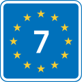
 L41: E-Road
 -
 L42: Primary route
 -
 L43: Secundary route
 -
 L44: Ring road
 -
 L45: National bicycle route
 -
 L45.2: Regional or local bicycle route
 -
 L46: Bicycle highway
 -
 L47: EuroVelo
 -
 L50: Marguerite route (tourist route)


M: Service signs
Sources[fn 26]
New service signs can be designed when needed, eg. by request from a business. The permission to do this is found in §359 ¶2 in Executive Order 426 from 2023.[4] A list of approved signs can be found on the Danish Road Directorate's (Vejdirektoratet) webpage. Signs planned, but not designed yet, are "electrician" and "real estate agent".[8]
-
 M9:Container and cargo port
 -
 M10: Ferry for pedestrians and bicycles
 -
 M11: Car ferry
 -
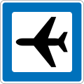 M12: Airport
 -
 M13: Train station
(formerly used )
) -
 M13.1: S-train station
 -
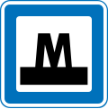 M13.2 Metro station
 -
 M13.3: Light rail station
 -
 M14: Bus station
 -
 M15: Freight terminal
 -
 M16: Park and ride
(formerly used )
) -
 M17: Post Office
 -
 M18: Hub (communal transport)
 -
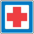 M21: Hospital emergency department, open 24 hours a day
 -
 M22: Telephone
 -
 M23: Breakdown service
 -
 M24: Filling station
 -
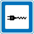 M24.1: Charging station for EV
 -
 M24.2: Charging and filling station
 -
 M30: Primitive camp site for hikers
 -
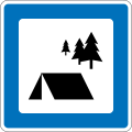
 M31: Camping and caravan site
 -
 M31.1: Site exclusivly for caravans
 -
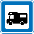 M32: Autocamper site
 -
 M33: Camping cabins
 -
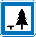 M34: Rest area
 -
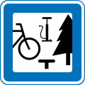 M34.1: Rest area for cyclists
 -
 M35: Beach or swimming pool
 -
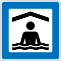 M35.1: Indoor swimming pool
 -
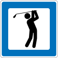 M36: Golf Course
 -
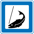 M37: Put and take fishing
 -
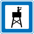 M38: Observation tower
 -
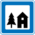 M41:Youth hostel
 -
 M42: Hotel
 -
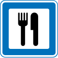 M43: Restaurant
 -
 M45: Cafeteria
 -
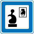
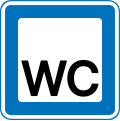 M46: Toilet
 -
 M46.1: Toilet (handicapped)
 -
 M47: Emptying chemical toilet
 -
 M47.1: Emptying chemical toilet
 -
 M51: Church
 -
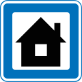
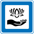
 M52: Place of Interest
 -
-
 M54: National Park
 -
 M57: Industrial area
 -
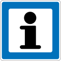 M61: Information point
 -
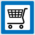 M101: Grocery store
 -
 M102: Room to let
 -
 M103: Baker
 -
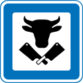 M104: Butcher
 -
 M105: Hairdresser
 -
 M107: Florist
 -
 M109: Bookshop
 -
 M111: Café
 -
 M112: Farm shop
 -
 M113: Antiques
 -
 M114: Garden centre, plant nursery etc.
 -
 M115: Marina
 -
 M116: Nature reserve
 -
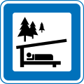 M117: Trail shelter
 -
 M118: Sports facility
 -
 M119: Car dealership, car rental
 -
 M120: Commercial district
 -
 M121: Shopping center, street, etc.
 -
 M123: Education
 -
 M124: Veterinary clinic or hospital
 -
 M125: Kindergarten etc.
 -
 M126: Art, pottery, etc.
 -
 M127: Military
 -
 M128: Hospital
 -
 M129: Public offices
 -
 M130: Cultural center
 -
 M131: Recycling
 -
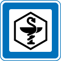 M132: Pharmacy
 -
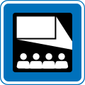 M133: Cinema
 -
 M134: Wellness, massage, beauty clinic, etc.
 -
 M138: Picnic area, indoor or outdoor
 -
 M140: Cohousing
 -
 M143: Stud farm
 -
 M144: Winery
 -
 M145: Drivers education
 -
 M146: Forest burial ground (cremated remains)


Additional Signs
Sources[fn 27]
-
 U1.1:
U1.1: -
 U1.2:
U1.2: -
 U2.1:
U2.1: -
 U2.2:
U2.2: -
 U3.1:
U3.1: -
 U3.2:
U3.2: -
 U3.3:
U3.3: -
 U3.4:
U3.4: -
 U3.5:
U3.5: -
 U3.6:
U3.6: -
 U4.1:
U4.1: -
 U4.2:
U4.2: -
 U5.1:
U5.1: -
 U5.2:
U5.2: -
 U6.3:
U6.3: -
 U6.4:
U6.4: -
 U7:
U7:


Symbols
Sources[fn 28]
-
 US1: Car (not above 3.5 ton registered weight)
 -
 US2: Heavy goods vehicle + any connected trailer
 -
 US3: Bus (above 3.5 ton registered weight, and more than 8 passenger seats)
 -
 US4: Heavy goods vehicle with trailer
 -
 US5: Trailer
 -
 US6: Caravan
 -
 US7: Motorhome
 -
 US8: Bicycle or small moped
 -
 US9:Small moped
 -
 US10: Motorcycle or large moped
 -
 US11: Tractor or motor equipment
 -
 US12: Disabled
 -
 US13: Light rail


Historic signs
-
 A21: Cyclists
 -
 A22: Children
 -
 Slippery road
 -
 A99: Other danger
 -
 B13: Stop
 -
 C12: No U-turn
 -
 Goods vehicles prohibited
 -
 C51: No overtaking
 -
 D21: Cycleway
 -
 D22: Footway
 -
 D27: Combined path
 -
 E17: Pedestrian crossing
 -
 E33.1: Parking
.svg)
_alternate_version.svg)

.svg)
.svg)
.svg)

.svg)
.svg)
.svg)
.svg)
.svg)
.svg)
Notes
- ^ Diagrams of sign A11, A16, A19, A20, A21, A22, A23, A26, A27, A31, A33, A34, A35, A36, A37, A38, A39, A41.1, A41.2, A42.1, A42.2, A43.1, A43.2, A43.3, A44, A46.1, A46.2, A72, A73, A74.1, A74.2, A75, A91, A92, A95, A96, A97, UA22, UA31, UA41, UA43, UA43.1, UA72, UA73 and UA99 are found in §13 of executive order 425 from 2023[3]
- ^ a b
Built-up areas (urban areas), are in this context areas within the signs for entering and leaving a built-up area.
 and
and
- ^
These signs are placed at a different distance than the other warning signs:
A18: Two-way traffic
A35: Dangerous shoulder
A74: Level crossing
A75: Distance to level crossing
A92: Quayside
The distance at which these signs are placed, is found in the description of the signs in §12 of executive order 425 from 2023[3] - ^ Actibump is a method of traffic calming. It is tested 2 places in Denmark(2023).[5] [6] This sign warns of an actibump. As this this is a test, this sign is not included in the executive order
- ^ Used at the beginning of a 2-1 road in combination with A43.1
 Source: Text accompanying the diagram of UA43.1 in §13 of executive order 425 from 2023[3]
- ^ Diagrams of sign B11 B13 B15 B16 B17 B18 B19 UB11.1 UB11.2 UB11.3 are found in §16 of executive order 425 from 2023[3]
- ^ Diagrams of sign C11.1 C11.2 C12 C19 C21 C22.1 C22.2 C23.1 C23.3 C24.1 C24.2 C25.1 C25.2 C26.2 C31 C35 C36 C41 C42 C43 C51 C52 C53 C54 C55 C58 C59 C61 C62 C63 C92UC 33 UC57 UC60.1 UC60.2 UC60.3 UC60.5 UC60.6 UC60.7 UC60.8 UC61 UC62 Are found in §19 of executive order 425 from 2023[3]
- ^ U-turn is also prohibited (§19 of executive order 425 from 2023[3])
- ^ The symbol for bicycle(US8) also applies to a class of vehicles called small mopeds (50cc and restricted to max 30 km/h). In executive order 425 from 2023[3] § 19, the text accompanying this sign is "Cykel og lille knallert forbudt" In translation Bicycle and small moped prohibited
- ^ Diagrams of sign D11.1 D11.2 D11.3 D11.4 D11.5 D11.6 D11.7 D11.8 D12 D15 D16 D21 D22 D23 D26 D27 D55 D56 UD1 UD21.1 UD 21.2 are found in §23 of executive order 425 from 2023[3]
- ^ Diagrams of sign E11.1 E11.4 E11.5 E11.6 E11.7 E11.8 E11.9 E15 E16.1 E16.2 E17 E18 E19 21.1 E21.2 E21.4 E22.1 E22.2 E22.3 E22.4 E23 E24 E26.1 E26.2 E30 E31 E32 E33 E34 E35 E37 E39 E40 E41 E42 E43 E44 E45 E47 E48 E49 E50 E51 E52 E53 E54 E55 E56 E68 E68.9 E69 E69.9 E70 E80 E90 E91 E93 UE33.1 UE33.2 UE33.4 UE34 UE80 are found in §27 of executive order 425 from 2023[3]
- ^ Variant of Pedestrian crossing

- ^ Variants of dead end sign


- ^ This diagram consists of two signs:
 E80 is the upper part with the speed limits.
  UE80 is the lower part, and indicates it is mandatory to use seat belts and driving lights. These signs and their definitions are found in §27 of executive order 425 from 2023[3]
- ^ Diagrams of sign F11 F12 F13 F14 F16 F18 F21.1 F21.2 F21.3 F21.4 F33.1 F33.2 F34.1 F34.2 F34.3 are found in §34 of executive order 425 from 2023[3]
- ^ a b c Signs for bypass routes, when the motorway is blocked [7]
- ^ Diagrams of sign G11 G14 G15 G18 are found in §36 of executive order 425 from 2023[3]
- ^ Diagrams of sign H41 H42 H45 H46 H47 H49 H49.1 H50 H50.1 H51 are found in §38 of executive order 425 from 2023[3]
- ^ Diagrams of sign I11 I12 I13 I16 I17 I18 I20 are found in §40 of executive order 425 from 2023[3]
- ^ §39 of executive order 425 from 2023[3]
- ^ a b Placed below the exit sign can be destination and number of the following exit, or name of the following motorway junction
- ^ Diagrams of sign J11 J12 J13 are found in §41 of executive order 425 from 2023[3]
- ^ a b c The sign is placed above a lane before a split in the motorway, or before an exit. The signs can contain additinal information as well as arrow(s) pointing down to the lane(s)
- ^ Diagrams of sign K11, K12 and K30 is found in §42 of executive order 425 from 2023[3]
- ^ Diagrams of signL41, L42, L43, L44, L46, L47 and L50 is found in §44 of Executive Order 425 from 2023. L45 and L45.2 is found the same place but combined aś L45[3]
- ^ only a few of the service signs are shown in the executive order
- ^ Diagrams of subpanel U1 U2 U3 U4 U5 U6 U7 are found in §9,¶2 of executive order 425 from 2023[3]
- ^ Diagrams of symbol US1 US2 US3 US5 US6 US7 US8 US9 US11 US12 US13 are found in §9,¶3 of executive order 425 from 2023[3]


References
- ^ "United Nations Treaty Collection". treaties.un.org. Retrieved 2023-12-07.
- ^ a b Transportministeriet (2023-02-14), Bekendtgørelse af færdselsloven
- ^ a b c d e f g h i j k l m n o p q r s t u Transportministeriet (2023-04-13), BEK nr 425 om vejafmærkning (Executive order 425 on Road Markings)
- ^ a b Transportministeriet (2023-04-13), BEK nr 426 om anvendelse af vejafmærkning (Executive order 426 on the Use of Road Markings)
- ^ "Her testes nyt fartbump i Danmark - Vejdirektoratet kalder det "ubehageligt"". nyheder.tv2.dk (in Danish). "TV 2". 2022-12-06. Retrieved 2024-04-21.
- ^ "Vejdirektoratet afprøver Actibump på to statsveje". vejdirektoratet.dk (in Danish). "Vejdirektoratet". 2023-06-16. Retrieved 2024-04-21.
- ^ "Nye skilte på motorvejen - lær dem at kende og undgå kø". bt.dk (in Danish). "BT". 2014-12-02. Retrieved 2024-04-21.
- ^ "Liste med samtlige godkendte servicetavler med symboler til kommerciel servicevejvisning". vejregler.dk (in Danish). "Vejdirektoratet". 2023-08-13. Retrieved 2024-04-21.