
Road signs in Italy
Road signs in Italy conform to the general pattern of those used in most other European countries, with the notable exception that the background of motorway (autostrada) signs is green and those for 'normal' roads is blue. They are regulated by the Codice della Strada (Road Code) and by the Regolamento di Attuazione del Codice della Strada (Rules for the Implementation of the Road Code) in conformity with the 1968 Vienna Convention on Road Signs and Signals.
Italy signed the Vienna Convention on Road Signs and Signals on November 8, 1968 and ratified it on February 7, 1997.[1]
Design
Distances and other measurements are displayed in metric units.
Warning signs are usually placed 150 metres before the area they're referring to; if they're farther or nearer, an additional sign displays the actual distance in metres. Prohibition signs and mandatory instruction signs, instead, are placed exactly at the beginning of the area of validity.
Colours and shapes
Signs follow the general European conventions concerning the use of shape and colour to indicate function of signs:
| Type of sign | Shape | Border | Background colour |
|---|---|---|---|
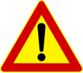
| Warning | Triangular | Red | White |
| Prohibition | Circular | Red | White |
| Mandatory instructions | Circular | White | Blue |
| Supplementary | Rectangular | Black | White |
| Information | Rectangular | White | White (urban) Blue (other roads) Green (motorway) |
Colours of directional road signs
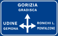
- On motorways, directional signs are green with white lettering.
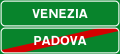
- On main roads, directional signs with more than one destination are blue with white lettering.
- Within cities, directional signs with more than one destination are white with black lettering.
On main roads and within cities, the colour of a directional sign with a single destination depends on the type of destination:
- if the destination is a city that is reached by means of a motorway, the sign is green and carries the motorway name as well as the destination
- in the other cases when the destination is a city, the sign is blue
- if the destination is a city district, a hospital or an airport, the sign is white
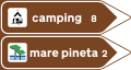
- if the destination is a geographical feature or a tourist attraction, the sign is brown
Typeface

A version of the
The font is officially regulated by the 1992 Codice della Strada, article 39 section 125.[2] It defines both Alfabeto Normale and Alfabeto Stretto for uppercase letters, lowercase letters and digits, "positive" (dark on light background) and "negative" (light on dark background). However, there are regulations about the use of Alfabeto Normale dating back to 1969.[3]
Uppercase is used in most cases. Lowercase is sometimes used for city districts and tourist attractions.
Language
The standard language is Italian. In some autonomous regions or provinces bilingual signs are used (mainly Italian/German in South Tyrol, Italian/French in Aosta Valley and Italian/Slovenian along the Slovenian border, but also Italian/Friulan in the Friuli historical region and Italian/Sardinian in Sardinia).
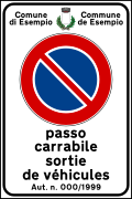
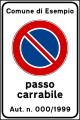
These are some examples of the italian sign "Passo carrabile" (No parking in front of vehicular access to the side properties) in the bilingual variants:
-
 "Passo carrabile" sign in Italian
 -
 "Passo carrabile" sign in Italian and French (used in Aosta Valley)
 -
 "Passo carrabile" sign in Italian and German (used in South Tyrol)
 -
 "Passo carrabile" sign in Italian and Slovenian (used in some municipalities of Friuli-Venezia Giulia)


Gallery
Warning signs
-
 Uneven road
(formerly used that meant "Humps or dip")
 -
 Bumps in the road (formerly used
 that meant "Humps or ramp")
 -
 Dip (formerly used
 that meant "dangerous for dip")
 -
 Bend, to right
(formerly used )
) -
 Bend, to left
(formerly used )
) -
 Double bend, first to right
(formerly used )
) -
 Double bend, first to left
(formerly used )
) -

-

-

-
-
 Trams crossing ahead
 -

-
 Bicycle crossing ahead
 -
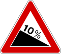 Steep hill downwards
(formerly used )
) -
 Steep hill upwards
 -
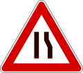
 Road narrows
(formerly used )
) -
 Road narrows on right
 -
 Road narrows on left
 -

-
 Dangerous verges
 -
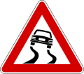 Slippery road
(formerly used )
) -
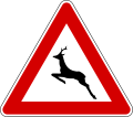
 Children
(formerly used )
) -

-
-
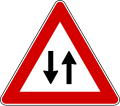
-
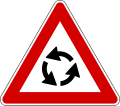 Roundabout ahead
 -

-
 Loose chippings
 -
 Falling rocks from right
 -
 Falling rocks from left
 -

-
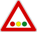 Horizontal traffic lights
 -
 Low-flying aircraft
 -
-

-
 Other danger
(formerly used )
) -
 Level crossing countdown marker (placed under the triangular warning sign, usually 150 m before crossing)
 -
 Level crossing countdown marker (placed at two-thirds of the distance from the crossing, usually 100 m)
 -
 Level crossing countdown marker (placed at one-third of the distance from the crossing, usually 50 m)
.svg)


.svg)


Temporary signs
-

-
 Uneven road
 -
 Road narrows
 -
 Road narrows on right
 -
 Road narrows on left
 -
 Loose chippings
 -

-
-
 Other danger


Regulatory signs
Priority signs
-

-

-
 )
) -
 Give priority to vehicles from opposite direction
(formerly used )
) -
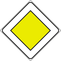 Priority road)
(formerly used
-
 End ofpriority road)
(formerly used
-
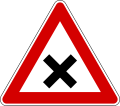
 Crossroads)
(formerly used
-
 Junctionwith a minor side-road from right
 -
 Junctionwith a minor side-road from left
 -
 Merging traffic from right
(formerly used )
) -
 Merging traffic from left
(formerly used )
) -
 Traffic has priority over oncoming vehicles
(formerly used )
)


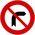
Prohibition signs
-
-

-

-
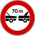 Minimum distance
 -

-

-

-

-
-

-

-

-
 Nomotorised quadricycles)
(formerly used
-

-

-
-
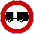 No vehicles with trailer
 -
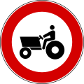 No tractors
 -
 No vehicles carrying dangerous goods
 -

-
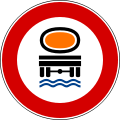 No vehicles carrying goods which could pollute water
 -
 No vehicles overwidth shown)
(formerly used
-
-
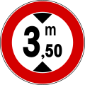
 No vehicles over length shown
 -
-
-
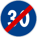
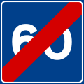
 Derestriction
 -

-
-
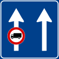
 End of no overtaking by heavy goods vehicles
 -
![No parking on side where sign is placed. Without additional inscriptions, it is valid from 8 am to 8 pm on urban roads while on extra-urban roads it is valid at all times. (formerly used [4])](//upload.wikimedia.org/wikipedia/commons/thumb/9/94/Italian_traffic_signs_-_divieto_di_sosta.svg/120px-Italian_traffic_signs_-_divieto_di_sosta.svg.png)
-
![No stopping on the side where sign is placed (formerly used with the additional inscription "DIVIETO DI FERMATA" that means "NO STOPPING" [4])](//upload.wikimedia.org/wikipedia/commons/thumb/0/06/Italian_traffic_signs_-_divieto_di_fermata.svg/120px-Italian_traffic_signs_-_divieto_di_fermata.svg.png) No stopping on the side where sign is placed
No stopping on the side where sign is placed
(formerly used with the additional inscription "DIVIETO DI FERMATA" that means "NO STOPPING" [4])
 -
 Parking space reserved for vehicles used by people with disabilities
(formerly used ). For personal parking, it can be used
  with the badge's number
 -
-

-
 No parking at all times in front of vehicular access to the side properties (also used
 )
) -
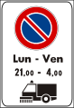
 Parking prohibited at certain times and allowed in others


.svg)


.svg)


.svg)
.svg)


![No parking on side where sign is placed. Without additional inscriptions, it is valid from 8 am to 8 pm on urban roads while on extra-urban roads it is valid at all times. (formerly used [4])](/File:Italian_traffic_signs_-_divieto_di_sosta.svg)
![No stopping on the side where sign is placed (formerly used with the additional inscription "DIVIETO DI FERMATA" that means "NO STOPPING" [4])](/File:Italian_traffic_signs_-_divieto_di_fermata.svg)
.svg)


.svg)
Mandatory signs
-
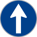 Drive straight
 -
 Turn right
(formerly used )
) -
 Turn left
 -
 Right turn only ahead
 -
 Left turn only ahead
 -
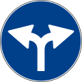 Right or left turn only ahead
 -
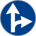 Drive straight or turn right
(formerly used or
or  )
) -
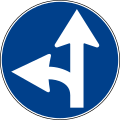 Drive straight or turn left
(formerly used )
) -
 Keep right
 -
 Keep left
 -
 Pass either side
 -

-

-
 End of minimum speed
 -

-

-
 EU Country border
 -
-
 Stop, pay toll
 -

-

-
 Cycle lane)
(formerly used
-
 End ofcycle lane
 -
 Shared path
 -
 End ofshared path
 -
 Segregated pedestrian and cycle path
 -
 End ofsegregated pedestrian and cycle path
 -
-
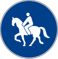
 End of bridleway


.svg)


Indication signs
-
 Motorwaydirection
 -
 Primary or secondary roaddirection
 -
 Urban area direction
 -

-
 Direction to a geographical feature or a tourist attraction
 -
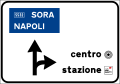 Directions in urban areas
 -
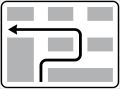
 Directions at amotorway
 -
-
 Directions on a main highway with lane canalization
 -
 Directions on amotorway
 -
 Overhead directional sign
 -
 Motorwaynumber sign
 -
 Motorwayspur number sign
(not an official road sign but it is used) -
 International tunnel number sign
 -
 State highway number sign)
(formerly used
-
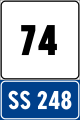
 Regional road number sign
 -

-
 Municipal road number sign)
(formerly used
-

-
 Highway location marker
 -
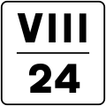 Intermediate highway location marker with hectometre shown in roman numerals (in the example the sign is placed at the kilometre 24.8 of the road)
 -
 Motorwaylocation marker and distance from the exit shown (horizontal version)
 -
 Motorwaylocation marker and distance from the service area (vertical version)
 -
 Main highway location marker and distances from next destinations
 -
![Number of overpass along a motorway[5]](//upload.wikimedia.org/wikipedia/commons/thumb/d/d9/Italian_traffic_signs_-_numerazione_cavalcavia_autostrada.svg/120px-Italian_traffic_signs_-_numerazione_cavalcavia_autostrada.svg.png) Number of overpass along a motorway[5]
Number of overpass along a motorway[5] -
 Destination that can be reached from next exit on a motorway or an expressway
 -
 Town sign: start of urban area (50 km/h speed limit and no use of horn)
 -
![Town sign: start of urban area where electric micromobility is being experimented (50 km/h speed limit, no use of horn and particular caution to cyclists and motorized scooters)[6]](//upload.wikimedia.org/wikipedia/commons/thumb/3/3b/Italian_traffic_signs_-_segnale_sperimentale_micromobilita_elettrica.svg/73px-Italian_traffic_signs_-_segnale_sperimentale_micromobilita_elettrica.svg.png) cyclists and motorized scooters)[6]
cyclists and motorized scooters)[6] -

-
 End of urban area, with distances to other towns (end of 50 km/h speed limit and of the prohibition of using horn)
 -
 Provincial boundary sign (roads other than motorways)
 -
 Provincial boundary sign (motorway)
 -
 Regional boundary sign (roads other than motorways)
 -
 Regional boundary sign (motorway)
 -
 Direction to motorway
 -
 Motorway distance sign
 -
 Direction to service shown in urban areas (in the example municipal police)
 -
 Street name sign
 -
 Street name sign with one way
 -
 Municipality boundary name sign
 -
 River sign
 -
-
 Directions to tourist destinations
 -
 Direction to an industrial zone
 -
 Directions in an industrial area
 -
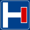
 Hotel information centre ahead
 -
 information about hotels
 -
 Direction to hotels ahead
 -
 Directions to hotels
 -

-

-
 School bus stop. If the sign is mounted on a bus it means that bus is used as a school bus
(formerly used )
) -
 Emergency telephone
(formerly used ) -

-

-
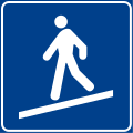 Pedestrian ramp
 -
 No through road
 -
 No through road(side road)
 -
 Advisory speed limit
 -
 End of advisory speed limit
 -
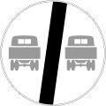
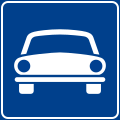 Fast-traffic highway, only motor vehicles allowed
(formerly used and
and  )
) -
 End of road reserved for motor vehicles
 -
 Tunnel (roads other than motorways)
 -
 Tunnel (motorways)
 -
 Bridge (roads other than motorways)
 -
 Bridge (motorways)
 -
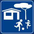 Home ZoneEntry
 -
 End ofHome Zone
 -
 Pedestrian zone
 -
 End of pedestrian zone
 -
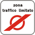
 Restricted vehicular traffic zone
 -
 End of restricted vehicular traffic zone
 -
 Start of a 30 km/h zone
 -
 End of a 30 km/h zone
 -
 Bicycle crossing
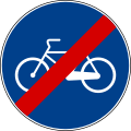
 -
 Semi-direct left turn
 -
 Indirect left turn
 -
 Possibility of reversing the direction of travel (roads other than motorways)
 -
 Possibility of reversing the direction of travel (motorways)
 -

-
 Breakdown bay with emergency telephone. The background is blue in roads other than motorway
 -
 Use of lanes on extra-urban roads (example)
 -
 Bus lane on urban road (example)
 -
 Bus lane on urban road (example)
 -
 Use of lanes on motorways
 -
 End of lane. The background is green on motorway
 -
 Increase in the number of lanes. The background is green on motorway
 -
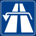
 Motorway. If the symbol of motorway is used inside other information signs it has a squared shape ()
-
 Motorway ahead with a summary of transit restrictions)
(Formerly used
-
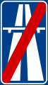
 Motorwayends
 -
 Expressway. If the symbol of expressway is used inside other information signs it has a squared shape (
 )
) -
 Expressway ahead with a summary of transit restrictions
 -
 Expressway ends
 -

-

-

-
 Advised direction for trucks ahead
 -
 Advised direction for trucks
 -
 General speed limit (installed at national borders)
(formerly used )
) -
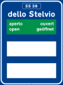 Information about road condition of passes: road open
 -
 Information about road condition of passes: road open and mandatory snow chains
 -
 Information about road condition of passes: road open and advised snow chains
 -
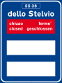 Information about road condition of passes: road closed
 -
 Information about road condition of passes: road closed after the town shown and mandatory snow chains
 -
 Information about road condition of passes: road closed after the town shown and advised snow chains
 -
-
 Repairs
 -

-
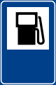 Petrol station
 -
 Petrol station with LPG
 -

-
 Tram stop
 -
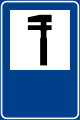
 Information centre
 -
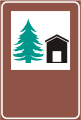 Youth hostel
 -
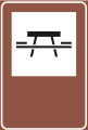 Picnic site
 -

-
 Local radio information. The background is blue in roads other than motorway
 -

-
 Refreshments
 -

-
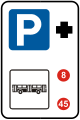 Park and ride (bus station)
 -
 Park and ride (tramway)
 -
 Park and ride (train or underground)
 -
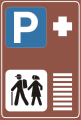 Park and ride (hiking trail)
 -
 Motorail services
 -

-

-
 Sewage discharge
 -
 Car ferries
 -
 Services in motorway service area (plus distance from the next area)
.svg)
.svg)
.svg)


.svg)
.svg)


.svg)
.svg)
.svg)

.svg)
![Number of overpass along a motorway[5]](/File:Italian_traffic_signs_-_numerazione_cavalcavia_autostrada.svg)
.svg)
![Town sign: start of urban area where electric micromobility is being experimented (50 km/h speed limit, no use of horn and particular caution to cyclists and motorized scooters)[6]](/File:Italian_traffic_signs_-_segnale_sperimentale_micromobilita_elettrica.svg)
.svg)


.svg)
.svg)
.svg)

.svg)
.svg)


.svg)
.svg)


.svg)
.svg)
.svg)
.svg)
.svg)
.svg)
.svg)
.svg)

.svg)
.svg)


.svg)


.svg)


.svg)


.svg)
.svg)


Additional panels
-
 Distance (in meters)
 -
 Distance (in kilometers)
 -
 Length of a danger or a prescription (in meters)
 -
 Length of a danger or a prescription (in kilometers)
 -
 Timetable: the sign applies all day
 -
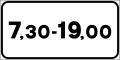 Timetable: the sign between the hours shown
 -
 Timetable: the sign between the hours shown but only in holidays (represented by the cross)
 -
![Timetable: the sign between the hours shown but only in working days[7] (represented by the two hammers crossed)](//upload.wikimedia.org/wikipedia/commons/thumb/6/6b/Italian_traffic_signs_-_validit%C3%A0_%28modello_II_3-d%29.svg/120px-Italian_traffic_signs_-_validit%C3%A0_%28modello_II_3-d%29.svg.png) Timetable: the sign between the hours shown but only in working days[7] (represented by the two hammers crossed)
Timetable: the sign between the hours shown but only in working days[7] (represented by the two hammers crossed) -
 The sign applies only to the category shown (in the example semi-trailer trucks)
 -
 The sign doesn't apply to the category shown (in the examplebuses)
 -
 Beginning of a danger or a prescription (vertical)
 -
 Continual of a danger or a prescription (vertical)
 -
 End of a danger or a prescription (vertical)
 -
 Beginning of a danger or a prescription (horizontal)
 -
 Continual of a danger or a prescription (horizontal)
 -
 End of a danger or a prescription (horizontal)
 -
 No road markings or road markings work in progress
 -
 Road accident
 -
 Crossing of railway linking tracks: the trains move very slowly and usually with the presence of a flagger (this crossing is not considered a level crossing).
 -
 Snow removal vehicle at work
 -
 Road subject to flooding
 -
 Queue
Queue -
 Construction vehicles at work
 -
 In case of snow or ice
 -
 In case of rain
 -
 Slow moving vehicle ahead
 -
 Tow-away zone
 -
 Lane sign: an overhead sign applies only to te lane pointed out by this arrow.
 -
 Hairpin turn ahead
 -
 Number of hairpin turn
 -
 Road cleaning
 -
 Road cleaning during times shown
 -
 Direction of main road (example). It is used with priority sign
(formerly used )
) -
 Direction of main road (example). It is used with priority sign
-
 Direction of main road (example). It is used with priority sign
-
 No parking during road cleaning operations
 -
 Mandatory direction for vehicle carrying dangerous goods
 -
 Mandatory direction ahead for trucks
 -
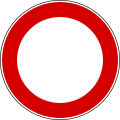
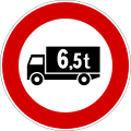
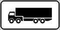
 No trucks
.svg)
.svg)
.svg)
![Timetable: the sign between the hours shown but only in working days[7] (represented by the two hammers crossed)](/File:Italian_traffic_signs_-_validit%C3%A0_(modello_II_3-d).svg)
.svg)
.svg)
.svg)
.svg)
.svg)
.svg)
.svg)
.svg)


.svg)


Complementary signage
-
 Reflexion posts (left and right) on two-way roads
 -
 Reflexion posts (left and right) on one-way roads
 -
 Chevron marker (turn right)
 -
 Chevron marker (turn left)
 -
 T-intersection marker
 -
 Chevron marker (singular)
 -
 Chevron maker (red singular)


Obsolete signs (No longer used)
-
 Dangerous bends
 -
 Give way to the line coaches
 -
 No U-turns
 -
 No right turn
 -
 No left turn
 -
 No overtaking for trucks
 -
 End of no overtaking for trucks
 -
 Alternative parking (No parking on the side of the number I on odd days and on the side of the number II on even days)
 -
 Alternative parking (No parking on the side of the number I on odd days and on the side of the number II on even days)
 -
![Regulated parking (Parking allowed using disc parking) [8]](//upload.wikimedia.org/wikipedia/commons/thumb/4/47/Fig._47_-_Sosta_regolamentata-_1959.svg/120px-Fig._47_-_Sosta_regolamentata-_1959.svg.png)
-
 Motor vehicle lane
 -
 Motorcycle lane
 -
 Two lanes traffic


![Regulated parking (Parking allowed using disc parking) [8]](/File:Fig._47_-_Sosta_regolamentata-_1959.svg)


Similar systems
- European route numbersare unsigned in Albania, only national destinations.
- Burundi largely shares the same road signage system used in Italy, except that the language used is French. The European road network does not serve Burundi.
- Malta largely shares the same road signage system used in Italy, except that the languages used are English and Maltese instead of Italian. Also in Malta, road signs are adapted for left-hand traffic.
- San Marino almost wholly shares the same road signage system used in Italy, since this microstate is surrounded on all sides by Italy.
- Sierra Leone largely shares the same road signage system used in Italy, except that the language used is English. The European road network does not serve Sierra Leone.
- Vatican City almost wholly shares the same road signage system used in Italy, since this microstate is surrounded on all sides by Italy.
See also
- Road signs in Europe
References
- ^ "United Nations Treaty Collection". treaties.un.org. Retrieved 2023-12-09.
- ^ Art. 125 - Iscrizioni, lettere e simboli relativi ai segnali di indicazione
- ^ Nuovi segnali "nome-strada"
- ^ a b See the article 59 of "Decreto Del Presidente Della Repubblica 30 giugno 1959, n. 420". Gazzetta ufficiale della Repubblica Italiana (in Italian).
- ^ This road sign is not regulated by the Highway Code: it had been designed by the Ministry of Public Works in order to prevent the launch of objects from bridges
- ^ This sign has been introduced in 2019
- ^ Saturday is considered a working day if it isn't an official holiday
- ^ See the article 61 of "Decreto Del Presidente Della Repubblica 30 giugno 1959, n. 420". Gazzetta ufficiale della Repubblica Italiana (in Italian).