
Talk:Scotland/Archive 18
| This is an archive of past discussions. Do not edit the contents of this page. If you wish to start a new discussion or revive an old one, please do so on the current talk page. |
| Archive 15 | Archive 16 | Archive 17 | Archive 18 | Archive 19 | Archive 20 | → | Archive 25 |
Stances Cont'd
It seems apparent to me, that there's a overwhelming majority infavour of changing the map. Also, the editors who wish to keep the current map? seem to not be participating lately in the overall discussion on the matter. Should that be considered a consensus for change? GoodDay (talk) 20:19, 30 March 2008 (UTC)
- I would love to hear other thoughts and opinions on this topic. I have put a lot of work into researching this debate and placing the facts on the table considering this is such a minor change I don't know if that is a good thing... so please at least let me know what you think :-) -- UKPhoenix79 (talk) 05:08, 31 March 2008 (UTC)
- GoodDay, I noticed this comment you made on the "Wales" article (see below) in relation to the Welsh map, in which you seemed to support the removal of the shading illustrating the rest of the UK. You seem to have a completely opposite and very outspoken view in relation to Scotland. My question is - and not wishing to seem suspicious of your "single topic" interest - WHAT EXACTLY ARE YOU UP TO?!?
- "Seeing as Scotland doesen't shade the rest of the UK on their map, should this article do the same? GoodDay (talk) 19:45, 20 March 2008 (UTC)"
Still here, GoodDay, and thanks for the time you've spent UKPhoenix79. As for not participating, as a member of a "gang of nationally motivated editors who've decided their narrow group creates a consensus and have taken ownership of the article in order to maintain it. Nasty indeed." and one of "the same obstinate three or four still fight for the Scotland-alone map", it seems to me that this situation has dissolved into a slagging match between two sides. What has turned me off this discussion are the comments left on individual talk pages, (claims by editors of being "driven away" or treated in a "Charles Bronson" like manner, and general sniping directed towards the supposed "Scottish Clan" - you know who you are for as pointed out in this realm your comments can indeed be read by all), which have been a real eye-opener for me on this occassion.
Leaving to one side the issue of colour and scale, there are really only two options here:
- Have the info box in the Scotland article show a map of Scotland.
- Have the info box in the Scotland article show a map of the United Kingdom (With Scotland highlighted)
I have made my opinions known and my arguments have been described as unsustainable and increasingly strange. I see little point in stating these again here, (they can be found elsewhere), and as for my preference for the map, it matters not. Rab-k (talk) 09:20, 31 March 2008 (UTC)
- Thanks I actually had fun researching the other countries. I must say I found it rather interesting. I hope that those other comments weren't aimed at me. Being British I hope that you didn't ever think that I was attacking the Scottish Clan because that would be akin to attacking myself, and that is just not how I personally feel. I've tried to be fair and actually went to great lengths to get as many voices into this conversation as possible. I saw that this little and I mean little item was a hot issue for this page and I hope that somehow I have made an improvement by getting the issues front and center and even creating viable alternatives since none were available at the time. But without making a choice one way or another do you at least like the version I created :-D -- UKPhoenix79 (talk) 09:52, 31 March 2008 (UTC)
- Thanks for the compliment... I think 4 is the best also, though I prefer green, it seams that the majority like red more, oh well you cant win them all. -- UKPhoenix79 (talk) 11:23, 31 March 2008 (UTC)
I think it is worthwhile to make some comments about how to go about choosing the best kind of map display. Obviously, consensus with the rest of wikipedia plays a part, but suppose we did not have to attend to that, or it was not an over-arching requirement that "trumped" all other concerns. It seems to me from my own knowledge of psychological and cognition research into graphical displays in the past that one must strive for simplicity and clearness in the displays so that what they are intended to convey is conveyed as quickly and unambiguously as possible: immediacy and accuracy. So, this means we must first agree on what is to be conveyed (the locations of the constituent countries of the United Kingdom) Given that (I assume this is not a contentious issue), we must then turn our attention to simplicity and clearness and this means avoiding all unnecessary clutter as well as using an appropriate scale. Thus the terrain-type additions, apart from sea-land boundaries, would be inadvisable. This rules out maps 1 and 2 on this basis. Maps 1 and 2 are also ruled out by issues of clarity as the scale is too small to achieve the degree of immediacy and accuracy that is desired, I argue. Map 3 would also be ruled out as it would be inconsistent in its exclusion of continental Europe, and inclusion of the Republic of Ireland. The option where the Republic of Ireland is excluded seems to me to fail as it conveys a misleading context (that Northern Ireland is an island, and, indeed, no European context is supplied.) Map 4 does not have this inconsistency (indeed, it is largely a corrected version of Map 3). So, it seems that attention should be devoted to this option if we are considering only these for options. The residual issues remain a possible need to provide a wider European context, and the choice of colouring scheme to highlight most immediately and accurately what we want to highlight. The first can be solved by having the map-insert, as I suggested above, showing where on a greater map of Europe this particular map is located; the second can be solved by a careful choice of contrasting colours for highlighting the areas we want highlighting. In this respect, I think the adjusted red highlighting scheme for Map 4 is the better option than the green. So, as far as I am aware (and in conformance with my own preference, because I used this argument to direct my choice), I think the research would tend to favour Map four, adjust red colouring. Whether that agrees with various preferences affected by overtly political stances, or wikipedia's advice or even with its requirements is, of course, another matter entirely. DDStretch (talk) 11:42, 31 March 2008 (UTC)
- As I pointed out above, '#2' is my preference; but yes '#4' is also acceptable. As long as Scotland is shown as being with the UK? I'm OK. GoodDay (talk) 15:22, 31 March 2008 (UTC)
- PS- I've scratched out some of my postings at Wales, England and Northern Ireland, where I intially prefered consistancy at any cost. I'm telling ya'll this, so as to save another editor time/trouble of reporting it to you. GoodDay (talk) 15:32, 31 March 2008 (UTC)
Scotland is nation? at beginning of article
I think that there is logical mistake. Scotland is country or land or something similar. Nation refers to set of people with some characteristics... Scots are nation.--Čikić Dragan (talk) 15:55, 31 March 2008 (UTC)
- Would you believe, nation has just been added to the begining of the England article. GoodDay (talk) 17:04, 31 March 2008 (UTC)
- Čikić Dragan I direct you to Archive 16 of the talk page. --Barryob (Contribs) (Talk) 17:10, 31 March 2008 (UTC)
- "The United Kingdom of Great Britain and Northern Ireland is the full name of the country. Scotland is a kingdom within the United Kingdom (UK), and forms part of Britain (the largest island) and Great Britain (which includes the Scottish islands). As the UK has no written constitution in the usual sense, constitutional terminology is fraught with difficulties of interpretation and it is common usage nowadays to describe the four constituent parts of the UK (Scotland, England, Wales and Northern Ireland) as “countries”." From Scottish Parliament website "Is Scotland a country?". 195.27.13.214 (talk) 17:25, 31 March 2008 (UTC)
- Čikić Dragan I direct you to Archive 16 of the talk page. --Barryob (Contribs) (Talk) 17:10, 31 March 2008 (UTC)
- Cikicdragan is right of course! Why people (the nation?) want to assert a piece of land is a sentient group of humans is madness to me. I think this source explains the problem best. --Jza84 | Talk 18:35, 31 March 2008 (UTC)
- McCrone, David, Understanding Scotland: The Sociology of a Nation. London: Routledge, 2001, p. 47:
I think, no, I'm quite sure, I posted that here already. And others. Like the man said, all in the archives. Angus McLellan (Talk) 19:17, 31 March 2008 (UTC)Scotland as nation
Whether or not Scotland is a nation evokes strong responses. On the one hand, the political nationalist takes it as axiomatic so that it is a self-evident truth. On the other hand, those who are opposed to political independence pount out that there are too many deep and abiding differences across the country to sustain an argument for cultural homogeneity. What we see in this debate is its thoroughly political context. Asking the question seems to require that one reveals political preferences, that nationhood and statehood are inextricably linked. That is not our way here. We are concerned with decoupling these terms so as to argue that it is quite proper to treat Scotland as a nation without implying that it is or should be a state.
- McCrone, David, Understanding Scotland: The Sociology of a Nation. London: Routledge, 2001, p. 47:
Are you saying the Scottish parliament website is wrong? Note, it also states that Scotland is a Kingdom within a Kingdom,(UK).--Jack forbes (talk) 19:11, 31 March 2008 (UTC)
- You mean 1707, of course. GoodDay (talk) 19:27, 31 March 2008 (UTC)
- The Kingdom of Scotland ceased to exist, period in 1707. GoodDay (talk) 19:47, 31 March 2008 (UTC)
- Watching the news every day I notice that when mention of the Queen is made she is invarably called the Queen of England, so the bbc and itv believe that England is a Kingdom, ergo, Scotland is a Kingdom! So with the media and a majority of English people believing this, 1707 or no 1707 you have a lot of people to convince otherwise!--Jack forbes (talk) 19:58, 31 March 2008 (UTC)
- This article, Kingdom of Scotland, England & Kingdom of England suggests otherwise. GoodDay (talk) 20:02, 31 March 2008 (UTC)
I didn't expect such "emotionfull" and fast responses. I feel I touch in very sensitive thing. I'm not such versed in circumstances in Scotland. Does it have any relation to possible separation of Scotland? In serbian language we use noun "nation" in named sense. And we learn it at high school as at university. I assume in English is different. Now I don't have time to ponder this, but I hope I will do it. Sorry if I insulted someone.--Čikić Dragan (talk) 20:06, 31 March 2008 (UTC)
Ach well, within the next decade these conversations will become a relic of another time:)--Jack forbes (talk) 20:11, 31 March 2008 (UTC)
- "Sociology of a Nation"? Yes, "Sociology is the study of society" not geography! Simillarly, that's not a statutory defintion one bit. Would it not be possible that that's an illiterate, biased author.
- Why don't we use Home Nations instead? To me (and clearly many others - perhaps half the editors involved in the last of the regular debates about this) "nation" just reads stupidly (Scotland is a group of people in Europe). --Jza84 | Talk 21:20, 31 March 2008 (UTC)
- Could we use 'Home Nation' at England, Wales and Northern Ireland, aswell? If so? I'm all for it. GoodDay (talk) 21:23, 31 March 2008 (UTC)
- I imagine the term 21:34, 31 March 2008 (UTC)
- I quote the Home Nations article: "Both British and Irish media frequently use the term Home Nations to include Ireland as a whole, often when referring to sporting events." Will you be fixing that soon? Angus McLellan (Talk) 22:06, 31 March 2008 (UTC)
- nation- a people sharing a set of characteristics, customs, culture and aspirations. Scotland? Check
- a kingdom? Well, as has been said, if England can be informally named a kingdom, why can't Scotland?
- a country? Well, yes, it's a convenient term to avoid the politics.
So, where does that leave us? Where Scotland itself is - in the mist.--Gazzster (talk) 21:41, 31 March 2008 (UTC)
Well, I'm in Glasgow and theres not a bit of mist to be seen! In fact, it's been blue sky all day. If you need any more weather forecasts for Scotland let me know, you must be looking at the wrong ones!--Jack forbes (talk) 22:11, 31 March 2008 (UTC)
- Home Nation is rarely used outside sporting context and then you get the whole Ireland/Northern Ireland issue so it is a bad idea to use it to refer to Scotland. --Barryob (Contribs) (Talk) 22:12, 31 March 2008 (UTC)
Scotland, the area of
- So much easier to simply delete 'nation'; but we've been down that rocky road before. GoodDay (talk) 22:21, 31 March 2008 (UTC)
- Or delete 'home'?--Jack forbes (talk) 22:27, 31 March 2008 (UTC)
- IMO we should delete 'nation'. GoodDay (talk) 22:30, 31 March 2008 (UTC)
- I have only been here for a short time, so as an outsider it's my humble opinion that this discussion is never going to be resolved so should be left as it is, at least for a few months anyway!--Jack forbes (talk) 22:56, 31 March 2008 (UTC)
- Serious or not, I don't see the relevance. If you can find a source that says that the United States or the United Kingdom are nations, add it to the article(s). If you can't, or if you find ones flatly denying it - easy enough for the UK - think twice. We do verifiability and neutral point of view. We don't ignore what the sources say in pursuit of standardisation. The number of Google books hits for any given phrase varies with the phase of the moon. Today, "Scotland is a nation" supposedly gets 137 hits (54 on Google scholar), and "Scotland is a country" gets 283 (69), while "Scotland is a constituent country" gets 0 (0). Who can say what tomorrow will bring, or how this will change if we restricted ourselves in time or by topic or try slightly different phrasing? Angus McLellan (Talk) 23:45, 31 March 2008 (UTC)
- Perhaps someone else can answer this? -- If Scotland is a nation, how are the Scottish people a nation, and is the United Kingdom a nation? See This, this and this for some interesting results. --Jza84 | Talk 23:50, 31 March 2008 (UTC)
- If you want to discuss the content of the United Kingdom article, Talk:United Kingdom is the place, and Talk:Scottish people would be the place to discuss Scottish people. This article is about Scotland, not about Britain, or the United Kingdom, or the United States, or Canada, or anything else. Just Scotland. This seems fairly obvious from the title, but evidently it needs saying as we do seem to keep wandering off-topic by bringing in other articles. If there are inconsistencies, there are inconsistencies. So long as the articles accurately represent the sources, all's well with the world and the wiki. G. K. Chesterton wrote "Scotland is a nation", a clear sign that it is good English, no matter how the phrase may sound to any of us. Angus McLellan (Talk) 00:09, 1 April 2008 (UTC)
- At the same time we must be vigilant against personal readings and possible misinterpretations because of ambiguity. It's all well and good to say "Scotland is a nation," and put a reference for that in a footnote, but what does it mean? "Nation" is a term with a number of meanings, we have to be clear here which one is being used. --G2bambino (talk) 00:13, 1 April 2008 (UTC)
- At the same time we must be vigilant against
- If you want to discuss the content of the United Kingdom article, Talk:United Kingdom is the place, and Talk:Scottish people would be the place to discuss Scottish people. This article is about Scotland, not about Britain, or the United Kingdom, or the United States, or Canada, or anything else. Just Scotland. This seems fairly obvious from the title, but evidently it needs saying as we do seem to keep wandering off-topic by bringing in other articles. If there are inconsistencies, there are inconsistencies. So long as the articles accurately represent the sources, all's well with the world and the wiki. G. K. Chesterton wrote "Scotland is a nation", a clear sign that it is good English, no matter how the phrase may sound to any of us. Angus McLellan (Talk) 00:09, 1 April 2008 (UTC)
One to throw into the mix - if, as some here insist, Scotland is not a Kingdom, (despite the Scottish Parliament stating that it is), why then at various times since the Union of 1707, (including currently), have monarchs of the United Kingdom continued to use
- O bugger. Sorry to make things even more convoluted, but a kingdom, united or distinct, is not necessarily a nation. The former Kingdom of Yugoslavia was not a nation, but rather a union of nations, as was the Russian Empire, the Austrian Empire and Kingdom of Hungary. And indeed, as was the Kingdom of England, which includes(ed) Cornwall and Wales. A kingdom is a territorial unit. A nation is somewhat different. A nation is a people united by a common culture, social bond, language, aspiration, etc. It doesn't necessarily have to be a defined territorial unit. Discussing whether Scotland remains a distinct kingdom doesn't really help. We should be discussing whether this great land fits the definition of a nation.--Gazzster (talk) 09:10, 1 April 2008 (UTC)
- <edit conflict>I haven't read most of this debate but I'd like to say a couple of things.
- Scotland under King of the Picts, thus becoming the first monarch of the Kingdom of Scotland.
- England united in 927 when Northumbria fell to the King of Wessex Athelstan to become the monarch of a united Kingdom of England
- Wales in 1218 Llywelyn the Great had the title bestowed upon him and his successors by his half-brother-in-law Henry III
- Wales in 1284 became Princedom inside the Kingdom of England by the Statute of Rhuddlan
- The Henry VIII realized that the Laudabiliterthat gave the Kings of England authority to rule Ireland was void because this power came from Rome of which he had just proclaimed held no power.
- England and Scotland united into a new nation (Wales being an princedom of England) signifying this union by calling the New nation the United Kingdom of Great Britain in 1707.
- Ireland had no representation in parliament until another Acts of Union in 1801
- The term "United Kingdom" was originally just a shortened form for "the United Kingdom of Great Britain", the name by which the united kingdoms of England and Scotland were officially known after 1707. Ireland was always separately named in Britain's formal title--"the United Kingdom of Great Britain and Ireland"--and this continued after the Anglo-Irish Union of 1801, with "Ireland" changing to "Northern Ireland" in 1921.[1]
- Scotland under
- Nowhere did any territory get demoted only united. So after the Statute of Rhuddlan and 2 Acts of union that means that the UK has 1 Princedom and 3 Kingdoms. The Unions did not dissolve the Kingdoms only solidified political union and ensured that the monarch would be the same for all 4 areas. Hope that helps. -- UKPhoenix79 (talk) 09:17, 1 April 2008 (UTC)
- <edit conflict>I haven't read most of this debate but I'd like to say a couple of things.
- (edit conflict) I don't know how often I have said this in the past, but it's a lot. There needs to be greater contempt for the consistency of language. Nation and country do not have fixed meanings, and Scotland is called both. The UK is also called both, as was Yugoslavia, though others deny that either is a "nation". That's as far as you can take the argument. Sadly, no-one's going to listen to me here, and probably we'll just have watch the same old chasing of shadows indefinitely. Deacon of Pndapetzim (Talk) 09:18, 1 April 2008 (UTC)
- Just a small point - above it is stated "England and Scotland united into a new nation" - No..united into a new 'state' or 'country', but a 'nation' can not simply be created by a political union. Cheers Fishiehelper2 (talk) 09:34, 1 April 2008 (UTC)
- Agh... I'm using the uneducated common speak version of nation, where nation and country mean exactly the same thing; not the professional dictionary version where those two words have different meanings. Jeese you comment like this is an encyclopedia or something :-P -- UKPhoenix79 (talk) 09:46, 1 April 2008 (UTC)
- Just a small point - above it is stated "England and Scotland united into a new nation" - No..united into a new 'state' or 'country', but a 'nation' can not simply be created by a political union. Cheers Fishiehelper2 (talk) 09:34, 1 April 2008 (UTC)
- (edit conflict) I don't know how often I have said this in the past, but it's a lot. There needs to be greater contempt for the consistency of language. Nation and country do not have fixed meanings, and Scotland is called both. The UK is also called both, as was Yugoslavia, though others deny that either is a "nation". That's as far as you can take the argument. Sadly, no-one's going to listen to me here, and probably we'll just have watch the same old chasing of shadows indefinitely. Deacon of Pndapetzim (Talk) 09:18, 1 April 2008 (UTC)
Okay, are we agreed then that while Scotland is not a "State", it is and can be classed as:
- A "Kingdom" (within a "United Kingdom")
- A "Nation" (including a "Home Nation")
- A "Country" (including a "Constituent Country")
And are we also agreed that these terms in relation to Scotland are not exclusive? Or, as Deacon suggests, do we keep going round in circles on this also? Rab-k (talk) 09:47, 1 April 2008 (UTC)
- Saying that Scotland is a Kingdom is more exact and professional. It is a Constituent country not a country, just read the articles I have linked they are very different things. And like I just did a second ago many people believe that a Nation is a Country not realizing the minute error in that statement. Even though the error is in the reader, I can see why other editors wish to avoid this term. -- UKPhoenix79 (talk) 09:53, 1 April 2008 (UTC)
- I would hope that if there is an issue with the intro proposals of changes would be given. Not only that but seeing if the other Kingdoms/Princedom has the same problems would be a good idea. Whats good for the goose after all. I do see an issue with N. Ireland though its still a good idea to bring it up on the talk page (if needed), but I wouldn't see any issues aligning similar descriptions for the Constituent countries on the isle of Great Britain. Why should we let our cousins over the pond be more organized than us? -- UKPhoenix79 (talk) 10:27, 1 April 2008 (UTC)
- I read the Wales and Northern Ireland preface and I like them:
- Wales is one of the four constituent countries of the United Kingdom. Traditionally a principality Wales is located in the southwest of the island of...
- Northern Ireland is a constituent country of the United Kingdom, lying in the northeast of the island of Ireland, covering 5,459...
- I found that the English and Scottish versions might be troublesome so I recommend that we at least follow the Welsh example. -- UKPhoenix79 (talk) 10:56, 1 April 2008 (UTC)
- The thing is that Wales's status as a principality in its own right (even if the post of Prince of Wales is nominally vacant for periods, ditto the Duchy of Cornwall exists even when there isn't a living Duke of Cornwall) within the UK seems much clearer than whether or not Scotland and England are still kingdoms, even if both the monarchy and Scottish Parliament website claim the trappings of the separate kingdoms. Unified kingdoms come in all sorts - personal union no more secure than the parrallel succession rules producing the same outcome, legislative agreement formally locking the successions together (e.g. the Queen of the UK also being Queen of Canada, ...of Australia, ...of New Zealand etc..., or at least some of the myriad of titles held by the Emperor of Austria-Hungary) and an actual merger of crowns and country together. I've never seen anything that states that the Scottish and English crowns still exist as separate entities in law, regardless of whatever gestures may be made at ceremonies. Timrollpickering (talk) 12:53, 1 April 2008 (UTC)
Therein lies the joy of not having a written constitution! (The nearest we get to such being Parliamentary Acts concerning the Union of Scotland and England in 1707, the Union of Great Britain and Ireland in 1801, the European Union post 1973 and devolved government in Scotland, Wales and Northern Ireland, post 1998). As for "separate entities in law", does not the role of the monarch re.
- Also, there arent that many kingdoms that exist without a monarch...--Cameron (t/c) 13:32, 1 April 2008 (UTC)
- I use the UK Parliament as an example of England, Scotland, Wales & Northern Ireland not being nations - There's members in the House of Commons & House of Lords representing all the constituent countries. I'm assuming of course, Scotland still sends members to London. GoodDay (talk) 13:36, 1 April 2008 (UTC)
- Yes they do, hence the Devolved English parliament question and the famous West Lothian question...--Cameron (t/c) 14:05, 1 April 2008 (UTC)
- I use the UK Parliament as an example of England, Scotland, Wales & Northern Ireland not being nations - There's members in the House of Commons & House of Lords representing all the constituent countries. I'm assuming of course, Scotland still sends members to London. GoodDay (talk) 13:36, 1 April 2008 (UTC)
- Also, there arent that many kingdoms that exist without a monarch...--Cameron (t/c) 13:32, 1 April 2008 (UTC)
Despite all (and politics) I again think that you should not use here noun nation, because of staff in article nation --> Ambiguity in usage. I cite: "In the strict sense, terms such as 'nation', ethnos, and 'people' (as in 'the Danish people') denote a group of human beings." So in English it can mean part of land also, but in, I cite again, "daily speech". In that sense removing of "nation" is not harmful. Maybe, now the problem is what to put? There I can also read "Country denominates a geographical territory". So putting country is logical correct. Or maybe some should remake article nation. --Čikić Dragan (talk) 16:10, 1 April 2008 (UTC)
- I'd have to agree. I was wondering however, does anybody have a Scottish English dictionary to hand? If so, what is the entry for nation? I have some British English dictionaries that state nation means a group people. --Jza84 | Talk 16:12, 1 April 2008 (UTC)
The learned Prof. Hugh Seton-Watson, who knew a thing about states and nations said "I am driven to the conclusion that no 'scientific definition' of a nation can be devised; yet the phenomenon has existed and exists. " He also wrote in his book Nations and State:
States can exist without a nation, or with several nations, among their subjects; and a nation can be coterminous with the population of one state, or be included together with other nations within one state, or be divided between several states. There were states long before nations, and there are some nations that are much older than most states which exist today. The belief that every state is a nation, or that all sovereign states are national states, has done much to obfuscate human understanding of political realities. A state is a legal and political organisation, with the power to require obedience and loyalty from its citizens. A nation is a community of people, whose members are bound together by a sense of solidarity, a common culture, a national consciousness.
I've no particular problem with saying Scotland (or England or Italy) is a nation because by common use, nation is used for country (United Nations; League of Nations, and others) with verifiable scholastic citations; both Bush and Brown are both fond of "our nation" statements when referring to their countries. Equally, I've no problem with saying nation is a people (Cherokee, Apache, Albanian, etc) and again with citations. In the case of Scotland both meanings could be used e.g Scottish nation would include Ulster-Scots and the opening statement would not be incompatible with both meanings. However, if this use of the "n" word is so problematic, maybe a shorter opening sentence such as "Scotland (Gaelic: Alba) is a country within the United Kingdom in northwest Europe." would be enough. -Bill Reid | Talk 19:08, 1 April 2008 (UTC)
- I think that we do not need strict definition of nation here. Since we need to converge to it. It means to know as many as possible what the nation is. But that is subject of article nation. Maybe is good to be prone to authentic meaning of nation I think not involving things like "Americans are nation" and so on. Also you cite that "A nation is a community of people...", and Scotland and any other similar notion (eg. Italy, Germany) involve literaly things as land and other (eg. buldings, etc. ) on it land. I agree to your latest proposal that I also propose.--Čikić Dragan (talk) 22:18, 1 April 2008 (UTC)
I thought of this churning controversy when reading the final paragraph of Brian Morton's article in Sunday's Observer [2]. So many hairs being split here about "nation" (could the Scotland article become the first to end up placing its concepts Sous rature?); frustrating in that so much more could/should be done to make real enhancements to this article, not least covering the C18-C19 history. AllyD (talk) 21:58, 1 April 2008 (UTC)
Someone on another page stated that Scotland can't be a nation as everyone would have to belong to the same ethnicity or some such thing. That being the definition of nationality then it is a simple matter to say that the Scottish nation does exist but that many people in Scotland are nationless (obviously those who have a nation by immigration or whatnot may or may not be included in this). The nationless Scots would be the Goill described in the Gaelic language. —Preceding unsigned comment added by Boromean (talk • contribs) 19:24, 2 April 2008 (UTC)
- That's confusing ethnic nationalism with civic nationalism. Mind you a lot of comments on this and related page suggests many people don't understand the nature of nationalism with sweeping comments that one nation/country/identity or so forth "doesn't exist". Timrollpickering (talk) 19:35, 2 April 2008 (UTC)
- By the explanations of nation one can see that nationless people doesn't exist. --Čikić Dragan (talk) 20:05, 2 April 2008 (UTC)
The nature, native nature of nationalism is perfectly clear. Scotland is inhabited by the subjects of the of the Queen. Scots that do not have an ethnic nationality, there or abroad, are nationless. The overlay of other, civic, things is just frippery as the european constitution demonstrates.
Nationless people may not be concievable but it is perfectly obvious that they must exist and that what denies that possibility is empire (hard or soft power) not nationality as it is actually understood and just not rationalized. —Preceding unsigned comment added by Boromean (talk • contribs) 16:48, 3 April 2008 (UTC)
- By saying Scotland itself is a nation? Doesn't that mean, people living outside of Scotland, can't say they are of Scottish nationality? GoodDay (talk) 17:06, 3 April 2008 (UTC)
em No but obviously those who claim civic nationality exists would not wish to encourage that and that is a position that is best explained by their being described as administrators of a queens subjects in some auxilliary legal department. Any claim to nationality would be derived from an association with an ethnic nationality and in that sense most, but not all, scots are best described as nationless. People who would claim scottish ethnicity would not claim viking - but not gaelic ethnicity (even if they were shetlanders) would they? They would just not claim scottish ethnicity full stop. Civic nationality is just a chauvanism. —Preceding unsigned comment added by Boromean (talk • contribs) 09:42, 4 April 2008 (UTC)
- I defenitely agree with those who say that Scotland is a nation. --Checco (talk) 16:51, 4 April 2008 (UTC)
This is ridiculous. Of course Scotland is a nation. Even Unionists do not dispute this, they just think that the Scottish national interest is best served by being in political union with England. 82.41.202.48 (talk) 08:58, 5 April 2008 (UTC)
- From Chambers Dictionary:
nation noun 1. the people living in the same country, or under the same government 2. a race of people: the Jewish nation.
- From Oxford Dictionary:
A nation is formed of a large group of people closely associated with one another "by common descent, language, or history, as to form a distinct race or people, usually organized as a separate political state and occupying a definite territory
Colour names
Minor nit - the names of the colours seem to have become confused in the last few edits. Previously the colour of the UK in this image was described as camel: Image:Europe_location_SCO.png, but its described as camel for this image too: Image:Uk_map_scotland.png. They can't both be right. It doesn't help that camel isn't one of the standard colour names. The colour used for the UK now (ffffd0) is very close to the standard 'Light Yellow' (ffffe0), I'll fix that here. I'm not brave enough to label Europe 'peach puff'! UKPhoenix79, can you check the labels you've used for this elsewhere? Bazzargh (talk) 11:22, 1 April 2008 (UTC)
- Looks more like "Cream" IMHO. Rab-k (talk) 11:29, 1 April 2008 (UTC)
- I'm sure somewhere on wikipedia there's a battle raging over what exact shade 'mauve' means, but I won't argue with you here if you want to change it. Its not like our 'red' is some exact pantone red either. Bazzargh (talk) 11:39, 1 April 2008 (UTC)
- No battle desired. I guess individual monitors will affect the hue of whatever colour is used. Best left to the author to determine the description. Rab-k (talk) 12:58, 1 April 2008 (UTC)
- Sorry I took the name from other counties. I too think its actually something else, light yellow, cream, etc. I like light yellow since its simple for people with little knowledge of English to understand. -- UKPhoenix79 (talk) 21:51, 1 April 2008 (UTC)
- No battle desired. I guess individual monitors will affect the hue of whatever colour is used. Best left to the author to determine the description. Rab-k (talk) 12:58, 1 April 2008 (UTC)
- I'm sure somewhere on wikipedia there's a battle raging over what exact shade 'mauve' means, but I won't argue with you here if you want to change it. Its not like our 'red' is some exact pantone red either. Bazzargh (talk) 11:39, 1 April 2008 (UTC)
Reverts
Why is the reverting continuing? If it continues somebody will have to apply for another lock which, really, shouldnt be necessary. I dont see why any reverting is taking place anyway? I'd say a 10 vs 3 consensus is pretty clear? Does anyone doubt the consensus? --Cameron (t/c) 16:15, 1 April 2008 (UTC)
- I was reverting the anon, because I thought UKPhoenix79's map had been accepted (guess I was too optimistic). GoodDay (talk) 16:19, 1 April 2008 (UTC)
To avoid further edit-warring: Let's make a poll to quantify the consensus that some of us are feeling:
- At least one good thing has come out of the 'new' poll. We have a new 'voter'. Welcome Ddstrech! --p|c) 17:04, 1 April 2008 (UTC)
- At least one good thing has come out of the 'new' poll. We have a new 'voter'. Welcome Ddstrech! --
Option 1
(the old map with solely Scotland being highlighted.)
Option 2
(PhoenixUk's map with reference to the UK as the sovereign state that Scotland is part of.)
- Tomeasy (talk) 16:29, 1 April 2008 (UTC)
- GoodDay (talk) 16:31, 1 April 2008 (UTC)
- --Cameron (t/c) 16:36, 1 April 2008 (UTC)
- --Jza84 | Talk 16:40, 1 April 2008 (UTC)
- DDStretch (talk) 16:53, 1 April 2008 (UTC)
- Inge (talk) 17:25, 1 April 2008 (UTC)
- --G2bambino (talk) 18:55, 1 April 2008 (UTC)
- UKPhoenix79 (talk) 21:53, 1 April 2008 (UTC)
Discussion
SFC dissaproves; anybody got other ideas? GoodDay (talk) 18:06, 1 April 2008 (UTC)
- I disapprove because I want to have a rational discussion about what should be there and why it should be there. I was optimistic that an RFC would bring such discussion to the table - instead the purpose of the RFC has been ditched in favour of one editor going daft wasting 10's of hours coming up with nonsensical statistics and maps - all of which is designed to create only one answer. Even the RFC statement (which I tried to change multiple times, to no avail) has been phrased in a very biased and single minded means. Until there is a rational discussion I won't be getting involved in farcical "polls" - 3 options which produced what certain editors wanted and one option to produce what other editors want - no bias there, no sir, not at all. SFC9394 (talk) 18:17, 1 April 2008 (UTC)
- Hay it was 5 hours!!! but I was fair and I actually thought that I would find some results that showed that others had done the same before. Please check my work was I wrong? Would you be annoyed with my waist of time if it would have shown that the idea you liked was the most popular one? I worked very hard to find out the truth of the matter, not knowing if I was in the wrong and I put the evidence up in an unbiased way. I even created multiple maps for people to have a wider selection. Creating maps that I even wouldn't want to use that others had asked for.-- UKPhoenix79 (talk) 22:02, 1 April 2008 (UTC)
- They're more preferences than ideas. Just a working example. SFC9394, you have barely been active in discussions but that's what you've asked for a rational discussion. Also, I'd be mindful of not using terms like "nonsensical" and "farcical" - the issue is clearly important to a great many editors. There's nothing farcical about a straw poll, though they are not binding they can contribute towards a way forwards, which is what we all want is it not? --Jza84 | Talk 18:40, 1 April 2008 (UTC)
- I want to have a rational discussion about what should be there and why it should be there. I guess you missed most of the earlier discussion, then. Or, is this a matter of something only being rational if it agrees with your point of view? There was a good amount of back-and-forth about what was important to convey in the map, and how to create one that was most satisfactory (with the good work of User:UKPhoenix79). If you can point out anything irrational about the map that seemed to satisfy most editors here, please go ahead and try to convince us. --G2bambino (talk) 19:00, 1 April 2008 (UTC)
- Thanks for the compliment. -- UKPhoenix79 (talk) 22:02, 1 April 2008 (UTC)
- I want to have a rational discussion about what should be there and why it should be there. I guess you missed most of the earlier discussion, then. Or, is this a matter of something only being rational if it agrees with your point of view? There was a good amount of back-and-forth about what was important to convey in the map, and how to create one that was most satisfactory (with the good work of User:UKPhoenix79). If you can point out anything irrational about the map that seemed to satisfy most editors here, please go ahead and try to convince us. --G2bambino (talk) 19:00, 1 April 2008 (UTC)
- They're more preferences than ideas. Just a working example. SFC9394, you have barely been active in discussions but that's what you've asked for a rational discussion. Also, I'd be mindful of not using terms like "nonsensical" and "farcical" - the issue is clearly important to a great many editors. There's nothing farcical about a straw poll, though they are not binding they can contribute towards a way forwards, which is what we all want is it not? --Jza84 | Talk 18:40, 1 April 2008 (UTC)
- To be more explicit, I wonder if SFC9394 missed this contribution by myself where I explicitly tried to put forward a rational basis for choosing a map which was part of the discussion. Now, if required, I can go away and begin to cite authoritative research by (amongst others) Edward Tufte on good design of graphical displays to back up my comments, and so to ignore it by implying a rational discussion has not taken place is a bit of a mystery to me. (To give a bit more context: on The Edward Tufte website we read "Edward Tufte has written seven books, including Visual Explanations, Envisioning Information, The Visual Display of Quantitative Information, and Data Analysis for Politics and Policy." And he is just one of a number of academic researchers whose work I am familiar with who are involved in very practical work on the graphical display and communication of information. DDStretch (talk) 19:17, 1 April 2008 (UTC)
- "Just a working example" - "There's nothing farcical about a straw poll, though they are not binding they can contribute towards a way forwards" - then those statements should be amplified for the "consensus" that was "implemented" as soon as the protection came down - along with the "implementation" on the other CC articles. When rational discussion is presented I will take part - when nonsensical statistics are presented (and yes, I will use that word - where do the stats come from - what defines where such maps are used - regions, provinces, states - the very definition isn't agreed upon, yet "definitive statistics" are being provided? Nonsensical) and loaded polls are presented (3 to 1) I won't be going near it. SFC9394 (talk) 18:57, 1 April 2008 (UTC)
- I am stating the statistics cannot and are not absolutely factual - and yet are presented as if they are. I am stating that the "poll" was created unilaterally (along with the RFC statement) without any discussion or agreement on the parameters. There has been no discussion at any stage - and when I attempted to change the RFC to neutral wording I get threatened with being reported for "changing another users comments". SFC9394 (talk) 19:09, 1 April 2008 (UTC)
- I've already apologized for that. It was a misunderstanding where you said I removed your comments and never anthologized and gave a link where I reverted your change to my comments and that ticked me off.... I didn't look father down and see that you actually wrote something else. It was a misunderstanding that I quickly apologized for when I realized you never intended to say what I thought you implied. -- UKPhoenix79 (talk) 22:12, 1 April 2008 (UTC)
- Not from me. I didn't present the stats, start the poll nor have I editted the word "nation" or "the map". I haven't slurred anybodies actions either. Instead I've focussed on discussion and trying to obtain a consensus. If you had objections, instead of saying that you do, why not tell us what they are and what you'd like to see happen? Who knows, you might convince someone or find a compromise? As it stands there is clearly a desire from a large number of people who want change on this article and it doesn't make sense to ignore them outright. --Jza84 | Talk 19:17, 1 April 2008 (UTC)
- I never suggested it was you. The core problem I have can be honed down to the fact that 2 minutes after the protection was lifted the map was changed based on "consensus" that doesn't exist - a "consensus" that you correctly state is actually just ideas, working examples and non-binding polls. Which reiterates my entire point, I am not wasting my time entering in to "discussions" with that type of activity - it truly is just a waste of my time - an entire short circuit on the core policies of wikipedia. SFC9394 (talk) 19:24, 1 April 2008 (UTC)
- There was consensus for those actually working for the past 2 days to come to one. You removed yourself from the discussion early on. How are we supposed to know that you didn't want to talk or even discuss the issue. So consensus was reached it was just reached without your permission? -- UKPhoenix79 (talk) 22:12, 1 April 2008 (UTC)
- "There has been no discussion at any stage" I think you may be seriously overlooking some of the discussion, as I pointed out in my previous message I posted in response to an earlier message by yourself. Additionally, I haven't, like Jza84, been involved in producing stats, edited or even commented on the use of nation or state (though I did warn an anonymous IP user about his imminent breaking of the 3rr rule to help prevent him getting blocked) Please reconsider what you have read of the contributions of others and see if you still agree with what you wrote. After all, misrepresenting others' edits is hardly rational in itself, and certainly isn't factual, but I know as well as anyone else that we can all make slip-ups in the heat of the moment. DDStretch (talk) 19:26, 1 April 2008 (UTC)
- SFC: And just who, then, is going to decide when there is a consensus? You? The map you insist on removing was created through a collaborative effort of the majority of editors involved here, through a process of - surprise, surprise - ideas, working examples and straw polls. You seem to feel it your right to sweep all that aside and declare a consensus not found. As Jza, and I, requested: state your objections and/or explain the irrationality of the new map. --G2bambino (talk) 19:31, 1 April 2008 (UTC)
- "There has been no discussion at any stage" I think you may be seriously overlooking some of the discussion, as I pointed out in my previous message I posted in response to an earlier message by yourself. Additionally, I haven't, like Jza84, been involved in producing stats, edited or even commented on the use of nation or state (though I did warn an anonymous IP user about his imminent breaking of the 3rr rule to help prevent him getting blocked) Please reconsider what you have read of the contributions of others and see if you still agree with what you wrote. After all, misrepresenting others' edits is hardly rational in itself, and certainly isn't factual, but I know as well as anyone else that we can all make slip-ups in the heat of the moment. DDStretch (talk) 19:26, 1 April 2008 (UTC)
Third Option?
Might a 3rd option be to allow UKPhoenix's map stand just for a week to get a "feel" for it? It does not have to be permanant. If it can be agreed that neither map is permanant, and that it can be reverted to one or the other at the end of this 'cooling off' periode, it may lessen the tension over the map. This is my point of view for the Wales page... it may come to pass that we chose there to revert the map in a week or so. Currently, we are getting a 'feel' for which map works best. Might a compromise between both sides be reached with this 3rd option?Drachenfyre (talk) 19:14, 1 April 2008 (UTC)
Mediation
Though the dispute, to me at least, seems solved. Certain editors are still reverting good faith edits. I am going to request mediation if from the mediation committee if we can not resolve this amicable. I really would like to talk but none of the editers who oppose the new changes and keep reverting seem to want to...It's a shame really because we needn't bother mediation about something as trivial as this, they have enough on their hands as it is really...--
- Yeah, Mediation is the next step. Problem is? will there be full participation there, from all involved. GoodDay (talk) 18:18, 1 April 2008 (UTC)
- That doesnt really interest me in the slightest. Non participants only have themselves to blame. Mediation always make a good job of things. --p|c) 18:20, 1 April 2008 (UTC)
- That doesnt really interest me in the slightest. Non participants only have themselves to blame. Mediation always make a good job of things. --
- Then I'm for giving Mediation a try; whatever gets the traffic moving. GoodDay (talk) 18:21, 1 April 2008 (UTC)
- Mediation can only be requested if all involved parties sign the request. I think the best idea would be to issue a quick note to all the involved parties, what do you think? --p|c) 18:31, 1 April 2008 (UTC)
- Mediation can only be requested if all involved parties sign the request. I think the best idea would be to issue a quick note to all the involved parties, what do you think? --
- Agreed. GoodDay (talk) 18:32, 1 April 2008 (UTC)
- Although I am reluctant to get involved any more with this sad state of affairs I think sometimes we just have to bite the bullet and get on with it. So, I would be happy to be involved in mediation as well, because the alternative is becoming disruptive and not conducive to collaborative working at all. DDStretch (talk) 18:47, 1 April 2008 (UTC)
- I got the request. I won't block it by refusing. Mr Stephen (talk) 13:35, 2 April 2008 (UTC)
Good faith won't help if you don't have good sources or good arguments, it won't change the fact that Jza84 thumbing through his dictionary, or G2bambino's gut feeling as to the meaning of the word "nation", count for relatively little compared to the hundreds of writers who've committed the phrase "Scotland is a nation" to print over the years. A location map which doesn't locate the subject - and the contested one does not, but perhaps that will be remedied - is not really doing its job. Why bother then? Just have a map of Scotland and forget the rest of the world. As for the straw polls, it would be wise if those who favour them over discussion, - has anyone read
- It is not the nationhood question that is being reverted constantly, it's the map. If you want sources stating that Scotland is not a sovereign country but merely a part of the UK... I have plenty...--p|c) 19:32, 1 April 2008 (UTC)
- It is not the nationhood question that is being reverted constantly, it's the map. If you want sources stating that Scotland is not a sovereign country but merely a part of the UK... I have plenty...--
- (edit conflict) "A location map which doesn't locate the subject - and the contested one does not..." It locates the subject within the context of the United Kingdom, and so this claim is not true. Perhaps it does not locate it within the context you think it should, and if this is what you meant, then fine, but it is better to say that rather than being inaccurate in your criticism, surely? In fact, you will see that I, for one, suggested a small map-insert that would give a greater context, in the same way that local maps for,(e.g.) Chew Stoke and others do. If this were done, would this satisfy one of your concerns, and if not, why not? DDStretch (talk) 19:35, 1 April 2008 (UTC)
- Some French guy said that perfection is achieved, not when there is nothing more to add, but when there is nothing left to take away. The map you favour is thus not perfect. It includes something which can be taken away, specifically the boundaries of the United Kingdom. Angus McLellan (Talk) 19:45, 1 April 2008 (UTC)
- Not for a long time I would say...--p|c) 19:55, 1 April 2008 (UTC)
- Not for a long time I would say...--
PS:The map on the german scotland page is very good.
- (edit conflict) And in the limit, if you blindly accept "Some French Guy's" quote without thinking critically and hard about it, you will display nothing? Perhaps you need to explain what the bases for an ideal map would be in your eyes? And, by the way, the quote does not logically entail the conclusion which you imply by the "thus" without all kinds of hidden assumptions and sub-arguments: and a enthymeme, which is what you have presented us with, is often not a perfect way to construct a discussion where both sides are striving to reach an agreement or negotiated common ground. (I can give quotes to justify that, too, if we are in the "quotation of philosopher's discourse" now.) DDStretch (talk) 20:04, 1 April 2008 (UTC)
- I think the irreducible minimum, the point at which nothing remains which might be removed, is a map highlighting the location of Scotland and nothing else. If I ask myself if showing the UK or the EU or NATO or the Commonwealth would help the reader in locating Scotland, my answer is that it may not help. But straw men aside, what do you see as the reasons for including additional information on the location map? Angus McLellan (Talk) 20:50, 1 April 2008 (UTC)
- As for myself? I just want it to be shown on the map, that Scotland is a part of the United Kingdom. I'm not asking for Europe, Earth, the Solar System, Milkyway Galaxy, the Universe to be shown? just the UK. GoodDay (talk) 20:55, 1 April 2008 (UTC)
- Let me ask this way: Is there any reason for it not to be included? (This should be good, GD!) --p|c) 20:56, 1 April 2008 (UTC)
(outdent) (reply to Angus McLellan) Thanks for the reply. I think you need to explain just what you mean by the term "location" as you state you want "a map highlighting the location of Scotland and nothing else", whilst later on you ask "If I ask myself if showing the UK or the EU or NATO or the Commonwealth would help the reader in locating Scotland, my answer is that it may not help.", which seems to suggest you view "location" as referring to an absolute concept, when one can only use relative terms to specify an object's location (typically highlighted by the question "The location with respect to what?" on being asked "Please give me the location of X.") The burden is really upon you to explain this term "location" in concrete ways which enables us to understand exactly what you would want to be shown in the map (and by this, I don't mean an answer like "the location of Scotland", I mean, "What things would a map acceptable to you contain?") However, you asked me "what do you see as the reasons for including additional information on the location map?" and my answer is "nothing beyond what is required to show its location relative to the other places near to it." and that gets us back to our obvious different interpretations of the word "location" as that is the only way this disagreement can exist. Once that is sorted out, the extent of any context (if we agree on that) can be established, by which I mean what surrounding objects that enable us to understand its location coluld be included. I hope you can see that this all hinges on our different interpretations of "location": I have given you what I think it is, the matter is now in your hands. Thanks you. DDStretch (talk) 21:21, 1 April 2008 (UTC)
- Location? Nothing more than a coloured splotch on a map. A splotch, not a speck, so not a map of the whole world or even all of Europe. The canvas should be large enough that the reader may recognise the area from the shapes on the map without making the spot of colour easy to miss. Plain text labels - especially if grey rather than black - would be relatively unobtrusive and suffice for identifying neighbouring things. If the article needs more information in map form then more maps it can and should have, but in the appropriate place. And where would the appropriate place for a map or maps of the UKofGB[&[N]I]] be? In the government section, or in the currently unillustrated modern parts of the history section perhaps. Angus McLellan (Talk) 00:42, 2 April 2008 (UTC)
IMHO {Living in Scotland} Scotland is not a nation state however there is a sense of nationality that of being scottish yet there also exists one of being British and English and Welsh etc.
Scotland is not and hopefully never will be an indpendant nation but is more of a member nation. I have never heard pm's etc refer to Scotland as a nation, more as a member or part of the United Kindom.
However thats just my 2 cents. —Preceding unsigned comment added by 86.138.198.139 (talk) 01:06, 3 April 2008 (UTC)
Option Four?
Prehaps a forth option to the debate between the two styles of maps is a map-rotating cycle. For instance, one style of map would be adopted for April, and then it would change to the other style. Editors from both sides would have to trust the other to make these edits in good faith, but it would offer both sides the opportunity to have their style of map represented, both have good arguments both ways.Drachenfyre (talk) 07:15, 2 April 2008 (UTC)
Article now fully protected (again)
Since I was concerned at the amoun t of edit-warring that was going on, I put in a request for the article to be fully-protected until the disputes are ended. I did ask that the article be put back into its state just after the previous page protection had ended, as I thought this would be a sensible way of preventing any cries of "foul" for freezing the article in a state it just happened to be in as a result of the edit-warring. I see that hasn't happemed, and since I am in favour of the state it is currently frozen in, I thought I should give you an explanation. You can see the request on
I was actually contemplating protecting the article anyway, ignorant of the request on RFPP. Guys, this is really silly; have a read through the archives to see how many times such issues have been trawled through in the past - both the map and the whole nation/country/region thing have been done to death ad nauseum. It demonstrates the worst of Wikipedia. Let me just leave a passing remark regarding the map - its sole purpose is to help somebody who doesn't know where Scotland is locate it - therefore the wider the context the better. Overloading it with political information (colour coding the UK, EU etc) distracts from that purpose, that information can be conveyed in a later diagram. Thanks/wangi (talk) 22:06, 1 April 2008 (UTC)
Improvement suggestions for Choice 3 & 4 maps
Ok so far I have created some of the choices below and a couple (3B & 3C) I found.
3A - UK only


3B - British Isles


3C - British Isles Home Nations


4A - Standard map


4B - Green map


4C - Home Nations map


Are there any suggested improvements on these maps? Would it be better for me to crop out some of Ireland like found here. This is not a debate about if these are better than choice 1 & 2 maps, that can be found pretty much everywhere else. This is only for suggested improvements on choice 3 & 4 maps. Thanks -- UKPhoenix79 (talk) 00:21, 2 April 2008 (UTC)
- As a mapmaker myself I think 4A is the best work listed here. It hits the spot for me (and is inline with other maps); I wouldn't make any other ammendments. --Jza84 | Talk 00:24, 2 April 2008 (UTC)
- 4A all the way. GoodDay (talk) 00:25, 2 April 2008 (UTC)
- Yes, 4A. 4B is good too, but I fear the tones are too similar for anyone colour-blind or with other sight issues. --G2bambino (talk) 00:29, 2 April 2008 (UTC)
- Good point about 4B. I guess that would be the same for 4C also. -- UKPhoenix79 (talk) 00:43, 2 April 2008 (UTC)
- Yes, 4A. 4B is good too, but I fear the tones are too similar for anyone colour-blind or with other sight issues. --G2bambino (talk) 00:29, 2 April 2008 (UTC)
- 4A all the way. GoodDay (talk) 00:25, 2 April 2008 (UTC)
- Is it possible to have a blow-up box in the lower left hand side if the map showing where in Europe this map is? Additionally, prehaps we can have the Shetland's croped out of the map, there is alot of wasted space in the northern section of the map with their inclusion.12.160.89.130 (talk) 07:02, 2 April 2008 (UTC)Drachenfyre (talk) 07:03, 2 April 2008 (UTC)
- So let me get this straight, you're suggesting that in order to avoid "wasted space", the map of Scotland on the Scotland article should have a chunk of Scotland "croped out", presumably to enable the likes of Kent and Cornwall to be more readily seen? From the sublime to the ridiculous... Rab-k (talk) 08:30, 2 April 2008 (UTC)
- Well actually, just from the ridiculous to the extremely ridiculous. Ben MacDuiTalk/Walk 08:55, 2 April 2008 (UTC)
- I think the Shetlands should just be shown as they are. A true scale is something very nice on maps and I do not find their location so extreme that it would support abandoning the rationale of one common scale. Or did you even argue to leave them out completely Drachenfyre? This should definitely be avoided. I think, with respect to the Shetlands the map is fine as it is. Tomeasy (talk) 08:49, 2 April 2008 (UTC)
- I was thinking in terms of a blow up for them too (like we do for Alaska sometimes in our maps in the US). But the main point of my post was not that (thanks for focusing on the minor point), but for the inclusion of a blow up box displaying where in Europe the British Isles are, prehaps in the Atlantic/Celtic sea region. This would further polish off the map and make it more professional looking.Drachenfyre (talk) 12:27, 2 April 2008 (UTC)
- You cant not have the Shetlands. Scotland without the shetlands is like fish with chips, bill without bell, the queen without her corgis...--p|c) 17:29, 2 April 2008 (UTC)
- You cant not have the Shetlands. Scotland without the shetlands is like fish with chips, bill without bell, the queen without her corgis...--
Talk Pages
My ideal for this page is dedicated group of editors, determined to see this article in all its manifestations improve. Sadly, such attempts seem all but impossible whilst this pitiful, and apparently endless dialogue continues. I realise that in this environment all editors, no matter their prior experience or qualifications, are equal. Nonetheless, does it not embarrass any of you to take up so much time pushing a nationalist point of view whilst making no attempt whatever to address the article's other deficiencies? Please note that for those of you who have had an irony by-pass, that this is a rhetorical question. I for one am not really interested in whatever justifications you may have. I trust however that you will, for the good of this encyclopedia, consider the matter in whatever spare moments you may have off from designing and discussing maps that seem destined to court further controversy.
I have a suggestion for this talk page: perhaps we should create two. One could be entirely for nationalist debates about the map and the precise wording of the opening sentence of the lead. The other could be for those tedious issues such as improving references, providing up-to-date statistics, honing syntax etc. This page (on which I now write) could then be reserved solely for a monthly update on whatever conclusions have been reached on the relevant sub-pages. Those of us keen to support the Scottish/British/UK POV, or to nobly attempt the addition of a modicum of neutrality into the debate, could then conduct our affairs without the annoyance of having to 'watch' messages appearing about 18th century history or transport. And vice-versa of course. Ben MacDuiTalk/Walk 08:55, 2 April 2008 (UTC)
- Yes, unfortunately we often lose sight of what's really important. We tend to get excited, in this, and other articles, about things that are fun to argue about, and can be done by simply mouthing our own opinions without the tedious effort of research. And yes, as you imply, most users fly like vampires before garlic when a verification tag appears on an article. But that's Wikipedia for you. So about the nationalist issue: since both sides can argue quite reasonably, why not avoid the term nation and just stick with the rather tame constituent country?--Gazzster (talk) 09:05, 2 April 2008 (UTC)
- It may surprise everyone to hear this but I find all this map and nation question rather funny. I find it funny that I actually wanted to spend 5 hours to research what other countries did (though I am proud of my work) and how people can go ape about a word. All this is done without an actual conversation only national viewpoints (irony intended) and pride are debated, not actual solutions or comparisons on other countries. How is it that the Northern Ireland with all of its troubled past in real life, has an article that is stable, yet Scotland's is not? I say if there is a dispute look at how other pages have resolved similar situations in the past and learn from them. I must admit that I am proud that I made somethings that might have a longevity here on wikipedia. But really how funny is it that a word and a map could create such strife. Imagine if we editors actually find something to really argue about :-D -- UKPhoenix79 (talk) 09:28, 2 April 2008 (UTC)
- Not sure about the "Nationalist" vs "Scottish/British" idea Ben MacDui. Your own POV perhaps? My politics are my politics you see, and don't quite fit your mould. You're better off sticking to the facts and not making any assumptions here as to people's political stances. (Unless of course they've plastered them all over their User Page). The choices, as I've stated previously, are for a map in the info-box of the Scotland article showing Scotland, (in other words a purely geographic map), or a map in the info-box of the Scotland article showing the UK, (with Scotland highlighted in a geo-political map). No politics necessarily involved. While we're about it, can someone fix the Prince Edward Island info-box map; it makes PEI look as though it is independent from Canada. Thanks Rab-k (talk) 15:23, 2 April 2008 (UTC)
- Don't worry, I've fixed the PEI map, Rab-k. PS- I'm happy to see you've finally agreed to consistancy (and thus changing the Scotland map). GoodDay (talk) 15:45, 2 April 2008 (UTC)
- Not sure about the "Nationalist" vs "Scottish/British" idea Ben MacDui. Your own POV perhaps? My politics are my politics you see, and don't quite fit your mould. You're better off sticking to the facts and not making any assumptions here as to people's political stances. (Unless of course they've plastered them all over their User Page). The choices, as I've stated previously, are for a map in the info-box of the Scotland article showing Scotland, (in other words a purely geographic map), or a map in the info-box of the Scotland article showing the UK, (with Scotland highlighted in a geo-political map). No politics necessarily involved. While we're about it, can someone fix the Prince Edward Island info-box map; it makes PEI look as though it is independent from Canada. Thanks Rab-k (talk) 15:23, 2 April 2008 (UTC)
- It may surprise everyone to hear this but I find all this map and nation question rather funny. I find it funny that I actually wanted to spend 5 hours to research what other countries did (though I am proud of my work) and how people can go ape about a word. All this is done without an actual conversation only national viewpoints (irony intended) and pride are debated, not actual solutions or comparisons on other countries. How is it that the Northern Ireland with all of its troubled past in real life, has an article that is stable, yet Scotland's is not? I say if there is a dispute look at how other pages have resolved similar situations in the past and learn from them. I must admit that I am proud that I made somethings that might have a longevity here on wikipedia. But really how funny is it that a word and a map could create such strife. Imagine if we editors actually find something to really argue about :-D -- UKPhoenix79 (talk) 09:28, 2 April 2008 (UTC)
I think you misconstrue me Rab. My grumble is about the "British Nationalist" vs "Scottish (Nationalist)" tone. It is virtually impossible for anyone interested in the idea of 'Scotland' not to have some take or other on the wider politics. What I find frustrating is the apparent importance this issue has taken on. As I mentioned above, I can't think of a single map solution that is going to suit everyone, and I doubt there is one that is not going to aggravate a substantial minority. So what? I can't think of any sensible reason to litter the talk page with umpteen maps, the intent of which may be to genuinely find a solution, but the presence of which is only likely to alienate the few sane editors bothering to take an interest in the page. Maybe what we need to do is call a spade a spade and add a short section about 'Scotland within the Union'. There is copious material here to draw on. Do we need a map at all in the Infobox? Maybe the two maps most favoured by both sides could inhabit this new section as an example of the conflicting views and difficulties. Difficult to achieve, certainly but perhaps not impossible. Ben MacDuiTalk/Walk 18:17, 2 April 2008 (UTC)
- Thanks for your reply Ben. I also feel that an impasse has been reached, but I also feel that my own opinion, (FWIW), is only shared by one or two others and that the majority here favour a map in the Scotland info-box which shows the UK, (with Scotland highlighted, in some form or another). I have had, and have taken, the opportunity to state my case but have failed to persuade others of the merit of my arguments, and likewise they in turn have equally failed to persuade me. I do feel however that the situation cannot continue indefinately and with that in mind, for the sake of the article, I hereby withdraw and shall take no further part. I shall leave the content of Scotland/UK articles to others, and wish them well. Rab-k (talk) 19:01, 2 April 2008 (UTC)
- I certainly would not object to having both maps shown with a short explanation. Putting aside my political views(which perhaps I have'nt done till now, I can't pretend that Scotland is not part of the UK) I think this is a sensible compromise!--Jack forbes (talk) 19:22, 2 April 2008 (UTC)
- A solution at Prince Edward Island seems to be holding; if it proves permanent? perhaps such a solution could be applied here. GoodDay (talk) 19:37, 2 April 2008 (UTC)
- Perhaps we could show the Scotland only map at the top of the article, then further down the UK map with Scotland highlighted?--Jack forbes (talk) 19:48, 2 April 2008 (UTC)
- I think we could acheive a better outcome having a single map in the infobox to be honest. There are Scotland only topographical/geological maps later on too. --Jza84 | Talk 19:57, 2 April 2008 (UTC)
- Well, I thought that GoodDays compromise was an excellant idea, although as I said the Scotland map should be at the top of the page, after all the article is called Scotland! With both maps shown everyone could walk away happy! —Preceding unsigned comment added by Jack forbes (talk • contribs) 20:07, 2 April 2008 (UTC)
- Sorry, forgot to sign!--Jack forbes (talk) 20:10, 2 April 2008 (UTC)
- Well, I thought that GoodDays compromise was an excellant idea, although as I said the Scotland map should be at the top of the page, after all the article is called Scotland! With both maps shown everyone could walk away happy! —Preceding unsigned comment added by Jack forbes (talk • contribs) 20:07, 2 April 2008 (UTC)
- I think we could acheive a better outcome having a single map in the infobox to be honest. There are Scotland only topographical/geological maps later on too. --Jza84 | Talk 19:57, 2 April 2008 (UTC)
- If both maps were adopted for the 4 constituent country articles? The ..within the UK.. map, would have to be at the top. Just a suggestion anyways. GoodDay (talk) 20:15, 2 April 2008 (UTC)
- I think we could be very close to a solution with perhaps the only sticking point being the whereabouts of the maps! Could we not have the UK map directly below the Scotland map so any casual reader could see that Scotland is part of the UK?--Jack forbes (talk) 20:34, 2 April 2008 (UTC)
- Does anybody really believe that people don't know where Scotland is located? I can understand if people were making cases for Karagandy Province Coronie District Thaba-Tseka District Gelderland or Aiwo. But just like 70% of articles on wikipedia none of these even bother to show other territories near them let alone show another map. The closest that I found in my research was some of the Belgium regions. But what they did was show the subdivisions inside those regions directly below the main map. Scotland is one of the most well known subdivisions on the planet so well known that along with England most people believe that they are fully independent States (heck some who live there believe that now). Are we to believe that our readers need a special case for Scotland that even remote Kazakhstans subdivisions don't do, even when most people wouldn't even be able to find Kazakhstan on a map? Let alone know any of its subdivisions names or locations. -- UKPhoenix79 (talk) 21:00, 2 April 2008 (UTC)
- Does anybody really believe that people don't know where Scotland is located? I can understand if people were making cases for
- (no offence to any americans present) but many americans believe Scotland is located within England...--p|c) 21:05, 2 April 2008 (UTC)
- I have been asked before if I come from London, Paris.... Yep London the capital of the country Paris... No joke! But if the Gelderland article can believe that it is great alone, why is it that Scotland, a very very famous territory, is believed that people wont be able to locate it? -- UKPhoenix79 (talk) 21:11, 2 April 2008 (UTC)
- If as you say, everyone knows where Scotland is, that would be a great argument for just having a Scotland alone map, but as we are trying to compromise I don't think we should go over that again!--Jack forbes (talk) 21:25, 2 April 2008 (UTC)
- But most people don't realize that it is a part of another country, even those living there (my parents included)... not trying to get back into that either... but couldn't resist. -- UKPhoenix79 (talk) 21:35, 2 April 2008 (UTC)
- Then surely that is a good enough reason to have both maps, a map of Scotland and a map confirming it is part of the UK!--Jack forbes (talk) 21:43, 2 April 2008 (UTC)
- Isn't the UK conformation that Scotland is in the UK? Why re-invent the wheel? If every other country even obscure territories like Wangdue Phodrang District in obscure countries like Bhutan believe it is... then why is Scotland a special case? Is this country so unique? Or is this a pride issue like the map question in Alaska? Where some believe that the map currently used to show Alaska doesn't reflect how truly large Alaska is and want a map to show is size. I wonder why is it that editors of Rhode Island don't feel the same way... Pride is a great thing but it can cloud ones judgment. -- UKPhoenix79 (talk) 22:05, 2 April 2008 (UTC)
- If as you say, everyone knows where Scotland is, that would be a great argument for just having a Scotland alone map, but as we are trying to compromise I don't think we should go over that again!--Jack forbes (talk) 21:25, 2 April 2008 (UTC)
- I have been asked before if I come from London, Paris.... Yep London the capital of the country Paris... No joke! But if the Gelderland article can believe that it is great alone, why is it that Scotland, a very very famous territory, is believed that people wont be able to locate it? -- UKPhoenix79 (talk) 21:11, 2 April 2008 (UTC)
I really am trying here! I think I will bow out of the discussion for now, maybe get a beer from the fridge and relax.--Jack forbes (talk) 22:14, 2 April 2008 (UTC)
- Fare enough. Love to have a beer with you later and have a good conversation. Cheers! -- UKPhoenix79 (talk) 22:18, 2 April 2008 (UTC)
Prehaps a forth option to the debate between the two styles of maps is a map-rotating cycle. For instance, one style of map would be adopted for April, and then it would change to the other style the following month. Editors from both sides would have to trust the other to make these edits in good faith, but it would offer both sides the opportunity to have their style of map represented, both have good arguments both ways. I find I like seeing the nation within the context of Europe, but also within the British Isles.Drachenfyre (talk) 08:26, 3 April 2008 (UTC)
Or prehaps have both maps present in the info box: the map of the Scottish and Welsh nations within the British Isles, then a map of both of those nations within the contex of the EU right underneath it. Prehaps if would make the info box a tad larger, but it would alow the widest accomidation.Drachenfyre (talk) 08:32, 3 April 2008 (UTC)
- Again are these subnational entity's so unique or hard to locate that they have to have a special case? How is it that the outer reaches of Africa are not subject to this? Is this just national pride that is fueling this? Look I love my country but I don't think that we should make it an exception especially when countries I usually consider more prideful than us are humble enough to keep to the same MoS as all the other articles on wikipedia. -- UKPhoenix79 (talk) 08:42, 3 April 2008 (UTC)
- Prehaps the current situation regarding nations of the British Isles is in fact unique... and this uniqueness should be reflected on the map. My point is whatever the viewpoint, both sides of the debate will continue to edit back the map to the one they feel respresents the nation in question best. A compromise will need to be found, as both sides have valid points. In my opinion this compromise may include showing both maps, with the nation within the context of the British Isles, and the nation within the context of the European Union/EU. Or some rotating dynamic.Drachenfyre (talk) 09:04, 3 April 2008 (UTC)
- Out of 193 countries recognized by the UN I highly doubt that the UK is the most unique out of all of them. Thats pride talking before reason isn't it? -- UKPhoenix79 (talk) 10:17, 3 April 2008 (UTC)
- I do not think it is pride. Rather, look at who has the computers, internet, and expertise to engage in wikipedia. What I mean is, prehaps those preferial nations (Africa or otherwise) have unique national structures but do not have the wikipedia presence that Scotland, England, and UK (and to a lesser degree Wales) does. They simply are not here to edit their pages that would reflect their structure better.
- Because the current interest in the status of Scotland, Wales, and even England hold within the UK, some accomidation should be reached, a compromise that will alow for both sentiments to be represented. If it is possible, I feel that a two-map solution should be considered. Two maps on the info page that would give as even a weight to both points of view, but both would equally answer "where in the world is Scotland".Drachenfyre (talk) 11:50, 3 April 2008 (UTC)
- Are you saying that the Americans, Europeans & Asians dont use computers? Some of the most technically advanced nations reside there and they also have some prideful nations inhabiting them (wont say who since that would only offend people) But Lets look at Germany... Up until the late 1800's all independent with their own history, political aspirations, culture, & traditions... Yet if you check the German articles you wont find that reflected in special maps. How about where there is a separatist movement? Lets try the Basque region of Spain like Navarre with recent problems with ETA it still has only one map showing the nation and the subdivision of Navarre. I'm just saying that everybody has calls to say that they are unique. I just don't think that anyone can say that they are more unique and need a different solution to everyone else. -- UKPhoenix79 (talk) 09:34, 4 April 2008 (UTC)
Point of information - according to the PM the UK is a "multinational state"
It may be of use to know that the incumbent Prime Minister of the United Kingdom, Gordon Brown, writing last week in The Daily Telegraph, described the United Kingdom as a 'multinational state'.
"In these islands we have, over centuries, created the world's most successful multinational state because we celebrate and respect the multiple identities that enrich us all."
I would argue that this is a somewhat novel description of the UK (WP:OR on the part of the PM? :) ), but nonetheless 'multinational state' probably strikes many people as being a reasonable summary of the famously "unwritten" constitution (it is actually written down, but not codified into one, single document).
Note that the PM refers (correctly) to the UK as a 'state' (not a 'country'); and 'multinational' infers that the UK is composed of a number of distinct 'nations'. --Mais oui! (talk) 09:28, 3 April 2008 (UTC)
- But are these nations the peoples or is it a geographical term? I'm yet to be persuaded. --p|c) 12:16, 3 April 2008 (UTC)
- According to the defination of a nation, it can be both the people and the land geographic land which the people inhabit. So, I would suggest the PM is speaking of the four nations that currently comprise the UK.Drachenfyre (talk) 12:25, 3 April 2008 (UTC)
- But are these nations the peoples or is it a geographical term? I'm yet to be persuaded. --
- SHHHH! Dont tell the British PM that he used "multinational" out of context! Joaking of corse. According to good old fashioned Webster's (1974)... a nation is "A people inhabiting a certin territory and united by common political insitutions; the country or territory itself, an aggregation of persons and speaking the same or a cognate language, and usually sharing a common ethnic origon."Drachenfyre (talk) 12:40, 3 April 2008 (UTC)
- In sense of previous debate I cannot see any problem with this. In sense of "political organization" UK is state, but as geographical determinant I think it can be qualified as country.--Čikić Dragan (talk) 09:59, 3 April 2008 (UTC)
- I just checked a good old fashioned paper-dictionary. It seems to agree with Jza84's definition. And states that "a common history and culture are the defining point. That would make the Uk a nation too, dont you agree? --p|c) 12:41, 3 April 2008 (UTC)
- I just checked a good old fashioned paper-dictionary. It seems to agree with Jza84's definition. And states that "a common history and culture are the defining point. That would make the Uk a nation too, dont you agree? --
Yes, the UK is a nation as well. And there are adhearents to a UK nationality (British) as well.Drachenfyre (talk) 12:46, 3 April 2008 (UTC)
- What nationality other than British is there to adhere to? (within the UK, I mean)--p|c) 13:07, 3 April 2008 (UTC)
- What nationality other than British is there to adhere to? (within the UK, I mean)--
In the 2001 UK Census, results released in 2002, 83% of the people of Scotland described themselves as of Scottish nationality (27% described themselves as of British nationality). http://www.statistics.gov.uk/CCI/nugget.asp?ID=278&Pos=1&ColRank=2&Rank=480
There was a HUGE controversy with this too. HUGE. In England and Wales, the respondants there did not have a tickbox available to describe themselve as of Welsh or English nationality. The only tickbox available for a Welsh or English respondant was to check white-British or Irish... and understandable they wrote that they were white-British. Drachenfyre (talk) 13:44, 3 April 2008 (UTC)
- Id put it down to ignorance...I have never met an intelligent person to earnestly think his/her nationality to be English/Scotish etc--p|c) 13:47, 3 April 2008 (UTC)
- Well, the next Census is 2011, and there are dress rehearsals in the works scheduled for 2009. I anticipate it very much. I am looking for an increase in Welsh speakers myself.Drachenfyre (talk) 13:53, 3 April 2008 (UTC)
- Id put it down to ignorance...I have never met an intelligent person to earnestly think his/her nationality to be English/Scotish etc--
Wait...
Id put it down to ignorance...I have never met an intelligent person to earnestly think his/her nationality to be English/Scotish etc
... are you saying that 87% of the people of Scotland are ignorant if they identify as of Scottish nationality? Or do I misunderstand you?Drachenfyre (talk) 13:57, 3 April 2008 (UTC)
- Id call anyone ignorant who thinks they are a nationality that doesn exist. --p|c) 13:59, 3 April 2008 (UTC)
- A nations-state rather then a nation-state. Notice the s in the first defination. Edit: I am going to use that link on the Wales page Mais oui, that is a good quoteDrachenfyre (talk) 10:07, 3 April 2008 (UTC)
- Jeez. Candidate for Wikipedia:Lamest edit war gentlemen.--Gazzster (talk) 13:55, 3 April 2008 (UTC)
- Are you telling me that the minute the 1707 act of union was ratified the English and Scottish people immediately gave up the thought that their nationality was English/Scottish? It really takes more than a piece of paper to change peoples hearts. As long as a person is not anti English/Scottish then people have every right to be proud of their nationality whether it be Scottish, English or Welsh and it certainly does not make them ignorant! I for one am a proud Scot who has English relatives and we are all proud of our nationalitys!--Jack forbes (talk) 16:23, 3 April 2008 (UTC)
- Jeez. Candidate for Wikipedia:Lamest edit war gentlemen.--Gazzster (talk) 13:55, 3 April 2008 (UTC)
- A nations-state rather then a nation-state. Notice the s in the first defination. Edit: I am going to use that link on the Wales page Mais oui, that is a good quoteDrachenfyre (talk) 10:07, 3 April 2008 (UTC)
Two-map option here
Here is an example of a two-map option found on the Afrikaans page of Wales Drachenfyre (talk) 14:02, 3 April 2008 (UTC) : http://af.wikipedia.org/wiki/Wallis
What I would recommend is for the map of Scotland in europe that was found on the page here already, and directly underneath a map of the British Isles with Scotland highlighted in that.Drachenfyre (talk) 14:02, 3 April 2008 (UTC)
- I actually looks really good. I thought it would look bitty but it looks really professional. --p|c) 14:05, 3 April 2008 (UTC)
- P.S. Is this a " 14:08, 3 April 2008 (UTC)
- LMAO Drachenfyre (talk) 14:09, 3 April 2008 (UTC)
- As this is a compromise between the two sides, I recommend we use specifically the Scotland in Europe map that was here already (or a Scotland within the EU within Europe) Likewise, I would like to see Wales in Europe on the Wales page (but I need help making that so). Further, we can use UKPhoenix's British Isles maps too, directly underneathDrachenfyre (talk) 14:24, 3 April 2008 (UTC)
- P.S. Is this a " 14:08, 3 April 2008 (UTC)
- I agree, it looks really good and is the most informative option of all. --p|c) 14:26, 3 April 2008 (UTC)
- Since the Scottish page is currently protected, we can try this on the Wales page, if anyone knows how to do this. I can edit text but not savy enough for pics.Drachenfyre (talk) 14:29, 3 April 2008 (UTC)
- I would certainly agree to this compromise!--Jack forbes (talk) 15:39, 3 April 2008 (UTC)
Well, thank goodness for that! If everyone is happy I will remove the protection tomorrow. Raise any objections to unprotection before then. -- Derek Ross | Talk 16:07, 3 April 2008 (UTC)
- This is the Scotland two-map option on the Afrikaans page Drachenfyre (talk) 16:09, 3 April 2008 (UTC)
\http://af.wikipedia.org/wiki/Skotland
- Edit: This may mean that the size of UKPhoenix's map may need to be scaled down though. Ive been trying to work on this on the Wales page but with no successDrachenfyre (talk) 16:10, 3 April 2008 (UTC)
- Or cropped. I think a section along the bottom could go. -- Jza84 | Talk 16:12, 3 April 2008 (UTC)
- I like seeing the coast of France for context. But I am sure we may be able to see the various options.Drachenfyre (talk) 16:20, 3 April 2008 (UTC)
- Or cropped. I think a section along the bottom could go. -- Jza84 | Talk 16:12, 3 April 2008 (UTC)
- There's 1 editor, we've yet to hear from today (editor SFC). I'm hoping he/she will accept this compromise. GoodDay (talk) 16:15, 3 April 2008 (UTC)
- I have been trying to work this on the Wales page with no success. I think it is the country map info box formatting... it is different there then here. I have not found a work around.Drachenfyre (talk) 16:21, 3 April 2008 (UTC)
The two maps above referred to be Drachenfyre were not precisely the two I had in mind. If we are to provide two maps based on the incompatible preferences suggested by different Users in my view they need to be Europe location SCO 2.png or some variant and one of the many UK based maps above. The Afrikaans page has two 'UK' style maps and the English language version of Beeld:LocationScotland.png was continually removed for reasons that should by now be well understood. Ben MacDuiTalk/Walk 21:36, 3 April 2008 (UTC)
- Though I think the three level scheme would be more imformative, I defer unles there are others who agree. In the absence there of, and in light of this as a compromise, then I would prefer Scotland in Europe alone.♦Drachenfyre♦·Talk 21:46, 3 April 2008 (UTC)
I agree, I think, save that what I am saying is that the European map above the British Isles map should be your (b) showing Scotland within a European (geographical) context only - otherwise it is simply two UK-type maps. Ben MacDuiTalk/Walk 21:46, 3 April 2008 (UTC)
- Ya know something folks? There's so many map examples on this articles 'talk page' right now? I'm becoming confused. GoodDay (talk) 21:50, 3 April 2008 (UTC)
I agree exactly Ben. This is intended as a compromise. I see no other way to satisfy both positions... both of which have valid points. I still think the other three level maps should be created though, for use in the body of an article.♦Drachenfyre♦·Talk 21:50, 3 April 2008 (UTC)
- I originally thought that was the suggestion from Drachenfyre and should have had a closer look at the Africaans map(stupid!!!) I agree with Ben.--Jack forbes (talk) 21:55, 3 April 2008 (UTC)
- It was the origional idea Jack... but then I thought that it would have been more informative to have a Scotland within a UK within a EU within a Euro map. But that seems more controversal. SO, back to the idea of only Scotland within Europe, Wales within Europe.♦Drachenfyre♦·Talk 22:53, 3 April 2008 (UTC)
- Now, to just do it! We can try on the Wales page as Scotland is still in lock down. I tried earlier, but was unable to get it to work. Prehaps someone else can try? The Afrikaans map is formatted differently then ours is, but I am sure that we should be able to do it. Is there another resource to ask to see if we can get this done?♦Drachenfyre♦·Talk 22:53, 3 April 2008 (UTC)
- I've left a message on Template talk:Infobox Country for guidence on how to make this happen for us.♦Drachenfyre♦·Talk23:20, 3 April 2008 (UTC)
- I've left a message on
Tangent about Euro maps
- On a side note, in anticipation of the change, could someone create a map of Scotland within the EU within Europe, and also Wales within the EU withing Europe? And for England and N. Ireland too? These maps would also be good for any page of the nation within the EU.Drachenfyre (talk) 16:20, 3 April 2008 (UTC)
- Please please please don't do the Scotland Only map again and bring that thought over to England, Wales & N. Ireland! If you look at Beeld:LocationWales.PNG or Beeld:LocationScotland.png You will see that it shows you the entire UK and then the next map shows you the nations location inside the UK. Highlighting just one nation is not correct & should be avoided. So in the very least while we are doing something that no other country in the English Wikipedia does, please lets keep one MoS alike. The country is what it shown in the Continent view & the subdivision is shown in the focused Country view! PLEASE do this one thing & although I will personally disagree with having 2 maps I will be fine with the settlement. -- UKPhoenix79 (talk) 19:35, 3 April 2008 (UTC)
- Scotland's location within the EU!? Sounds ludicrous, mixing geographical and politicial maps like that. It makes it appear as though Scotland were a member of the EU! --p|c) 20:01, 3 April 2008 (UTC)
- Scotland's location within the EU!? Sounds ludicrous, mixing geographical and politicial maps like that. It makes it appear as though Scotland were a member of the EU! --
You misunderstand me. Use a three shade color scheme, the darker shade for the home nation, a lighter for the UK, and yet an even lighter shade for the EU. This would satisfy my request, and be informative as well.Drachenfyre (talk) 21:13, 3 April 2008 (UTC)
It would be simular to these, but with a shade color between these two. Scotland, Wales, England, and N. Ireland do return represenitives to the EU, so it is a valid display.Drachenfyre (talk) 21:15, 3 April 2008 (UTC)


Wouldn't Europe be better, then EU? GoodDay (talk) 21:19, 3 April 2008 (UTC)
UKPhoenix I would have to disagree with your sentiment. This is a compromise between two different sides. Prehaps we are chosing a unique corse of action, but it offers something for everyone.Drachenfyre (talk) 21:22, 3 April 2008 (UTC)
GoodDay: I think Europe is best as the UK and constituent countries are members of the EU. But if consensus is Europe only then I will go with that I suppose. Drachenfyre (talk) 21:26, 3 April 2008 (UTC)
- We are gonna have the Scotland only map, placed in this article's history section; I assume? GoodDay (talk) 21:32, 3 April 2008 (UTC)
From my perspecitve, this should be regarded as a compromise. In the European map above the British Isles map it should be the either Scotland by its self, or a) part of a three-color shade showing Scotland within a UK and EU context, or b) showing Scotland within a European context only. THIS was the compromise for both sides. That most so far have said they liked♦Drachenfyre♦·Talk 21:42, 3 April 2008 (UTC)
- The map at the top though, will show Scotland within the UK, I assume. GoodDay (talk) 21:45, 3 April 2008 (UTC)
- Do I understand this correctly? Two maps, one of which won't show Scotland at all? Angus McLellan (Talk) 00:58, 4 April 2008 (UTC)
- The map at the top of the article, would be Scotland within the UK, the second map would be Scotland on its own; that's my guess. PS - There's been so many proposed maps? I've lost track & have become confused. GoodDay (talk) 01:04, 4 April 2008 (UTC)
Were back tracking... This is what the argument originally started about! It has now come full circle! This is not cool.... -- UKPhoenix79 (talk) 04:52, 4 April 2008 (UTC)
Straw Poll
{{collapse top|Old straw poll, largely no participation}} -- removed for archiving
Ok lets try this again <sigh>. Please edit or add choices if I incorrectly reflected the views given.
Keep the same
Choice 1
Keep the map. This option is to highlight only the constituent country in question and to show an expanded view of Europe as a whole.

examples from other countries (currently used by no major subdivisions)
Please comment by following this format:
- * <your comment> -- ~~~~
Replace the map
Choice 2
This option is to highlight all of the UK and have a different colour for the constituent country in question and to show an expanded view of Europe as a whole.


examples from other countries (currently used by no major subdivisions)
Please comment by following this format:
- * <your comment> -- ~~~~
- I'm gonna have to clarify things for myself. These maps should be at the top of the 4 articles-in-question. GoodDay (talk) 15:12, 4 April 2008 (UTC)
Choice 3
To show only the country and its constituent parts keeping in line with other countries allow people to go to the main country page to get a wider geographical location.
3A
3B
3C
examples from other countries (currently used by 70% of the worlds major subdivisions)


Please comment by following this format:
- * <your comment> -- ~~~~
Choice 4
To show a close up of the UK shade any nations that are not a part of the UK in a different colour. The constituent country in question will have a different colour to the rest of the UK.
4A
4B
4C
4D - unedited examples


examples from other countries (currently used by 18% of the worlds major subdivisions)


Please comment by following this format:
- * <your comment> -- ~~~~
- This is my preferred option. no doubt about it I cannot see why we should Break the MoS used on every single article on wikipedia. I love my country and I love this/these nations but I don't see why we should let our pride get in the way of keeping this encyclopedia to a standard that every other country in the world can agree upon. Are we that prideful that we need to make a special case to show how truly amazing our country is? -- UKPhoenix79 (talk) 05:31, 4 April 2008 (UTC)
Two Maps
Choice 5
Two maps shown in info box. One is showing the constituent countries inside the UK the second is to highlight only the constituent country in question and to show an expanded view of Europe as a whole.
examples from other countries (currently used by no major subdivisions)
Please comment by following this format:
- * <your comment> -- ~~~~
- out of all the 2 map solutions this is the one I really do not like. While it shows constituent country map of the entire UK with Scotland proudly highlighted it also has a Europe map showing only Scotland highlighted again as if it is independent. The problems with this map still persist. If a 2 map solution is the only way to go then I am resigned to accept that, but this one is not the best solution. It is a continence of the state that the article was in before and almost contradicts the map above it. I can only see this continuing the problem we had before. not by myself but by other editors that wonder into this page and try to fix the map. Please I just ask that we try to avoid this if a 2 map solution is what people feel would be best. -- UKPhoenix79 (talk) 09:04, 4 April 2008 (UTC)
- This is my preferred option. It allows both sides of the debate to have one map each in the info box that they both like. If we are pioneering a new display on the info box, then we are innovators. Both maps are informative, for it offers someone new to the Scotland subject to see Scotland in Europe, and just below it to see the political location within the British Isles. This is the option that had already received the broadest support when it was first mentioned. This is the option that I wish for Wales too. I leave it to the English and No. Ireland page to decide on their own maps♦Drachenfyre♦·Talk 09:15, 4 April 2008 (UTC)
- This is also my preferred option with the provisio that the Scotland within Europe map is at the top! Would it be possible ( I'm no expert ) to somehow bring up Scotland a bit larger? Or even go back to the Scotland alone map within the EU?--Jack forbes (talk) 14:58, 4 April 2008 (UTC)
- Looking further down I see that Drachenfyre agrees with me as far as the Scotland within Europe map at the top although if the Scotland within the EU is not practical ( is it? ) within Europe would have to do!--Jack forbes (talk) 15:21, 4 April 2008 (UTC)
Choice 6
Two maps shown in info box. One is showing the constituent countries inside the UK the second has the UK shown with no other countries highlighted

examples from other countries (currently used by no major subdivisions)
Please comment by following this format:
- * <your comment> -- ~~~~
Choice 7
Two maps shown in info box. One is showing the constituent countries inside the UK the second has the UK shown with EU countries highlighted

examples from other countries (currently used by no major subdivisions)
Please comment by following this format:
- * <your comment> -- ~~~~
- I would like to have seen a Scotland (dark green) with the UK (lime maybe) within the EU (very light green). I would have felt it offered the best political map. Prehaps that is option 8?♦Drachenfyre♦·Talk 09:30, 4 April 2008 (UTC)
Choice 8
Two maps shown in info box. One is showing the constituent countries inside the UK the second has the one of the constituent countries one colour, UK shown in another colour, and the EU countries highlighted in a 3rd colour.
note: Proposed map doesn't exist yet with the EU highlighted differently.
examples from other countries (currently used by no major subdivisions)
Please comment by following this format:
- * <your comment> -- ~~~~
- While I still prefer this over choice 5... Isn't this just Choice 2? Why even bother have the other UK map at all? People didn't like this choice originally I actually cannot phrase this better than what DDStretch said The scale is too small to make this option worthwhile except to show, in only the vaguest sense roughly where the places one wants to highlight are. I believe his opinions hold true for all the expanded EU maps don't forget that these are going into info boxes and while are not meant to show detail they are supposed to be large enough to show the article topic it references without a magnifying glass. -- UKPhoenix79 (talk) 09:53, 4 April 2008 (UTC)
{{collapse bottom}} -- removed for archiving
One discussion at a time?
1) This discussion is becoming impossible as it is now being conducted on three fronts, which seem to contradict one another. There is what may be an outbreak of an emerging consensus under 'Two-map option here'. There is then a confused discussion about Euro maps followed by a request for a straw poll, not so far as I can see, especially relevant to the first of these sections. Can I ask editors with a serious interest in resolving this subject to respond below?
2) UKPhoenix79 - you are the first person I have seen so far trying to change the content of the Archive Summary for their own ends outside of the regular update [3]. If you want to amend its contents you might consider raising the issue here rather than starting an edit war on yet another page. In my view this summary needs expanding to ensure anyone reading it picks up more of the key points. When this discussion is resolved and archived the summary will be updated (and discussed if necessary). There is no reason at all to attempt to suppress an opinion that carried weight for some time just because you don't agree with it. Ben MacDuiTalk/Walk 08:46, 4 April 2008 (UTC)
- With the discussion ongoing saying that there has been a conclusion reached seamed rather early would you think? So I removed that section after the archiving of old conversations while this is still ongoing... how is that editing for my own ends? Can we wait until this decision is over before we write a summery about the past conversations and the conclusion reached? The straw poll is really the only way to figure out what is really going on here. I too am getting lost with differing opinions and what exactly is being discussed so getting it all in one location and organized seams like the best solution... am I mistaken? -- UKPhoenix79 (talk) 08:54, 4 April 2008 (UTC)
- I am not aware of any in-house rules about 'Archive Summaries' but what has happened in the past is that when an old page is archived conclusions or notable points get added to the summary. You can argue that the summary is not up-to-date or inaccurate or otherwise lacking here. What I am asking is that you don't summarily amend it by removing material that at that time represented a view that received consistent support just because you don't agree with it. When this debate is completed (assuming it ever is) the summary will be updated again. I didn't add anything from A17 to the map section as clearly the debate was ongoing and not yet concluded. By all means suggest an amendment before the next update here. I am buy no means averse to that (although it might be helpful to wait until some sort of consensus is reached). However if you simply start changing the summary without any discussion there will be chaos. It is hard enough to keep track of what is being said now without also having arguments about what was said in the past. Ben MacDuiTalk/Walk 11:28, 4 April 2008 (UTC)
- I made the assumption that with the conversation re-emerging that the finality of the statements drawing to a conclusion of the discussion wouldn't be much help, thats all. I didn't add any text or draw any conclusions from A17 since it made little sense. So I figured it would be best to wait, thats why the text was removed, nothing more, nothing less. -- UKPhoenix79 (talk) 19:18, 4 April 2008 (UTC)
Two map option (part 2)
Option 8
My reading of the above discussion is that there is some support for a two-map option similar to the Afrikaans page http://af.wikipedia.org/wiki/Skotland using Europe location SCO 2.png or some variant and one of the many UK based maps above.
This is my choice. There should be two maps, the top map should reflect Scotland within Europe. The bottom map should reflect Scotland within the British Isles, distinguishing it from the UK as a whole. I am not swayed by UKPhoenix's position that both maps should be the UK only. This solution is the best compromise that should prevent reverts in future, as both positions will have the map they prefer displayed in the info box. SO WHAT that we decide on a unique course of action here, The circumstances dictate that this what we should do. So Scotland within Europe, and then Scotland within the British Isles.♦Drachenfyre♦·Talk 09:05, 4 April 2008 (UTC)
- But even the South African wiki doesn't use the map you suggest they use Image:LocationScotland.png. The map your referring to is perfect for and in my opinion should be used in the Kingdom of Scotland since it is historically appropriate. But no country shows its subdivisions this way... As you know I've checked. There seams to be little to no requests to use this map only. So why use it now? If something was flawed to begin with why continue using this? Is there a real encyclopedic reason to show Scotland by itself inside of Europe? If this was about the Scots language then yes by all means. But this article is about an important subdivision of the UK. Why use a map that doesnt reflect that? -- UKPhoenix79 (talk) 09:15, 4 April 2008 (UTC)
- UKPhoenix, you are missing a significant element of my position: that this is a compromise between your UK map position and others Scotland within Europe position. At this point I do not care what other country pages do, because clearly we need a compromise that would have the broadest support for Scotland's page! I do not agree with you because I believe in the compromise two-map option. ♦Drachenfyre♦·Talk 09:22, 4 April 2008 (UTC)
- Edit: We had already received this concensus above. I would like to build on this concensus as the best option to move forward with. It is a bold and innovative compromise between those that wish to see Scotland within Europe, and those that wish to see Scotland's political position within the UK. This is the best option we have that may forestall reverts based on maps. This is the solution I advoate for Wales too.♦Drachenfyre♦·Talk 09:28, 4 April 2008 (UTC)
- Its clear that you know but Do I understand this correctly? [..] Angus McLellan (Talk) 00:58, 4 April 2008 (UTC) and [..] There's been so many proposed maps? I've lost track & have become confused. GoodDay (talk) 01:04, 4 April 2008 (UTC) please allow the process to work. You might have an idea on what you want and I have an idea on what I want, but let others have their say hence why there is a forum for people to voice their opinions and possibly create other choices like your recent choice 8. Lets make this process work this time! -- UKPhoenix79 (talk) 09:43, 4 April 2008 (UTC)
- In this conversation Two-map option here,Cameron, GoodDay, Jack forbes, Ben MacDui, myself, all clearly suported this two-map solution, with Jza84 | Talk leaving an ambigous but constructive response. The comments made by Angus McLellan and GoodDay you took out of context, when the discussion turned to showing a three-tiered map of Scotland within the UK, within the EU, within Europe. In my opinion the two map option offers the best possible option for a solution to these pages. Your position is known and understood: that any map not showing Scotland, Wales, England, as part of the UK is invalid. We get that. But now the conversation is one of compromise between your position and others who wish to see Scotland within Europe. This compromise is dynamic, offering something for both sides.♦Drachenfyre♦·Talk 10:00, 4 April 2008 (UTC)
- What about G2bambino, DDStretch, Tomeasy, Davidkinnen, Pyrotec, AllyD, Barryob, Andrwsc, Inge, Mr Stephen, and the two veterans of this article Rab-k & SFC9394? You had a short conversation over 5 hours and there are others that have yet to say their peace. I did not believe I took those comments out of context, but please lets hear from those others in the conversation you had, because I do not know which choice they are looking for. Let them tell us. I'm sure that they will be along shortly. There is virtue in patience after all and hearing it from their own mouths would be best. -- UKPhoenix79 (talk) 10:21, 4 April 2008 (UTC)
- Where do you get the impression that I am rushing the debate? LOL. Why are you characterizing me as precipitous? Scotland is in lock-down over this, so nothing is going to change that! I welcome everyones comments, and as you say I am sure they will be along shortly. However, we can still prepare for a two-map solution, and offer the results to the talk page for comment. It is funny that you have characterized myself as rushing the debate. I am furthering the compromise, one that I am sure others will embrace as well. If I am wrong, I am wrong. But I suspect not.♦Drachenfyre♦·Talk 10:36, 4 April 2008 (UTC)
- Oh ok. From your tone and what was said more than anything else. But text I guess can be relative to those reading it. Yea that is why I made the choices above so that we can see what it will be and have a good convo about them. -- UKPhoenix79 (talk) 10:41, 4 April 2008 (UTC)
- I disagree GoodDay. It should be Scotland within Europe in the Info box, and directly under that in the Info box Scotland within the British Isles.♦Drachenfyre♦·Talk 15:46, 4 April 2008 (UTC)
- Does this mean we're about to enter a new dispute? Yikes. GoodDay (talk) 15:48, 4 April 2008 (UTC)
- /sighs♦Drachenfyre♦·Talk 16:01, 4 April 2008 (UTC)
- <rolls eyes> Welcome to my world -- UKPhoenix79 (talk) 19:14, 4 April 2008 (UTC)
From the BBC, Monday, 18 September, 2000http://news.bbc.co.uk/1/hi/wales/930409.stm
I misspoke earlier, it was 73% who responded as Scottish nationality:♦Drachenfyre♦·Talk 14:29, 6 April 2008 (UTC)
Scottish census difference
Welsh people will only have the option of classifying themselves as British, Irish or Other.
In Scotland, however, people will have the choice of describing themselves as Scottish through a special tick box which the Scottish Parliament has insisted is included on the forms.
The Office for National Statistics has so far refused to include a Welsh tick box, saying that if people want to class themselves as Welsh they can tick the box marked "Other" and then write "Welsh" alongside.
This has not proved good enough for protesters in Wales, and there have been growing calls for Welsh people to be given the same status as the Scots when the census is carried out next year.
And the results from the 01 Census:
From UK Office of National Statistics http://www.statistics.gov.uk/CCI/nugget.asp?ID=278&Pos=1&ColRank=2&Rank=480
National Identity Would you describe yourself as British?
People living in England are more likely to describe themselves as British (48 per cent) than those in Scotland (27 per cent) or Wales (35 per cent), according to Living in Britain, the report of the 2001 General Household Survey.
The remaining population of Scotland (73%) responded that they were of Scottish nationality.♦Drachenfyre♦·Talk 14:29, 6 April 2008 (UTC)
Has this qualified for WP:LAME yet?
The amount of discussion and the various reverts must surely be pushing this whole matter into
And am I the only one who keeps finding that after a period of only several hours there have been umpteen additional comments all over the talk page, new options and even new straw polls and everything else, making it hard to keep up or know if one's opinion needs to be re-registered? Timrollpickering (talk) 13:30, 4 April 2008 (UTC)
- With respect Timrollpickering, I do not think statements such as this is helpful resolving the issue. The debate remains passionate on both sides as many try to define the cultural and constitutional status of Scotland. Each side has a vaild point of view, it is trying to find common ground that is at issue. As can be seen, currently we have a proposed compromise that hopefully will settle the issue. If you have a comment on the debate at hand, that would be welcomed.♦Drachenfyre♦·Talk 14:08, 4 April 2008 (UTC)
- Most of the entries on that list similarly involve such levels of passion and everyone being right. When it's generating huge talk pages that are difficult to navigate (and comment upon for those who turn their back for even a short period) and, as others have noted, it seems to be taking place in multiple places, frankly it is getting a bit lame and not really helpful for a solution (or for that matter making for easy reading for the archives the next time someone decides the current version doesn't suit their particular nationalist POV). Timrollpickering (talk) 14:24, 4 April 2008 (UTC)
- I see your point Timrollpickering. A note that there is both 'UK nationalism' as well as 'Scottish nationalism' driving debate here, and therefore the need for compromise on the maps issue.♦Drachenfyre♦·Talk 14:40, 4 April 2008 (UTC)
- On one hand the debate is sprawling out of control. I agree with Timrollpickering and others about that. However, I don't think this is lame at all and find that view unhelpful, disencouraging and even disparaging. Though I repsect that several are trying to be candid about the issue to help towards the spirit of what's needed here, I think a little more 14:28, 4 April 2008 (UTC)
- If only those tiny few had agreed to change the map (last week)? all this would've been avoided. The tragedy of it all. GoodDay (talk) 14:56, 4 April 2008 (UTC)
- From my perspective both sides need to give, or else we continue at the current impass, with no one allowed to edit the Scotland page. Is this fair? I think not.♦Drachenfyre♦·Talk 15:44, 4 April 2008 (UTC)
- Most of the entries on that list similarly involve such levels of passion and everyone being right. When it's generating huge talk pages that are difficult to navigate (and comment upon for those who turn their back for even a short period) and, as others have noted, it seems to be taking place in multiple places, frankly it is getting a bit lame and not really helpful for a solution (or for that matter making for easy reading for the archives the next time someone decides the current version doesn't suit their particular nationalist POV). Timrollpickering (talk) 14:24, 4 April 2008 (UTC)
- Edit: IS there a way to crop the UK image in half?♦Drachenfyre♦·Talk 18:06, 4 April 2008 (UTC)
- I think that might get people into another edit war don't you? -- UKPhoenix79 (talk) 19:13, 4 April 2008 (UTC)
Two-Map solution, preview
I learned how to make two maps appear on the info box, and this is a preview of the two-map solution compromise. The top map would display geographic Scotland within a geographic Europe. The much larger map of the British Isles, showing the political boundried of the UK with Scotland hi-lighted. ♦Drachenfyre♦·Talk 17:12, 4 April 2008 (UTC)
I hope everyone would recognize this offers both sides of the debate something that they are looking for. ♦Drachenfyre♦·Talk 17:12, 4 April 2008 (UTC)
Comments?
- Reverse them. Have the Scotland within the UK at the top (prefferably, the one I originally called for). Have the Scotland only put into the History section. GoodDay (talk) 17:14, 4 April 2008 (UTC)
- Worth considering surely, lets get more comments. I prefer as it is, in the spirit of the compromise.♦Drachenfyre♦·Talk 17:17, 4 April 2008 (UTC)
- I find this solution occupies too much space. Many might not like to hear this, but I am generally against the two map solution. I understand the difficulties we are facing here urging consensus and that's why I would reluctantly agree to this compromise. However, I find the limitations of this solution apparent: (1) The fight will still go on: now it will be about which map is on top. (2) The two maps give information that could easily be conveyed by one map, e.g. choice 2 or the lower one in this 2 map solution. (3) We are inventing a new case (OK, except for the article on the Africaans wikipedia) for a situation that is actually not as special as the length of this discussion might imply. As UKPhoenix mentioned, I also think it is a worthwhile challenge to use the framework the remainder of this encyclopedia follows. Tomeasy (talk) 17:30, 4 April 2008 (UTC)
- Howabout putting the Scotland only map, into this articles' history section? GoodDay (talk) 17:35, 4 April 2008 (UTC)
I agree with Tomeasy in that the maps take up too much space, (and thanks to Drachenfyre for producing the draft) although if the UK map was about half its current size it may work. I also agree that the 'fight will still go on' - but given the traffic on this page there is nothing unusual about that! I am not myself too bothered about which map goes on top, but attempting to relegate one of the compromise positions to a place elsewhere on the page is not a compromise. There is a map of Scotland in the Geography section that has been there for a long time without generating any controversy. The fight will only be worth fighting if a significant number of editors reach agreement and can defend that consensus against all-comers. This is certainly the history of the last two years. If a new cadre of editors comes along and creates a new consensus it will be up to them to defend it. Its not likely to happen all by itself. I am not in the least concerned as to whether we are creating something new or not. Special circumstances sometimes require special solutions. If there is a compromise solution of some kind it may be defendable. In the absence of any such, falling back on generalisms is not likely to work. It is disappointing to see some of us on the UK side of the border withdrawing from a possible solution - I don't believe attempting to hold a polarised position is going to result in anything other than continued ill-will. Ben MacDuiTalk/Walk 17:58, 4 April 2008 (UTC)
Yes thanks Drachenfyre for all the hard work but I think this version is rather too. Big the Scotland only map in the history section would seem a good compomise, if noone objects. --
I second Ben MacDui's sentiments completly. I would like to see the British Isles/UK map smaller (I had made that comment somewhere before myself). For Wales, I think I will recommend there using the prior map of Wales within the UK within Europe to offer better context for Europe as a whole. It is worrisome that there is so much acromony regarding the various sides, but this will continue until other considerations are resolved.♦Drachenfyre♦·Talk 18:04, 4 April 2008 (UTC)
- Is there a way to make the UK image half the size for a preview?♦Drachenfyre♦·Talk 18:08, 4 April 2008 (UTC)
- Howabout putting the Scotland only map, into this articles' history section, The history sections showing an independent nation within Europe makes complete because it is historically accurate. Also any reason the the Kingdom of Scotland article should not use Image:Europe location SCO 2.png? Seams that is the appropriate version to use there is it not?. We are inventing a new case (OK, except for the article on the Africaans wikipedia) well kinda, look at the image they're using Beeld:LocationScotland.png. Even they dont have only Scotland highlighted. -- UKPhoenix79 (talk) 19:09, 4 April 2008 (UTC)
- Do most of us agree that we that we should have two maps , Scotland within Europe (or Scotland with IN EU)and Scotland within the UK. I really don'nt think there is much disagreement, both sides of the argument are getting exactly want they want! Let's be honest, if we don'nt come to some kind of agreement it's going to continue to be an edit war, and all this consrtuctive discussion will come to nothing! I have certainly moved to a middle ground and it would be nice if others would do the same!--Jack forbes (talk) 00:29, 5 April 2008 (UTC)
To take things back a bit... Really a "compromise" misses the point of the map in the first place. In the infobox Its sole purpose is to help somebody who does not know where Scotland is at all to locate it — therefore the widest context possible with the least additional information to confuse things (i.e. UK, EU) is the best. Maps elsewhere in the article can describe the political and/or geographical situation. No map is a better compromise than even more confusion for the average reader by having multiples. The map is not in the infobox for political insight, it is there for location. Thanks/wangi (talk) 00:59, 5 April 2008 (UTC)
- Please explaine why having a Scotland only map above a Scotland within the UK would confuse anyone? and if it is to explaine where Scotland is does this not do exacty that?--Jack forbes (talk) 01:11, 5 April 2008 (UTC)
- On a cursory glance Image:Europe location SCO 2.png seems to quite well locate Scotland within Europe, with a call-out at the bottom right to expand the context worldwide - this seems to quite well show the location of Scotland to anyone who was otherwise ignorant of it. Only issue i'd have with that graphic is the depiction of the EU within Europe - that's not necessary to locate Scotland. Thanks/wangi (talk) 01:36, 5 April 2008 (UTC)
- Oh boy your coming really late into this conversation. check out Wikipedia talk:WikiProject UK geography#Something amiss in Scotland Talk:Scotland/Archive 17#Change map & Talk:Scotland/Archive 17#Major Subdivisions list to catch up. If you check here you will see that no major subdivision on wikipedia uses that train of thought only countries get supranational maps. -- UKPhoenix79 (talk) 05:29, 5 April 2008 (UTC)
- The 'conversation' started long before that I'm afraid. Either you believe Scotland is a country or you don't. The rest is simply elaboration on the theme. Ben MacDuiTalk/Walk 08:57, 5 April 2008 (UTC)
- True enough it has been said before, thats one of the very first things I said when I brought it up at Wikipedia talk:WikiProject UK geography#Something amiss in Scotland. Though even those who originally wanted the old map said that Scotland wasn't a country and showed that the article goes into great pains to point that out. -- UKPhoenix79 (talk) 10:28, 5 April 2008 (UTC)
- I don't recall any evidence to the effect that Scotland is not a country. It's not an independent state, but that's another thing altogether. Opinions without evidence are not much use here: Scotland is a country that is part of a union of nations called the United Kingdom; Scotland is a country on the north-western periphery of Europe, with a population of about 5 million; Scotland is a country which likes to maintain an identity distinct from its immediate neighbor to the south; Scotland is a country whose views on its education system are marked by a number of myths; and so on. Google books, news and scholar will find many more if more are needed: books; news; scholar. Angus McLellan (Talk) 12:12, 5 April 2008 (UTC)
- I apologise for not following this discussion in depth, but just to make one part of my position clear: Scotland is undoubtably a country, as is England. It does not follow that the 'single colour map' is the best map for this encyclopedia. Mr Stephen (talk) 11:25, 5 April 2008 (UTC)
- I thought I should reply to the above. Since I dont have time to do the research right now I'll give you a link and an excerpt taken from the very first link I found [4]
- There are eight accepted criteria used to determine whether an entity is an independent country (also known as a State with a capital "s") or not.
- A country need only fail on one of the eight criteria to not meet the definition of independent country status. Scotland does not meet all eight criteria; it fails on six of the eight criteria...
- 1. Has space or territory that has internationally recognized boundaries (boundary disputes are OK).
- Yes, Scotland does have internationally recognized boundaries. Scotland is 78,133 square kilometers in area.
- 2. Has people who live there on an ongoing basis.
- Yes, according to the 2001 census, Scotland's population is 5,062,011.
- 3. Has economic activity and an organized economy. A country regulates foreign and domestic trade and issues money.
- Somewhat. Scotland certainly has economic activity and an organized economy; Scotland even has its own GDP (over 62 billion pounds as of 1998). However, Scotland does not regulate foreign or domestic trade, the Scottish Parliament is not authorized to do so. Under the terms of the Scotland Act 1998, the Scottish Parliament is able to pass laws on a range of issues known as "devolved issues." The United Kingdom Parliament is able to act on "reserved issues." Reserved issues include a variety of economic issues: fiscal, economic and monetary system; energy; common markets; and trade and industry. The Bank of Scotland does issue money but it prints the British pound on behalf of the central government.
- 4. Has the power of social engineering, such as education.
- Somewhat. The Scottish Parliament is able to control education, training, and social work (but not social security). However, this power was granted to Scotland by the UK Parliament.
- 5. Has a transportation system for moving goods and people.
- Somewhat. Scotland itself has a transportation system but the system is not fully under Scottish control. The Scottish Parliament controls some aspects of transportation, including the Scottish road network, bus policy and ports and harbors while the UK Parliament controls railways, transport safety and regulation. Again, Scotland's power was granted by the UK Parliament.
- 6. Has a government that provides public services and police power.
- Somewhat. The Scottish Parliament has the ability to control law and home affairs (including most aspects of criminal and civil law, the prosecution system and the courts) as well as the police and fire services. The UK Parliament controls defense and national security across the United Kingdom. Again, Scotland's power was granted to Scotland by the UK Parliament.
- 7. Has sovereignty. No other State should have power over the country's territory.
- No. The United Kingdom Parliament definitely has power over Scotland's territory.
- 8. Has external recognition. A country has been "voted into the club" by other countries.
- No. Scotland does not have external recognition nor does Scotland have its own embassies in other independent countries.
- Thus, as you can plainly see, Scotland (nor Wales, nor Northern Ireland, nor England itself) is not an independent country nor is it a State. However, Scotland is most certainly a nation of people living in an internal division of the United Kingdom of Great Britain and Northern Ireland. Sorry for the quick reply. -- UKPhoenix79 (talk) 19:28, 5 April 2008 (UTC)
The two new maps resolve nothing, once again showing Scotland in the UK context. At the risk of repeating myself, I thought the whole idea of this discussion was to resolve the disagreement between two parties, one wanting a Scotland alone map, the other a map of Scotland within the UK. I feel we are going round in circles!--Jack forbes (talk) 13:24, 5 April 2008 (UTC)
Scotland ( Gaelic ) | |
|---|---|
 Royal Coat of Arms | |
| Motto: [ GB-SCT |

- I think the second preview made looks very good. I only have one slight problem with it. Scotland should not be shown within the EU but within Europe. Otherwise people could believe Scotland is a part of the Eu, which, of course, it not true. However S is undoubtedly a part of Europe. Thanks --p|c) 13:33, 5 April 2008 (UTC)
- I think the second preview made looks very good. I only have one slight problem with it. Scotland should not be shown within the EU but within Europe. Otherwise people could believe Scotland is a part of the Eu, which, of course, it not true. However S is undoubtedly a part of Europe. Thanks --
- Wow, I am impressed! That is the best map that I have seen so far. I am talking of the upper map in the secondly posted two-map solution. With this map at hand I do not see why a second map should be required. It serves perfectly the purpose of locating Scotland, or does it show to little of Europe? It also shows a reasonable size of Scotland, I find. It is from the set of maps (David Liuzzo), which I also like esthetically for they show some geographical features. At last it shows Scotland in the UK context, as is appropriate and done for all other subdivisions on wikipedia as UKPhoenix has shown with his abundant research. Unfortunately, this last point will cause trouble, I am afraid. Anyway, as I am simply expressing my opinion: I like it very much.
- As to the second map in this attempt. I agree with Cameron's critic. I do not really see why the EU should be highlighted. In contrast to Cameron I say Scotland is part of the EU as is England, Bavaria, Bretagne etc. since they are subdivisions of EU member states, but this is a minor point. However, I think the Eu should be shaded only when we display one of its 27 member states. Tomeasy (talk) 14:39, 5 April 2008 (UTC)
- WOW! The SECOND PREVIEW is EXACTLY what I like and Want for Wales! The top has a nice close up the British Isles/Northwestern Europe, while also giving the UK political state, and the bottom shows the country (Wales or Scotland) within both the EU (these countries do return represenitives to the EU) and in the European geographic context! Can someone make this for Wales please please!!♦Drachenfyre♦·Talk 14:57, 5 April 2008 (UTC)
- Who made all of us so happy? I just see an IP. Somebody who hasn't contributed so far? Tomeasy (talk) 15:07, 5 April 2008 (UTC)
- Well, I am happy with the two-map solution, and feel it is innovative, illustrating both the geographic context within the British Isles (map one), and within Europe (map two) and shows the political state it is in (map one) and the second most important 'federation' that it is in (the EU). The two map solution to me, useing these styles of maps, is the best in my opinion. I really wish to get these copies for Wales to offer our contributers there♦Drachenfyre♦·Talk 15:14, 5 April 2008 (UTC)
- Who made all of us so happy? I just see an IP. Somebody who hasn't contributed so far? Tomeasy (talk) 15:07, 5 April 2008 (UTC)
- Edit: However, I think we should show northwestern Europe to include the northern coast of France to Brittany. Can the image be edited for this please? The map should be cropped to include Ireland, but not so much of the Atlantic, and include Shetland, but not so much space above it.♦Drachenfyre♦·Talk 15:02, 5 April 2008 (UTC)
Heck, when you think on this, this two-map solution and style of presentation may be adopted at large, for the reasons we demonstrate. Think how small countries and regions can display a close up of their country in the top map, while also giving a wider contential context as well? Its amazing to me.♦Drachenfyre♦·Talk 15:34, 5 April 2008 (UTC)
- I still prefer the Scotland only map be placed in the 'history section. PS- the fact I'm agreeing to it being in the article at all? is a big concession on my part. GoodDay (talk) 15:37, 5 April 2008 (UTC)
Edit: This is precident setting! The reason why UKPhoenix did not find other examples of a two-map solution is because the formatting is not readilly known... I had to ask that question to find out how. When more editors see that it is possible, I'm sure they will use it. Espcially for those that wish to show their country and region in the top map, and the continental context below. And as the unknown contributer demonstrates, by using the same style maps that are found in other country pages you also maintain styalistic intregrity, cohesion, and professionalism. Wow, I am truely amazed at the oppurtunity before us here. Others will follow this lead, trust.♦Drachenfyre♦·Talk 15:45, 5 April 2008 (UTC)
- We may have map consistancy on the 4 UK constituent country articles, yet. Something I'm looking forward to. GoodDay (talk) 15:51, 5 April 2008 (UTC)
- Reflecting on the new map of the British isles, this is the styalistic consistancy I advocate.♦Drachenfyre♦·Talk 15:53, 5 April 2008 (UTC)
- Very neat; I like it. GoodDay (talk) 15:56, 5 April 2008 (UTC)
Quite frankly, this two-map option makes the infobox look like a dog's breakfast and will detract from the page. - Bill Reid | Talk 16:08, 5 April 2008 (UTC)
- The one [5] certainly looks more compact...--p|c) 16:12, 5 April 2008 (UTC)
- As I've said Billreid; The X only maps should be in the articles 'history section'. Thus making the article less top-heavy & more accurate. GoodDay (talk) 16:15, 5 April 2008 (UTC)
- "I still prefer the Scotland only map be placed in the 'history section. PS- the fact I'm agreeing to it being in the article at all? is a big concession on my part. GoodDay"
- Even given the bizarre nature of this talk page this statement should receive a prize. You think its a concession to have a map of Scotland .... on the Scotland page. If this is your idea of a compromise then I can see we are a very, very long way from a solution. Ben MacDuiTalk/Walk 16:26, 5 April 2008 (UTC)
- Hi Cameron. Your link does not work :-)
- Even though, I am not enthusiast about a two-map solution, I agree with Drachenfyre in three aspects: (1) The presented solution is in so far a very good example that the two maps being used have the same style. I find this very important when considering a two-map solution. In deed, it looks much more professional. (2) I can also imagine the two-map solution will pop up more often in the future, if we decide to use this scheme here. Especially small countries might adopt it. (3) The frame for the upper map might be slightly improved by centering a little bit more towards south-east, so a little less Atlantic and a little more continent. But this is a minor issue. Tomeasy (talk) 16:29, 5 April 2008 (UTC)
- It should do now [6]! --p|c) 16:38, 5 April 2008 (UTC)
When you look at the Afrikaans map they crop northern Europe above Scotland. This has the effect of making the top map look more compact, resting as it does on the map displaying the British Isles. It would also allow for us to blow this map up more. This is feasable, so long as we use the same style of map. ♦Drachenfyre♦·Talk 16:41, 5 April 2008 (UTC)
- Edit: Croping the map would aslo mean losing the context of the Scotland within the EU within Europe, so we lose information in my opinion. That is not good.♦Drachenfyre♦·Talk 16:45, 5 April 2008 (UTC)
Scotland returns represenitives to the EU, who vote on issues that effect policy in all regions. This makes it a very important geo-political structure that can easily be referenced.♦Drachenfyre♦·Talk 16:50, 5 April 2008 (UTC)
- Cameron: Do you prefer the Africaans example to the one presented here? I like the style of the maps shown here more, which is of course a matter of taste. I find the examples that you've linked to very plain. Also, I found one small flaw: Neither of the two maps shows the Shetland Islands. I mean, using two maps, it should really be possible to be so precise. Tomeasy (talk) 16:56, 5 April 2008 (UTC)
- What on earth is the point of having two maps to delineate Scotland? One should be enough. No, I don't think others will pick it up; its messy, makes the infobox far too large and ugly. I can appreciate what the proposer is trying to achieve but this just doesn't work. -Bill Reid | Talk 16:56, 5 April 2008 (UTC)
- Hi Bill Reid. You've made your stance more than clear. I also do not like the idea of using two maps in the infobox. I am the opinion that this box should be as concise as possible. However, you might have recognized already that we did not get consensus on which map to choose, if there has to be just one map. We are simply in an impasse here and strong words won't help. Still, I get the feeling that the two-map solution will also not get us out, since there is opposition to this now too (You, GoodDay, I and as I understood UKPhoenix). So, what to do in this case, where we have two groups of people pro and contra showing a UK context and now also two groups of people pro and contra the two-map solution. If you have an idea forward, please do not hold back and voice it as strong as your previous concern. Tomeasy (talk) 17:09, 5 April 2008 (UTC)
(de-indent)My desire here is for an article that both educates and looks good. The purpose of the map should be to locate Scotland in the world and nothing else – it doesn't need two maps to do that. So I suppose its the choice of what single map to use, not a cobbled together solution that makes the infobox (which is already pretty ugly) worse. -Bill Reid | Talk 17:25, 5 April 2008 (UTC)
- My desire? A Scotland within the UK map in the topinfobox; and a Scotland soley mapl placed in the 'history section' of the article. GoodDay (talk) 17:28, 5 April 2008 (UTC)
- The point of two? Context and compromise. The argument here started with weather to display Scotland soley, or Scotland as part of the UK only, and also Scotland as part of Europe. The two map solution offers the answer to all of these issues of context.♦Drachenfyre♦·Talk 17:03, 5 April 2008 (UTC)
- Both maps, should not be in the topinfobox (as it makes the article topheavy). The Scotland soley map should be in the 'history section'. GoodDay (talk) 17:12, 5 April 2008 (UTC)
Well, to be honest I am getting bored with this conversation. No compromise is in sight, Ive made my opinions known. I shall remove myself to Wales and work there, and offer the two-map contextual option there. If Scotland choses the two maps, that is good. But If not and Wales and Scotland and others go their seperate ways, well these are seperate country entries and we do not have to mimic each other. Good luck in Scotland figuring this out! If you head to Wales we can debate the Wales options too. I had looked towards some cohesion, but it seems that it is not possible. Dydd da!♦Drachenfyre♦·Talk 17:16, 5 April 2008 (UTC)
Editor 80.41.203.149 To editor 80.41.203.149, you do not have a talk page so I can not send you a message there. PLEASE PLEASE can you make that for Wales too? I wish to show the Wales community options availbale and to move forward. Also, I will post this example of two maps on other smaller countries as well, to allow them to see other choices for themselves. Thank you again 80.41.203.149 for showing us the map!♦Drachenfyre♦·Talk 17:44, 5 April 2008 (UTC)
- Sign, I'm gonna have to bend even more. Let's adopt the 'double map idea', being used at Wales. -- GoodDay (talk) 01:00, 6 April 2008 (UTC)
The purpose of the map isn't political
A lot of the hoo-ha on this page is down to a simple misunderstanding of the purpose of the info box map. Look at it from the perspective of the average reader - not editors. The map is there to help somebody who does not know where Scotland is at all to locate it. It should be as simple and as wide a context as possible to acheive that purpose. Political overlays (be that the UK or Europe) confuse the map - their place is later in the article. A "compromise" of two maps is only a winner for the editors in that comprimise - it shafts our readers by really killing the usefullness of the infobox. Read what Bill Reid says above too. Must say I had a good chortle with UKPhoenix79's comment: "Oh boy your coming really late into this conversation"... Have a look throught the archives and the article protection log - this is ground hog day. Thanks/wangi (talk) 18:24, 5 April 2008 (UTC)
- As you don't like the idea of a two map solution which map would you prefer? Also, withought any compromise the edit war will continue, so while not everyone likes the idea of the two maps(I don't object!) surely this is preferable!--Jack forbes (talk) 18:43, 5 April 2008 (UTC)
- I don't see a problem with the two maps either; far from creating confusion, more context gives greater clarity! As was stated at some point earlier: something can only be located in comparison to something else. It's wrong to imply that using borders makes the map political; the borders are exactly what help define and locate Scotland. --G2bambino (talk) 20:53, 5 April 2008 (UTC)
- This is just plain daft. We have this not bad article – on the whole – and then we are presented with a hideous infobox already as long as the Scott Monument containing not one map but two and each showing Scotland's position relative too the rest of the world; how silly is that! Lets keep this simple – one infobox, one map that shows Scotland's position vis-a-vis the rest of the world. And yes, G2, one map will exactly define and locate Scotland – less is more. -Bill Reid | Talk 00:48, 6 April 2008 (UTC)
- And your opinion is the benchmark against which all others are measured? Please. I don't know where you got this Scotland shown in relation to the world twice business, but I didn't see that; and, even if it were true, that's not an argument against two maps, it's an argument against two maps conveying the same information. And, really, I don't know what size of a computer monitor you have, but a whole world map to show Scotland's location? One would need a magnifying glass to find it.
- I'd be happy with one map showing Scotland within the UK (i.e. the one that's presently there), but two maps is not the end of the world (though the infobox layout could use some finessing). --G2bambino (talk) 01:04, 6 April 2008 (UTC)
- This is just plain daft. We have this not bad article – on the whole – and then we are presented with a hideous infobox already as long as the Scott Monument containing not one map but two and each showing Scotland's position relative too the rest of the world; how silly is that! Lets keep this simple – one infobox, one map that shows Scotland's position vis-a-vis the rest of the world. And yes, G2, one map will exactly define and locate Scotland – less is more. -Bill Reid | Talk 00:48, 6 April 2008 (UTC)
- Hold it, hold it. I'm completely against a Scotland only map, that map is a non-starter big time. GoodDay (talk) 00:51, 6 April 2008 (UTC)
- In the last few days, I believe I've accepted about 3 proposals (map proposals, of course). I'm getting desperate for a consensus. GoodDay (talk) 01:08, 6 April 2008 (UTC)
- For the Wales maps, we will have a Wales within the UK within the EU, the map is being created GoodDay.♦Drachenfyre♦·Talk 01:14, 6 April 2008 (UTC)
WHO REMOVED THE PREVIEW! Is this censurship to remove this two map option?♦Drachenfyre♦·Talk 01:11, 6 April 2008 (UTC)
OK, bambino, my opinions are equally as valid a yours; this is a discussion remember. Two maps = twice. Two maps is duplication - waste of space. The infobox is already long and two maps (unnecessary) makes it even longer; surely even you can see that if you scroll up. Magnifying glass? -Bill Reid | Talk 01:15, 6 April 2008 (UTC)
- Actually, I apologise. I read too quickly and thought you said "that is just plain daft" - as in my opinion; not "this is just plain daft" - as in this whole discussion. Anyway, two maps doesn't necessarily equal repetition; different scales show different information; as an architect, I know this. As I said, I'd be content with the present map, but, if people wish to show the country within the larger context of the EU, then I'm personally not going to make a big stink about it. The only thing I don't want to see is a return to the Scotland-only map. --G2bambino (talk) 01:34, 6 April 2008 (UTC)
Fine. My take in this is for one map, not two. Your stance for a not a 'Scotland -only' map is of course your personal preference, but there are others who have a legitimately different view and who want a simplified map that displays Scotland distinctively vis-a-vis the rest of the world/Europe. Rgds. Bill Reid | Talk 01:54, 6 April 2008 (UTC)
Someone had removed this option from the discussion, readding so that others may continue to preview and have their say. ♦Drachenfyre♦·Talk 02:51, 6 April 2008 (UTC)
- I don't know who removed that but thanks for reinserting it. I have moved it up to where people started to talk about it to help those that re-read this talk page. I will ask the original map maker if I can zoom in on the uk map to make it more focused on the isle to make the image larger, currently the uk map is too far away and rather unfocused, aside from that it is really good!
- Personally my stance about the second map stands and as others have pointed out before having the EU wide map also makes it cluttered & going out of the MoS established. That being said I would be willing to accept one of three options.
- 1. a focused on the uk with the country coloured and the subject nation coloured differently
- 2. 1 & a map of europe showing the uk coloured with the subject nation coloured differently
- 3. 1 & a map of europe showing the uk coloured with the subject nation coloured differently & the EU coloured differently than the UK or the subject nation.
- Showing the subject nation being England, Wales, N.Ireland or dare I say it or even Scotland only coloured in Europe without the rest of the UK highlighted makes it look like it is an independent country. That is factually wrong for all the nations, and showing the subject nation coloured with the rest of the EU highlighted, without differentiating coloures for the UK makes it seam that the subject nation is a part of the EU by its own right. That is not true and a blatant fallacy, since it is actually the UK that is the country and the UK that joined the EU. That false image should be avoided like the plague. If on the other hand you are showing factually historical subjects like the Kingdom of Scotland then using Image:Europe location SCO 2.png is 100% correct in EVERY aspect and should be used. This article is about a major subdivision of the United Kingdom and as such should represent that fact. The history section is where those maps belong since that is factually correct and informative in those sections. -- UKPhoenix79 (talk) 07:54, 6 April 2008 (UTC)

The purpose of the map is to help the reader of the article. IMHO, as it appears alongside the lead it should help the reader to understand the lead. Let's look at it: Scotland (Gaelic: Alba) is a nation in northwest Europe and one of the four constituent countries of the United Kingdom of Great Britain and Northern Ireland. Lying to the north west of continental Europe the Scottish mainland occupies the northern third of the island of Great Britain and shares a land border to the south with England. It is bounded by the North Sea to the east, the Atlantic Ocean to the north and west, and the North Channel and Irish Sea to the southwest. Additionally, Scotland consists of over 790 islands including Shetland and the Hebrides. Without spelling out in detail what everyone here can work out (and with the acknowledged lack of a border between England & Wales, which surely could be fixed) this map does the job of illustrating the text admirably, even at infobox scale, and I have yet to see anything better. Mr Stephen (talk) 11:03, 6 April 2008 (UTC)
- 100% agree with Mr Stephen! Anyone, give me one reason that stands against this map. Tomeasy (talk) 11:32, 6 April 2008 (UTC)
- Try reading the sub-section heading above. Then you could re-read the endless debates above that, or look at the article's history page, where this map was frequently proposed and then removed. I understand that there are different views, but it is dispiriting to imagine that there is such a lack of understanding of the alternate view. To summarise:
- Some of us believe that Scotland's place within the UK is of such importance that any infobox map should show that. The strength of the argument is that there is significant precedent for this elsewhere on Wikipedia. The counter-argument is that as Scotland not only existed as a separate state in the past, but also continues to have a considerable amount of autonomy within the UK and is a country in it's own right, that this is unnecessary.
- Some of us believe that the purpose of the infobox is to locate Scotland on the map of the world not make political points and/or wish to downplay the position of Scotland within the UK. The counter argument (as I understand it) is that this is POV Scottish nationalism - to which the riposte is of course that the alternate view is POV British nationalism.
- Does that help? Ben MacDuiTalk/Walk 12:21, 6 April 2008 (UTC)
The reason you need two maps is because of the constant edit wars that will continue between the UK nationalists and the Scottish nationalists, each trying to define Scotland's place in the world. It should be noted that in the last census over 85% of the people of Scotland responded that they are of Scottish nationality, not British. Each side has valid points, and each side will continue to change the map unles we can agree on a map(s) that will allow both to have some representation of 'their' Scotland. Weather we feel that two maps is 'too much' or not, it offers the broadest possible display of what both sides desire. It should also be pointed out that the two-map option above currently takes up less room then the current map of the British Isles.♦Drachenfyre♦·Talk 13:18, 6 April 2008 (UTC)
Scottish Ethnicity/Nationality and the Map
- Yet another side-branch. It should be noted that in the last census over 85% of the people of Scotland responded that they are of Scottish nationality, not British. The 2001 Scottish Census form is here. Help me Drachenfyre; where is the place to enter "Scottish nationality"? Mr Stephen (talk) 13:59, 6 April 2008 (UTC)
I misspoke earlier, it was 73% who responded as Scottish nationality.♦Drachenfyre♦·Talk 14:41, 6 April 2008 (UTC)
From the BBC Monday, 18 September, 2000 http://news.bbc.co.uk/1/hi/wales/930409.stm
Scottish census difference
Welsh people will only have the option of classifying themselves as British, Irish or Other.
In Scotland, however, people will have the choice of describing themselves as Scottish through a special tick box which the Scottish Parliament has insisted is included on the forms.
The Office for National Statistics has so far refused to include a Welsh tick box, saying that if people want to class themselves as Welsh they can tick the box marked "Other" and then write "Welsh" alongside.
This has not proved good enough for protesters in Wales, and there have been growing calls for Welsh people to be given the same status as the Scots when the census is carried out next year.
And the results from the 01 Census:
From UK Office of National Statistics http://www.statistics.gov.uk/CCI/nugget.asp?ID=278&Pos=1&ColRank=2&Rank=480
National Identity Would you describe yourself as British?
People living in England are more likely to describe themselves as British (48 per cent) than those in Scotland (27 per cent) or Wales (35 per cent), according to Living in Britain, the report of the 2001 General Household Survey.
The remaining population of Scotland (73%) responded that they were of Scottish nationality.♦Drachenfyre♦·Talk 14:30, 6 April 2008 (UTC)
Mr Stephen, depending on where you lived in the UK determined which census forms you got. It looks like you pulled up the one sent for Wales or England... which didnt include an option for Welsh, English, Scottish nationality. Clearly for the government, respondants in Wales and England were either British, Irish or Other. Appearently the ONS doesnt believe that a self-identifying Scotsman would live in England (for work for instance). I dont know where you lived at the time of the census (it was during the
Actually, I didnt mispeak earlier. This is where I probably (origionally) came across that 'over 85%' identifying as of Scottish nationality... it was a review of the Census results by the Scottish Executive in 2005.
http://www.scotland.gov.uk/Publications/2005/06/22110457/05107
The results were :White Scottish: 88.9%, Other White British 7.38%.
THESE are the results Welsh protestors expected had they been given an oppurtunity to have a Welsh tick box in the census.♦Drachenfyre♦·Talk 15:58, 6 April 2008 (UTC)
We have had a wide range of discussions and disagreements, some would prefer only one map whether it is Scotland alone or Scotland within the UK. Others are happy enough having two maps, with some wanting both in a UK context and others(myself included) one in a UK context and the other Scotland within Europe/EC. How long do these dicussions go on for(it's the first one I've been involved in!) and what is it, or who is it that decides the conversations have come to an end. And thereafter how is the decision made as to what map or maps to use. You'rs, just a little confused --Jack forbes (talk) 16:37, 6 April 2008 (UTC)
- Someone bold enought to make it so! lol. That is what will stop it. I favor your position too as a unfying option: Scotland within the UK map, and Scotland within the EU within Europe map. ♦Drachenfyre♦·Talk 16:43, 6 April 2008 (UTC)
- Anyone out there bold enough? Don't look at me, I'll need to be here a bit longer before I'm that bold!--Jack forbes (talk) 16:54, 6 April 2008 (UTC)
UKphoenix, I'm not trying to sound too pedantic, but can you have two 2nd preferences?--Jack forbes (talk) 18:02, 6 April 2008 (UTC)
- Not meaning to speak for UKPhoenix, I understand him to mean that he doesnt mind either two.♦Drachenfyre♦·Talk 19:23, 6 April 2008 (UTC)
- Sorry to keep this going, but there are two or three options I would go along with equally, can I put all three down as my first option?:) yours argumentavely --Jack forbes (talk) 20:22, 6 April 2008 (UTC)
Maps
-
 Location of Scotland (orange) in the United Kingdom (camel).
 -
 Location ofEuropean continent(white).
 -
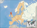 Location of Scotland (orange) in the European Union (camel).
 -
 Location of theEuropean continent(white).
 -
 Location of the United Kingdom (orange) in the European Union (camel).
 -
 Location of Scotland (dark green) in the United Kingdom (mid green) in the European Union (light green).


