Tongguan or Tong Pass, was a former mountain pass and fortress located south of the confluence of the Wei and Yellow Rivers, in today's Tongguan County, Shaanxi, China. It was an important chokepoint, protecting Xi'an and the surrounding Guanzhong region from the North China Plain. Tong Pass was built in 196 AD by the warlord Cao Cao during the late Han dynasty. The fortress was the seat of Tongguan County, but was demolished in the 1950s to make way for the Sanmenxia Dam and reservoir.


 Old photo
 The Tong Pass in 1941
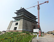 Modern recreation of the fortress' western gate

