
U.S. Route 319
U.S. Route 319 | ||||||||||||||
|---|---|---|---|---|---|---|---|---|---|---|---|---|---|---|
 US 319 highlighted in red | ||||||||||||||
| Route information | ||||||||||||||
| Auxiliary route of US 19 | ||||||||||||||
| Length | 303.052 mi[1][2] (487.715 km) | |||||||||||||
| Existed | 1933[citation needed]–present | |||||||||||||
| Major junctions | ||||||||||||||
| South end | ||||||||||||||
| ||||||||||||||
| North end | ||||||||||||||
| Location | ||||||||||||||
| Country | United States | |||||||||||||
| States | Florida, Georgia | |||||||||||||
| Counties | FL: Franklin, Wakulla, Leon GA: Thomas, Colquitt, Tift, Irwin, Ben Hill, Coffee, Telfair, Wheeler, Dodge, Laurens, Johnson, Jefferson | |||||||||||||
| Highway system | ||||||||||||||
| ||||||||||||||

U.S. Route 319 (US 319) is a spur of
.Route description
.svg)
Florida
The route starts as a two-lane highway at the eastern end of
In Sopchoppy, the route angles east, briefly meets up with US 98 once more, before parting ways again and running north through
Georgia

The route bypasses Grady County and enters Thomas County co-signed with SR 35 at the intersection of SR 93 and travels northeast in the direction of Thomasville in Thomas County, where the route forms the western and northern perimeter around Thomasville. US 319 then continues northeast, passes through Coolidge, and crosses into Colquitt County, running as a bypass around the east of Moultrie. The route crosses into Tift County and intersects with I-75 just before running through Tifton.
In
Continuing northeast, the route heads into Johnson County, runs through Wrightsville, and heads into southern Jefferson County, where it turns east in Bartow, before meeting its northern terminus at US 1 and SR 4 in Wadley.
US 319 from Tifton to the Florida State Line is a GRIP corridor.
National Highway System
The following portions of US 319 and SR 35 are part of the National Highway System, a system of routes determined to be the most important for the nation's economy, mobility, and defense:
- US 319/SR 35:
- US 319 only:
History
Florida
The entire length of US 319 in Franklin County was designated as "Blue Star Memorial Highway" by the Florida State Legislature in 1957.[6]
The section of US 319 that is co-signed with US 98 and SR 30 in Medart in Wakulla County was designated as "Agnes Morrison Memorial Highway" by the Florida State Legislature in 1961.[6]
From Kinhega Drive, about 9 miles (14 km) north of its intersection with I-10 in Leon County, to the Georgia state line, US 319 and SR 61 were designated as "Kate Ireland Parkway" by the Florida State Legislature in 1992.[6]
Georgia
US 319 does not make an appearance on Georgia road maps until October 1937, when the spur from the Florida state line to Thomasville is shown, co-signed with SR 3.[7] Prior to October 1937, US 19 appears as the designation of this section of the route.[8]
In July 1941, US 319 was extended from Thomasville, and ran through Moultrie, following what was signed as SR 35 at the time, to Cordele, co-signed with the current route taken by SR 33 from Moultrie.[9] Since late in 1946, US 319 follows its current route.[10]
The section of US 319 that forms the Thomasville Bypass was designated as "Will Watt Parkway" in 1996 after a prominent resident of Thomasville.[11]
The section of US 319 that forms the east bypass around Moultrie in Colquitt County was designated as "Veterans Parkway" in 2002.[12]
Major intersections
This section is missing mileposts for junctions. |
| State | County | Location | mi[1][2] | km | Destinations | Notes | ||
|---|---|---|---|---|---|---|---|---|
| Florida | Franklin | Apalachicola | 0.000 | 0.000 | Southern terminus; base of John Gorrie Memorial Bridge over Apalachicola River | |||
| see US 98 (mile 177.980-209.555) | ||||||||
| | 31.575 | 50.815 | SR 377 concurrency | |||||
| | 36.811 | 59.242 | CR 370 east (Rio Vista Drive) | Western terminus of CR 370 | ||||
CR 299 north (Curtis Mill Road) | Southern terminus of CR 299 | |||||||
SR 375 concurrency | ||||||||
| 42.908 | 69.054 | CR 372 east (Surf Road) | Western terminus of CR 372 | |||||
SR 375 concurrency | ||||||||
CR 375 south (Jack Crum Road) | Northern terminus of CR 375 | |||||||
| 50.213 | 80.810 | Newport | Northern end of US 98/SR 30 concurrency | |||||
| | 54.659 | 87.965 | Harvey Mill Road ( CR 374 west) | |||||
CR 368 west) | ||||||||
| 55.429 | 89.204 | SR 369 concurrency; southern terminus of CR 61 | ||||||
| | 61.516 | 99.000 | ||||||
CR 2204 east (Oak Ridge Road) | Western terminus of CR 2204 | |||||||
| | 68.469 | 110.190 | SR 369 concurrency; southern end of SR 61 concurrency | |||||
Tallahassee Regional Airport | Northern end of SR 61 concurrency; southern end of SR 263 concurrency | |||||||
| 71.796 | 115.544 | SR 261 concurrency | ||||||
| 74.014 | 119.114 | CR 259 (Tram Road Southeast) | ||||||
| 76.895 | 123.751 | Old St. Augustine Road ( CR 2196 ) | ||||||
| 77.404 | 124.570 | |||||||
| 79.668 | 128.213 | Downtown Tallahassee, Monticello | ||||||
| 80.370 | 129.343 | Goodwood Gardens and Museum | Eastern terminus of CR 146; western terminus of CR 0347 | |||||
| 81.066 | 130.463 | CR 151 (Centerville Road) | ||||||
| 82.781 | 133.223 | |||||||
| 82.89 | 133.40 | SR 8) – Pensacola | I-10 exit 203 | |||||
| 83.125 | 133.777 | Interchange southbound; intersection northbound | ||||||
| 83.236 | 133.955 | SR 261 concurrency; southern end of SR 61 concurrency; interchange southbound; intersection northbound | ||||||
| 85.636 | 137.818 | CR 0346 west (Ox Bottom Road) | Eastern terminus of CR 0346 | |||||
CR 0342 (Bannerman Road / Bradfordville Road) | ||||||||
Tall Timbers Research Station & Land Conservancy | Eastern terminus of CR 12 | |||||||
| | 96.107 | 154.669 | CR 0338 east (Sunnyhill Road) | Western terminus of CR 0338 | ||||
| 96.791 0.000 | 155.770 0.000 | Florida–Georgia state line; northern end of SR 61 concurrency; southern end of SR 35 concurrency | ||||||
| Georgia | Grady | Beachton | 2.251 | 3.623 | Southern terminus of SR 93 | |||
Metcalf | Former SR 122 west | |||||||
| | 17.023 | 27.396 | SR 38 west / Dixie Highway north – Cairo | Southern end of US 84/SR 38 concurrency; southern terminus of Dixie Highway Scenic Byway | ||||
| | Southern end of SR 3 Alt. concurrency | |||||||
| | 20.057 | 32.279 | Northern end of US 84/SR 38 and SR 3 Alt. concurrencies | |||||
Downtown Thomasville | Northern terminus of SR 35 Conn. | |||||||
| Coolidge | 31.375 | 50.493 | ||||||
| Southern terminus of US 319 Bus. | ||||||||
| 45.048 | 72.498 | Southern end of SR 37 and SR 133 concurrencies | ||||||
| 45.788 | 73.689 | Northern end of SR 37 concurrency | ||||||
| 47.578 | 76.569 | Northern end of SR 133 concurrency; northern terminus of US 319 Bus. | ||||||
| Norman Park | 55.288 | 88.977 | Southern terminus of SR 256 | |||||
| Western terminus of SR 35 Loop and Old Omega Road | ||||||||
| Tifton | 65.829 | 105.942 | Southern end of US 82/SR 520 concurrency | |||||
| 66.983 | 107.799 | |||||||
| | 68.383 | 110.052 | Northern end of US 82/SR 520 concurrency | |||||
| Irwin | Ocilla | 85.390 | 137.422 | Southern end of SR 32 concurrency | ||||
| 85.941 | 138.309 | Northern terminus of SR 35; northern end of SR 32 and SR 35 concurrencies; southern end of US 129/SR 11/SR 90 concurrency | ||||||
| Ben Hill | Fitzgerald | 96.960 | 156.042 | Northern end of US 129/SR 11/SR 90 concurrency; southern end of SR 107 concurrency | ||||
| | 101.295 | 163.019 | Western terminus of SR 206 | |||||
| | 109.271 | 175.855 | Eastern terminus of SR 182 | |||||
| Coffee | | 116.473 | 187.445 | Northern end of SR 107 concurrency; southern end of US 441/SR 31 concurrency | ||||
| Telfair | Jacksonville | 119.024 | 191.551 | |||||
McRae-Helena | 138.086 | 222.228 | ||||||
| 136.652 | 219.920 | |||||||
| 137.558 | 221.378 | Southern end of US 280/SR 30 concurrency | ||||||
| 139.995 | 225.300 | US 341 south / SR 27 south – Lumber City | Southern end of US 23/US 341/SR 27 concurrency | |||||
| Northern end of US 280/SR 30 concurrency | ||||||||
| Dodge |
No major junctions | |||||||
| Laurens | | 152.633 | 245.639 | |||||
| | 164.933 | 265.434 | Southern end of SR 117 concurrency | |||||
| I-16 exit 51 | ||||||||
| 170.218 | 273.939 | US 441 Byp. north / SR 117 north | Northern end of US 441 and SR 117 concurrencies; southern terminus of US 441 Byp. | |||||
| 172.456 | 277.541 | |||||||
| 173.306 | 278.909 | Western end of US 80/SR 26 concurrency | ||||||
| East Dublin | 175.544 | 282.511 | Eastern end of US 80/SR 26 concurrency | |||||
| Johnson | Wrightsville | 182.604 | 293.873 | Northern end of SR 31 concurrency; southern end of SR 78 concurrency | ||||
| Jefferson | | 197.940 | 318.554 | Southern end of US 221/SR 171 concurrency | ||||
| Bartow | 201.176 | 323.761 | ||||||
| 201.534 | 324.338 | Northern end of US 221/SR 171 concurrency | ||||||
SR 4 Bus.) – Swainsboro, Louisville | ||||||||
| 206.261 | 331.945 | Northern terminus; northern end of SR 78 concurrency | ||||||
1.000 mi = 1.609 km; 1.000 km = 0.621 mi
| ||||||||
Special routes
This section needs expansion. You can help by adding to it. (August 2012) |
Thomasville connector
This section relies largely or entirely upon a single source. (September 2019) ) |
State Route 35 Connector | |
|---|---|
| Location | Thomasville |
| Length | 1.1 mi[13] (1.8 km) |
State Route 35 Connector (SR 35 Conn.) is a 1.1-mile-long (1.8 km)
The entire route is in Thomas County.
| Location | mi[13] | km | Destinations | Notes | |
|---|---|---|---|---|---|
SR 38) / East Jackson Street west – Quitman, Monticello, Thomasville, Southern Regional Tech College | Southern terminus; roadway continues as East Jackson Street. | ||||
| | 1.1 | 1.8 | Northern terminus; roadway continues as US 319 north/SR 35 north (Moultrie Road). | ||
| 1.000 mi = 1.609 km; 1.000 km = 0.621 mi | |||||
Thomasville business loop
State Route 35 Business | |
|---|---|
| Location | Thomasville |
| Existed | 2007[citation needed] |
State Route 35 Business (SR 35 Bus.) was a business route for SR 35 that served the downtown area of Thomasville. The route was decommissioned in 2007.[citation needed]
Moultrie business loop
U.S. Highway 319 Business | |
|---|---|
| Location | Moultrie |
| Length | 6.8 mi[14] (10.9 km) |
U.S. Route 319 Business (US 319 Bus.) is a 6.8-mile-long (10.9 km) business route for US 319 that travels through the central portion of Moultrie. It is concurrent with SR 33 for its entire length.
US 319 Bus. begins at an intersection with US 319/SR 35 (Veterans Parkway) and SR 33 (Pavo Road) in the south-central part of Moultrie. US 319 Bus. and SR 33 travel concurrently as South Main Street to the north-northwest and immediately curve to the north-northeast. An intersection with 32nd Avenue SE leads to Colquitt Regional Medical Center. One block later, an intersection with 31st Avenue leads to the hospital, as well. Just past an intersection with the eastern terminus of Hugh Bannister Drive, they begin a curve back to the north-northwest. Just south of an intersection with the northern terminus of Lower Meigs Road, the highways curve back to the north-northeast. An intersection with 11th Avenue leads to the Jim Buck Goff Recreation Complex. At 4th Avenue, the northbound lanes of US 319 and SR 33 turn right and travel to the east, while the southbound lanes stay on South Main Street. South Main Street remains a two-way street until 2nd Avenue SE. One block later, they turn left onto 1st Street SE and continue their northern direction. On the southeastern corner of the intersection with 2nd Avenue SE lies the main office for Southwest Georgia Bank.
One block later, at 1st Avenue SE, they intersect the eastbound lanes of
Between 2nd Avenue NE and 4th Avenue NW, they pass the U.S. post office for the city. Whereas the northbound lanes travel on a bridge over the NS line, the southbound lanes actually meet them at a railroad crossing. Just south of Sylvester Drive, the southbound lanes have an intersection with SR 111 (West Bypass NW). SR 111 does not meet the northbound lanes, or vice versa. Just north of Sylvester Drive, northbound Main Street has signage that indicates that it is northbound US 319 Bus./SR 33, although they are actually on 1st Street NE.
The entire length of US 319 Bus., and the portion of SR 33 concurrent with it, is part of the National Highway System, a system of routes determined to be the most important for the nation's economy, mobility, and defense.[5]
The entire route is in Moultrie, Colquitt County.
| mi[14] | km | Destinations | Notes | ||
|---|---|---|---|---|---|
| 0.0 | 0.0 | SR 35 (Veterans Parkway) / SR 33 south (Pavo Road) – Moultrie, Thomasville, Tifton, Pavo, Coolidge, Moultrie Tech College | Southern end of SR 33 concurrency; southern terminus; roadway continues as SR 33 south (Pavo Road). | ||
| 4.6 | 7.4 | One-way pair | |||
| 4.6 | 7.4 | ||||
| 5.8 | 9.3 | No access from US 319 Bus. north/SR 33 north to SR 111 or vice versa; northern terminus of SR 111 | |||
| 6.8 | 10.9 | Northern end of SR 33 concurrency; northern terminus; roadway continues as US 319 north/SR 35 north (Tifton Highway); US 319 south/SR 35 south/SR 133 south provides access to Colquitt Regional Medical Center. | |||
1.000 mi = 1.609 km; 1.000 km = 0.621 mi
| |||||
Tifton loop route
State Route 35 Loop | |
|---|---|
| Location | Tifton |
| Length | 0.4 mi[15] (640 m) |
State Route 35 Loop (SR 35 Loop) is a 0.4-mile-long (0.64 km)
The entire route is in Tift County.
| Location | mi[15] | km | Destinations | Notes | |
|---|---|---|---|---|---|
| | 0.0 | 0.0 | Western terminus | ||
| Eastern terminus of SR 35 Loop; southern terminus of Magnolia Drive; roadway continues as Old Omega Road. | |||||
| 1.000 mi = 1.609 km; 1.000 km = 0.621 mi | |||||
Gallery
-
 US 319/SR 61 concurrency near the Georgia state line
 -
 US 98/US 319 concurrency in Carrabelle
 -
 Intersection of SR 65 with US 98/319
 -
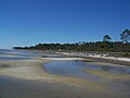 US 98/319 concurrency in Franklin County, Florida


See also
References
- ^ a b FDOT straight line diagrams, accessed February 2014
- ^ a b "County GIS Base map shapefiles/geodatabases (varies by county)". Georgia Department of Transportation. Retrieved December 11, 2012.
- ^ National Highway System: Florida (PDF) (Map). Federal Highway Administration. May 8, 2019. Retrieved August 15, 2019.
- ^ National Highway System: Tallahassee, FL (PDF) (Map). Federal Highway Administration. May 9, 2019. Retrieved August 15, 2019.
- ^ a b c d National Highway System: Georgia (PDF) (Map). Federal Highway Administration. May 8, 2019. Retrieved August 15, 2019.
- ^ Florida State Legislature (March 2, 2018). "Listing of Designated Roads in Florida"(PDF). Retrieved August 15, 2019.
- ^ State Highway Department of Georgia (October 1, 1937). System of State Roads (PDF) (Map). Scale not given. Atlanta: State Highway Department of Georgia. Retrieved December 11, 2012.
- ^ State Highway Department of Georgia (July 1, 1937). System of State Roads (PDF) (Map). Scale not given. Atlanta: State Highway Department of Georgia. Retrieved December 11, 2012.
- OCLC 5673161. Retrieved December 11, 2012.
- OCLC 5673161. Retrieved December 11, 2012. (Corrected to November 7, 1946.)
- ^ Georgia General Assembly (November 21, 1996). "Will Watt Parkway — Designated" (PDF). Acts and Resolutions of the General Assembly of the State of Georgia 1996. Retrieved December 11, 2012.
- ^ Georgia General Assembly (November 2002). "HR 838" (PDF). Acts and Resolutions of the General Assembly of the State of Georgia 2002. Retrieved December 11, 2012.
- ^ a b Google (September 8, 2019). "Overview map of SR 35 Conn" (Map). Google Maps. Google. Retrieved September 8, 2019.
- ^ a b Google (September 9, 2019). "Overview map of US 319 Bus. (Moultrie)" (Map). Google Maps. Google. Retrieved September 9, 2019.
- ^ a b Google (September 8, 2019). "Overview map of SR 35 Loop (Tifton)" (Map). Google Maps. Google. Retrieved September 8, 2019.