
Burscough
| Burscough | ||
|---|---|---|
Shire county | ||
| Region | ||
| Country | England | |
| Sovereign state | United Kingdom | |
| Post town | ORMSKIRK | |
| Postcode district | L40 | |
| Dialling code | 01704 | |
| Police | Lancashire | |
| Fire | Lancashire | |
| Ambulance | North West | |
| UK Parliament | ||
| Website | https://burscoughparishcouncil.org | |
Burscough (
The parish includes the hamlets of New Lane and
History and growth
The remains of a substantial Roman fort are located at Burscough; it has an area of 30,000 m2 and was begun in 1st century.[4] The fort was linked to the nearby forts at Wigan and Ribchester, and is significant as Roman sites are rare in the west of Lancashire. It is a scheduled monument.[5]
Burscough developed later as a small farming village on a low ridge above the West Lancashire Coastal Plain, and has Viking roots – Burh-skogr = fortress in the woods. Of early importance to the village was Burscough Priory, the ruins of which stand to the southwest of the current settlement. The priory formerly housed the tombs of the Earls of Derby, a prominent family in the region, which are now to be found in Ormskirk parish church.[6]
With the building of the Leeds and Liverpool Canal and the coming of the railways in the mid-18th century new developments took place north of the original village, in what came to be called Burscough Bridge, though the two communities have long since melded together.
For over a hundred years (from c. 1892) there was an
Administration
Burscough is within the West Lancashire constituency of the Parliament of the United Kingdom, and is currently represented by Ashley Dalton of the Labour Party.[8]
Lancashire is a two-tier county, meaning Burscough is governed by both a county council and a borough council. The town is part the Burscough & Rufford electoral division of Lancashire County Council, currently represented by Eddie Pope of the Conservative Party.[9][10] Burscough is split between the wards of Burscough Town and Burscough Bridge & Rufford on West Lancashire Borough Council.[11]
The civil parish of Burscough is governed by Burscough Town Council, which has up to fourteen councillors.[12]
RNAS Burscough (HMS Ringtail)
There was an operational Fleet Air Arm air station, RNAS Burscough (HMS Ringtail), 1.5 miles (2.4 km) southwest of the town. It was active between September 1943 and May 1946.
Community
Schools
Burscough has a number of primary schools:
- Lordsgate Township C of E
- St. John's Church of England
- Burscough Village (formerly Colburne Close Primary)
- Burscough Bridge Methodist
- St. John's Roman Catholic
There is also a secondary school, Burscough Priory Academy (formerly Burscough Priory High School and Burscough Priory Science College) and also a small public library.[13]
Retail and commercial
Shopping in the town is provided for by a large
Briars Hall country house hotel, just off the A59, was originally an 18th-century country manor house, and is set in 5 acres (2.0 ha) of mature gardens and woodland.[14]
Burscough Wharf
On 12 February 2011, a small retail and leisure development known as Burscough Wharf opened its doors to the public. Situated on the Leeds and Liverpool Canal, next to the southern bridge of the town centre, the development consists of approximately thirty units available for retail, leisure or office/studio space. Current businesses operating within the central square of Burscough Wharf consist of an instrumental music school, various independent gift shops, food and drink outlets, including a burger restaurant, gin bar and tea room, and health and beauty salons,[15] and a fortnightly artisan market has been established.[16]
Churches
Burscough has three churches: St John the Baptist Church, St John the Evangelist Roman Catholic Church and Burscough Methodist Church.
Transport

The A59 trunk road and Leeds and Liverpool Canal pass through Burscough and the A5209 brings large volumes of traffic through the town from where it connects to the A59. Lancashire County Council describe the town as suffering from "severe congestion". The canal junction with the
Victor Electrics
Burscough Bridge was the home of
Initial models looked like a conventional van, with a bonnet at the front, which housed the batteries,
Windmill Farm Railway
The Windmill Farm Railway is a
Media
Local news and television programmes are provided by
Sport and leisure
Burscough F.C.
Allotment society
Although the allotments in Burscough have been used since the construction of the Richmond Avenue housing estate, the need for a formal society was identified by the Parish Council in order to obtain further land for allotments in Burscough. Following a series of meetings a society was formed and the constitution agreed during a meeting on 23 November 2011.[31]
Fishing
There is a fishery in the town at Warper's Moss Lane, which has four-man-made lakes stocked with a wide variety of coarse fish including carp to around 20 pounds (9.1 kg). Fishing is available on a day ticket.
Martin Mere
Martin Mere is a large
Gallery
-
 Burscough Parish Church
 -
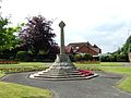 Lathom and Burscough War Memorial
 -
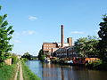 Ainscough Flour Mill on the Leeds and Liverpool Canal
 -
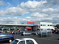 Tesco supermarket in Burscough


See also
References
- ^ "PP002 - Sex". Nomis. Retrieved 17 October 2023.
- ^ "PP002 - Sex". Nomis. Retrieved 17 October 2023.
- ^ "Paper 2: Population and Household estimates at small area level" (PDF). West Lancashire Borough Council. November 2012. Retrieved 7 February 2019.
- ^ "New Roman fort uncovered in Lancashire after years of speculation". 29 July 2020.
- ^ Historic England. "Roman Fort and sections of Roman Roads (1470328)". National Heritage List for England. Retrieved 12 December 2023.
- ISBN 0-300-10910-5.
- ^ "RAOC History". Lathom and Burscough Military Heritage Society.
- ^ "West Lancashire". UK Parliament. 4 May 2023. Retrieved 4 May 2022.
- ^ Council, Lancashire County. "Boundary Map". Lancashire.gov.uk. Retrieved 4 May 2023.
- ^ "Lancashire County Council: Elections". elections.lancashire.gov.uk. Retrieved 4 May 2023.
- ^ "New Ward/District Maps 2022 - West Lancashire Borough Council". www.westlancs.gov.uk. Retrieved 4 May 2023.
- ^ "Town Councillors". Burscough Town Council. Retrieved 4 May 2023.
- ^ "Burscough Library". Lancashire County Council. Retrieved 23 April 2016.
- ^ "Home page". Briars Hall Country House Hotel. Retrieved 24 September 2022.
- ^ "Burscough Wharf >> Burscough Wharf Leisure Development". Retrieved 10 August 2011.
- ^ "Burscough Wharf Artisan Market". 2BR Lancashire. 2018. Retrieved 7 February 2019.
- ^ "An Electric Designed by a Baker". Commercial Motor. 1 February 1927. p. 46.
- ^ Trader Handbook. Iliffe Books. 1961. p. 738.
- ^ Ordnance Survey, 1:25,000 map, 1928
- ^ Ordnance Survey, 1:25,000 map, 1972
- ^ "An Electric Van". Commercial Motor. 17 September 1929. p. 67.
- ^ "Door to Door Delivery by Electric Van". Commercial Motor. 13 January 1931. p. 53.
- ^ "Victor Electrics for 1935". Commercial Motor. 9 November 1934. p. 72.
- ^ "Brook Motors". Grace's Guide to British Industrial History. Retrieved 9 July 2016.
- ^ "Our Battery Electric Collection". Wythall Transport Museum. Retrieved 10 July 2016.
- ^ "Windmill Farm Steam Train". Windmill Animal Farm. Archived from the original on 23 February 2008. Retrieved 2 March 2008.
- ^ "Full Freeview on the Winter Hill (Bolton, England) transmitter". UK Free TV. Retrieved 7 January 2024.
- ^ "Central Radio". Retrieved 7 January 2024.
- ^ "North West Radio Stations". Retrieved 7 January 2024.
- ^ "Lancashire Telegraph". British Papers. 30 May 2014. Retrieved 7 January 2024.
- ^ "Burscough Allotment Society".
- The Directory of Railway Stations, R.V.J.Butt, PSL, 1995, ISBN 1-85260-508-1
External links
| International | |
|---|---|
| National | |
| Geographic | |