
Pawnee National Grassland
| Pawnee National Grassland | |
|---|---|
 The Pawnee Buttes in Pawnee National Grassland | |
 Pawnee National Grassland | |
| Location | Weld County, Colorado, United States |
| Nearest city | Greeley, Colorado |
| Coordinates | 40°48′29″N 103°59′21″W / 40.80806°N 103.98917°W[1] |
| Area | 193,060 acres (781.3 km2)[2] |
| Established | 1960 |
| Governing body | U.S. Forest Service |
| Website | Arapaho & Roosevelt National Forests and Pawnee National Grassland |
Pawnee National Grassland is a
The grassland is in an especially depopulated area of the
Recreation and access
Camping is available at the Crow Valley Recreation Area northwest of Briggsdale. The grassland contains several hiking trails, including one that allows foot access to the
Recreational activities on the Pawnee Grasslands have been somewhat curtailed over the last 10 years due to the discovery of extractable oil and natural gas. According to the US Forest Service, there are 63 active vertical oil and natural gas wells, and less than 3,000 acres of the 193,060 acres is protected from drilling.[4]
Geology
The grasslands is a joining of two soil types. In the east are prairie soils that are deep, and dark or reddish. From the west are
Water is available from a
Shortgrass prairie
The grassland is a part of the short grass plains of North America. The best example of this ecosystem are preserved around the Pawnee Buttes where grazing and intensive agriculture have had less impact. There are eleven vegetation zones represented with the most unique being the scarp woodlands on the north face of the buttes. Typical of higher elevations, there are limber pines and relicts of an ice-age forest.[5]
The wildlife of the grasslands is best represented near the buttes, with
Vegetative zones
- Short grass prairies cover the open flatlands at the below the buttes and the escarpments. They are dominated by blue grama and buffalo grass. Associated plants include the thread-leaf sedge, ring muhly, western wheatgrass, and the prickly pear cactus. The western wheatgrass dominates in "buffalo wallows" or other low patches.[5]
- Mixed prairie are the lighter and more sandy soils, found on the heights. The dominant plants are the
- The little bluestem is found across the entire grasslands, but it dominates in localized plots. These are in the swales and along north facing slopes where the shade will retain water longer. The same applies to soils that are sandy and gravelly. These areas are populated by little bluestem and a mix of Canada rye, phlox, borges, and a mix of grasses and forbs.[5]
- Shrub steppe areas are similar to the short grass and mixed prairie, but with a greater alkalinity. Thus, the fourwing saltbush dominates these areas. They are found along the bottom of the escarpments. There is a variety of shrubs and forbs, but the key plants will be the saltbush and other alkaline loving plants, i.e., small soapweed and common winterfat.[5]
- Arroyos form near the escarpments along major drainage. Arroyos can be up to 30 feet (9.1 m) deep. There is no standing water, but the volume of water from each rain event allows the soils to hold moisture for a longer period. Here the dominant plants are larger shrubs or small trees, Rocky Mountain juniper and choke cherry. The moister soils allow for current, gooseberry, and other shrubs similar to the breaks environment. There will also be little bluestem and Canada rye found.[5]
- Clay barrens are dominated by the eroding Brule Formation. Here Indian rice grass, Penstemon, and evening primrose. Where there is active erosion, there are no plants.[5]
- Break shrub are areas of broken rock. They can be along the upper edge of an escarpment, shelves on vertical slopes or rocky areas at the bottom of a cliff. These areas provide tenuous holds and deep rooting plants dominate. The roses.[5]
- Scarp woodlands are found on the north-facing cliff edges and rocky areas. They are in the narrow canyons draining northwards, providing water, and protection against evaporation. Here larger trees can take root, such as limber pine, small ponderosa pines, and Rocky Mountain juniper. These are in addition to the break shrubs found on less protected northern slopes.[5]
- Willow Spring is the only natural water source near the buttes. Here water loving peach-leaf willow abound along with a variety of sedges.[5]
- Bare rocks offer a limited chance for growth to crustose lichens, Caloplaca, and Lanconroa calcarea.[5]
- Road edges receive runoff from the hard pack road surface. Invasive plants move into the initial disturbance and find adequate water to remain. The dominant plants are: Indian ricegrass, sedges, grasses, and forbs.[5]
Flora
Wildflowers bloom from April through September. The best locations for viewing wildflowers are near rocky outcrops or wet potholes, such as are found near the Pawnee Buttes.[6]
- Blue flax (Linum lewisii)
- Buffalo bur (Solanum rostratum)
- Cryptantha (Cryptantha species)
- Groundsel (Senecio species)
- Hartweg evening primrose (Calylophus hartwegii)
- Hood's phlox (Phlox hoodii)
- Narrow-leaved penstemon (Penstemon angustifolius)
- Nuttall's violet (Viola nuttallii)
- Pink cleome (Cleome serrulata)
- Plains prickly pear cactus (Opuntia polyacantha)
- Prairie coneflower (Ratibida columnifera)
- Prairie evening primrose (Oenothera albicaulis)
- Prairie onion (Allium textile)
- Prairie snowball (Abronia fragrans)
- Puccoon (Lithospermum incisum)
- Purple ground cherry (Quincula lobata)
- Salsify (Tragopogon major)
- Scarlet globe mallow (Sphaeralcea coccinea)
- Snow on the mountain (Agaloma marginata)
- Star lily (Leucocrinum montanum)
- Sunflowers (Helianthus species)
- Tansy aster (Machaeranthera tanacetifolia)
- Threadleaf yellowrays (Thelesperma filifolium)
- Tufted sandwort (Arenaria hookeri)
- Western wallflower (Erysimum spermum)
- Wooly locoweed (Astragalus mollissimus)
- Yucca (Yucca angustifolia)
Gallery
-
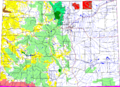 Colorado, with Pawnee National Grassland highlighted in red.
 -
 Weld County, Colorado with Pawnee National Grassland highlighted in red.
 -
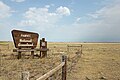 One of the signs marking the entrance to the grassland. This one is at the west side along State Highway 14.
 -
 Rock formation near the Pawnee Buttes.
 -
 Sunrise over the grassland.
 -
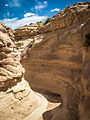 A gully near the Pawnee Buttes.
 -
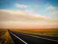
 View of Pawnee National Grassland from County Rd 116 in February.
 -
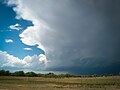 A thundercloud rolling in over the prairie.
 -
 Uninterrupted prairie
 -
 Oil wells on Colorado State Highway 14


See also
References
- ^ "Pawnee National Grassland". Geographic Names Information System. United States Geological Survey, United States Department of the Interior. Retrieved August 8, 2012.
- ^ "Land Areas of the National Forest System". U.S. Forest Service. Archived from the original on December 1, 2012. Retrieved December 9, 2012.
- ^ "Pawnee National Grassland". U.S. Forest Service. Archived from the original on October 20, 2016. Retrieved August 8, 2012.
- ^ "Pawnee National Grassland Oil and Gas Frequently Asked Questions". U.S. Forest Service. Archived from the original on July 6, 2015. Retrieved July 5, 2013.
- ^ a b c d e f g h i j k l m n o An Interpretive Resource Analysis of Pawnee Buttes, Colorado; Dissertation; Robert Jack Badaracco; Colorado State University; Fort Collins, Colorado; March 1971
- ^ Wildflowers of the Pawnee National Grassland, Pawnee National Grassland, U.S. Forest Service; Greeley, Colorado; 2012
External links
 Definitions from Wiktionary
 Media from Commons
 News from Wikinews
 Quotations from Wikiquote
 Texts from Wikisource
 Textbooks from Wikibooks
 Resources from Wikiversity
- Arapaho and Roosevelt National Forests and Pawnee National Grassland (United States Forest Service)