
River Clyde
This article has multiple issues. Please help improve it or discuss these issues on the talk page. (Learn how and when to remove these template messages)
|
| River Clyde | |
|---|---|
.jpg) The River Clyde running through the city of Glasgow | |
| Location | |
| Country | Scotland |
| Council areas | South Lanarkshire, North Lanarkshire, Glasgow, Renfrewshire, West Dunbartonshire, Inverclyde, Argyll and Bute |
| City | Glasgow |
| Physical characteristics | |
| Source | Lowther Hills in South Lanarkshire |
| • location | South Lanarkshire, Scotland |
| • coordinates | 55°24′23.8″N 3°39′8.9″W / 55.406611°N 3.652472°W |
| Mouth | Firth of Clyde |
• location | Inverclyde, Argyll, Scotland |
• coordinates | 55°40′46.3″N 4°58′16.7″W / 55.679528°N 4.971306°W |
| Length | 110 mi (180 km)[1] |
| Basin size | 1,545 sq mi (4,000 km2) |
| Basin features | |
| Designation | |
| Official name | Inner Clyde Estuary |
| Designated | 5 September 2000 |
| Reference no. | 1036[2] |
The River Clyde (
(Teyrnas Ystrad Clut).Etymology
The exact etymology of the river's name is unclear, though it is known that the name is ancient. In 50AD, the Egyptian mathematician, astronomer and geographer Claudius Ptolemy wrote of the river as "Klōta",[4] It was called Clut or Clud by the Britons and Clota by the Romans. It is therefore likely that the name comes from a Celtic language—most likely Old British. But there is more than one old Celtic word that the river's name could plausibly derive from. One possible root is the Common Brittonic Clywwd, meaning 'loud' or 'loudly'.[citation needed] More likely, the river was named after a local Celtic goddess, Clōta. The goddess's name in turn derives from an older, Proto-Celtic word meaning 'the strongly flowing one' or 'the holy cleanser'.
History
Prehistory
Humans have settled along the Clyde since the Paleolithic era. Artifacts dating from 12,000 BC have been found near Biggar, a rural town close to the river. Biggar is home to an archeological site at which Britain's most ancient artifacts have been unearthed.[5] Prehistoric canoes, used by ancient peoples for transport or trade, have been found in the river.[6] There are a number of Mesolithic sites along the Clyde, especially in the Upper Clyde Valley.[7] Permanent settlements and structures, including what is believed to be a temple to moon gods in Govan, were constructed in the area during the Neolithic and Bronze Ages. Celtic art, language, and other aspects of culture began spreading to the area from the south during this period, and prehistoric artifacts suggest that, by around 1000 BCE, they had become the dominant cultural influences there.
Ancient history
Before the
None of the documentary or archaeological evidence from the period when the Roman legions arrived suggests that battles took place in the area. Therefore the Roman legions and Damnonii tribespeople are assumed to have been on good terms and to have co-operated by means of trade and the exchange of military information. The Romans did, however, construct several
Kingdom of Strathclyde
Strathclyde was founded as an independent British kingdom, either during or shortly after the
In the
Medieval and early modern history
In the 13th century, Glasgow, then still a small town, built its first bridge over the river Clyde. This was an important step in its ability to eventually grow into a city. The establishment, in the 15th century, of both the University of Glasgow and the Archdiocese of Glasgow, vastly increased the importance of the town within Scotland. From the early modern period onwards, the Clyde began to be used commercially as a trade route; trade between Glasgow and the rest of Europe became commonplace. In the centuries that followed, the Clyde became increasingly vital to both Scotland and Britain as a major trade route for exporting and importing resources.
Course
.jpg)
The Clyde is formed by the confluence of two streams, the


The river then makes its way northwest, past the towns of
.jpg)

As it flows past Uddingston and into the southeastern part of Glasgow, the river begins to widen, meandering through Cambuslang, Rutherglen, and Dalmarnock, and past Glasgow Green. From the Tidal Weir westwards, the river is tidal: a mix of fresh and salt water.[10]
Over three centuries the river has been engineered and widened where it passes through Glasgow city centre and onwards towards Dumbarton and Greenock and the open sea. Shipping and shipbuilding grow in Glasgow and its neighbouring industrial burghs of Govan and Partick; with the Clyde, including is lower reaches, becoming the centre of world shipbuilding.
The river then flows west, out of Glasgow, past
The strath of the Clyde was the focus for the G-BASE project executed by the British Geological Survey in the summer of 2010.
Industrial growth

.jpg)

The economic prosperity that the Clyde made possible at the beginning of the Industrial Revolution was due to the location of Glasgow, as a port facing the Americas. Tobacco and cotton trade began to drive this economic engine in the early 18th century. However, an obstacle to further economic growth soon became evident: the Clyde was too shallow for the largest ocean-going ships to navigate into it, so cargo had to be transferred, at Greenock or Port Glasgow, to smaller ships that could sail upstream into Glasgow itself.
Deepening the Upper Clyde
In 1768, John Golborne advised that the river should be made narrower and the scour increased by constructing rubble jetties and dredging sandbanks and shoals. Another obstacle to navigation that had to be solved was that the river divided into two shallow channels by the Dumbuck shoal near Dumbarton. After James Watt's 1769 report describing this problem, a jetty was constructed at Longhaugh Point to block off the southern channel. This turned out to be insufficient to solve the problem, so in 1773, a training wall called the Lang Dyke was built on the Dumbuck shoal to stop water flowing over into the southern channel of the river.
In the late 18th and early 19th centuries, hundreds of jetties were built out from the banks of the river between Dumbuck and the Broomielaw quay in Glasgow proper. In some cases, this construction had the effect of deepening the river, because the increased flow of the newly constrained water wore away the river bottom. In other cases, dredging was required to deepen the river.[12][13][14]
In the mid-19th century, engineers took on the task of dredging the Clyde much more extensively. They removed millions of cubic feet of silt to deepen and widen the channel. The major stumbling block encountered by that project was a massive geological intrusion known as Elderslie Rock.[15] Because that rock increased the project's difficulty, the work was not completed until the 1880s. Around this time, the Clyde became an important source of inspiration for artists, such as John Atkinson Grimshaw and James Kay,[16] who were interested in painting scenes that depicted the new industrial era and the modern world.
Shipbuilding and marine engineering

The completion of the dredging was well-timed, because the channel finally became navigable all the way from Greenock to Glasgow just when the steelwork industry had begun to grow in the city. Shipbuilding replaced trade as the major activity on the river, and shipbuilding companies started rapidly establishing themselves there. The Clyde soon gained a reputation for being the best location for shipbuilding in the British Empire, and grew to become the world's pre-eminent shipbuilding centre. The term Clydebuilt became an industry symbol of high quality, and the river's shipyards were given contracts to build prestigious ocean-going liners, as well as warships. The Queen Mary and, in later years, the Queen Elizabeth 2 were built in the town of Clydebank.
Between 1712, when the
The shipbuilding firms became household names on Clydeside, and even around the world to some extent. These included, among many others,
One shipyard that was known as a 'Clyde' shipyard was not actually located on any of the Clyde's waterways: Alley & MacLellan's Sentinel Works in Jessie Street at Polmadie is around half a mile distant from the Clyde. It is said to have constructed over 500 vessels, many of which were assembled and then 'knocked down' to kit form for despatch to a remote location, such as Chauncy Maples. Clyde shipbuilding reached its peak in the years just before World War I: It is estimated that, in the year 1913 alone, over 370 ships were completed.
Yachting and yachtbuilding
The first recorded Clyde racing yacht, a 46-ton cutter, was built by Scotts of Greenock in 1803.[17] The pre-eminent Scottish yacht designer William Fyfe did not start designing yachts until 1807. The first yacht club on the Clyde was the Northern Yacht Club, which was established in 1824 and received its royal charter in 1831. The club was founded to organise and encourage the sport of yacht racing. By 1825, Scottish and Irish clubs were racing against each other on the Clyde. By the mid-19th century, yachting and yacht building had become widely popular.
The Clyde became famous worldwide for its significant contribution to yachting and yachtbuilding, and was the home of many notable designers: William Fife III, Alfred Mylne, G. L. Watson, E. McGruer, and David Boyd. It was also home to many famous yacht yards.
Robertson's Yard started repairing boats in a small workshop at Sandbank in 1876, and went on to become one of the foremost wooden boat builders on the Clyde. The 'golden years' of Robertson's yard were in the early 20th century, when they started building classic 12-and-15-metre (39 and 49 ft) racing yachts. More than 55 boats were built by Robertson's in preparation for World War I, and the yard remained busy even during the Great Depression in the 1930s, as many wealthy businessmen developed a passion for yacht racing on the Clyde. During World War II, the yard was devoted to Admiralty work, producing large, high-speed Fairmile Marine motor boats (motor torpedo boats and motor gun boats). After the war, the yard built the successful one-class Loch Longs and two 12 m (39 ft) challengers for the America's Cup, designed by David Boyd: Sceptre (1958)[18] and Sovereign (1964). Because of difficult business conditions in 1965, the yard turned to doing GRP production work (mainly building Pipers and Etchells), and it closed in 1980. During its 104-year history, Robertson's Yard built 500 boats, many of which are still sailing today.
Two other notable boatyards on the Clyde were Silvers, which operated from 1910 to 1970, and McGruers, which operated from 1910 to 1973. They were situated on the
Glasgow Humane Society

The Glasgow Humane Society is responsible for the safety and preservation of life on Glasgow's waterways. Founded in 1790, it is the oldest lifesaving organisation in the world.
Shipbuilding decline

During and immediately after
Today, two major shipyards on the Upper Clyde remain in operation. They are both owned by a naval defence contractor,
Regeneration
Major regeneration schemes include those in the 1970s of forming Strathclyde Country Park, lying between Hamilton and Motherwell, as part of motorway developments; the establishment of the Glasgow Garden Festival 1988 as part of the re-use of city docklands and associated industrial uses led by the Scottish Development Agency in the 1980s and early 90s. The
The
Pollution
The British Geological Survey has identified and evaluated organic chemical pollutants in the sediment of the Clyde estuary.
The amount and type of sedimentary pollution in the Clyde reflects the area's industrial history.
Although pollution from heavy industry and power generation has been decreasing, there is evidence that human-made pollution from new synthetic compounds in electrical products and textiles has been increasing.
Media
This article contains a list of miscellaneous information. (September 2022) |
The Clyde plays an important role in the
The Clyde appears prominently in the films
-
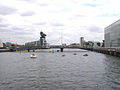 Bells Bridge
 -
 Millennium Bridge
 -
 Modern buildings, including theSSE Hydro
 -
 The estuary opens out past Dumbarton.
 -
 Looking across to Dumbarton at low tide
 -
 Looking east toward Glasgow's CBD
 -
 South-facing view of theTradeston bridge
 -
 Aerial view looking downstream along the River Clyde to the Erskine Bridge, the Firth of Clyde and the Argyll hills


Heat Pumps
The River Clyde, or more accurately the Clyde Estuary, has significant potential as a heat source. The flow rate downstream alone is around 50 m3/s.[30] Reducing this temperature by 3 °C would enable river heat pumps to extract 188.1 MW of heat. Since river heat pumps typically have an efficiency of 3.0, the heat deliverable is 1.5 times the river component. As a result, the estuary could deliver 282 MW of heat. The temperature of industrial heat pump delivery is typically 80 °C. [citation needed]
In 2020, West Dunbartonshire Council deployed a river source heat pump scheme in the area called Queens Quay. It is the first large heat pump scheme in Britain to deliver at 80 °C. The heat pumps were supplied by Star Refrigeration Ltd, who manufactured them in their Glasgow factory. The project was delivered by Vital Energi.


See also
- Bodinbo Island
- Bonnington Pavilion
- HMNB Clyde
- Red Clydeside
- Rivers of Great Britain
- Donald's Quay
References
- Encyclopaedia Britannica. Retrieved 30 May 2019.
- ^ "Inner Clyde Estuary". Ramsar Sites Information Service. Retrieved 25 April 2018.
- ^ "TM Places". www.trismegistos.org.
- ^ McClure, Edmund (1910). British Place-names in Their Historical Setting. London: Society for Promoting Christian Knowledge. p. 92.
- ^ "Scotland's oldest home found at 14,000 years old". The Scotsman.
- ^ "The Glasgow Story". 21 December 2020.
- ^ "Vol 14 (2005): People and their monuments in the Upper Clyde Valley:a programme of survey, field walking and trial excavation in the environs of the Blackshouse Burn Neolithic enclosure, South Lanarkshire, 1989--99 | Scottish Archaeological Internet Reports". journals.socantscot.org. Retrieved 28 July 2021.
- ^ "The British Damnonii Tribe". 22 December 2020.
- ^ The Tweed: Take a trip on a river flowing with history, The Independent, 21 April 2007
- ^ "Tidal Weir". Glasgow City Council. 2017. Retrieved 9 August 2020.
- ^ C.Michael Hogan. 2011. Irish Sea. eds. P.Saundry & C.Cleveland. Encyclopedia of Earth. National Council for Science and the Environment. Washington DC
- ^ Chisholm, Hugh, ed. (1911). . Encyclopædia Britannica. Vol. 12 (11th ed.). Cambridge University Press. p. 84.
- ISBN 0-415-20082-2.
- ^ "Making the Clyde". Best Laid Schemes. Archived from the original on 18 January 2006. Retrieved 10 May 2007.
- ^ "Removal of Elderslie Rock". The Glasgow Herald. 11 March 1886. Retrieved 8 April 2016.
- ISBN 1-85158-630-X.
- ^ Shipbuilding, Scotts' (2 June 2022). Two Centuries of Shipbuilding by the Scotts at Greenock. DigiCat. p. 67.
- ^ "Sceptre". britishclassicyachtclub.org. Archived from the original on 14 April 2005. Retrieved 3 October 2010.
- ^ "A brief history of Silvers Marine". Silvers marine.
- ^ "Register of Scottish-built ships". Clydeships.co.uk.
- ^ "Colourful history of McGruers". Helensburgh heritage.
- ^ Harris, Hilary. "Seaward the Great Ships". Moving Image Archive. National Library of Scotland. Retrieved 11 November 2017.
- ^ "Clyde Waterfront Regeneration". Clyde Waterfront. 16 June 2008. Retrieved 25 September 2008.
- ^ "Trails". Scotland's Great Trails. Retrieved 18 August 2018.
- ^ PMID 17553529.
- ^ S2CID 1480181.)
{{cite journal}}: CS1 maint: multiple names: authors list (link - ^ S2CID 102768.)
{{cite journal}}: CS1 maint: multiple names: authors list (link - ^ "Harmful chemicals in green Glasgow burn to be flushed". BBC News. 19 February 2019. Retrieved 27 April 2021.
- ^ Suter, Ruth (26 April 2021). "SEPA called to investigate 'toxic' Glasgow burn". The Glasgow Times. Retrieved 27 April 2021.
- ^ "NRFA Station Mean Flow Data for 84013 - Clyde at Daldowie".
Further reading
- Millar, William John. The Clyde: from its source to the sea, its development as a navigable river.... (1888) [1]
- Shields, John. Clyde built: a history of ship-building on the River Clyde (1949)
- Walker, Fred M. Song of the Clyde: a history of Clyde shipbuilding (1984), 233 pages
- Williamson, James. The Clyde passenger steamer (1904) full text
External links
- River Clyde: Source to Firth Panorama Project Archived 21 September 2017 at the Wayback Machine
- The data base of ships built on the Clyde and in the rest of Scotland – lists over 22,000 ships built on the Clyde
- Carmen Thyssen-Bornemisza Collection on loan to Museo Thyssen-Bornemisza, Shipping on the Clyde in Glasgow from Grimshaw, on Flickr.com
- . Encyclopædia Britannica. Vol. VI (9th ed.). 1878. p. 43.
- Clyde Waterfront regeneration
- Clyde Waterfront Heritage
- River Clyde waterfront regeneration Archived 18 October 2005 at the Wayback Machine
- Gallery of pictures of the River Clyde from the Erskine Bridge
- Glasgow Digital Library: Glimpses of old Glasgow
- In Glasgow Photo Gallery of pictures of the River Clyde Archived 23 February 2007 at the Wayback Machine
- Clydebank Restoration Trust – Pictures and history
- Clyde Bridges Heritage Trail Archived 19 September 2007 at the Wayback Machine
- Clydebank Restoration Trust
- Video footage and history of Bodinbo or Bottombow Island at Erskine
Shipyards of the Clyde | |
|---|---|

Scotts Stephens Fairfield Connell Inglis Denny Beardmore |
| International | |
|---|---|
| National | |
| Geographic | |