
Colorado River (Texas)
| Colorado River | |
|---|---|
 Colorado River in Austin as seen from Mount Bonnell | |
 Map of the Colorado River and associated watershed | |
| Location | |
| Country | United States |
| State | Texas |
| Physical characteristics | |
| Source | |
| • location | Dawson County |
| • coordinates | 32°40′47″N 101°43′51″W / 32.67972°N 101.73083°W[1] |
| • elevation | 2,860 ft (870 m)[2] |
| Mouth | Matagorda Bay |
• location | Gulf of Mexico, at Matagorda County, Texas |
• coordinates | 28°35′41″N 95°58′59″W / 28.59472°N 95.98306°W[1] |
• elevation | 0 ft (0 m)[3] |
| Length | 862 mi (1,387 km) |
| Basin size | 39,900 sq mi (103,000 km2)[4] |
| Discharge | |
| • location | Bay City |
| • average | 2,609 cu ft/s (73.9 m3/s) |
| • minimum | 0 cu ft/s (0 m3/s) |
| • maximum | 84,100 cu ft/s (2,380 m3/s) |
The Colorado River is an approximately 862-mile-long (1,387 km) river
Its
Course

The Colorado River originates south of Lubbock, on the Llano Estacado near Lamesa. It flows generally southeast out of the Llano Estacado and through the Texas Hill Country, then through several reservoirs including Lake J.B. Thomas, E.V. Spence Reservoir, and O.H. Ivie Lake. The river flows through several more reservoirs before reaching Austin, including Lake Buchanan, Inks Lake, Lake Lyndon B. Johnson (commonly referred to as Lake LBJ), and Lake Travis. The Llano River joins the Colorado at Lake LBJ near Kingsland, and the Pedernales River joins at Lake Travis near Briarcliff. After passing through Austin, the Colorado River continues flowing southeast until emptying into Matagorda Bay on the Gulf of Mexico, near Matagorda.
History
The Colorado River, which means 'red'[7] or 'reddish' river in Spanish,[8] was frequently confused by Spanish explorers with the Brazos River to the north.[6] The European discoverer of these two neighboring rivers called the present Colorado River the Brazos de Dios, and called the present Brazos the Colorado River. The two names would later be reversed.[8]
The upper Colorado River was controlled by
River modifications
The river is an important source of water for farming, cities, and electrical power production. Major man-made
Flood control and use of the Colorado River is managed by two agencies established by the Texas Legislature: the Upper Colorado River Authority and the Lower Colorado River Authority. There are 11 major reservoirs along the Colorado River.[10][11]
Major tributaries
The Colorado River is joined by five significant
Gallery
-
 Pennybacker Bridge crossing the Lake Austin portion of the Colorado River
 -
 The Colorado River 5 mi (8 km) from its source along the Caprock Escarpment, the border of Dawson and Borden County.
 -

-
 Scenic view of Colorado River meandering under a bridge overpass under State Highway 60 in Wharton
 -
 Scene on the Colorado River, Austin, Texas (postcard, c. 1907)
 -
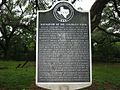 A historical marker on US 90A between Eagle Lake and Altair explains the difficulty of navigating the lower Colorado River in the 1800s.
 -
 Old postcard of Bull Creek in Austin
 -
 Colorado River east of Columbus, Texas
 -
 Water reflections on sculpture falls


.jpg)
See also
- Colorado City, Texas
- List of crossings of the Colorado River (Texas)
- List of rivers of Texas
- List of tributaries of the Colorado River (Texas)
- Matagorda Bay—the river's mouth
- Texas Hill Country
References
- ^ a b "Colorado River". Geographic Names Information System. United States Geological Survey, United States Department of the Interior.
- ^ Sand Creek, TX, 7.5 Minute Topographic Quadrangle, USGS, 1970 (1974 rev.)
- ^ Google Earth elevation for GNIS coordinates.
- ^ Clay, Comer; Kleiner, Diana J. (1999-02-15). "Colorado River". The Handbook of Texas Online. The General Libraries at the University of Texas at Austin and the Texas State Historical Association. Retrieved 2006-07-22.
- ^ a b Kammerer, J. C. (1987). Largest Rivers in the United States (Report). United States Geological Survey. Retrieved 2006-07-15.
- ^ a b c Clay, Comer; Kleiner, Diana J. (1999-02-15). "Colorado River". The Handbook of Texas Online. The General Libraries at the University of Texas at Austin and the Texas State Historical Association. Retrieved 2006-07-22.
- ^ "Colorado - Diccionario Inglés-Español". WordReference.com.
- ^ The American Cyclopædia.
- ISBN 978-0-300-12654-9.
- ^ "River Basin Map of Texas". Bureau of Economic Geology, University of Texas at Austin. 1996. Archived from the original (JPEG) on 2017-06-27. Retrieved 2006-07-15.
- Texas Parks and Wildlife. 2005-08-22 – via University of Texas at Austin.
- ISBN 9780528958342.
External links
- Colorado River from the Handbook of Texas Online
- Upper Colorado River Authority
- Lower Colorado River Authority