
Santa Ana Freeway
| |
|---|---|
| Location | |
| Country | United States |
| State | California |
| Counties | Orange, Los Angeles |
| Highway system | |
| Southern California freeways | |
The Santa Ana Freeway is one of the principal
North of the East Los Angeles Interchange complex, I-5 follows the
An abundance of landmarks, most importantly
The freeway is officially defined as Routes 101 and 5 from Route 110 (Four Level Interchange) to Route 405.[2]
History
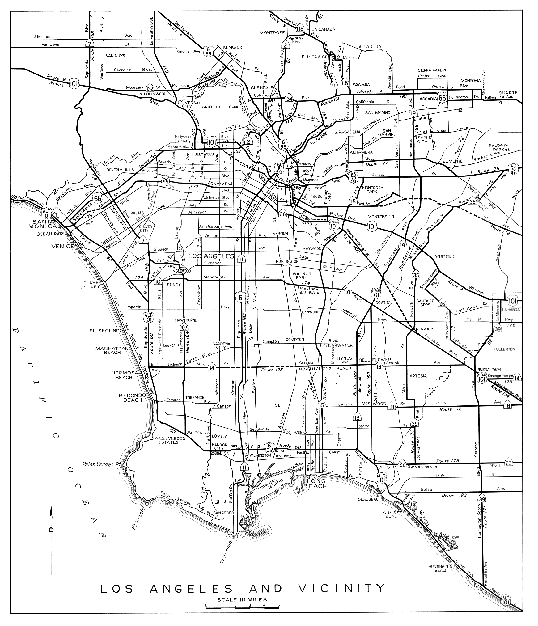
The Santa Ana Freeway is a bypass of the original state highway from Los Angeles to Santa Ana, which passed through
In 1933, the state legislature added a number of routes to the state highway system, including two that later formed parts of the Santa Ana Freeway. Route 166 began at the new
A U.S. Route 101 Bypass was created by 1941, beginning at the intersection of Routes 166 (Indiana Street, soon moved to Downey Road[
A freeway connecting downtown Los Angeles with
The entire Santa Ana Freeway began construction in 1947 and completed in 1956. Originally it was signed as US 101 before the segment of 101 between the East Los Angeles Interchange and the
Former Interstate 105
From 1964 to 1968, the I-105 designation was used on a stretch of road linking I-5/I-10, US 101, and SR 10 (former I-110) north of downtown Los Angeles, now known as the East Los Angeles Interchange. In 1968, this I-105 was decommissioned, and that portion of the Santa Ana Freeway was folded into US 101.[17]
Exit list
Except where prefixed with a letter, postmiles were measured on the road as it was in 1964, based on the alignment that existed at the time, and do not necessarily reflect current mileage. R reflects a realignment in the route since then, M indicates a second realignment, L refers to an overlap due to a correction or change, and T indicates postmiles classified as temporary ().[18] Segments that remain unconstructed or have been relinquished to local control may be omitted. The numbers reset at county lines; the start and end postmiles in each county are given in the county column.
| County | Location | Postmile [18][19][20] | Exit[21][22] | Destinations | Notes | ||
|---|---|---|---|---|---|---|---|
San Diego | Continuation beyond I-405 | ||||||
| 94A | Northbound exit and southbound entrance; south end of Santa Ana Freeway; south end of I-5 overlap | ||||||
| See I-5 Exits 94A–134 | |||||||
Los Angeles | 16.88 S0.00[a] | — | North end of I-5 overlap; south end of US 101 overlap; no access from I-5 north to US 101 north, and vice versa | ||||
| See US 101 Exits 1–3 | |||||||
San Pedro | North end of Santa Ana Freeway; north end of US 101 overlap | ||||||
| — | Continuation beyond SR 110 | ||||||
1.000 mi = 1.609 km; 1.000 km = 0.621 mi
| |||||||
See also
 California Roads portal
References
- ^ a b "Mapping L.A.: Boyle Heights". Los Angeles Times. Retrieved 2013-08-05.
- Caltrans. p. 63. Retrieved 2014-06-13.
- ^ Ben Blow, California Highways: A Descriptive Record of Road Development by the State and by Such Counties as Have Paved Highways, 1920 (Archive.org or Internet Archive), pp. 165, 194-195
- California Highways and Public Works, United States Numbered Highways, January 1928
- ^ California State Assembly. "An act to amend sections 2, 3 and 5 and to add two sections to be numbered 6 and 7 to an act entitled 'An act to provide for the acquisition of rights of way for and the construction, maintenance..." Fiftieth Session of the Legislature. Statutes of California. State of California. Ch. 767 p. 2040.: "Los Angeles, Indiana and 3rd Streets, to the Huntington Beach-Whittier Road near Santa Fe Springs." "State Highway Route 60 via Manchester Avenue to State Highway Route 2 near Miraflores." "State Highway Route 2 near Orange County Hospital to Main Street, Santa Ana, via Santa Ana Boulevard."
- ^ California State Assembly. "An act to establish a Streets and Highways Code, thereby consolidating and revising the law relating to public ways and all appurtenances thereto, and to repeal certain acts and parts of acts specified herein". Fifty-first Session of the Legislature. Statutes of California. State of California. Ch. 29 p. 286.: "Route 166 is from Route 172, at the intersection of Indiana and Third Streets, in Los Angeles, to Route 171 near Santa Fe Springs." "Route 174 is from: (a) Route 60 via Manchester Avenue to Route 2 near Miraflores. (b) Route 2 near Orange County Hospital to Main Street, Santa Ana, via Santa Ana Boulevard."
- Archive.org.
- H.M. Gousha Company, Los Angeles and Vicinity, 1935
- ^ Richard F. Weingroff, U.S. 6: The Grand Army of the Republic Highway
- H.M. Gousha Company, Los Angeles and Vicinity, 1939
- , 1941: SR 10 overlaps US 101 Bypass to Anaheim
- , 1942: SR 10 has been truncated
- Division of Highways, Los Angeles and Vicinity, 1944
- ^ Los Angeles Times, Super-Road Hearing Set, September 8, 1939, p. 20
- ISBN 0-520-24166-5, p. 61
- ^ California State Assembly. "An act to amend Sections 345, 466 and 612 of the Streets and Highways Code, relating to descriptions of certain State highways". Fifty-fourth Session of the Legislature. Statutes of California. State of California. Ch. 142 p. 1185.: "Route 166 is from Route 172, at the intersection of Downey Road to Route 174, near Norwalk."
- ^ "105 California". Interstate Guide. Retrieved 4 October 2014.
- ^ a b California Department of Transportation. "State Truck Route List". Sacramento: California Department of Transportation. Archived from the original (XLS file) on June 30, 2015. Retrieved June 30, 2015.
- ^ California Department of Transportation (July 2007). "Log of Bridges on State Highways". Sacramento: California Department of Transportation.
- ^ Staff (2005–2006). "All Traffic Volumes on CSHS". California Department of Transportation.
- California Numbered Exit Uniform System. California Department of Transportation. August 17, 2015. Retrieved June 20, 2016.
- California Numbered Exit Uniform System. California Department of Transportation. May 21, 2012. Retrieved June 20, 2016.