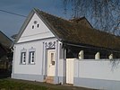
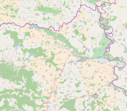
Bijelo Brdo, Croatia
Appearance
Bijelo Brdo
| |
|---|---|
| Coordinates: 45°31′02″N 18°52′15″E / 45.5172°N 18.8708°E | |
| Country | |
| County | |
| Municipality | Erdut |
| Government | |
| • Body | Local Committee |
| Area | |
| • Total | 14.7 sq mi (38.1 km2) |
| Population (2021)[3] | |
| • Total | 1,517 |
| • Density | 100/sq mi (40/km2) |
| Demonym(s) | Bjelobrđanin (♂) Bjelobrđanka (♀) (per UTC+2 (CEST) |
| Official languages | Croatian, Serbian[1] |
Bijelo Brdo (
D213 road and by R202 railway
. It has a total of 1,961 inhabitants (2011).
Geography
The village is situated 15 km east from Osijek, in the Slavonia region on the banks of the Stara Drava branch, in the micro-region of Erdutska kosa, at an altitude of 93m above sea level. It covers an area of 36.64 km².
History
Bijelo Brdo is important for archeological findings from the
Arsenije III Čarnojević. In 1706, the village numbered 63 houses and in that year became part of a Dalj estate.[4][5] The colonization of Slavonia was carried out in a systematic fashion through centuries but particularly during the period of WWII. Among people inhabiting poor areas, Slavonia was famed as a promised land which could feed large numbers of people, where there was a lot of fertile land and favorable living conditions.[6]
Culture
- Church of the Transfer of the relics of the Holy Father Nicholas, Bijelo Brdo, built between 1764 and 1809, reconstructed in 1996.
Demographics
The 2011 census recorded a total of 1,961 inhabitants. The 2001 census had a total of 2,119 inhabitants in 720 households. 1991 census, a total of 2,400 inhabitants, out of which
Yugoslavs
97 (4.04%), and other smaller communities.
Sport
- NK BSK Bijelo Brdo
- Bijelo Brdo Chess Club
Notable people
- Kuzman Stanić (1825–1898), parish priest of Timişoara
- Vasilije Trbić (1881–1962), Serbian Chetnik commander in Macedonia
References
- ^ a b c Government of Croatia (October 2013). "Peto izvješće Republike Hrvatske o primjeni Europske povelje o regionalnim ili manjinskim jezicima" (PDF) (in Croatian). Council of Europe. p. 36. Retrieved 30 November 2016.
- Wikidata Q119585703.
- ^ "Population by Age and Sex, by Settlements" (xlsx). Census of Population, Households and Dwellings in 2021. Zagreb: Croatian Bureau of Statistics. 2022.
- ^ "Bijelo Brdo | Općina Erdut". Retrieved 2019-08-16.
- ^ "Bijelo Brdo | Hrvatska enciklopedija". www.enciklopedija.hr. Retrieved 2019-08-16.
- ISSN 1330-0474.


