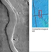
Image of the Cebrenia Quadrangle (MC-7). The northwest contains relatively smooth plains; the southeast contains Hecates Tholus (one of three Elysium shield volcanoes) and Phlegra Montes (a ridge system).
The Cebrenia quadrangle is one of a series of 30 quadrangle maps of Mars used by the United States Geological Survey (USGS) Astrogeology Research Program. The quadrangle is located in the northeastern portion of Mars' eastern hemisphere and covers 120° to 180° east longitude (180° to 240° west longitude) and 30° to 65° north latitude. The quadrangle uses a Lambert conformal conic projection at a nominal scale of 1:5,000,000 (1:5M). The Cebrenia quadrangle is also referred to as MC-7 (Mars Chart-7).[1] It includes part of Utopia Planitia and Arcadia Planitia.
The southern and northern borders of the Cebrenia quadrangle are approximately 3,065 km (1,905 mi) and 1,500 km (930 mi) wide, respectively. The north to south distance is about 2,050 km (1,270 mi) (slightly less than the length of Greenland).[2] The quadrangle covers an approximate area of 4.9 million square km, or a little over 3% of Mars' surface area.[3]
The quadrangle's prominent features are the large craters Mie and Stokes, a volcano, Hecates Tholus, and a group of mountains, Phlegra Montes. This area is a flat, smooth plain for the most part, so the relatively large craters Mie and Stokes really stand out. The Galaxias Region has an area of chaos, where the ground seems to have collapsed.
Viking 2 (part of Viking program) landed near Mie on September 3, 1976. Its landing coordinates were 48° N and 226° W.[5]
Results from Viking 2 mission
What it would look like walking around the landing site
The sky would be a light pink. The dirt would also appear pink. The surface would be uneven; the soil would be formed into troughs. Large rocks would be spread about. Most of the rocks are similar in size. Many of the rocks would have small holes or bubbles on their surfaces caused by gas escaping after the rocks came to the surface. Some boulders would show erosion due to the wind. Many rocks would appear to be perched, as if wind removed much of the soil at their bases.[6][7] In the winter snow or frost would cover most of the ground. There would be many small sand dunes that are still active. The wind speed would typically be 7 meters per second (16 miles per hour). There would be a hard crust on the top of the soil similar to a deposit, called caliche which is common in the U.S. Southwest. Such crusts are formed by solutions of minerals moving up through soil and evaporating at the surface.[8] Scientists, in a September 2009 article in the journal Science, have asserted that if Viking 2 only dug four inches deeper, it would have reached a layer of almost pure ice.[9][10][11]
Analysis of soil
Image from Mars taken by Viking 2
The soil resembled those produced from the weathering of basaltic
magnets aboard the landers indicated that the soil is between 3 and 7 percent magnetic materials by weight. The magnetic chemicals could be magnetite and maghemite. These could come from the weathering of basalt rock.[18][19] Experiments carried out by the Mars Spirit Rover (landed in 2004) indicated that magnetite could explain the magnetic nature of the dust and soil on Mars. Magnetite was found in the soil and that the most magnetic part of the soil was dark. Magnetite is very dark.[20]
Search for life
Viking did three experiments to look for life. The results were surprising and interesting. Most scientists now believe that the data were due to inorganic chemical reactions of the soil, although a few scientists still believe the results were due to living reactions. No organic chemicals were found in the soil. However, dry areas of
Phoenix Lander discovered the chemical perchlorate in the Martian Soil. Perchlorate is a strong oxidant so it may have destroyed any organic matter on the surface.[22]
If it is widespread on Mars, carbon-based life would be difficult at the soil surface.
Bright part is water ice that has been exposed by impact. The ice was identified using CRISM on the MRO. Location is 55.57 north and 150.62 east.
Research, published in the Journal of Geophysical Research in September 2010, proposed that organic compounds were actually present in the soil analyzed by both Viking 1 and 2. NASA's Phoenix lander in 2008 detected perchlorate which can break down organic compounds. The study's authors found that perchlorate will destroy organics when heated and will produce chloromethane and dichloromethane, the identical chlorine compounds discovered by both Viking landers when they performed the same tests on Mars. Because perchlorate would have broken down any Martian organics, the question of whether or not Viking found life is still wide open.[23]
Ice exposed in new craters
Impressive research, reported in the journal Science in September 2009,[24] has showed that some new craters on Mars show exposed, pure, water ice. After a time, the ice disappears, evaporating into the atmosphere. The ice is only a few feet deep. The ice was confirmed with the Compact Imaging Spectrometer (CRISM)] on board the Mars Reconnaissance Orbiter (MRO). The ice was found in a total of five locations. Three of the locations are in the Cebrenia quadrangle. These locations are 55°34′N150°37′E / 55.57°N 150.62°E / 55.57; 150.62, 43°17′N176°54′E / 43.28°N 176.9°E / 43.28; 176.9 and 45°00′N164°30′E / 45°N 164.5°E / 45; 164.5.[9][10][11]
This discovery proves that future colonists on Mars will be able to obtain water from a wide variety of locations. The ice can be dug up, melted, then taken apart to provide fresh oxygen and hydrogen for rocket fuel. Hydrogen was the powerful fuel used by the Space Shuttle main engines.
Two pictures from HiRISE showing how ice disappeared over time in a crater. Crater on left is before ice disappeared. Crater is 6 meters in diameter.
Other craters
Impact craters generally have a rim with ejecta around them, in contrast volcanic craters usually do not have a rim or ejecta deposits.[25] Sometimes craters will display layers. Since the collision that produces a crater is like a powerful explosion, rocks from deep underground are tossed onto the surface. Hence, craters can show us what lies deep under the surface.
, as seen by CTX camera (on Mars Reconnaissance Orbiter)
Western side of
Tyndall (Martian crater)
, as seen by CTX camera (on Mars Reconnaissance Orbiter)
Crater, as seen by HiRISE under HiWish program
Crater showing layers, as seen by HiRISE under HiWish program
Close view of layers in crater, as seen by HiRISE under HiWish program. Dark line are defects in image. This image was taken during a global dust storm.
Ejecta lobes from an impact crater, as seen by HiRISE under HiWish program
Craters with layered mounds and tall, sharp rims, as seen by HiRISE under HiWish program
Wide view of crater, as seen by HiRISE under HiWish program
Hecates Tholus
Main article:
Volcanology of Mars
Recent research leads scientists to believe that Hecates Tholus erupted explosively about 350 million years ago. The eruptions created depressions on the flanks of the volcano. Five million years ago, glacial deposits formed inside these depressions.[26] Some valleys on Hecates show a parallel drainage pattern.[25]
Hecates Tholus Ridges, as seen by HiRISE. Ridges are to the west-northwest of Hecates Tholus. The deepest ridge was measured to be about 50 meters high.[27]
Buvinda Vallis, as seen by THEMIS. Buvinda Vallis is associated with Hecates Tholus; it lies just east of Hecates Tholus.
Lava channels on flank of Hecates Tholus, as seen by HiRISE under HiWish program. A crater has been partially covered over by lava flows. This crater will be enlarged in the next image.
Enlarged view of lava filling a crater, as seen by HiRISE under HiWish program
Crater on edge of lava flow on Hecates Tholus, as seen by HiRISE under HiWish program. Lava seems to have formed tail shape on the lee side of obstacles like crater rims.
Volcano-ice interactions
Large amounts of water ice are believed to be present under the surface of Mars. Some channels lie near volcanic areas. When hot subsurface molten rock comes close to this ice, large amounts of liquid water and mud may be formed. Hrad Vallis in the Cebrenia quadrangle is close to Elysium Mons, a large volcano, which may have supplied water to create the channel. Hrad Vallis is pictured below.[28]
Hrad Vallis may have been formed when the large Elysium Mons volcanic complex melted ground ice, as seen by THEMIS.
The ground in Galaxias seems to have collapsed. Such land forms on Mars are called "Chaos terrain." Galaxias Chaos is different from many other chaotic regions. It does not have associated outflow channels, and it does not display a great elevation difference between it and the surrounding land area, as most of the other chaos regions. Research by Pedersen and Head, published in 2010, suggests that Galaxias Chaos is the site of a volcanic flow that buried an ice-rich layer, called the Vastitas Borealis Formation (VBF). It is generally believed that the VBF is a residue from water-rich materials deposited by large floods.[29][30] The VBF may have been of varied thickness and may have contained varied amounts of ice. In the thin atmosphere of Mars, this layer would have slowly disappeared by sublimation (changing from a solid directly to a gas). Since some areas would have sublimated more than others, the upper lava cap would not be supported evenly and would crack. Cracks/troughs may have begun from sublimation and shrinkage along the edges of the lava cap. Stress from the undermining of the cap edge would have made cracks in the cap. Places with cracks would undergo more sublimation, then the cracks would widen and form the blocky terrain characteristic of regions of chaos. The sublimation process may have been aided by heat (geothermal flux) from magma movements. There are volcanoes, namely Elysium Montes and Hecates Tholus, nearby which most likely are surrounded by dikes, which would have heated the ground. Also, a warmer period in the past would have increased the amount of water sublimating from the ground.[31]
This series of drawings shows a model for the formation of Martian chaos, as proposed by Pedersen and Head 2011.[32] Amount of sublimation is exaggerated to improve understanding. Click on image to see more details.
Galaxius Mons, as seen by HiRISE. The black line was a section that was not imaged. There are many more details visible on the original image.
Galaxias Chaos as seen by CTX. The scene in the next image is a part of this picture.
Galaxias Chaos as seen by HiRISE
Evidence of glaciers
Glaciers, loosely defined as patches of currently or recently flowing ice, are thought to be present across large but restricted areas of the modern Martian surface, and are inferred to have been more widely distributed at times in the past.
The pictures below show features that are probably associated with glaciers.
Elephant Foot Glacier in the Earth's Arctic, as seen by Landsat 8. This picture shows several glaciers that have the same shape as many features on Mars that are believed to also be glaciers.
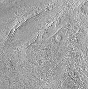
Material moving down slope in Phlegra Montes, as seen by HiRISE. Movement is probably aided by water/ice.
Lobate debris apron in Phlegra Montes, as seen by HiRISE. The debris apron is probably mostly ice with a thin covering of rock debris, so it could be a source of water for future Martian colonists. Scale bar is 500 meters long.
Wide view of a cliff and remains of a glacier, as seen by HiRISE under HiWish program
Close-up of a cliff showing possible faults, as seen by HiRISE under HiWish program; note the rock that seems to be split by the fault. Some boulders are sitting in round holes because their ability to gather and hold heat may have melted ground ice.
Close-up of grooves left by a glacier, as seen by HiRISE under HiWish program. The presence of grooves suggest that it was a wet-based glacier. Moisture under the glacier may have helped Martian organisms to survive.
Close-up of surface, as seen by HiRISE under HiWish program
Lineated valley fill, as seen by HiRISE under HiWish program
Close view of lineated valley fill and mantle, as seen by HiRISE under HiWish program
Flow being constricted, as seen by HiRISE under HiWish program
There is enormous evidence that water once flowed in river valleys on Mars.[45][46] Images of curved channels have been seen in images from Mars spacecraft dating back to the early 1970s with the Mariner 9 orbiter.[47][48][49][50] Indeed, a study published in June 2017, calculated that the volume of water needed to carve all the channels on Mars was even larger than the proposed ocean that the planet may have had. Water was probably recycled many times from the ocean to rainfall around Mars.[51][52]
Streamlined form along channel, as seen by HiRISE under HiWish program
Context for next image of layers along Hrad Vallis, as seen by CTX. Photo labeled with layers, streamlined forms, and arrow indicating direction water flowed.
Layers exposed along Hrad Vallis, as seen by HiRISE under HiWish program
Channel,as seen by HiRISE under HiWish program
Channel, as seen by HiRISE under HiWish program
Pedestal craters
A pedestal crater is a crater with its ejecta sitting above the surrounding terrain and thereby forming a raised platform (like a pedestal). They form when an impact crater ejects material which forms an erosion-resistant layer, thus causing the immediate area to erode more slowly than the rest of the region.[53][54] Some pedestals have been accurately measured to be hundreds of meters above the surrounding area. This means that hundreds of meters of material were eroded away. The result is that both the crater and its ejecta blanket stand above the surroundings. Pedestal craters were first observed during the Mariner missions.[55][56][57][58]
Pedestal crater, as seen by HiRISE under HiWish program
Pedestal crater, as seen by HiRISE under HiWish program
Close view of ejecta of pedestal crater, as seen by HiRISE under HiWish program. Arrow shows one of example of a boulder sitting in a pit. This image will be enlarged to better show this in the next two images.
Closer view of ejecta, as seen by HiRISE under HiWish program. Note: Arrows show examples of boulders sitting in pits.
Close view of ejecta, as seen by HiRISE under HiWish program. Note: Arrows show examples of boulders sitting in pits.
Layered structures
Wide view of groups of layers, as seen by HiRise under HiWish program. These layers probably represent mantle deposited when climate changed. They were shaped by the wind.
Close view of a group of layers, as seen by HiRise under HiWish program. Note: This is an enlargement from the previous image.
Close, color view of a group of layers, as seen by HiRise under HiWish program. Note: This is an enlargement from a previous image.
Layered feature in old crater, as seen by HiRISE under HiWish program
Additional images
Map of Cebrenia.
glaciers
on its slopes.
Troughs, as seen by HiRISE under HiWish program. Layers are also visible in the image.
Apsus Vallis, as seen by THEMIS. Apsus is near the Elysium volcanic system; it may have been partially formed by the action of lava.
Close up view of mantle, as seen by HiRISE under the HiWish program. Mantle may be composed of ice and dust that fell from the sky during past climatic conditions.
Ridge and surface features near rim of Adams crater, as seen by HiRISE under HiWish program
Layered mesa in crater, as seen by HiRISE under HiWish program
Cones, as seen by HiRISE under HiWish program
Crater ejecta, as seen by HiRISE under HiWish program
Close view of crater ejecta, as seen by HiRISE under HiWish program. Note this is an enlargement of the previous image.
Contact between lower light-toned unit and an upper dark unit, as seen by HiRISE under HiWish program
Dipping layers, as seen by HiRISE under HiWish program
Patchy terrain and layered features, as seen by HiRISE under HiWish program
Brain terrain on crater floor, as seen by HiRISE under HiWish program
Possible dike, as seen by HiRISE under HiWish program. Here magma probably moved along a fault line underground. Later erosion removed all but the hardened magma.
Concentric crater fill, as seen by HiRISE under HiWish program
Close view of concentric crater fill, as seen by HiRISE under HiWish program
global topography of Mars. Hover your mouse over the image to see the names of over 60 prominent geographic features, and click to link to them. Coloring of the base map indicates relative elevations, based on data from the Mars Orbiter Laser Altimeter on NASA's Mars Global Surveyor. Whites and browns indicate the highest elevations (+12 to +8 km); followed by pinks and reds (+8 to +3 km); yellow is 0 km; greens and blues are lower elevations (down to −8 km). Axes are latitude and longitude; Polar regions are noted.
^"Cebrenia". Gazetteer of Planetary Nomenclature. International Astronomical Union (IAU) Working Group for Planetary System Nomenclature (WGPSN). 2006-10-01. Retrieved 2014-02-04.
^Christensen, P. et al. 2004. Mineralogy at Meridiani Planum from the Mini-TES Experiment on the Opportunity rover. Science: 306. 1733-1739
^Baird, A. et al. 1976. Mineralogic and Petrologic Implications of Viking Geochemical Results From Mars: Interim Report. Science: 194. 1288-1293.
^Toulmin III, P. et al. 1977. Geochemical and Mineralogical Interpretation of the Viking Inorganic Chemical Results. Journal of Geophysical Research: 82. 4625-4634.
^Clark, B. et al. 1982. Chemical Composition of Martian Fines. Journal of Geophysical Research: 87. 10059-10097
^Hargraves, R. et al. 1976. Viking Magnetic Properties Investigation: Further Results. Science: 194. 1303-1309.
^Arvidson, R, A. Binder, and K. Jones. The Surface of Mars. Scientific American
^Bertelsen, P. et al. 2004. Magnetic Properties Experiments on the Mars Exploration rover Spirit at Gusev Crater. Science: 305. 827-829.
^Friedmann, E. 1982. Endolithic Microorganisms in the Antarctic Cold Desert. Science: 215. 1045-1052.
Michael H. Carr, United States Geological Survey, Menlo Park
^ abMilliken, R. E., J. F. Mustard, and D. L. Goldsby. "Viscous flow features on the surface of Mars: Observations from high-resolution Mars Orbiter Camera (MOC) images." Journal of Geophysical Research 108.E6 (2003): 5057.
^S.W. Squyres, M.H. Carr Geomorphic evidence for the distribution of ground ice on Mars Science, 213 (1986), pp. 249–253. doi:10.1126/science.231.4735.249
^J.W. Head, D.R. Marchant, J.L. Dickson, A.M. Kress, D.M. Baker Northern mid-latitude glaciation in the Late Amazonian period of Mars: Criteria for the recognition of debris-covered glacier and valley glacier landsystem deposits Earth Planet. Sci. Lett., 294 (2010), pp. 306–320
^J.W. Holt et al. Radar sounding evidence for buried glaciers in the southern mid-latitudes of Mars Science, 322 (2008), pp. 1235–1238
^ abG.A. Morgan, J.W. Head, D.R. Marchant Lineated valley fill (LVF) and lobate debris aprons (LDA) in the Deuteronilus Mensae northern dichotomy boundary region, Mars: Constraints on the extent, age and episodicity of Amazonian glacial events Icarus, 202 (2009), pp. 22–38
^J.J. Plaut, A. Safaeinili, J.W. Holt, R.J. Phillips, J.W. Head, R. Sue, N.E. Putzig, A. Frigeri Radar evidence for ice in lobate debris aprons in the mid-northern latitudes of Mars Geophys. Res. Lett., 36 (2009), p. L02203
^ abD.M.H. Baker, J.W. Head, D.R. Marchant Flow patterns of lobate debris aprons and lineated valley fill north of Ismeniae Fossae, Mars: Evidence for extensive mid-latitude glaciation in the Late Amazonian Icarus, 207 (2010), pp. 186–209
^ abJ. Arfstrom, W.K. Hartmann Martian flow features, moraine-like ridges, and gullies: Terrestrial analogs and interrelationships Icarus, 174 (2005), pp. 321–335
^Lucchitta, Baerbel K. "Ice and debris in the fretted terrain, Mars." Journal of Geophysical Research: Solid Earth (1978–2012) 89.S02 (1984): B409-B418.
^ abLevy, Joseph S., James W. Head, and David R. Marchant. "Concentric crater fill in Utopia Planitia: History and interaction between glacial “brain terrain” and periglacial mantle processes." Icarus 202.2 (2009): 462-476. Levy, Joseph S., James W. Head, and David R. Marchant. "Concentric crater fill in Utopia Planitia: History and interaction between glacial “brain terrain” and periglacial mantle processes." Icarus 202.2 (2009): 462-476.
^Hubbard, Bryn, et al. "Geomorphological characterisation and interpretation of a mid-latitude glacier-like form: Hellas Planitia, Mars." Icarus 211.1 (2011): 330-346.
^Baker, V., et al. 2015. Fluvial geomorphology on Earth-like planetary surfaces: a review. Geomorphology. 245, 149–182.
^Carr, M. 1996. in Water on Mars. Oxford Univ. Press.
^Baker, V. 1982. The Channels of Mars. Univ. of Tex. Press, Austin, TX
^Baker, V., R. Strom, R., V. Gulick, J. Kargel, G. Komatsu, V. Kale. 1991. Ancient oceans, ice sheets and the hydrological cycle on Mars. Nature 352, 589–594.
^Carr, M. 1979. Formation of Martian flood features by release of water from confined aquifers. J. Geophys. Res. 84, 2995–300.
^Komar, P. 1979. Comparisons of the hydraulics of water flows in Martian outflow channels with flows of similar scale on Earth. Icarus 37, 156–181.
^Luo, W., et al. 2017. New Martian valley network volume estimate consistent with ancient ocean and warm and wet climate. Nature Communications 8. Article number: 15766 (2017). doi:10.1038/ncomms15766
^S.J. Kadish, J.W. Head. 2011. Impacts into non-polar ice-rich paleodeposits on Mars: excess ejecta craters, perched craters and pedestal craters as clues to Amazonian climate history. Icarus, 215, pp. 34-46
^S.J. Kadish, J.W. Head. 2014. The ages of pedestal craters on Mars: evidence for a late Amazonian extended periodic emplacement of decameters-thick mid-latitude ice deposits. Planet. Space Sci., 91, pp. 91-100


 Two pictures from HiRISE showing how ice disappeared over time in a crater. Crater on left is before ice disappeared. Crater is 6 meters in diameter.
 Kufra Crater Floor, as seen by HiRISE. Pits are thought to be caused by escaping water.
 Fenagh CraterEjecta, as seen by HiRISE
 Chincoteague Crater, as seen by HiRISE
 Close-up of Chincoteague Crater, as seen by HiRISE
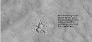 Group of secondary craters, as seen by HiRISE under HiWish program
 Layers in wall of crater, as seen by HiRISE under HiWish program
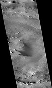 Mie Crater, as seen by CTX camera (on Mars Reconnaissance Orbiter). Viking 2 landed near Mie Crater in 1976.
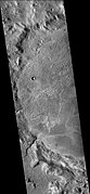 Western side ofAdams Crater (Martian Crater), as seen by CTX camera (on Mars Reconnaissance Orbiter)
 Western side ofTyndall (Martian crater), as seen by CTX camera (on Mars Reconnaissance Orbiter)
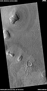 Crater, as seen by HiRISE under HiWish program
 Crater showing layers, as seen by HiRISE under HiWish program
 Close view of layers in crater, as seen by HiRISE under HiWish program. Dark line are defects in image. This image was taken during a global dust storm.
 Ejecta lobes from an impact crater, as seen by HiRISE under HiWish program
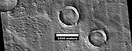 Craters with layered mounds and tall, sharp rims, as seen by HiRISE under HiWish program
 Wide view of crater, as seen by HiRISE under HiWish program


 Hecates Tholus, as seen by Mars Global Surveyor
 Hecates Tholus topography
![Hecates Tholus Ridges, as seen by HiRISE. Ridges are to the west-northwest of Hecates Tholus. The deepest ridge was measured to be about 50 meters high.[27]](//upload.wikimedia.org/wikipedia/commons/thumb/b/bf/Hecates_Tholus_Ridges.JPG/148px-Hecates_Tholus_Ridges.JPG) Hecates Tholus Ridges, as seen by HiRISE. Ridges are to the west-northwest of Hecates Tholus. The deepest ridge was measured to be about 50 meters high.[27]
Hecates Tholus Ridges, as seen by HiRISE. Ridges are to the west-northwest of Hecates Tholus. The deepest ridge was measured to be about 50 meters high.[27]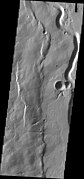 Buvinda Vallis, as seen by THEMIS. Buvinda Vallis is associated with Hecates Tholus; it lies just east of Hecates Tholus.
 Lava channels on flank of Hecates Tholus, as seen by HiRISE under HiWish program. A crater has been partially covered over by lava flows. This crater will be enlarged in the next image.
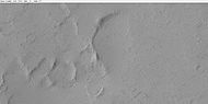 Enlarged view of lava filling a crater, as seen by HiRISE under HiWish program
 Crater on edge of lava flow on Hecates Tholus, as seen by HiRISE under HiWish program. Lava seems to have formed tail shape on the lee side of obstacles like crater rims.

![Hecates Tholus Ridges, as seen by HiRISE. Ridges are to the west-northwest of Hecates Tholus. The deepest ridge was measured to be about 50 meters high.[27]](/File:Hecates_Tholus_Ridges.JPG)


 Hrad Vallis may have been formed when the large Elysium Mons volcanic complex melted ground ice, as seen by THEMIS.
 Streamlined islands in Hrad Vallis, as seen by HiRISE

![This series of drawings shows a model for the formation of Martian chaos, as proposed by Pedersen and Head 2011.[32] Amount of sublimation is exaggerated to improve understanding. Click on image to see more details.](//upload.wikimedia.org/wikipedia/commons/thumb/f/f8/Galaxiascomplete2.jpg/127px-Galaxiascomplete2.jpg) This series of drawings shows a model for the formation of Martian chaos, as proposed by Pedersen and Head 2011.[32] Amount of sublimation is exaggerated to improve understanding. Click on image to see more details.
This series of drawings shows a model for the formation of Martian chaos, as proposed by Pedersen and Head 2011.[32] Amount of sublimation is exaggerated to improve understanding. Click on image to see more details. Galaxius Mons, as seen by HiRISE. The black line was a section that was not imaged. There are many more details visible on the original image.
 Galaxias Fossae Trough, as seen by HiRISE
 Galaxias Chaos as seen by CTX. The scene in the next image is a part of this picture.
 Galaxias Chaos as seen by HiRISE
![This series of drawings shows a model for the formation of Martian chaos, as proposed by Pedersen and Head 2011.[32] Amount of sublimation is exaggerated to improve understanding. Click on image to see more details.](/File:Galaxiascomplete2.jpg)


