
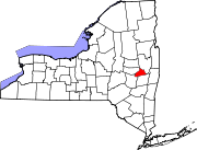
Duanesburg, New York
Duanesburg, New York | ||
|---|---|---|
FIPS code 36-21006 | | |
| GNIS feature ID | 0978910 | |
| Website | www.duanesburg.net | |
Duanesburg is a
History
Originally known as Duanes' Bush, Duanesburg was established as a township by
The town's earliest settlers chiefly comprised English Quakers from Dutchess County, New York, as well as a group of settlers who were originally from the town of Kent, Connecticut.[8][9][10][11]

The village of
In the late 20th century farming fell into decline, and the town became a home for commuters working in Albany and
Economy
Since 2000 a number of factors has contributed to an economic slowdown in the town. Regional economic prosperity shifted north of Albany (a difficult commute from Duanesburg). An aging population with no available low-cost housing for young people makes it hard for the young to stay. Housing stock is mostly limited to single family homes and antiquated multi-unit properties. Lack of available water for some commercial/industrial uses has limited this type of growth. Despite this, the town government has support the birth and growth of the first Winery in Duanesburg, Helderberg Meadworks, which began selling their mead in October 2012 through local wine stores and as of June 2014 has expanded to statewide distribution.[12]
Due to a lack of diversity in revenue (lack of commercial and industrial presence), individual property taxes may be higher than those of the surrounding area. The town's small population's desire to maintain a school district, two water districts, 46 miles of town owned-roads and other services have required that taxes be collected, but the town and school boards have attempted to contain costs as much as possible.
The town has been known for its many private airports. Skydiving is one activity that has brought in visitors for the last 30 years. Jonathan's Restaurant is located next to one of the airports. During the late 1990s Harrison Ford used to be a repeat visitor at the restaurant during rest stops at the local airport while en route to other destinations. Knox Airport (private), located the neighboring town of Knox, in Albany County, was involved in a large drug investigation. There have been numerous small airplane crashes over the last couple decades, and at least one suicide/fatality from skydiving.[13]
In addition to skydiving the town was known for
Geography
According to the United States Census Bureau, the town has a total area of 72.0 square miles (186.6 km2), of which 70.8 square miles (183.3 km2) is land and 1.2 square miles (3.2 km2), or 1.74%, is water.[14]
The town consists of mostly wooded hills up to an elevation of approximately 1,400 feet (430 m) above sea level. Most of the town was cleared farmland until the late 20th century. After this point forests grew to cover 60% of the total land area with a canopy higher than 40 feet (12 m). The forest is primary composed of poplar, hemlock, oak, maple, white pine, and balsam fir. The maximum tree heights in Duanesburg are approximately 80 feet (24 m) high.
The town is the source of the Normans Kill and of Bozenkill Creek. These creeks drop over a series of rapids and waterfalls cut through shale and sandstone rock beds. Christman's Sanctuary highlights some of this topography.
Most of the soil contains clay, significant loose rock, and/or shallow depth, therefore making it inadequate for a large farming industry. There is a significant amount of swamps at high and low elevations in the town due to clay soil and past glacial activity.
The town is unique for its east-west oriented drumlins formed during the last ice age. Most drumlins (oblong hills of glacial sediment) in New York State are north-south oriented.
Due to its higher elevation and position, Duanesburg provides a view that extends as far as southern Vermont, the Adirondack Mountains, and the Catskill Mountains.
Part of the south town line is the border of Albany County. The rest of the south and part of the west town line is the border of Schoharie County. The rest of the west and part of the north town line is the border of Montgomery County.
Demographics
| Census | Pop. | Note | %± |
|---|---|---|---|
| 1820 | 3,510 | — | |
| 1830 | 2,837 | −19.2% | |
| 1840 | 3,357 | 18.3% | |
| 1850 | 3,464 | 3.2% | |
| 1860 | 3,222 | −7.0% | |
| 1870 | 3,042 | −5.6% | |
| 1880 | 2,995 | −1.5% | |
| 1890 | 2,557 | −14.6% | |
| 1900 | 2,428 | −5.0% | |
| 1910 | 2,211 | −8.9% | |
| 1920 | 2,115 | −4.3% | |
| 1930 | 1,937 | −8.4% | |
| 1940 | 2,141 | 10.5% | |
| 1950 | 2,822 | 31.8% | |
| 1960 | 3,070 | 8.8% | |
| 1970 | 3,800 | 23.8% | |
| 1980 | 4,729 | 24.4% | |
| 1990 | 5,474 | 15.8% | |
| 2000 | 5,808 | 6.1% | |
| 2010 | 6,122 | 5.4% | |
| 2016 (est.) | 6,243 | [2] | 2.0% |
| U.S. Decennial Census[15] | |||
As of the
There were 2,141 households, out of which 38.0% had children under the age of 18 living with them, 66.6% were married couples living together, 7.0% had a female householder with no husband present, and 22.3% were non-families. 17.8% of all households were made up of individuals, and 5.9% had someone living alone who was 65 years of age or older. The average household size was 2.71 and the average family size was 3.07.
In the town, the population was spread out, with 26.9% under the age of 18, 5.6% from 18 to 24, 30.4% from 25 to 44, 27.8% from 45 to 64, and 9.3% who were 65 years of age or older. The median age was 38 years. For every 100 females, there were 101.0 males. For every 100 females age 18 and over, there were 101.9 males.
The median income for a household in the town was $58,463, and the median income for a family was $65,461. Males had a median income of $40,237 versus $28,125 for females. The
Communities and locations in Duanesburg
- Braman Corners – A hamlet in the western part of the town. The community was named after Joseph Braman.[17] The Joseph Braman House stands there.
- Millers Corners – A hamlet in the northwestern part of the town.
- Delanson – The Village of Delanson in the southeast part of the town.
- Duane – A hamlet south of Duanesburg.
- Duanesburg – The hamlet of Duanesburg in the southern part of the town.
- Duanesburg Churches – A location north of Duanesburg.
- Duane Lake – A hamlet.
- Duane Lake – A small man-made lake southeast of Duanesburg village.
- Eaton Corners – A location in the western part of the town.
- Mariaville – A hamlet near the northeast town line.
- Mariaville Lake – A hamlet.
- Mariaville Lake – A small lake near the east town line.
- Quaker Street – A hamlet in the southwest part of the town. Much of the hamlet is included in the Quaker Street Historic District, listed on the National Register of Historic Places in 1984.[18]
Notable people
- Isabelle Bronk (1858–1943), head of the Romance Languages department at Swarthmore College, 1901–1927
- Blackleach Burritt, noted clergyman in the American Revolution
- Charles A. Cady, Wisconsin State Assemblyman
- Mayor of Jersey City 1864-1867 and 1886–1892; represented New Jersey's 5th congressional district from 1869-1871[19]
- Stephen J. Dubner, co-author of Freakonomics
- freestyle wrestler and two-time NCAA Division I Wrestling National Champion for North Carolina State University
- Marybeth Tinning (1942–present), convicted murderer of eight of her nine children
- Emma White, American cyclist
- Lisa Barlow, cast member on The Real Housewives of Salt Lake City
See also
References
- ^ "2016 U.S. Gazetteer Files". United States Census Bureau. Retrieved July 5, 2017.
- ^ a b "Population and Housing Unit Estimates". Retrieved June 9, 2017.
- ^ "Profile of General Population and Housing Characteristics: 2010 Demographic Profile Data (DP-1): Duanesburg town, Schenectady County, New York". United States Census Bureau. Retrieved July 3, 2012.
- ISBN 0-7385-3803-5.
- ^ The Colonial Laws of New York. James B. Lyon (State of New York). 1894. p. 383. Retrieved September 1, 2009.
- ^ Laws of the State of New York. State of New York. 1788. p. 748. Retrieved August 31, 2009.
- ^ Laws of the State of New York. Thomas Greenleaf (State of New York). 1792. p. 214. Retrieved September 1, 2009.
- Sherburne, New York.
- ^ The following are the names of the eleven proprietors: Nathaniel Gray, Newcomb Raymond, Elijah Gray, Eleazer Lathrop, Josiah Lathrop, James Raymond, Joel Hatch, John Gray, Jr., Abraham Raymond, Timothy Hatch and Cornelius Clark.
- ^ "Sherburne Centennial Celebration - 1893 part 2". Retrieved April 8, 2017.
- ^ Dexter, Franklin B (1903). Biographical Sketches of the Graduates of Yale College with Annals of the College History. Henry Holt & Company. p. 103.
Sketch of the life of Rev. Blackleach Burritt.
- ^ "Helderberg Meadworks Craft Meadery". Retrieved April 8, 2017.
- ^ "NY man committed suicide in jump from plane - USATODAY.com". Retrieved April 8, 2017.
- ^ "Geographic Identifiers: 2010 Demographic Profile Data (G001): Duanesburg town, Schenectady County, New York". United States Census Bureau. Retrieved July 3, 2012.
- ^ "Census of Population and Housing". Census.gov. Retrieved June 4, 2015.
- ^ "U.S. Census website". United States Census Bureau. Retrieved January 31, 2008.
- ^ University of the State of New York Bulletin. University of the State of New York. 1914. p. 56.
- ^ "National Register Information System". National Register of Historic Places. National Park Service. March 13, 2009.
- ^ Orestes Cleveland , Biographical Directory of the United States Congress. Accessed June 12, 2007.
- Randall, Willard Sterne (201). Ethan Allen: His Life and Times. W.W. Norton & Co., New York and London. p. 617.
External links
 Media related to Duanesburg, New York at Wikimedia Commons
- Official website
- Duanesburg Historical Society
- Finding aid to the Duane Family and Duanesburg Patent Land Papers in the collections of the New York State Library

 | ||||
Towns |
| |||
Villages | ||||
CDPs | ||||
Other hamlets | ||||