
Kulgam district
This article needs additional citations for verification. (May 2017) |
Kulgam district
Kolgom | |
|---|---|
UTC+5:30 (IST) | |
| PIN | 192231 |
| Vehicle registration | JK18 |
| Website | kulgam |
Kulgam district is an administrative district of Indian-administered Jammu and Kashmir in the disputed Kashmir region.[1][4] It is in the Kashmir division and is located at a distance of 18 kilometres (11 mi) towards south-west of Anantnag. The district comprises block, tehsil and town of Kulgam.
Location
Kulgam is situated near the
Town Kulgam is situated about 68 km (42 mi) from Srinagar and about 17 kilometres (11 mi) from Anantnag. Roads connect to the neighbouring districts of Shopian, Pulwama, Anantnag, and Banihal.
History
This section needs additional citations for verification. (April 2017) |
Tazkira Sadat-i-Simanania, compiled by 13th-century scholar and poet Swaleh Reshi, gives the name of place as "Shampora". Syed Hussain Simnani later renamed it "Kulgam" (kul for 'clan' and gram for 'village' in Sanskrit). Simnani is said to have invited Mir Sayyid Ali Hamadani to Kashmir,[citation needed] with poets including Nund Rishi (Sheikh Noor-ud-din Noorani (RA)) and Lalleshwari.[citation needed] These poets and their disciples manifested the composite culture or Kashmiriyat, promoting and encouraging religious and cultural harmony even when viewed as heretics by other Asiatic countries.
The form of administration from Sher Shah Suri's reign led to creation of a Tehsil during Mughal Rule, through the aegis of Sheikh Hamza Makhdoom. This had jurisdiction encompassing Doru, Banihal, Gulabgarh, and Shopian. After time, constituent units including Pulwama, Shopian, and Reasi attained the status of district.
The area had been a hunting place for Mughal emperors and Dogra rulers, especially for Shahanshah Shah Jehan, who laid the "Chinar Bagh"[5] and Maharaja Hari Singh, who discovered the virgin potential of sanctuary[clarification needed] at Kutbal.[where?] The District is the birthplace of Sheikh Noor-ud-din Noorani, the founder of the Rishi order, and of the forefathers of Allama Iqbal and Jawaharlal Nehru.
Rebel groups
There has been insurgency in Kashmir since 1989. Beginning in the 1990s there is an upsurge of Rebel groups in the district, particularly the Lashkar-e-Taiba and Hizbul Mujahideen.[6][7] the rebels encourage the populace to boycott elections.[8][9]
Demographics
According to the
| Kulgam district: religion, gender ratio, and % urban of population, according to the 2011 Census.[13] | |||||||||
|---|---|---|---|---|---|---|---|---|---|
| Hindu | Muslim | Christian | Sikh | Buddhist | Jain | Other | Not stated | Total | |
| Total | 4,267 | 418,076 | 460 | 1,035 | 27 | 25 | 9 | 584 | 424,483 |
| 1.01% | 98.49% | 0.11% | 0.24% | 0.01% | 0.01% | 0.00% | 0.14% | 100.00% | |
| Male | 3,324 | 213,069 | 264 | 581 | 19 | 12 | 5 | 346 | 217,620 |
| Female | 943 | 205,007 | 196 | 454 | 8 | 13 | 4 | 238 | 206,863 |
| Gender ratio (% female) | 22.1% | 49.0% | 42.6% | 43.9% | 29.6% | 52.0% | 44.4% | 40.8% | 48.7% |
| Sex ratio (no. of females per 1,000 males) |
284 | 962 | – | 781 | – | – | – | 688 | 951 |
| Urban | 2,141 | 78,219 | 116 | 85 | 6 | 3 | 0 | 43 | 80,613 |
| Rural | 2,126 | 339,857 | 344 | 950 | 21 | 22 | 9 | 541 | 343,870 |
| % Urban | 50.2% | 18.7% | 25.2% | 8.2% | 22.2% | 12.0% | 0.0% | 7.4% | 19.0% |
At the time of the 2011 census, 91.91% of the population spoke Kashmiri and 6.32% Gojri as their first language.[12]
Administration
District Kulgam was separated from district Anantnag, along with several other new districts, and made administratively separate from 2 April 2007.
Kulgam district currently consists of eleven blocks: Kulgam, D.H Pora, Devsar, Pahloo, Qaimoh, Kund, Manzgam, Frisal, Pombay, Behibagh, and D.K. Marg.[14] This has not always been the case, in the 2008 reorganisation the district consisted of five blocks.[15] Each block consists of a number of panchayats (English: 'assembly rule', a traditional system of local government).
The district has seven administrative units (
There are five police stations in the district at: Kulgam,
Kulgam has two sub-divisions: Kulgam and Damhal Hanji Pora.
Politics
Kulgam district has 4 assembly constituencies: Noorabad, Kulgam, Homshailibugh, and Devsar.
Homshallibugh J&K is 39th assembly segment has three municipal towns –
Road facility
Kulgam has following roads connecting it to various assembly segments and with NH1A (major district roads):
- Kulgam - Anantnag Main Road
- Kulgam - Qazigund NH44
- Kulgam - Yaripora
- Kulgam - Aharbal via Nehama
- Kulgam - Aharbal via Damhal Hanji Pora
- Kulgam - Damhal Hanji Pora via Adijan
- Kulgam - Shopian via Nillow
- Kulgam - Shopian via Nehama
- Kulgam - Devsar
- Kulgam - Wanpoh via Ban
- Kulgam - Ahmedabad via Khul
Health facilities
- District Hospital at Kulgam
- Sub district hospital at Yaripora
- Sub district hospital at Qazigund
- Sub district hospital D. H.Pora (But without infrastructure and doctors)
Habitation and environment
The main source of livelihood in the district is agriculture and horticulture. The low-lying areas of Kulgam are very fertile for rice cultivation, and are considered as the 'Rice Bowl of Kashmir'. The higher elevations are known for production of apples. Livestock and sheep-rearing is a subsidiary occupation among the rural population, particularly in the higher elevations.[19]
Kulgam District is covered by the Pir Panjal mountain range on the southwest side, acting as a massive topographical protection. The area is significantly covered in forestation.
Tourism
Town Kulgam is situated about 68 km (42 mi) from Srinagar and about 17 km (11 mi) from Anantnag. Aside from places of spiritual interest, the district has tourist spots like Aharbal water fall on Veshew river which is a place of sight-seeing in the extreme south-west. High pastures and meadows are also places of tourist attraction in the area from Kund to Ladigasan (ahead of Aherbal clefts). The District also has an abundance of natural water from springs such as Kausar Nag, Waseknag, Khee Nag, etc.
Photo Gallery
-
 Aharbal Fall
 -
 Gdc_kilam
 -
 Kausar_Nag_Lake
 -
 Chiranbal_Meadows
 -
 Thanda_katha_zajimarag_kashmir
 -
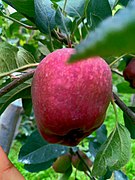 Italy_Jeromine_Apple_Variety_in_Kulgam
 -
 Huts_in_Aharbal
 -
 Chiranbal_fields
 -
 Chambgund_Bridge


References
- ^ due weightin the coverage. Although "controlled" and "held" are also applied neutrally to the names of the disputants or to the regions administered by them, as evidenced in sources (f) through (h) below, "held" is also considered politicized usage, as is the term "occupied," (see (i) below).
(a) Kashmir, region Indian subcontinent, Encyclopaedia Britannica, retrieved 15 August 2019 (subscription required) Quote: "Kashmir, region of the northwestern Indian subcontinent ... has been the subject of dispute between India and Pakistan since the partition of the Indian subcontinent in 1947. The northern and western portions are administered by Pakistan and comprise three areas: Azad Kashmir, Gilgit, and Baltistan, the last two being part of a territory called the Northern Areas. Administered by India are the southern and southeastern portions, which constitute the state of Jammu and Kashmir but are slated to be split into two union territories.";
(b) Pletcher, Kenneth, Aksai Chin, Plateau Region, Asia, Encyclopaedia Britannica, retrieved 16 August 2019 (subscription required) Quote: "Aksai Chin, Chinese (Pinyin) Aksayqin, portion of the Kashmir region, at the northernmost extent of the Indian subcontinent in south-central Asia. It constitutes nearly all the territory of the Chinese-administered sector of Kashmir that is claimed by India to be part of the Ladakh area of Jammu and Kashmir state.";
(c) "Kashmir", Encyclopedia Americana, Scholastic Library Publishing, 2006, p. 328,ISBN 978-1-84904-621-3Quote:"Some politicised terms also are used to describe parts of J&K. These terms include the words 'occupied' and 'held'." - ^ "The Jammu and Kashmir Official Languages Act, 2020" (PDF). The Gazette of India. 27 September 2020. Retrieved 27 September 2020.
- ^ "Parliament passes JK Official Languages Bill, 2020". Rising Kashmir. 23 September 2020. Archived from the original on 24 September 2020. Retrieved 23 September 2020.
- ^ "History | District Kulgam". kulgam.nic.in. Government of Jammu and Kashmir. Retrieved 8 March 2019.
- ^ "Chinar Bagh srinagar". google.co.in/maps. Google maps.
- ^ "Top Lashkar-e-Taiba militant killed". NDTV. 16 September 2007. Archived from the original on 11 March 2007.
- ^ "Gunbattle on between militants, security forces in south Kashmir". The Times of india. 25 May 2014. Archived from the original on 25 May 2014.
- ^ Pandit, M. Saleem (24 April 2014). "Low voter turnout in Kashmir due to militants' poll boycott call". The Times of india.
- ^ Shuja-ul-Haq (28 May 2021). "J&K cops arrest newly recruited militant in south Kashmir's Kulgam district". India Today. Retrieved 28 September 2021.
- ^ a b c d e "District Census 2011". Census2011.co.in. 2011. Retrieved 30 September 2011.
- ^ "Kulgam district Population". Census India. Retrieved 11 July 2021.
- ^ a b C-16 Population By Mother Tongue – Jammu & Kashmir (Report). Office of the Registrar General & Census Commissioner, India. Retrieved 18 July 2020.
- ^ a b C-1 Population By Religious Community – Jammu & Kashmir (Report). Office of the Registrar General & Census Commissioner, India. Retrieved 28 July 2020.
- ^ "Subdivision & Blocks", District Administration Kulgam, retrieved 5 July 2021
- ^ Statement showing the number of blocks in respect of 22 Districts of Jammu and Kashmir State including newly Created Districts, as on 31-03-2008 (PDF), 13 March 2008, archived from the original (PDF) on 10 September 2008
- ^ "About District/ Administrative Setup/ Police", District Kulgam, District Administration Kulgam, retrieved 5 October 2020
- ^ "ERO's and AERO's". Chief Electoral Officer, Jammu and Kashmir. Archived from the original on 22 October 2008. Retrieved 28 August 2008.
- ^ "Jammu Kashmir at a Glance". jkdfp.org. Democratic Freedom Party: JK.
- ^ "Kulgam District Profile". diragrikmr.nic.in. Department of Agriculture Kashmir. Archived from the original on 24 February 2019. Retrieved 11 February 2021.
Places adjacent to Kulgam district | ||||||||||||||||
|---|---|---|---|---|---|---|---|---|---|---|---|---|---|---|---|---|
| ||||||||||||||||